Labor Day Weekend won’t be quite as hot as it was on Wednesday, which was Boulder’s 40th 90° day of the year, but we are expecting warm and dry conditions to persist, perfect for any outdoor activities you may have lined up. The weather pattern will shift slightly early next week with the potential for isolated storms returning to the area. Whether you’re planning a trip into the Mountains or are staying comfortably down low in the city this holiday weekend, read on for the latest forecast details!
Y
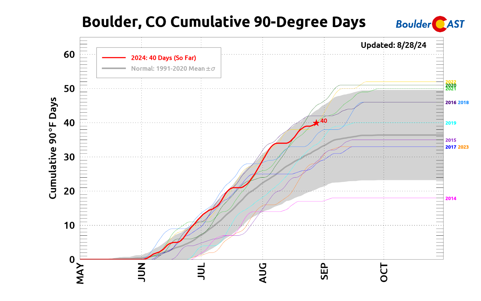
esterday was our 40th 90-degree day of the year in Boulder as we peaked at 91°F around 4PM on Wednesday. The long-term year-to-date average count is 32 days, so we’re definitely running well above normal in 2024. Typically there will only be another couple 90-degree days in September before we transition into the cooler Autumn season. However, as you will discover later in this post, there are at least one or two days in the 90s in the extended forecast…
A weak cold front is currently working south and east across Colorado this morning. Most of the cooler air and rain showers associated to this front are well east of Denver, as seen on this morning’s radar animation below. There was no precipitation in the Metro overnight and these showers will continue to head eastward, moving away from us through the morning.
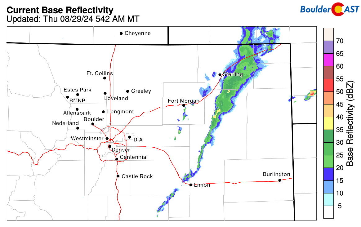
The cold frontal passage likely happened around 3AM last night, but its very difficult to discern the front on surface maps or in time from our station’s weather observations. The strong parent storm tied to this cold front is currently spinning just north of Montana.
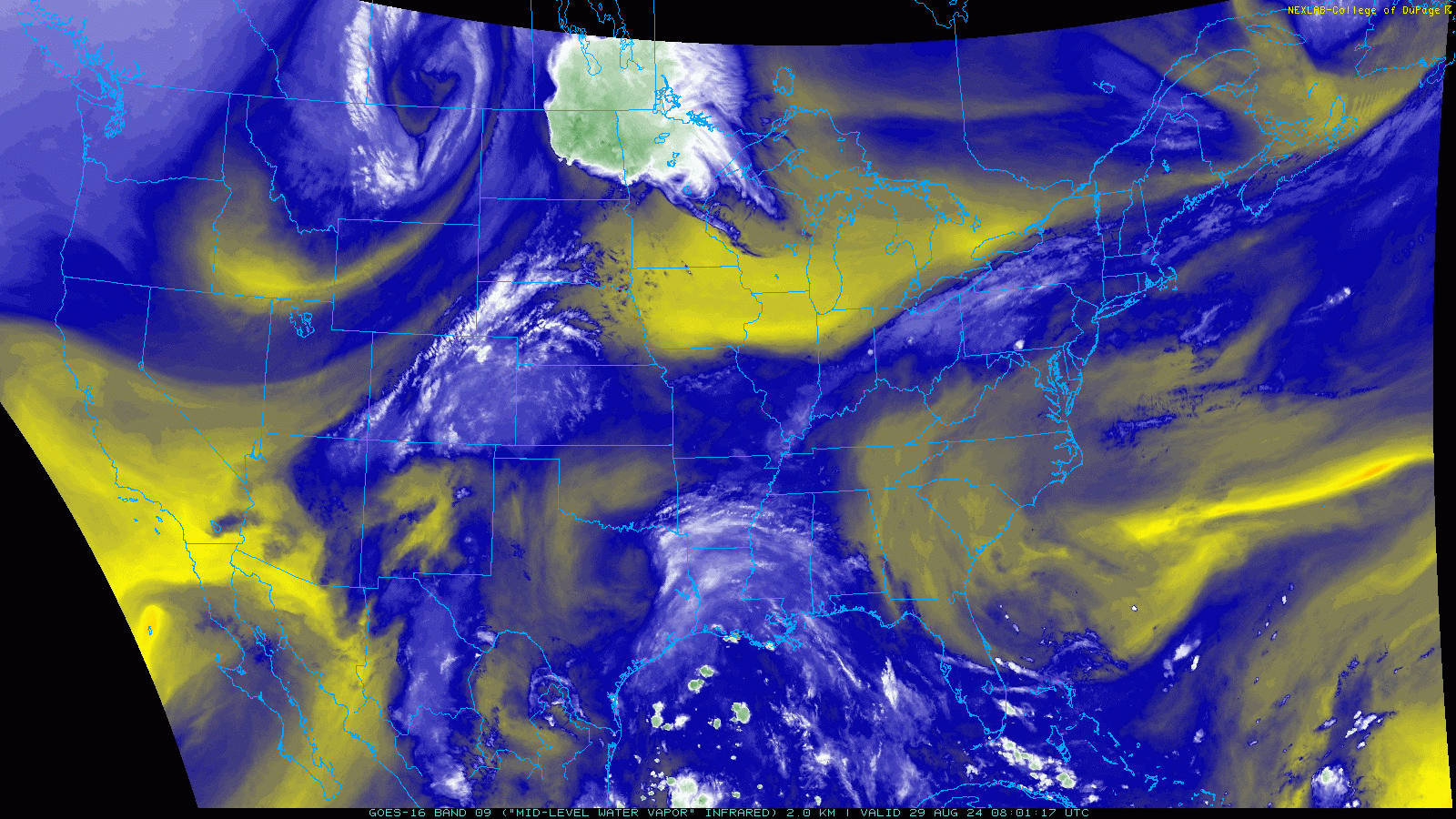
There were a few inches of snow reported in parts of Glacier National Park overnight — a sure sign that winter isn’t as far away as it feels! Some lingering clouds are noted over eastern Colorado this morning, but drier air is about to spread in from the northwest — and so too will the sunshine!
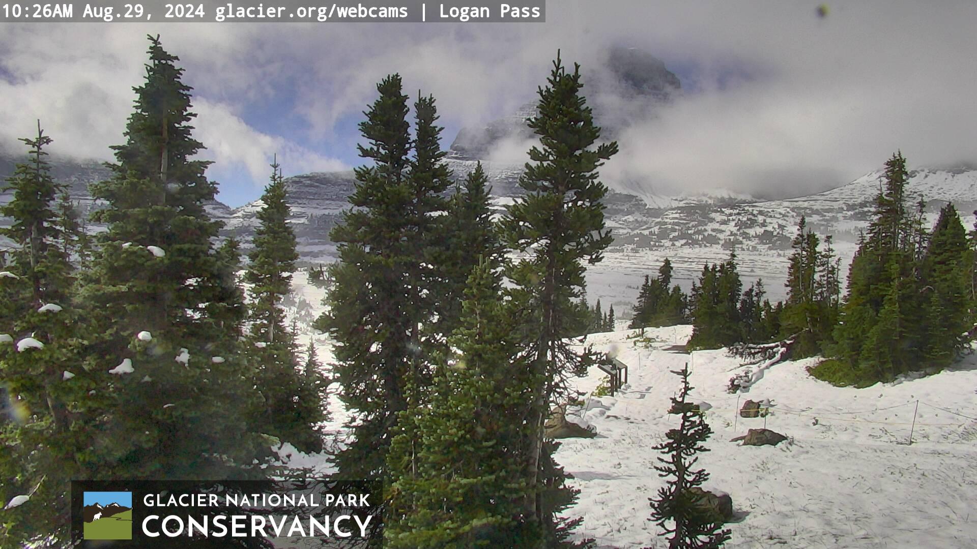
View from Logan Pass in Glacier NP in Montana Thursday morning where fresh snow is noted
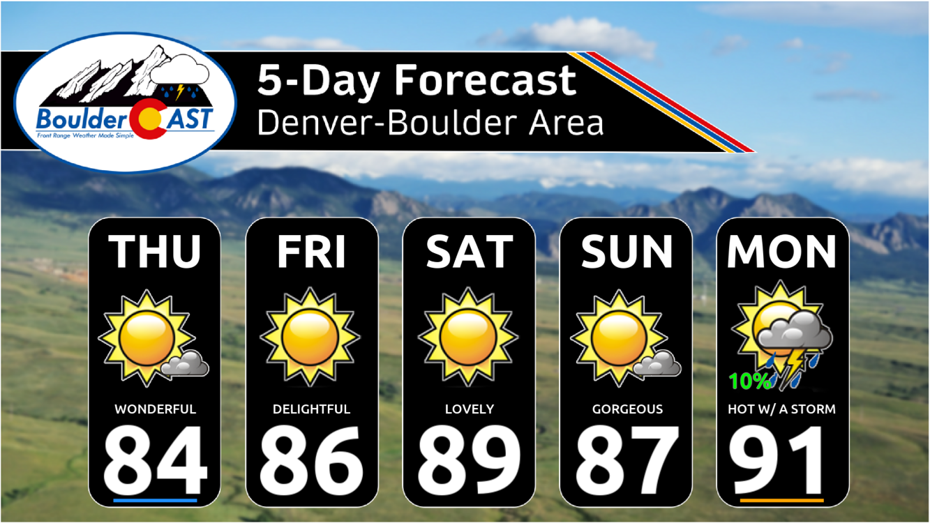
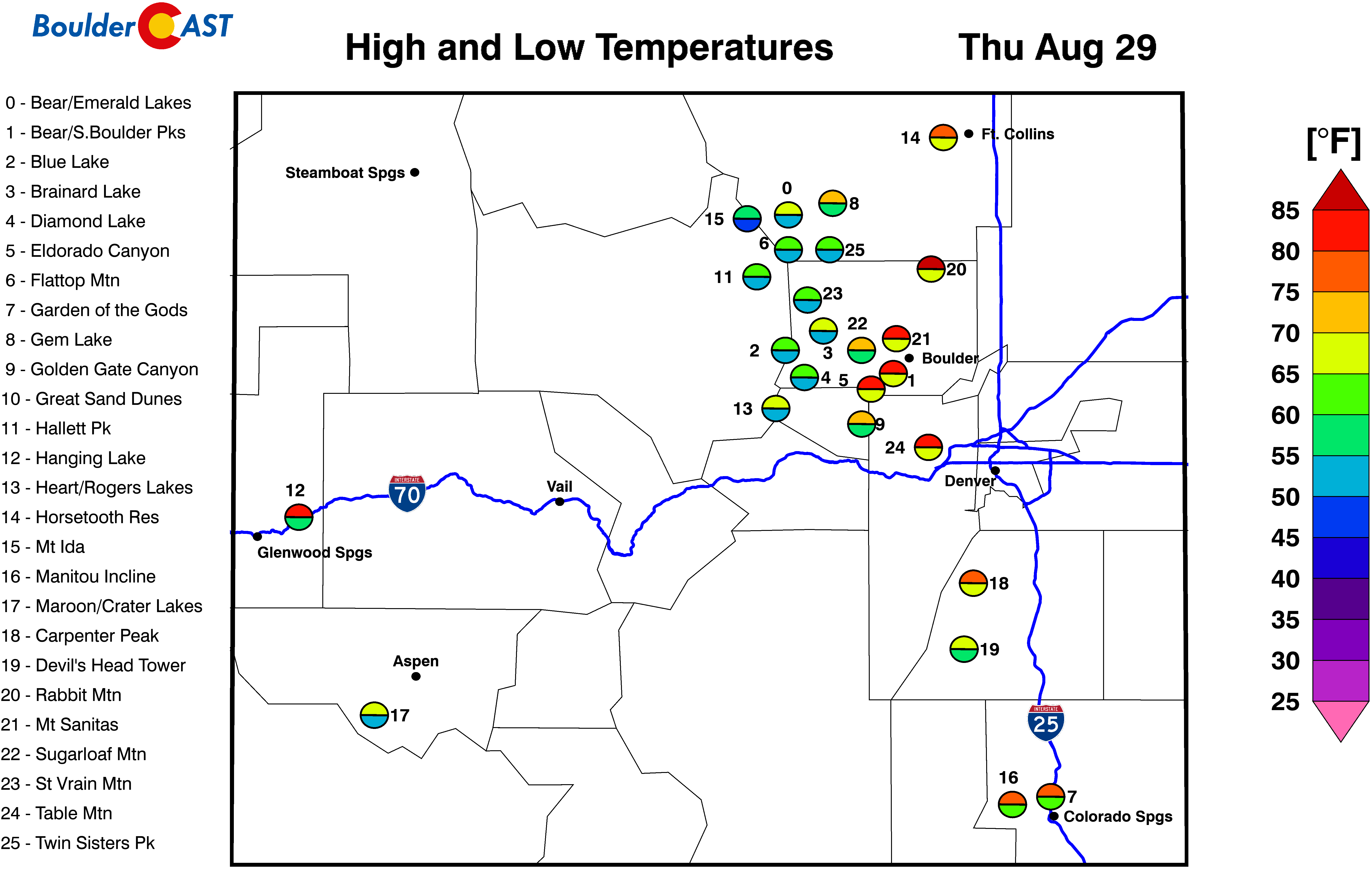
Through the day we will see this drier air take over with plenty of blue skies expected. There will be a few spotty clouds around, mainly early this morning and then again this afternoon, but it will be a dry day nonetheless. Look for high temperatures to reach the lower to middle 80s on Thursday. What a great day!

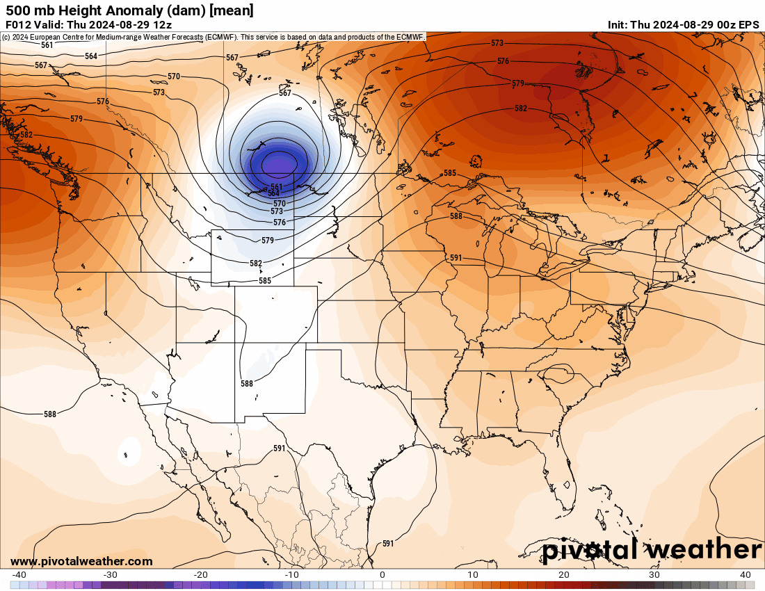
Peering ahead to tomorrow and Labor Day Weekend, things will remain very quiet across the Front Range as essentially there will be no weather systems nearby and dry air will be overhead. After today’s Montana low pressure zips off towards the Arctic, high pressure will slowly build in from the Pacific Ocean and across the Rockies over the weekend, eventually being centered directly over Colorado by Labor Day. This is shown in the European ensemble 500mb height anomaly forecast animation below which spans from today through Monday.
The Front Range should be bone dry under this setup through at least Sunday. Around the early to middle part of next week, moisture will be increasing slightly as high pressure slides slowly off to the south and east. We could see isolated storms return to the forecast as early as Monday (possibly Sunday in the Mountains), but more likely Tuesday or Wednesday will come with slight rain chances in the Denver Metro area.
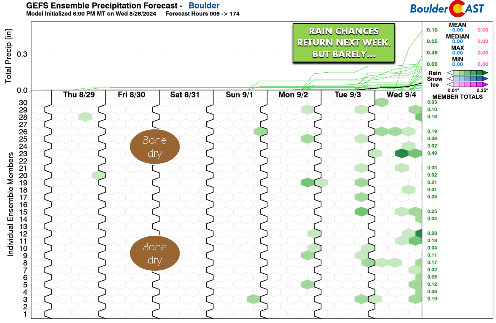
Temperatures during this dry spell will stay near or slightly above normal in the middle 80s to lower 90s. We’re adding a 10% chance of rain to Monday, but that may end up being a bit too optimistic. This truly is a dry stretch ahead! The extended forecast shows more-or-less rinse-and-repeat conditions for us the next four or five days.
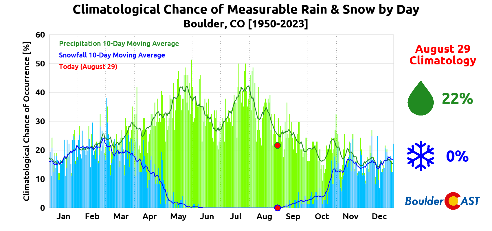
Daily rainfall chances, at least historically, are usually around 25% this time of year, falling down below 20% by the end of September. At this point, the atmospheric setup that supports the flow of monsoon moisture into Colorado usually fades, and that does appear to be the case this year as well. Monsoon season technically continues until the end of September, but that’s more so only for parts of Arizona. For all intents and purposes, monsoon season for Colorado ends on August 31st.
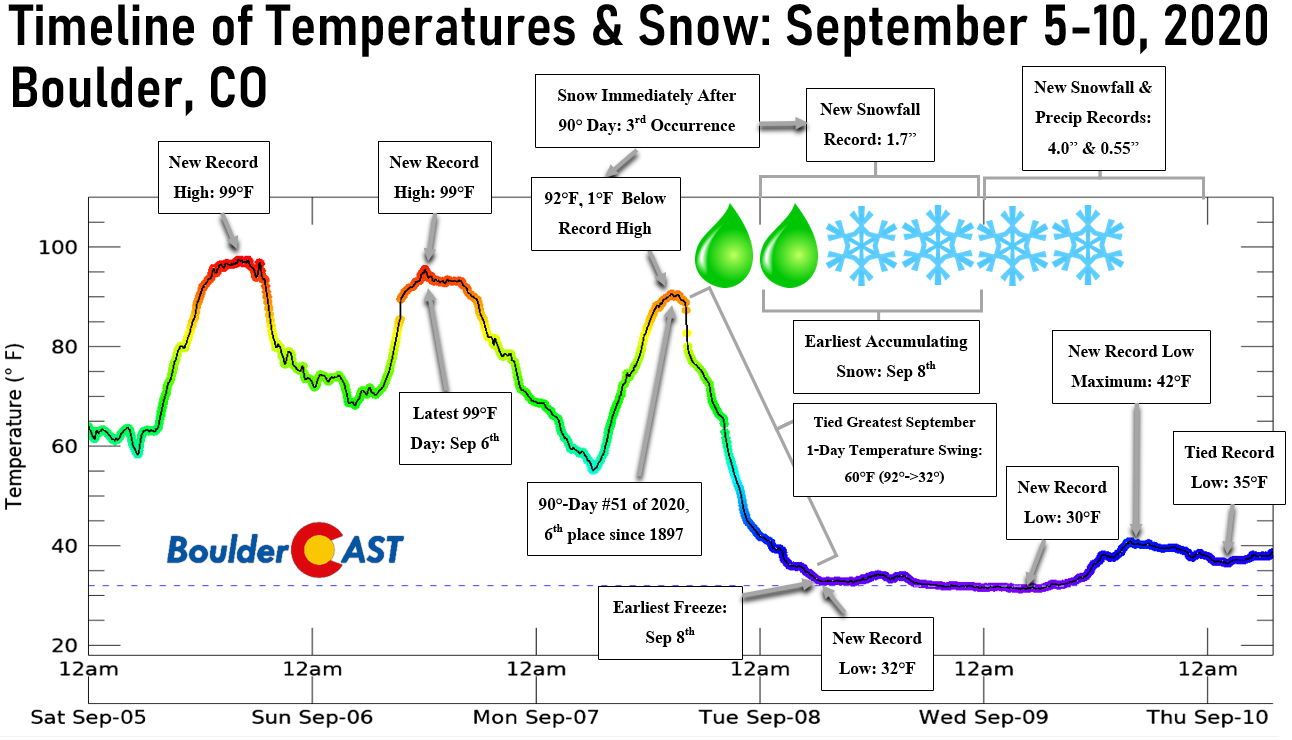
Snow chances also start to increase over the next week or two in these parts. Don’t forget we had freezing temperatures and accumulating snow in Boulder on Labor Day just four short years ago!
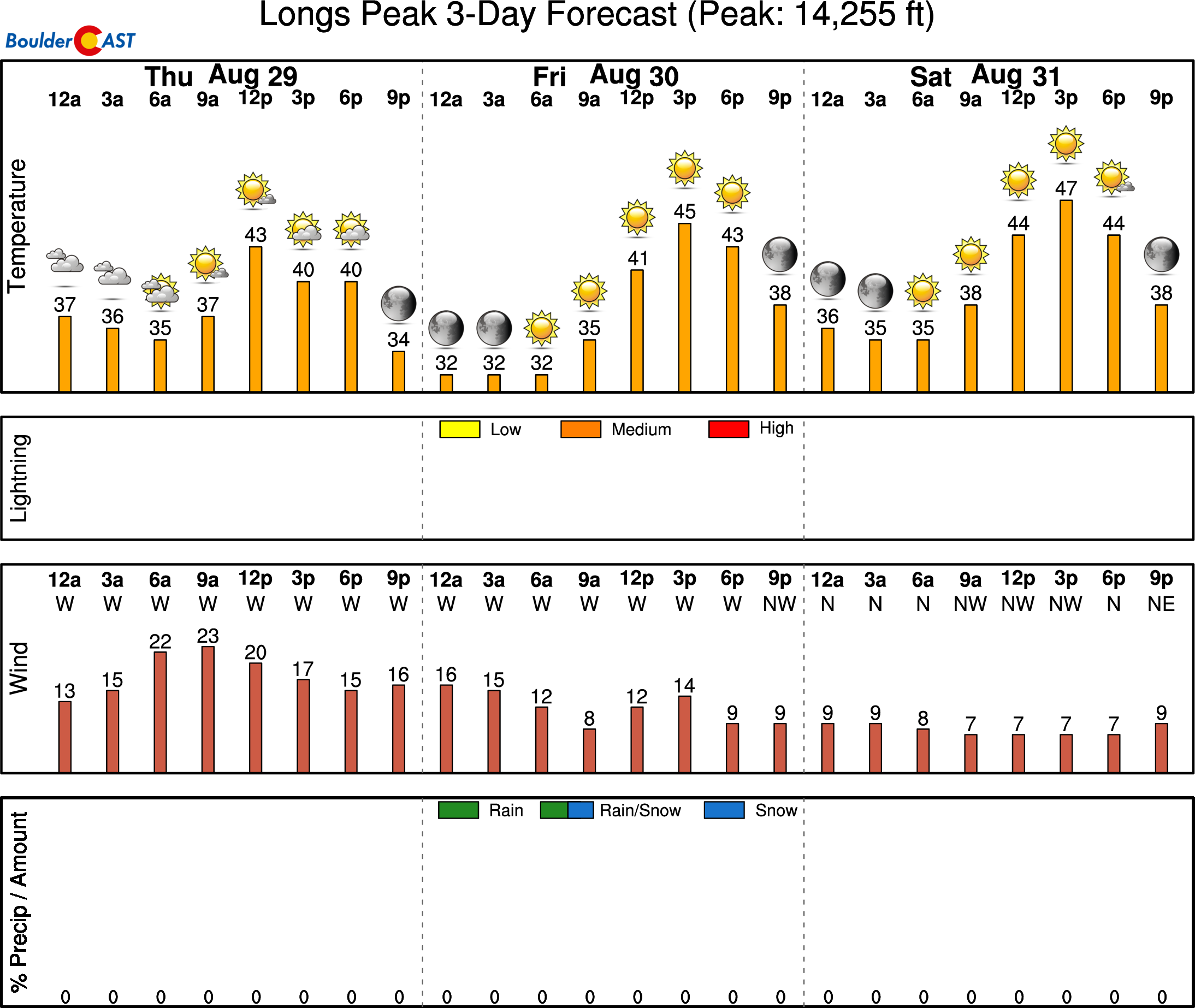
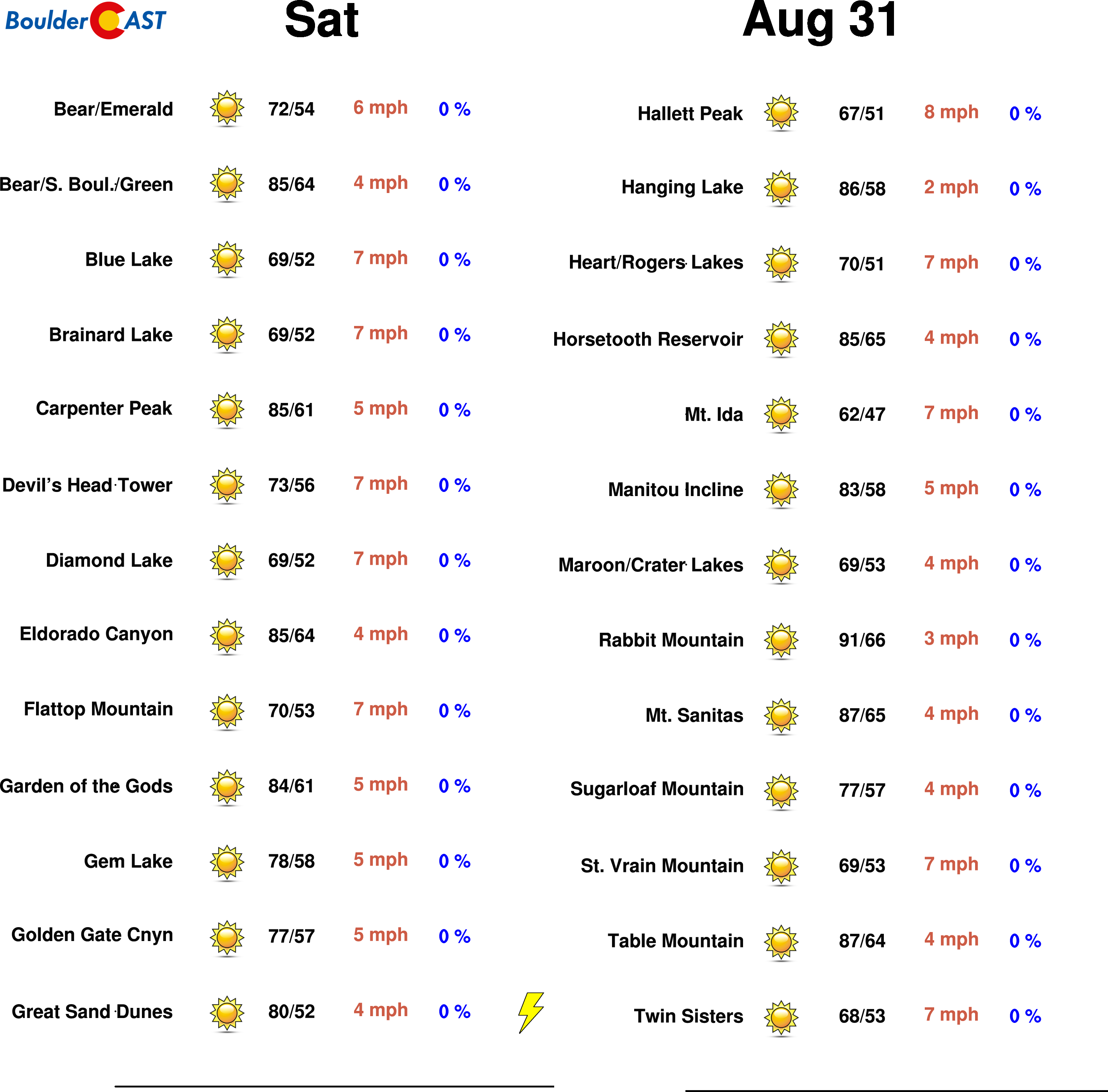
If you’re heading up to the Mountains for the long weekend, especially to do any hiking, be sure to check our SummitCAST page for the latest forecasts. Conditions this weekend look excellent for any camping trips, or any jaunts up 14ers. All the Mountains north of I-70 should be almost totally dry through Sunday morning, with spotty storms returning Sunday and Monday afternoons. The southern ranges in Colorado will have a slight chance of rain almost every afternoon, but nothing to be too concerned about. Enjoy the long weekend and beautiful weather accompanying it!
Get BoulderCAST updates delivered to your inbox:

Go Premium, get all the perks.
Daily Forecast Updates
Get our daily forecast discussion every morning delivered to your inbox.
All Our Model Data
Access to all our Colorado-centric high-resolution weather model graphics. Seriously — every one!
Ski & Hiking Forecasts
6-day forecasts for all the Colorado ski resorts, plus more than 120 hiking trails, including every 14er.
Smoke Forecasts
Wildfire smoke concentration predictions up to 72 hours into the future.
Exclusive Content
Weekend outlooks every Thursday, bonus storm updates, historical data and much more!
No Advertisements
Enjoy ad-free viewing on the entire site.
Enjoy our content? Help us out and give it a share:


You must be logged in to post a comment.