
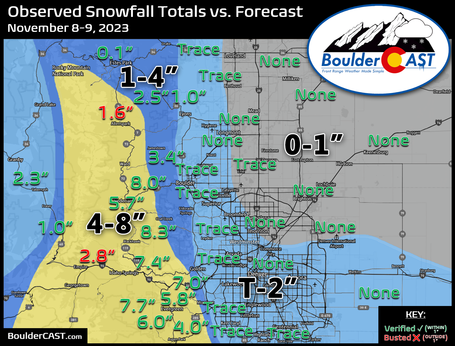
Shown below is our snowfall forecast map issued Tuesday afternoon with actual storm totals overlaid. Green values indicate that our forecast verified to within one inch of the observed snowfall total. Red numbers did not. Overall, a trace to 8″ of snow fell across the region, with basically the only accumulation occurring in the Foothills. Across the lower elevations, no accumulation was reported with just a few western and southern suburbs reporting a trace. Only a trace of snowfall was reported in Boulder with this event, and nothing at all out at DIA. Temperatures were in the upper 30s for most of the day Wednesday, so despite some snowflakes mixing in, it was never able to accumulate, even on the grassy surfaces. By the time temperatures dropped towards the freezing mark Wednesday evening, the precipitation had come to an end.
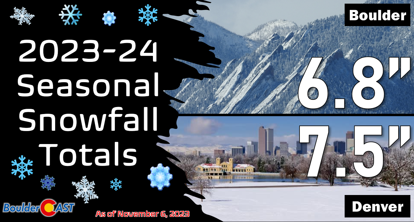
Seasonal snowfall totals will remain at 6.8″ and 7.5″ for Boulder and Denver respectively, with Denver continuing to hold a slight but fleeting lead.


You must be logged in to post a comment.