By the pace of the traffic tonight, many folks are not aware of the surrounding danger from freezing fog and mist that has already begun across much of the region. We give our thoughts on what is now our second ice event in the last seven days.
Of course, just as we get done explaining that these icy scenarios are rare for the Front Range and require impeccable alignment of various atmospheric components…sure enough, our second freezing drizzle event in less than a week! It has been quite the busy week for the team, so we do apologize for not checking in since our weekly outlook on Monday. Four days out, the models were indeed displaying hints of yet another freezing drizzle event for this evening. And we mean very subtle hints, but we did have our suspicions and therefore mentioned it in our weekly forecast.
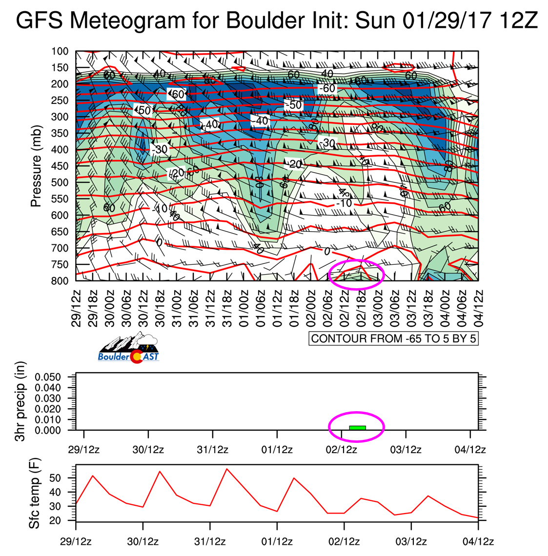
The GFS model meteogram forecast from Sunday morning is shown below. We have circled in pink two indicators we saw for a freezing drizzle event. Very shallow upslope and a saturated layer, as well as hints of potential accumulating precipitation (rain). A keen eye may also notice that the model’s timing was off by about twelve hours…
It was quite far out and these events are so finicky, we only passively mentioned the possibility in our forecast Monday. Fast forward to this evening and the fog has descended across the Denver Metro area!
Temperatures are in the low 20’s as of 7PM at BoulderCAST Station. Light mist has been falling for several hours and roads/sidewalks have become quite icy. We only expect things to get worse overnight as conditions should remain favorable for freezing mist, fog, and a few snow flurries through much of the night. The HRRR model is even showing a secondary push of upslope and cold air after midnight which should enhance the precipitation even further. Too much enhancement will deepen the fog layer and equate to more snowfall however, as opposed to freezing drizzle. It’s a very delicate balance needed to sustain the set-up.
By mid-to-late morning, the fog should lift with sunshine taking over for Thursday afternoon.
IMPACTS:
We can’t urge enough that you take caution! Many folks feel deceivingly safe when liquid is falling from the sky and not snow. With temperatures in the upper teens tonight, ALL of it will be freezing. It seems the Winter Weather Advisory issued earlier today has allowed crews to pre-treat roads. However, it only takes but one missed patch of pavement to create a dangerous sheet of ice and a recipe for a bad time. I personally cannot place my full faith in Boulder’s winter weather road crews based on their track record. Can you?
The fog layer should remain below ~8,000 feet. However, we can’t rule out a little icing or snow a bit higher up as well. If you have the willpower, hiking to the summit of Bear, Green, or South Boulder tomorrow morning for sunrise should produce picturesque “above the clouds” experiences.
Take is slow and bask in another superb display of Front Range weather! If you didn’t get a chance to read our informative post on how these type of events can happen in Denver, be sure to follow the link below. Good evening!


You must be logged in to post a comment.