
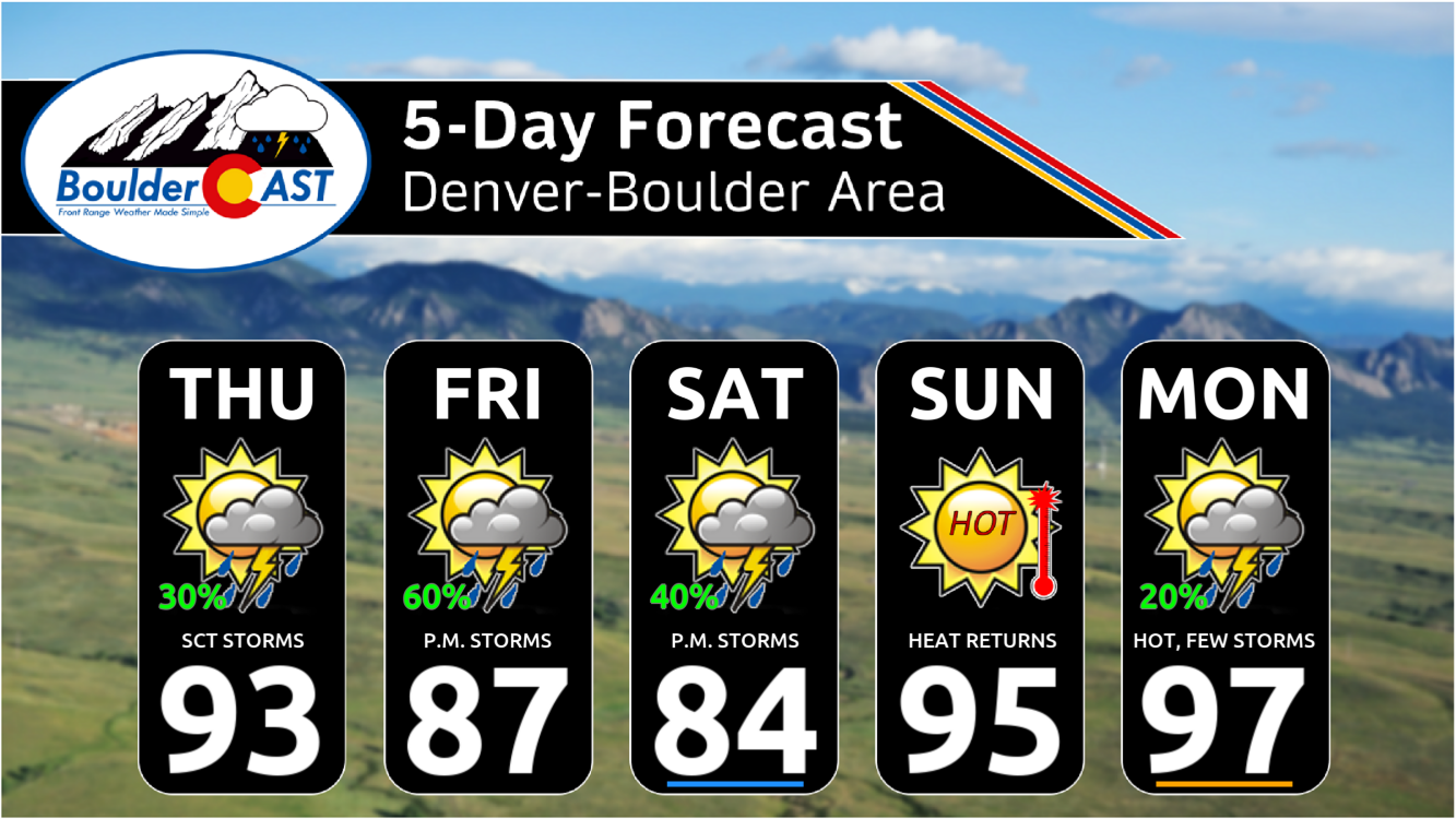
Wednesday brought historic heat across the Front Range, with Boulder hitting a record high of 101°F—the city’s hottest day in over a decade. A weak cold front has since cooled things off slightly, ushering in a good chance of storms the next few days as well. Sunday into Monday turn drier and hotter again as reverse monsoonal flow sets up, potentially stifling our typical summer storm pattern for a bit.
Record-Breaking Heat on Wednesday
Wednesday was no ordinary summer day—Boulder shattered its July 9th record, hitting a sizzling 101°F by late afternoon.
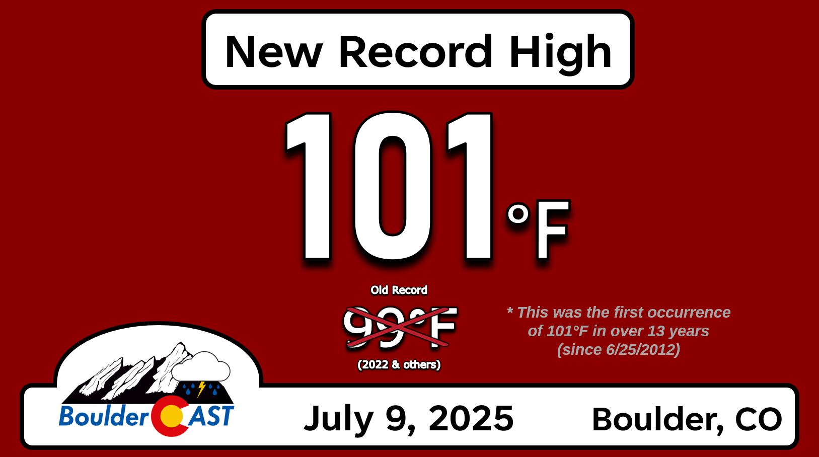
That’s the city’s first 101°F reading in over 13 years, dating all the way back to June 25, 2012—the day before the Flagstaff Fire ignited from lightning, scorching a large chunk of Boulder Open Space forest behind the Flatirons.
Other climate stations across Colorado followed suit on Wednesday:
- Denver: Tied daily record at 100°F
- Fort Collins: New daily record at 100°F
- Pueblo: Tied daily record at 103°F
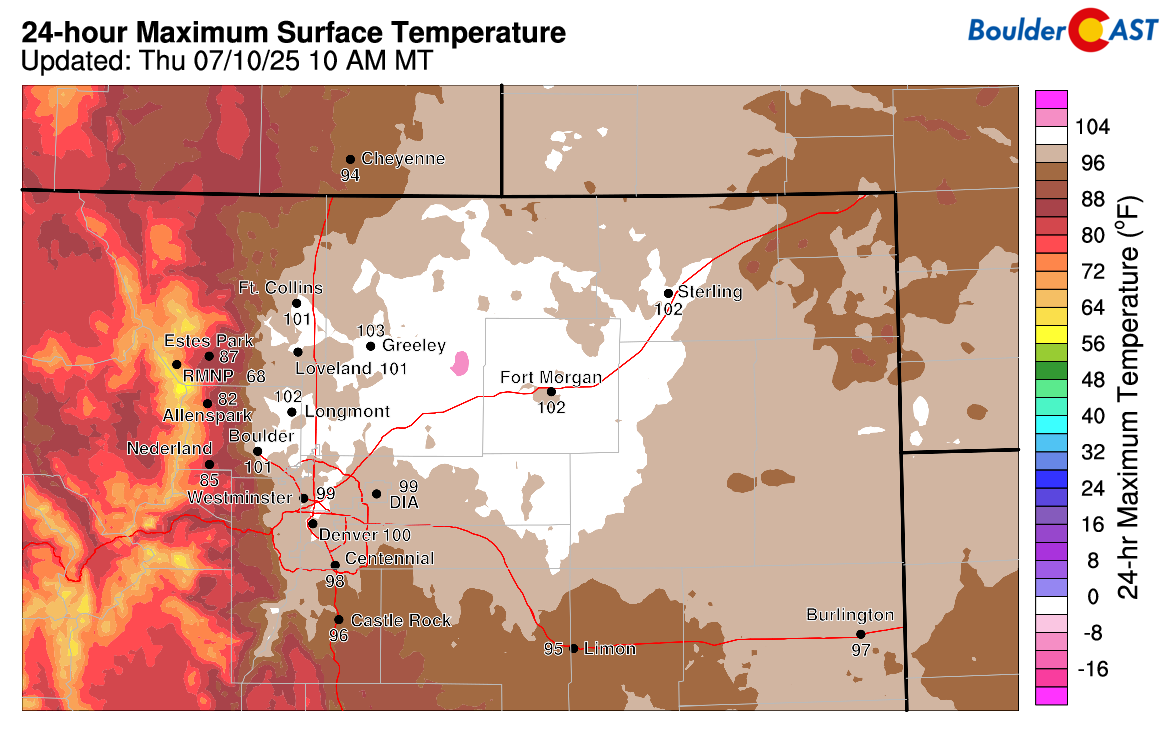
Approximate high temperatures on Wednesday July 9th in NE Colorado
Cold Front Brings (Temporary) Relief
Thankfully, the intense heat broke overnight as a weak cold front moved through from the west. It even sparked some scattered showers in the Denver Metro area early this morning. These were tied to a subtle upper-level disturbance crossing the Rockies.
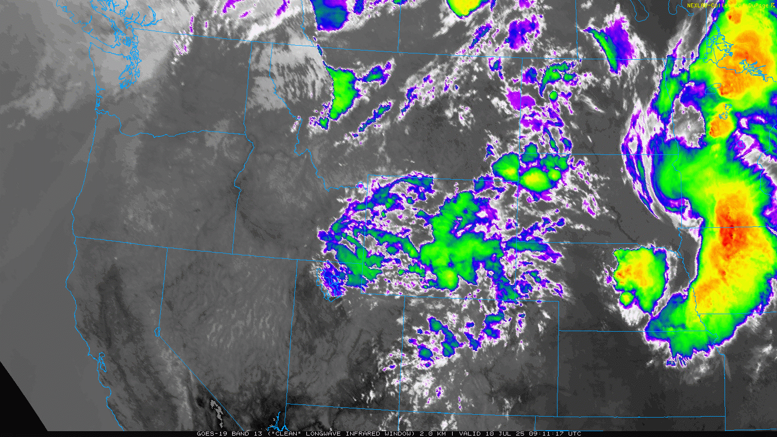
GOES-East infrared satellite animation from Thursday morning
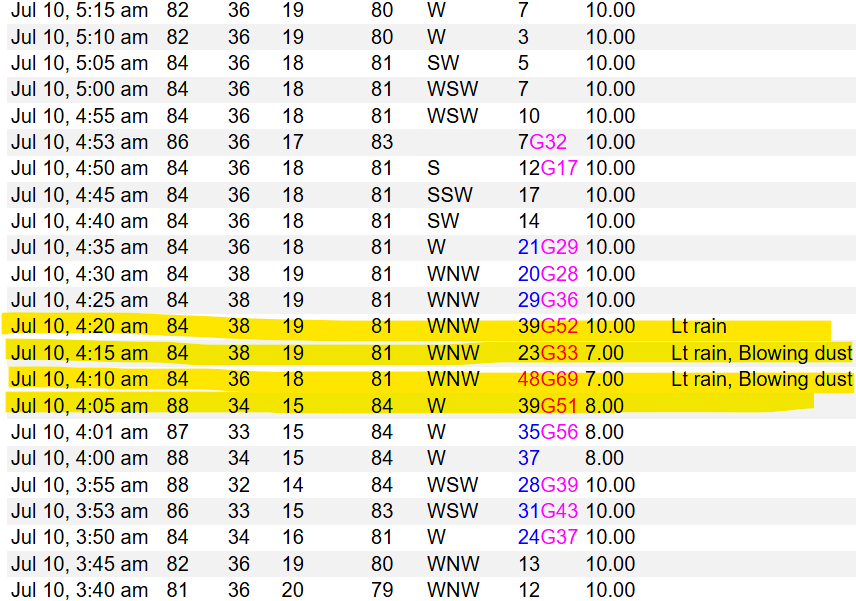
One especially intense shower near DIA produced a dry microburst just after 4:00 AM—with winds clocking in at 69 MPH and an abrupt temperature spike to 88°F. One resident even reported storm damage including downed fences.
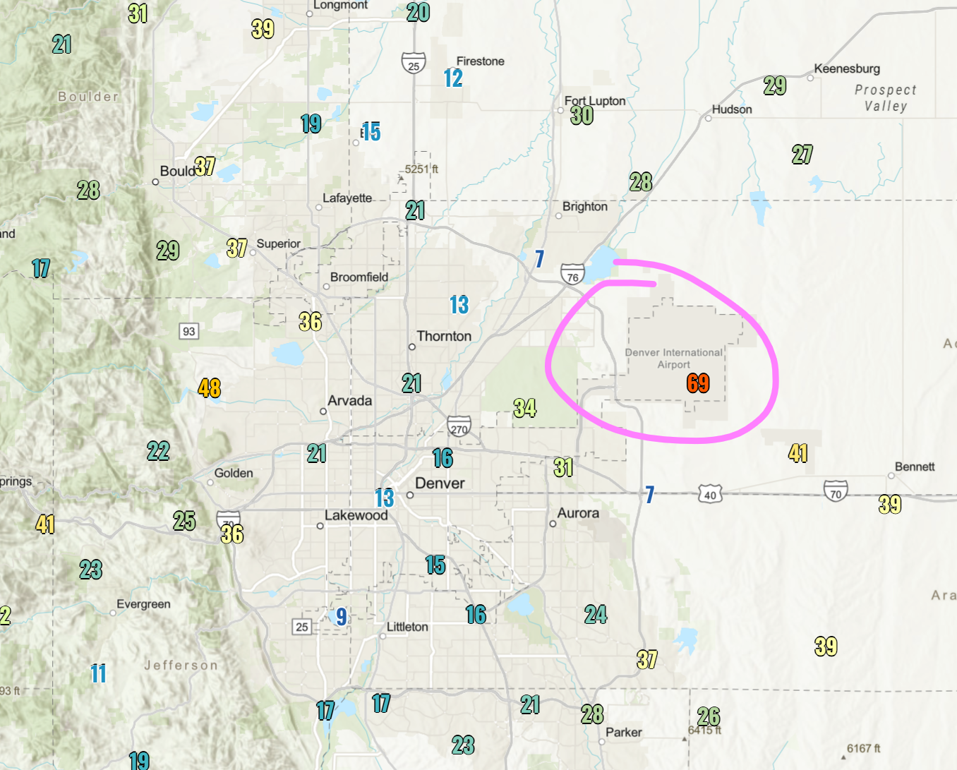
While there’s a slight chance this was a rare “heat burst,” the moisture profile and temperature change lean more towards a classic dry microburst.
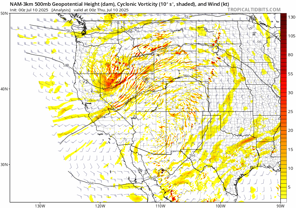
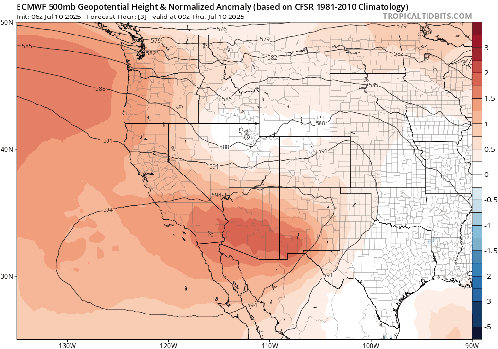
The mid-level ridge is now breaking down as the weak disturbance moves overhead, nudging the ridge southwest toward SoCal and the Baja.
The disturbance will be perfectly timed with daytime heating today, passing through our neck of the woods from midday into the evening. This will aid in storm development across entire area, beginning perhaps as early as 11:00 AM in some spots. Scattered high-based thunderstorms will be around through the day, ending after sunset.
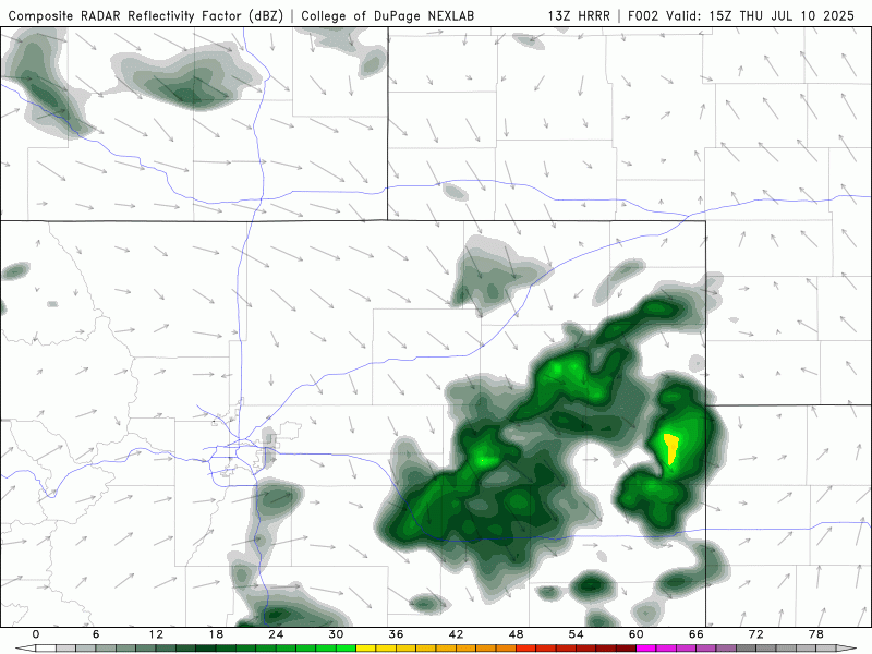
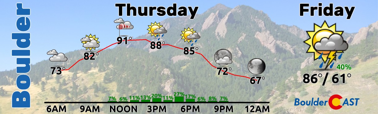
Expect a rapid warm-up Thursday morning as yesterday’s hot airmass mixes down from aloft. Afternoon highs will cool slightly into the lower to middle 90s, and storm coverage sits around 20–30% between 11 AM and 9 PM.
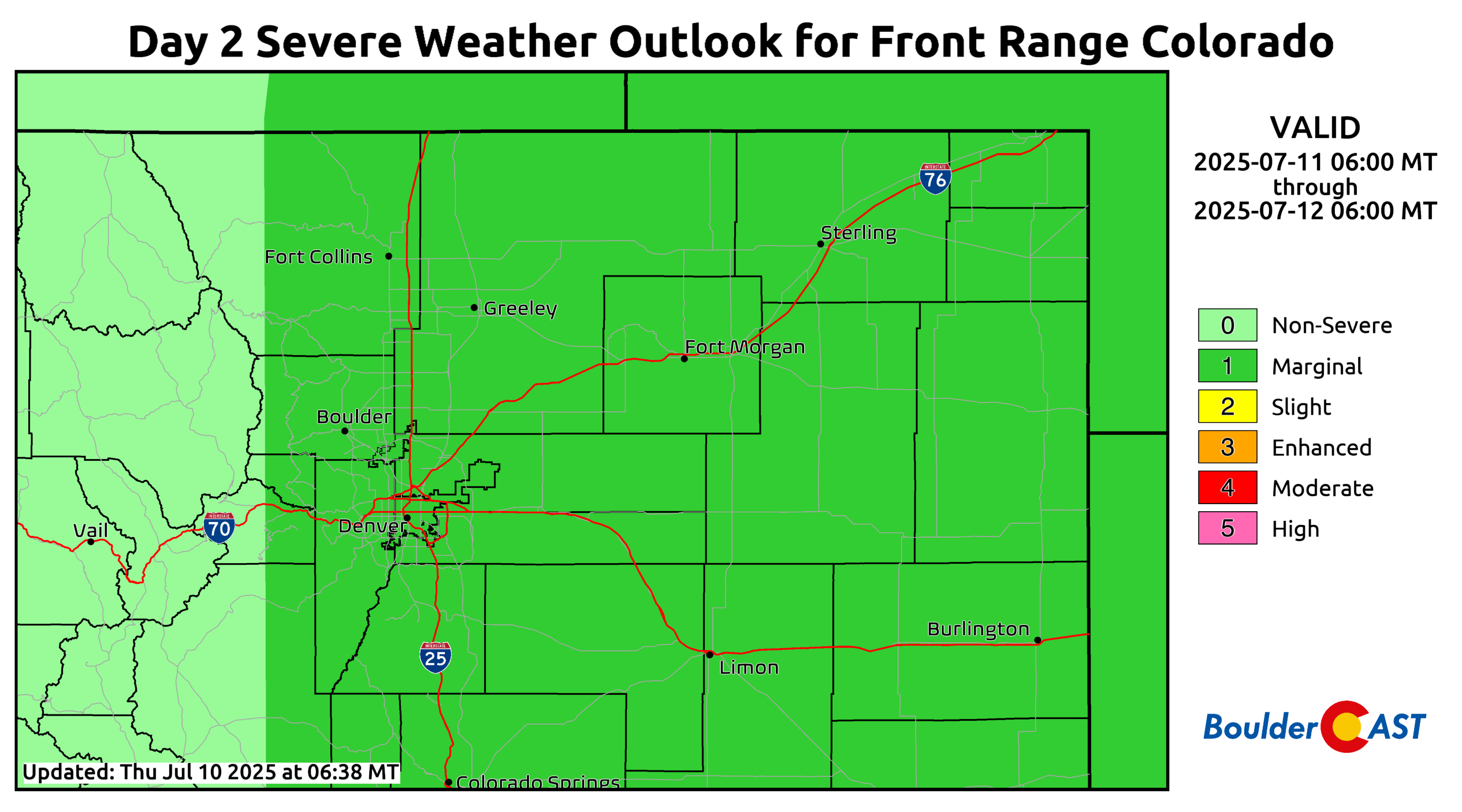
Model soundings and shear profiles don’t look too favorable for severe storms, though wind gusts up to 50 MPH may accompany some of the thundershowers today. Gusts up to 65 MPH are possible east of Interstate 25 where the Storm Prediction Center has a Marginal Risk.

Severe storm outlook for Thursday
On Friday, a stronger July cold front will swing south just after sunrise, pulling in upslope flow and higher moisture. Models have dialed back the front’s intensity a bit, which means less cooling, but also a lower chance of stubborn low clouds. That trade-off actually boosts our potential for afternoon storms. Storm odds Friday sit around 50%, and with improved wind shear, we could see isolated large hail and damaging winds across the area.
Severe storm outlook for Friday
Looking ahead to the weekend, the upper-level ridge settles near southern California while weak low pressure builds over Texas.
Unfortunately, this sets up a reverse monsoonal flow—with winds from the north across the Four Corners, which is opposite of what we want for a healthy monsoon.

This large-scale pattern will work to dry us out Sunday into Monday, with reduced or no chances of rain as our temperatures turn uncomfortably hot again soaring into the middle 90s. Thus, one could say that the heat isn’t totally going way the next couple days—it’s just regrouping! Have a great weekend!

Go Premium, get all the perks.
Daily Forecast Updates
Get our daily forecast discussion every morning delivered to your inbox.
All Our Model Data
Access to all our Colorado-centric high-resolution weather model graphics. Seriously — every one!
Ski & Hiking Forecasts
6-day forecasts for all the Colorado ski resorts, plus more than 120 hiking trails, including every 14er.
Smoke Forecasts
Wildfire smoke concentration predictions up to 72 hours into the future.
Exclusive Content
Weekend outlooks every Thursday, bonus storm updates, historical data and much more!
No Advertisements
Enjoy ad-free viewing on the entire site.
Enjoy our content? Give it a share:


You must be logged in to post a comment.