As the Front Range races towards near-record high temperatures on Thursday, the weather pattern is evolving to offer a short-lived reprieve on Friday with a chance of severe thunderstorms and cooler temperatures accompanied by well-mixed smoke blowing in from Mexico. While the blistering heat will ramp back up again over the weekend, we are tracking a potential dip towards more comfortable temperatures next week. Here’s the latest!

Go Premium, get all the perks.
Daily Forecast Updates
Get our daily forecast discussion every morning delivered to your inbox.
All Our Model Data
Access to all our Colorado-centric high-resolution weather model graphics. Seriously — every one!
Ski & Hiking Forecasts
6-day forecasts for all the Colorado ski resorts, plus more than 120 hiking trails, including every 14er.
Smoke Forecasts
Wildfire smoke concentration predictions up to 72 hours into the future.
Exclusive Content
Weekend outlooks every Thursday, bonus storm updates, historical data and much more!
No Advertisements
Enjoy ad-free viewing on the entire site.
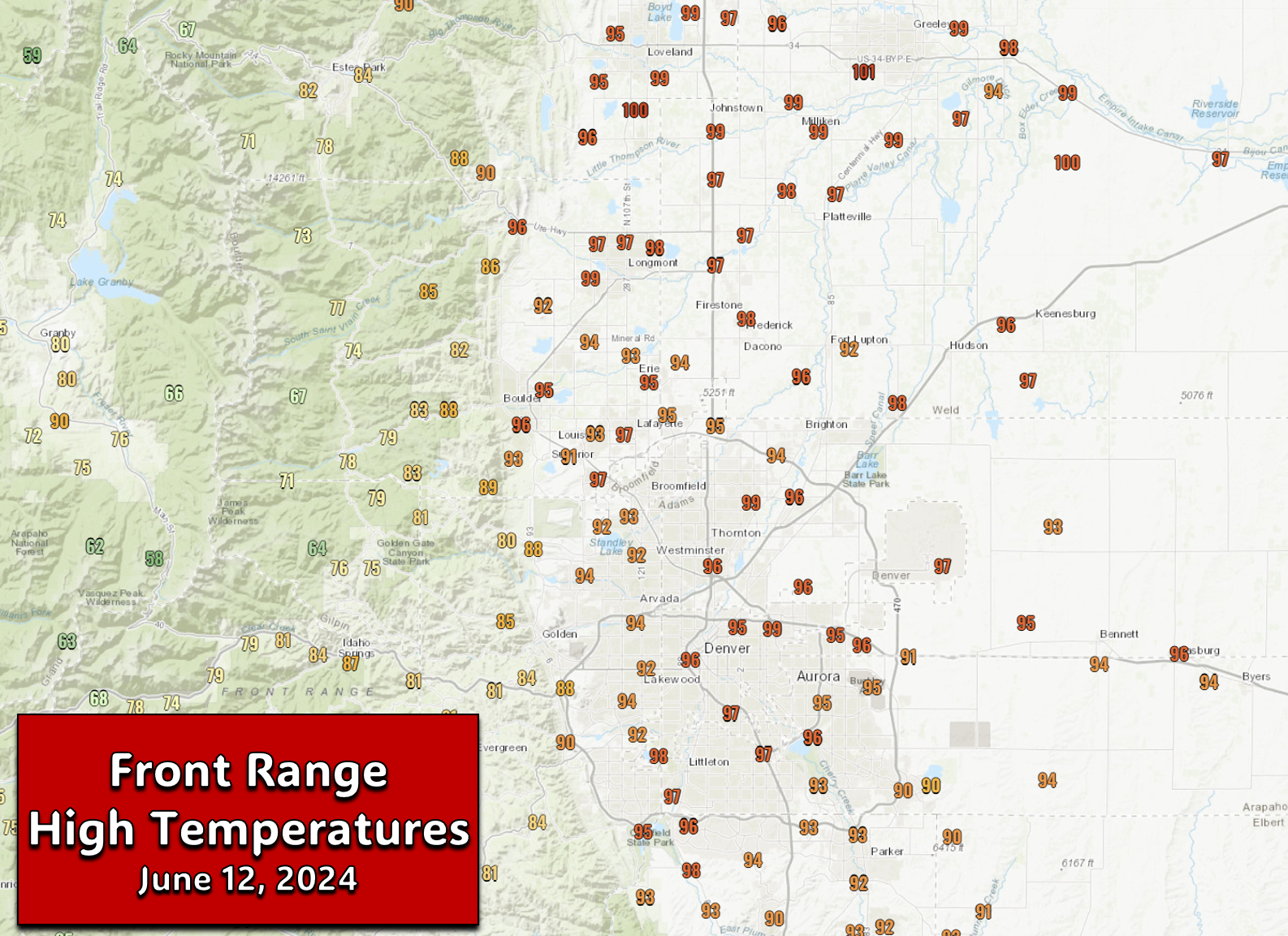
esterday’s high temperatures soared into the middle 90s across most of the Denver Metro area, with even a few hotter spots like Longmont and Greeley reaching the upper 90s! Denver (DIA) tied a record high for the date at 97°F, while Boulder was just a couple degrees behind.
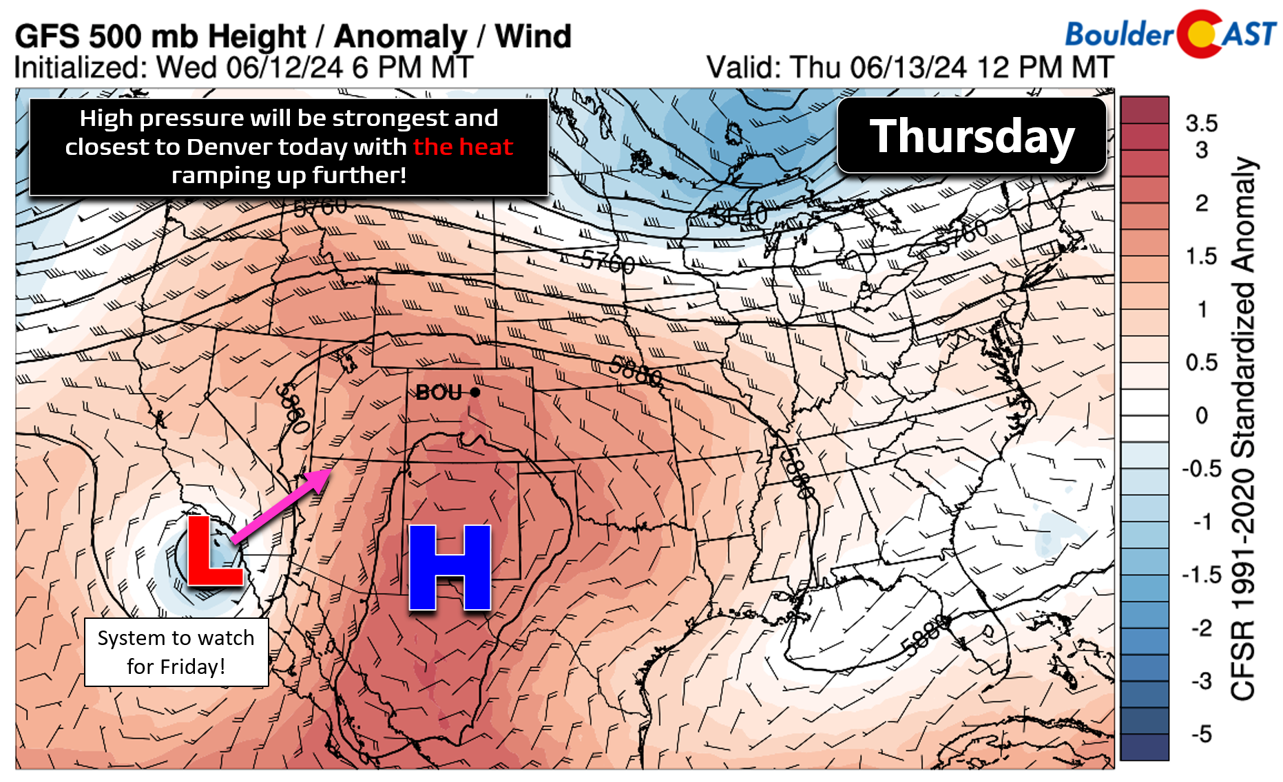
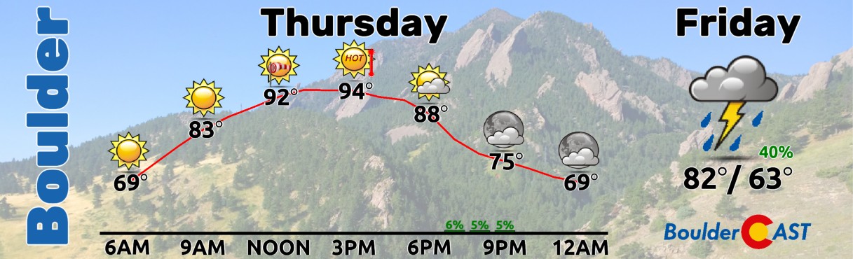
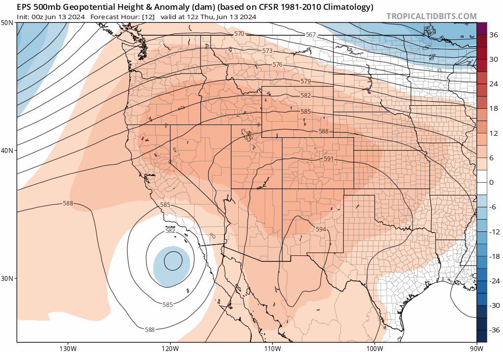
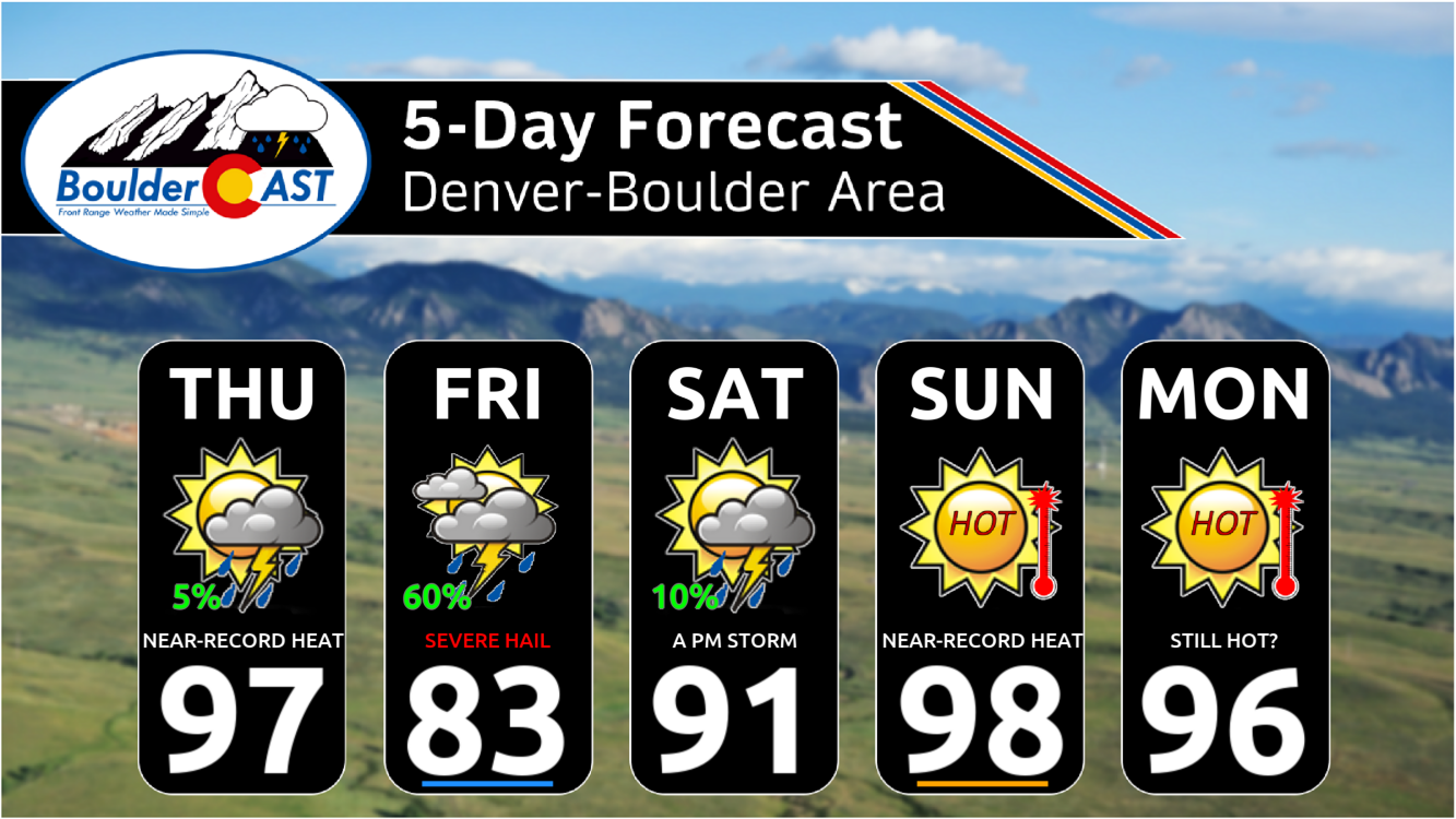
As hot as it was on Wednesday, which was the warmest day yet in 2024, today we’ll be even hotter as the large-scale pattern remains largely unchanged. The ridge of high pressure, now located directly to our south in New Mexico, will be at its strongest and closest approach to Denver this afternoon leading to further warming of the airmass.
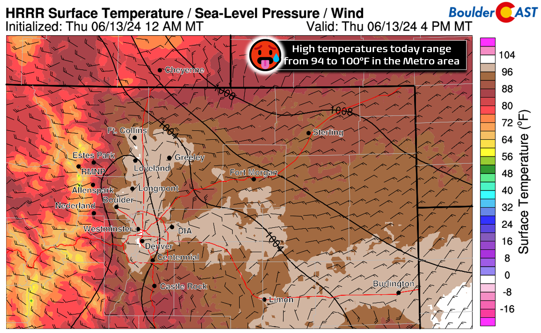
Highs will tick upwards a few degrees above Wednesday’s values, landing in the middle to upper 90s for most of the area, with a few spots likely to reach 100 degrees!
However, similar to yesterday, high-based showers and virga will be coming off the higher terrain by afternoon and early evening with clouds thickening and slightly cooler, gusty winds dotting the area. Areas that catch earlier outflow gusts may end up a tad cooler. The Storm Prediction Center does include much of the area at Marginal Risk for damaging dry microbursts with gusts up to 60 MPH. This is most likely to occur northeast of Denver around Greeley or Fort Morgan. Overall, it’s definitely going to be another hot day with morning sunshine turning partly to mostly cloudy later in the day with wind gusts hopefully helping to take the edge off the heat. The chance of rain is about 5% with isolated sprinkles on the table from any of the gusty showers!
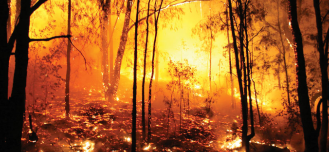
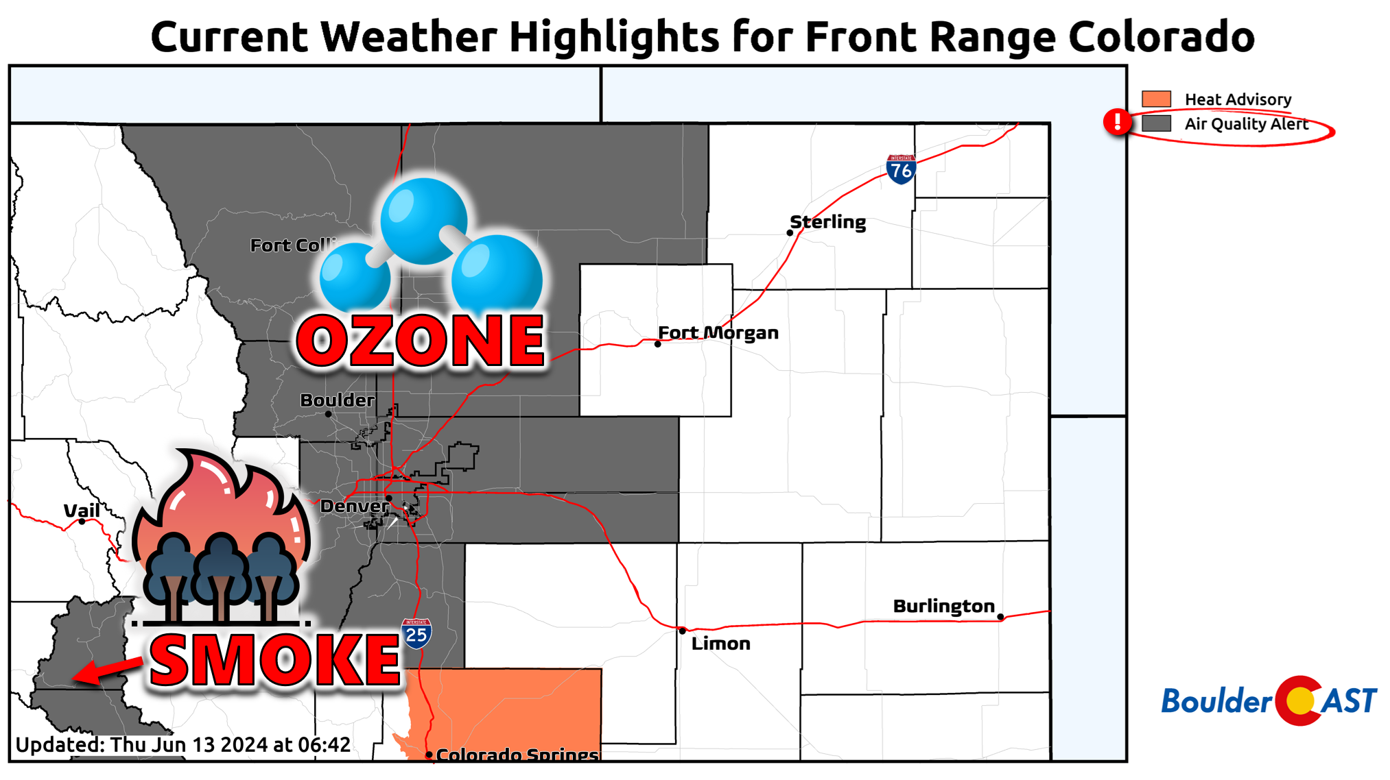
For the third or fourth straight day, the Denver Metro area will once again be under an Air Quality Alert for ozone which may reach hazardous levels for sensitive groups. We also have a separate Air Quality Alert in place near Leadville due to surface smoke from the 400+ acre Interlacken Fire which is not yet contained (and was ignited by an abandoned campfire sadly).
Looking ahead, our big and hot ridge of high pressure will breakdown tonight with a incoming cut-off low pressure set to move in from the Baja. This will bring a surge of subtropical moisture into Colorado tomorrow (along with a cold front this evening).
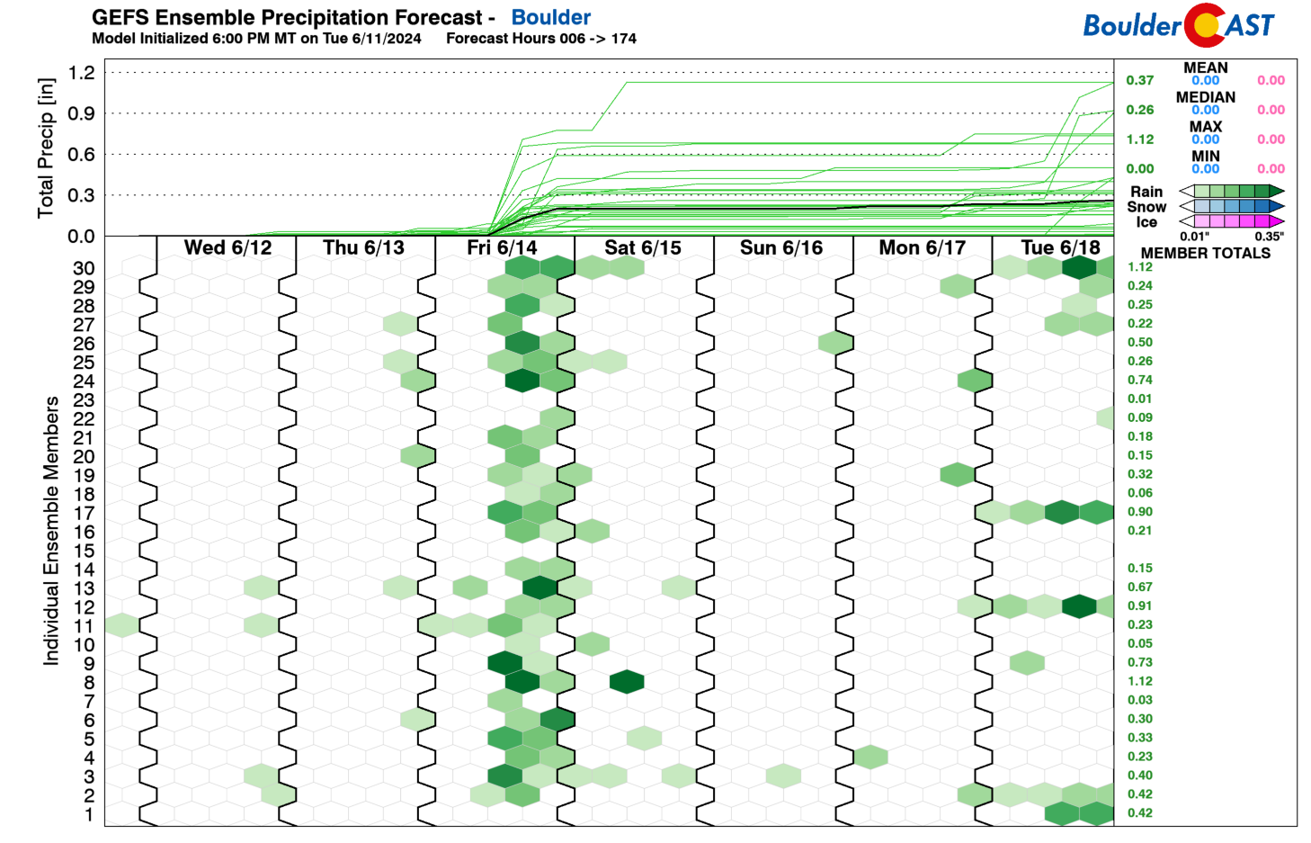
For Friday, expect more clouds and a much better chance of storms, but the wet weather won’t be a slam dunk. As always, with the convective nature of things this time of year, some places will do better than others. In general, though, a broad brush of 0.2 to 0.5″ of rain is expected, with locally higher and lower totals. Storms will fire during the early afternoon, with lingering spotty showers into Friday night. The best chance of storms for us appears to come between Noon and 6PM Friday. Highs tomorrow will be some 15 degrees cooler in the lower to middle 80s — woohoo!
We’re also tracking a chance for storms to turn severe on Friday across eastern Colorado, with the primary risk for us coming during the afternoon hours when large hail (up to 1.5″ in diameter) and damaging wind gusts could occur. The better risk, as always, will be east of Denver as our storms intensity downstream in the more moisture-rich environment of the Eastern Plains.
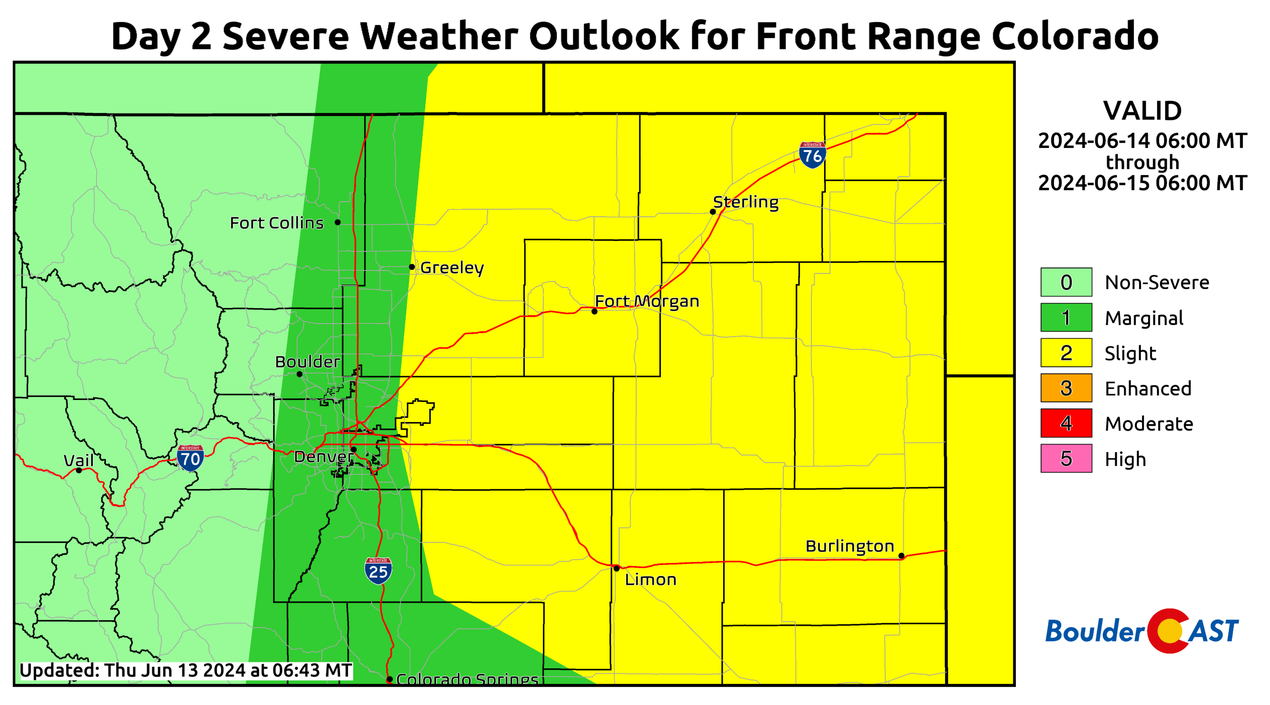
Boulder County in particular could use any and all moisture Mother Nature will give us on Friday as we’re on the cusp of slipping back into drought. Since April 29th, we’ve only received 0.61″ of rainfall, an all-time low for the 7-week late-spring period ending June 12th. In fact, we’ve seen less than half the previously low from 2006!
🏜️The unprecedented dry late-spring in #Boulder continues! Just 0.61" of rain has fallen in the city since April 29th, less than half the previous record low year of 2006.
We should see measurable rainfall this afternoon and evening, but soaking rains will be sporadic #COwx pic.twitter.com/qCG4bYvW0U
— BoulderCAST Weather 🏔️❄️ (@BoulderCAST) June 14, 2024
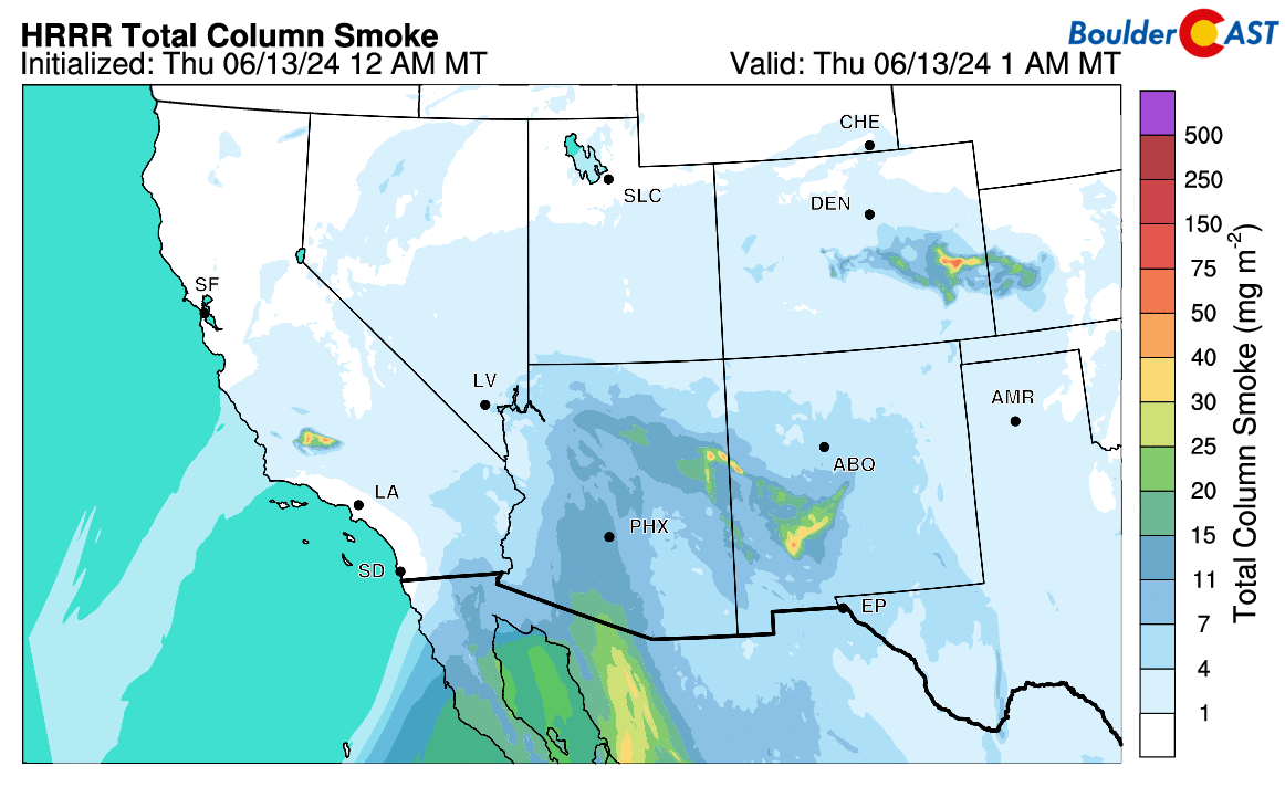
The incoming low pressure tonight will allow for a deep fetch of southerly flow into the Four Corners region, with origins well south in Mexico where large wildfires are actively burning. Thus, in addition to spotty locally-sourced smoke from the Interlacken Fire discussed earlier, widespread and well-mixed Mexican smoke will be arriving to the entire state tonight and will be around tomorrow into the weekend. It won’t pose any major air quality issues, but it will certainly produce a noticeable haze when viewing the Mountains! Head over to our Colorado Smoke Forecast page for the latest!
The rest of the weekend will feature largely dry and hot conditions across the Front Range, with just enough lingering moisture to allow for isolated PM thundershowers each day, mainly across the higher terrain. Temperatures will return above seasonal normals into the 90s both days, even towards the middle to upper 90s by Sunday.
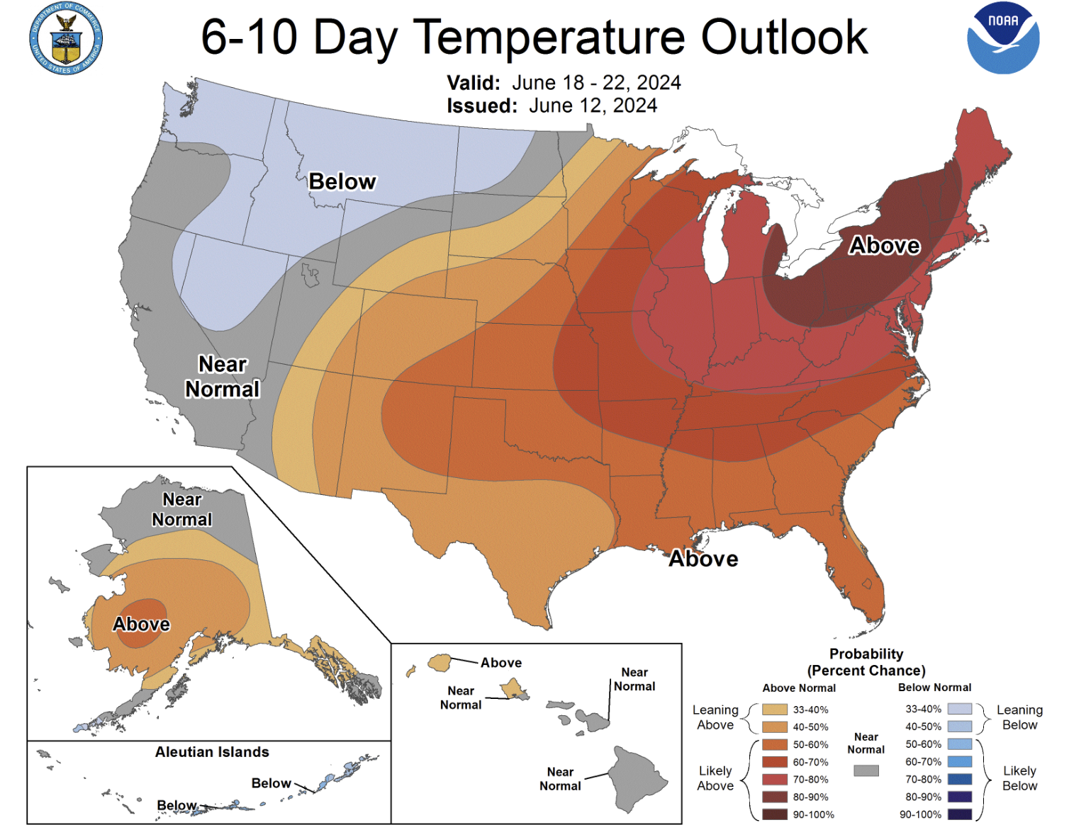
By early next week, we finally begin to see a welcomed pattern shift with a broad area of low pressure making progress into the northwestern United States. There is quite a bit of model variation on exactly how far south and east this trough makes it and when, but eventually it should reach our area and cool us off considerably. This is likely to happen sometime around Tuesday or so. However, right now it is not clear if Monday will be somewhat cooler, or if it will be yet another day flirting with the century mark!

Despite most ensemble suites generally showing this trough at least partially clipping northern Colorado next week, we have our doubts as this southward push becomes more and more unlikely this time of year. It seems the Climate Prediction Center is also a bit apprehensive as well:
For now, we’re going to lean “likely hot” on Monday with another dry day and temperatures well into the 90s. Just be aware that it could be cooler depending on the timing of the aforementioned cold front, and if that front does arrive, there could also be a slight chance of rain. It’s clear based on our five-day forecast that summertime is ever near — enjoy!
Get BoulderCAST updates delivered to your inbox:
Go Premium, get all the perks.
Daily Forecast Updates
Get our daily forecast discussion every morning delivered to your inbox.
All Our Model Data
Access to all our Colorado-centric high-resolution weather model graphics. Seriously — every one!
Ski & Hiking Forecasts
6-day forecasts for all the Colorado ski resorts, plus more than 120 hiking trails, including every 14er.
Smoke Forecasts
Wildfire smoke concentration predictions up to 72 hours into the future.
Exclusive Content
Weekend outlooks every Thursday, bonus storm updates, historical data and much more!
No Advertisements
Enjoy ad-free viewing on the entire site.
Enjoy our content? Help us out and give it a share:


You must be logged in to post a comment.