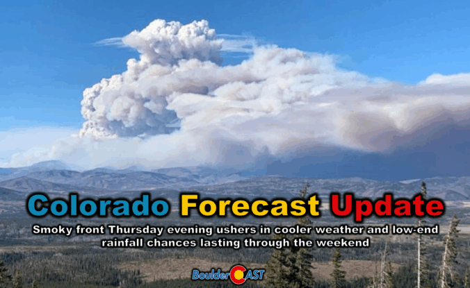
Thursday’s shaping up to be a busy weather day across the Front Range. We’re looking at hot temperatures, gusty winds, and a cold front arriving by evening that’ll bring a noticeable drop in temps — along with a wave of wildfire smoke. We’ll walk through what to expect today, how the weekend is shaping up, and whether any moisture from Hurricane Lorena might sneak into the region.
At a Glance:
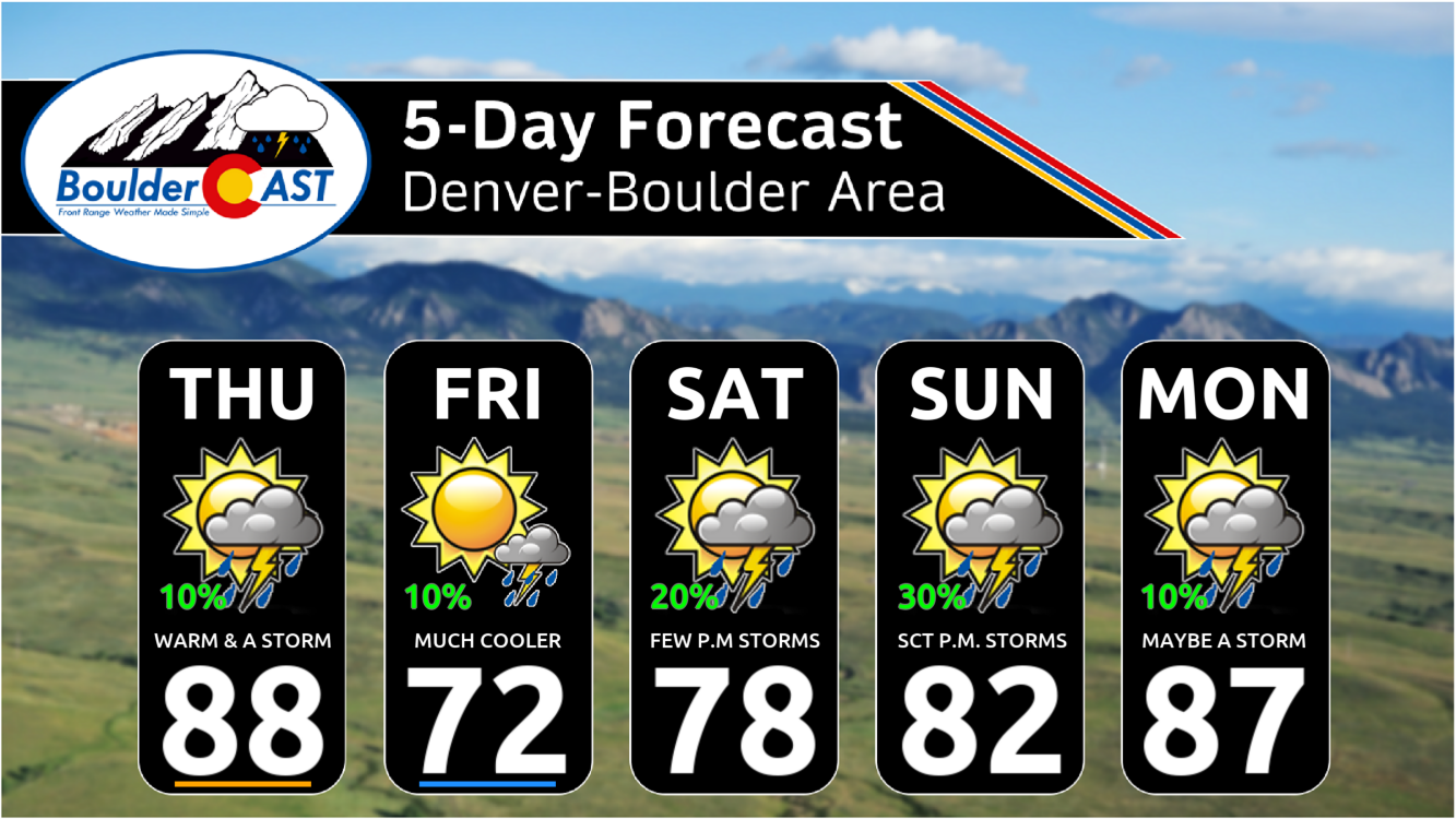
- Thursday heats up: Downslope flow drives temps into the upper 80s and low 90s across the Front Range, marking the hottest day since August 21st.
- Cold front arrives Thursday evening: A smoke-laden front tied to a distant low in Minnesota sweeps in around sunset.
- Smoke surge expected: Thick wildfire smoke from the Pacific Northwest and Canada will ride in with the front, degrading air quality Thursday evening; PM2.5 levels upstream are already unhealthy.
- Storm chances stay low: A few late-day storms may pop Thursday along the front and again over the weekend, but rainfall totals look unimpressive — outflow winds may be the bigger story for the lower elevations.
- Fall preview on Friday: Post-frontal air brings a crisp drop in temperatures, with highs in the low 70s and overnight lows dipping into the upper 40s by Friday night.
- Weekend moisture outlook: Some tropical moisture from Hurricane Lorena may reach the Four Corners, but the Front Range likely only gets isolated to scattered storm chances.

Go Premium, get all the perks.
Daily Forecast Updates
Get our daily forecast discussion every morning delivered to your inbox.
All Our Model Data
Access to all our Colorado-centric high-resolution weather model graphics. Seriously — every one!
Ski & Hiking Forecasts
6-day forecasts for all the Colorado ski resorts, plus more than 120 hiking trails, including every 14er.
Smoke Forecasts
Wildfire smoke concentration predictions up to 72 hours into the future.
Exclusive Content
Weekend outlooks every Thursday, bonus storm updates, historical data and much more!
No Advertisements
Enjoy ad-free viewing on the entire site.
Very warm Thursday
Expect the hottest day of the week today as warm downslope winds sweep across the Front Range ahead of a strong, smoke-filled cold front arriving this evening. Most spots will climb into the upper 80s, with usual hot zones like Longmont and Greeley flirting with the low 90s. It’s the warmest we’ve been since August 21st — hard to believe it’s been nearly two weeks of mild weather!
We’ll start off sunny, but clouds will build through the afternoon. There’s a slim 10% chance of a storm after 3PM — nothing major, just light rain and brief gusty outflow winds if anything pops. Winds more broadly will gust between 10 and 20 MPH, especially across Larimer and Weld Counties, where fire danger will be elevated.
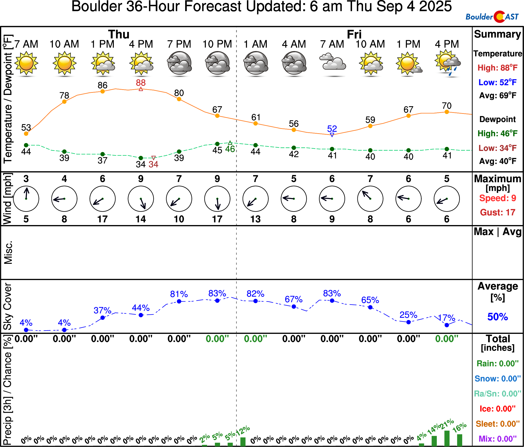
Models suggest the front arrives around sunset, but it could swing in a few hours earlier or later. We’re on the trailing edge of this boundary, which is loosely tied to a surface low up in Minnesota. It’s not sharply defined here, so timing remains a bit uncertain.
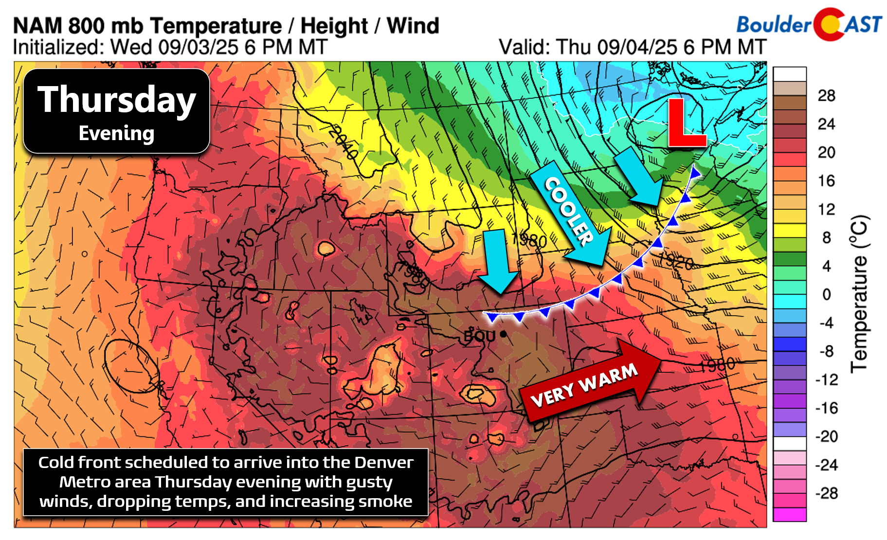
The smoky cold front
Once the front pushes through, temps will tumble — expect lows near 50° by Friday morning, and possibly dipping into the 40s for Friday night. Fall is knocking on the door!
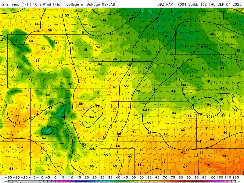
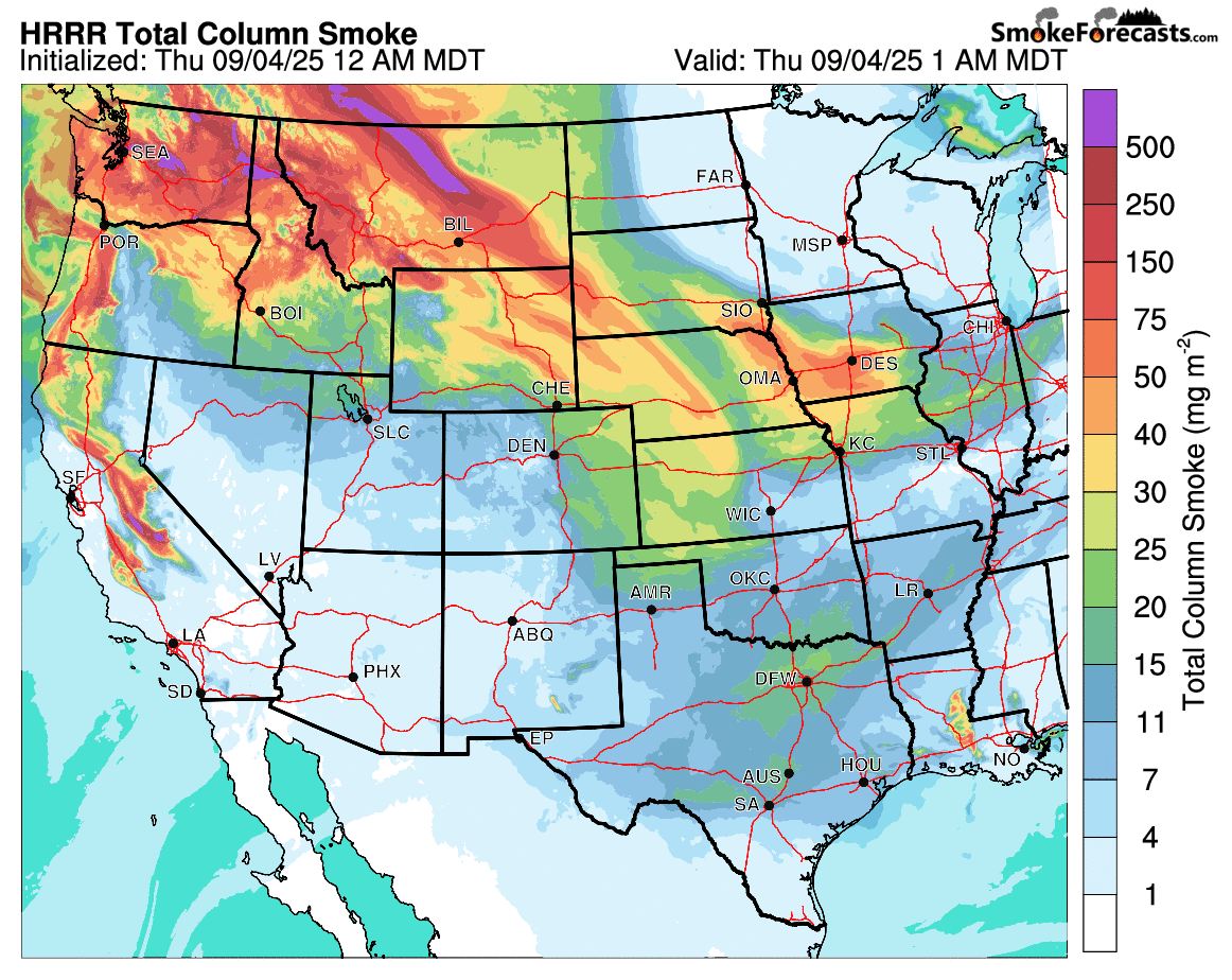
RAP surface temperature and wind forecast through Thursday night showing the frontal passage
This front is dragging with it a dense plume of wildfire smoke from the Pacific Northwest and western Canada. The latest HRRR smoke forecast shows the particulate transport — a textbook example of convergence along a frontal boundary!
GOES-East satellite imagery also clearly captures the smoky ribbon stretching across the northern Rockies and Plains right now:”
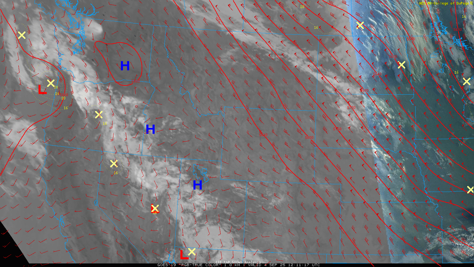
GOES-East visible satellite loop from early Thursday showing the smoke draped across the northern Rockies and Plains
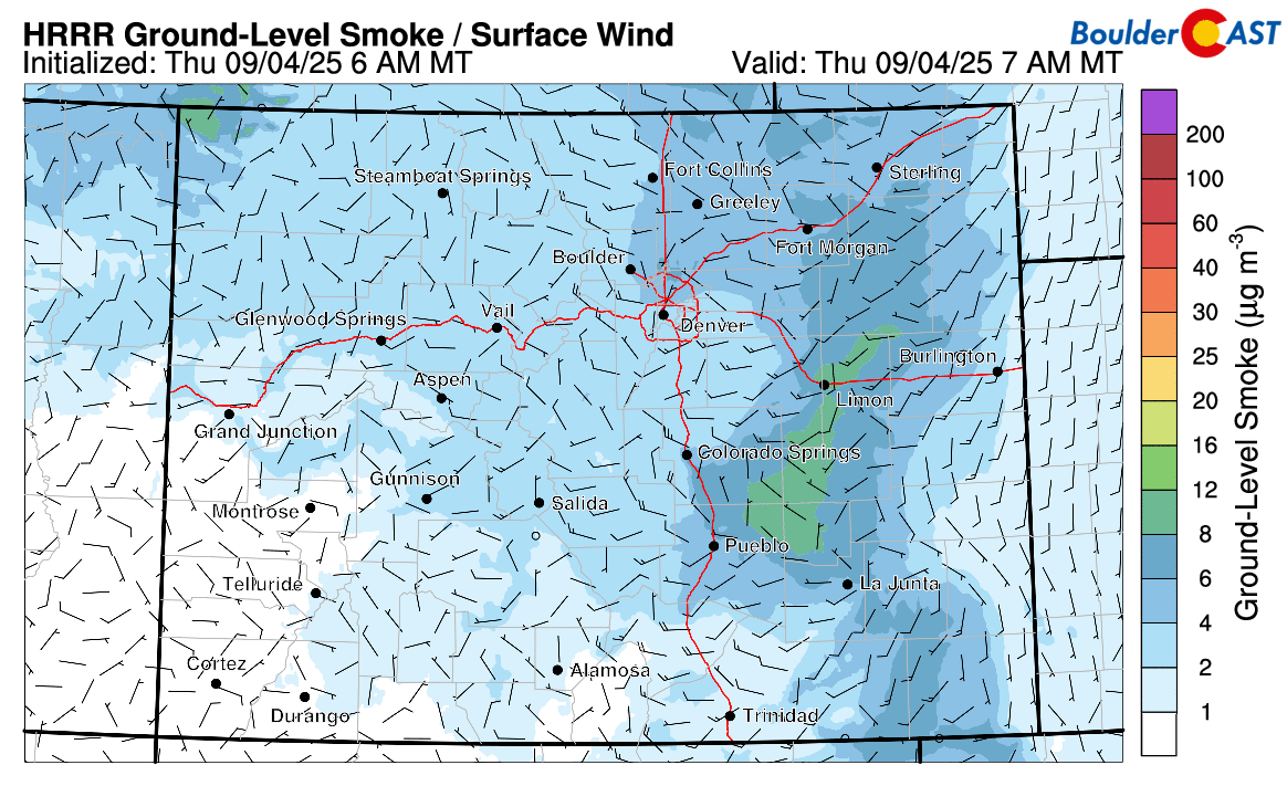
While much of the smoke will stay lofted, HRRR ground-level forecasts show that the initial northeasterly push along the front Thursday evening will bring in thick surface smoke. This model does show smoke clearing out pretty well on Friday across the lower elevations, but this might be too optimistic given how much smoke is actually coming into Colorado. The mountains definitely look to remain socked in with thick smoke through at least Saturday morning.
Air quality will for sure take a hit as the smoke settles in. PM2.5 levels upstream from Denver are already above 100 — and that air is headed our way!
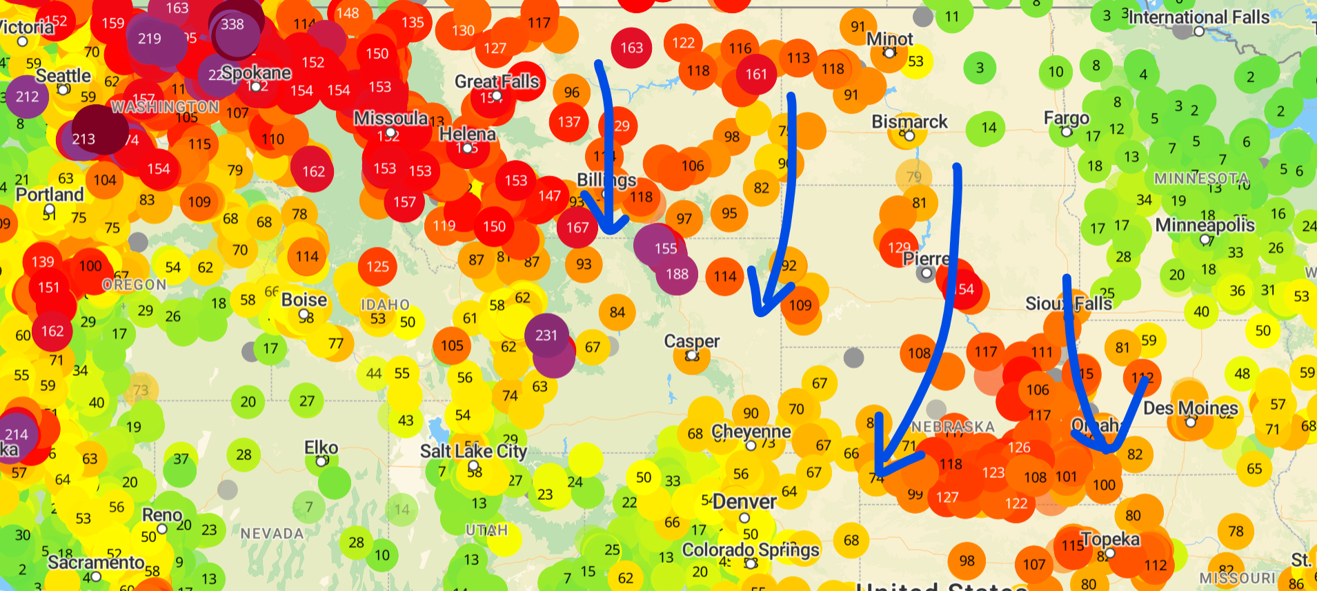
PM 2.5 AQI as of Thursday morning. A broad area of unhealthy air is noted north and northeast of Colorado
Crisp on Friday
Post-frontal air will feel autumnal, with highs only in the low 70s. A few thundershowers may bubble up over the higher terrain, with a slight chance (10%) one drifts into the Denver-Boulder area late in the day.
Weekend brings low-end rain chances
Looking ahead, Colorado stays under northwest flow with weak high pressure nudging in from the west. Meanwhile, a deep trough holds steady over the Great Lakes and East Coast.

This northwest flow setup is likely to offer only limited moisture for us but with a few embedded shortwaves. However, it’s unclear how well they’ll align with daytime heating. For now, we’re keeping low-end storm chances in the forecast through early next week, but don’t expect much actual accumulation.
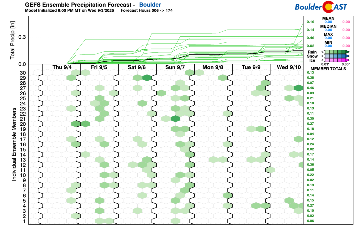
Sunday looks like the best shot of rain here, thanks to a possible moisture bump from Hurricane Lorena’s remnants.
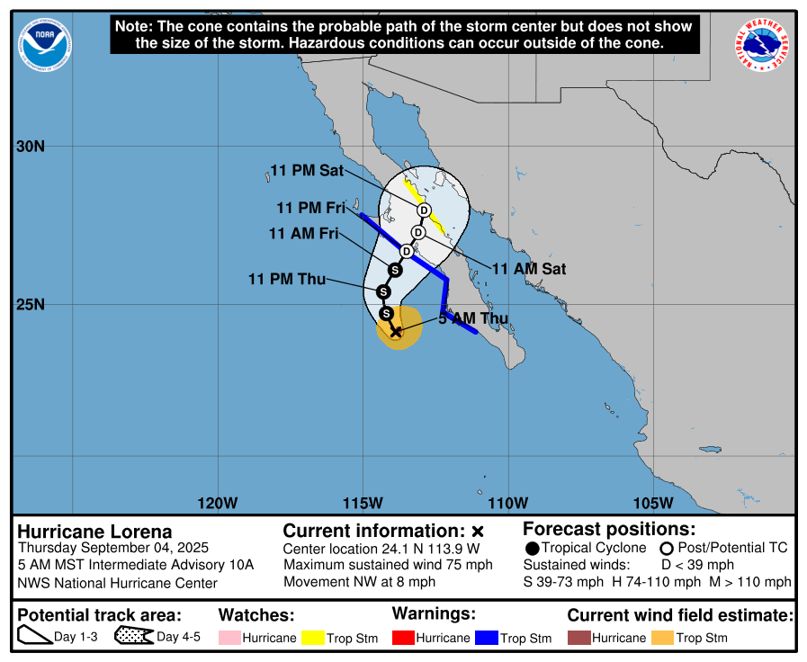
Lorena is expected to make landfall in Baja late Friday or Saturday, but weak steering may stall it inland. Some tropical moisture could sneak into the Four Corners, but current guidance suggests it won’t reach the Front Range. Southern Colorado and New Mexico are more likely to benefit.
The European ensemble is not very optimistic for much rain falling this weekend in our area. The Mountains will do okay, especially the San Juans, but east of the terrain wet weather may be much more difficult to come by as the low-levels will remain fairly dry. Developing convection may produce more wind than rain for us in the extended.
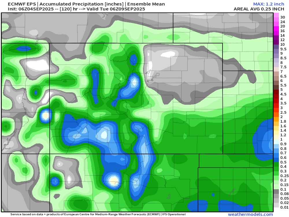
Bottom line: we’re including low-end rain chances throughout the five-day forecast, but expectations are low to modest at best. Stay tuned for updates as the pattern evolves.
Spread the word — share Colorado weather:
Go Premium, get all the perks.
Daily Forecast Updates
Get our daily forecast discussion every morning delivered to your inbox.
All Our Model Data
Access to all our Colorado-centric high-resolution weather model graphics. Seriously — every one!
Ski & Hiking Forecasts
6-day forecasts for all the Colorado ski resorts, plus more than 120 hiking trails, including every 14er.
Smoke Forecasts
Wildfire smoke concentration predictions up to 72 hours into the future.
Exclusive Content
Weekend outlooks every Thursday, bonus storm updates, historical data and much more!
No Advertisements
Enjoy ad-free viewing on the entire site.


You must be logged in to post a comment.