Colorado just wrapped up one of its wildest weather weeks of the season: persistent fire danger, surprise snow, historic damaging winds in Fort Collins, and a sudden arrival of dense wildfire smoke from Nebraska. Even worse, the atmosphere isn’t done with us yet. As we head into the weekend, a fast‑evolving setup is lining up another round of high‑impact conditions for the Front Range, from extreme fire danger to an abrupt overnight flip to snowflakes. And once we get through that, next week brings a pattern shift so extreme it’s poised to rewrite March climatology and decimate the already anemic snowpack across the entire West. Let’s get into it.
What You Need to Know
- This chaotic week brought nonstop fire danger, a damaging Fort Collins windstorm, surprise snow, and dense wildfire smoke across northern Colorado.
- A rapidly deepening trough arrives Saturday, driving a major low‑pressure system across the U.S. and setting the stage for high‑impact Front Range weather this weekend.
- Wind Round #1: Warm, deeply mixed air pushes 45–60 MPH gusts into the Boulder–Denver area Saturday afternoon, with isolated 70+ MPH gusts possible if a brief mountain wave forms.
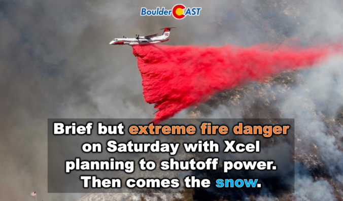
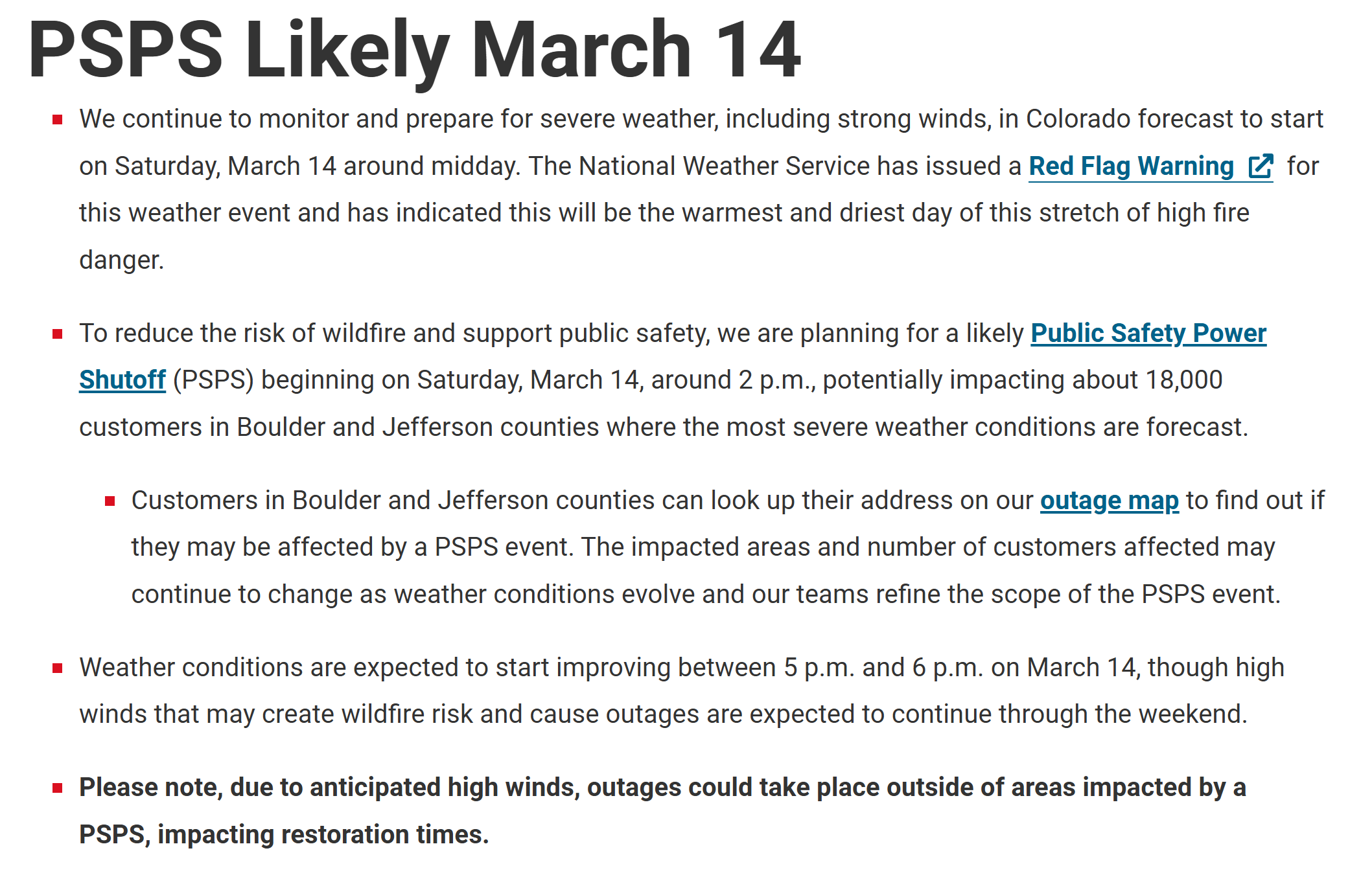
- Critically low humidity (near 10%) and strong winds will create briefly extreme fire danger, prompting Xcel Energy to likely cut power to customers in portions of Boulder and Jefferson Counties.
- A widespread Chinook arch cloud deck may slightly reduce fire risk by limiting heating and mixing, though at minimum there will be high fire danger.
- Wind Round #2: A powerful bora front blasts in late Saturday evening with 60+ MPH leading‑edge gusts and strong post‑frontal winds lasting all day Sunday, especially on the Eastern Plains.
- A fast‑moving burst of rain changing to snow arrives late Saturday evening, with most areas seeing under 1 inch, but 2–3 inches possible in the Foothills and Palmer Divide. Dicey travel will unfold Saturday night in the Mountains.
- Sunday stays cold and blustery with sub-freezing wind chills all day
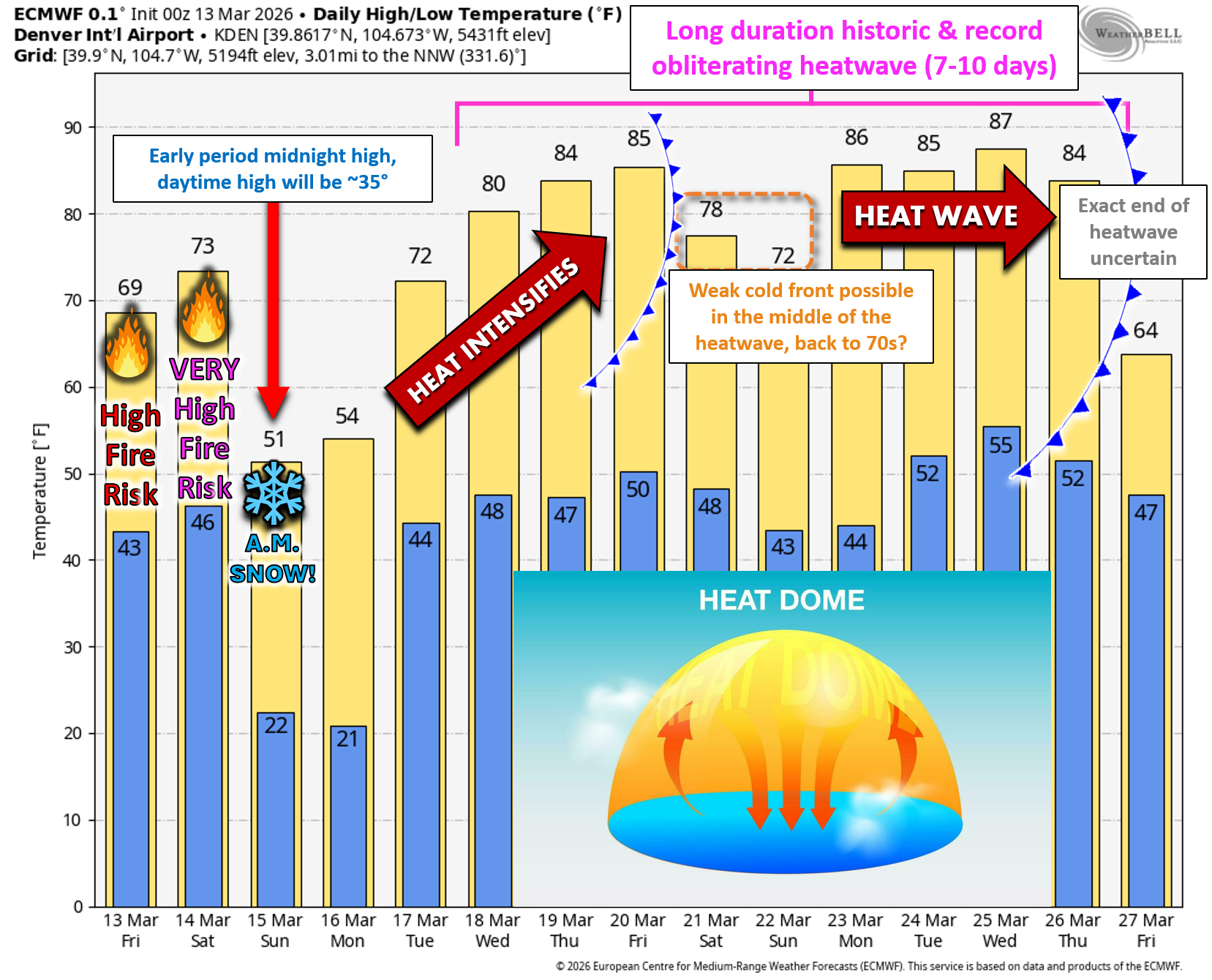
- Plan for a historic March heatwave next week, with highs in the 80s several days and widespread record‑breaking warmth across Colorado and the entire West.

Go Premium, get all the perks.
Daily Forecast Updates
Get our daily forecast discussion every morning delivered to your inbox.
All Our Model Data
Access to all our Colorado-centric high-resolution weather model graphics. Seriously — every one!
Ski & Hiking Forecasts
6-day forecasts for all the Colorado ski resorts, plus more than 120 hiking trails, including every 14er.
Smoke Forecasts
Wildfire smoke concentration predictions up to 72 hours into the future.
Exclusive Content
Weekend outlooks every Thursday, bonus storm updates, historical data and much more!
No Advertisements
Enjoy ad-free viewing on the entire site.
A wild weekend of weather ahead
It’s been one heck of a week in Colorado weather. We’ve bounced from relentless fire danger along the Boulder–Denver corridor, to an intense windstorm in Fort Collins on Thursday, to a surprise dusting of snow Tuesday night, and then a choking plume of wildfire smoke that surged into Larimer County Friday morning. It’s been… a lot.
And unfortunately, the atmosphere isn’t giving us a breather. The upcoming weekend looks just as chaotic, featuring a brief but dangerous windy fire risk Saturday afternoon and evening, followed by a sharp bora front that slams in overnight that will bring us a burst of snow, with finally sub-freezing wind chills all day Sunday.
Big‑Picture Setup: An Jet and a Deepening Trough
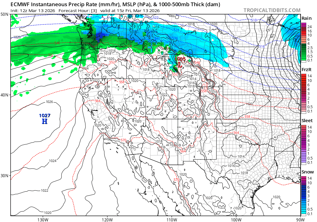
As of Friday evening, a robust atmospheric river is hammering the Pacific Northwest with heavy rain and mountain snow. That moisture plume stretches all the way inland through Montana and the Tetons — a sign of just how vigorous this river is.
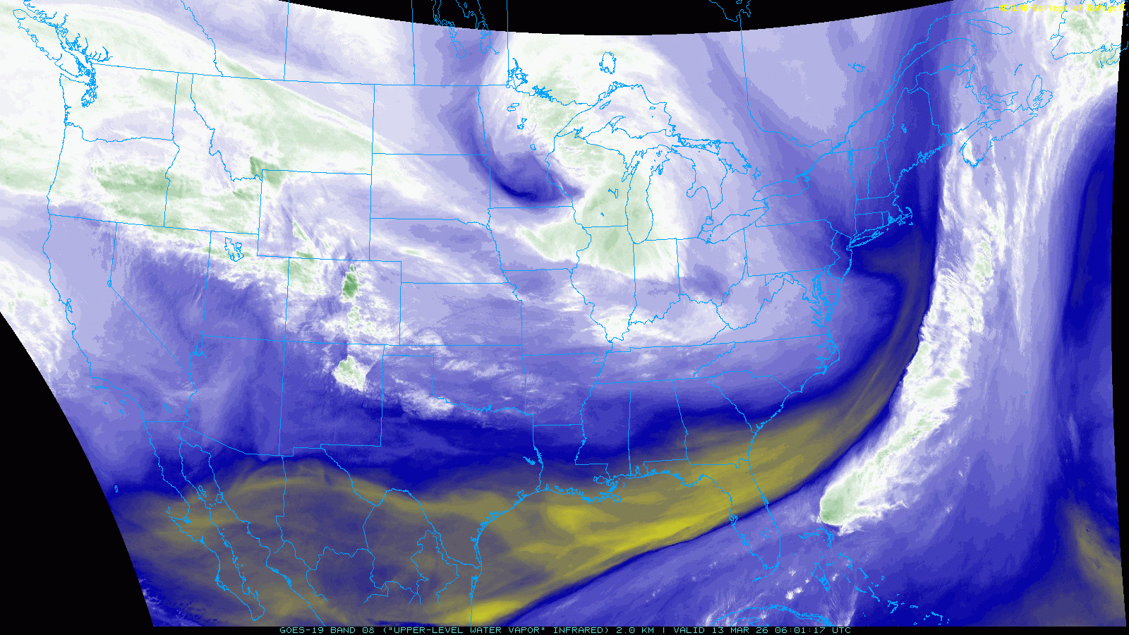
Meanwhile, the polar jet has been parked just north of Colorado all week, keeping us on the southern edge of its influence. That fringe zone is notorious for funneling persistent, annoying wind into the Front Range, and it’s been doing exactly that.
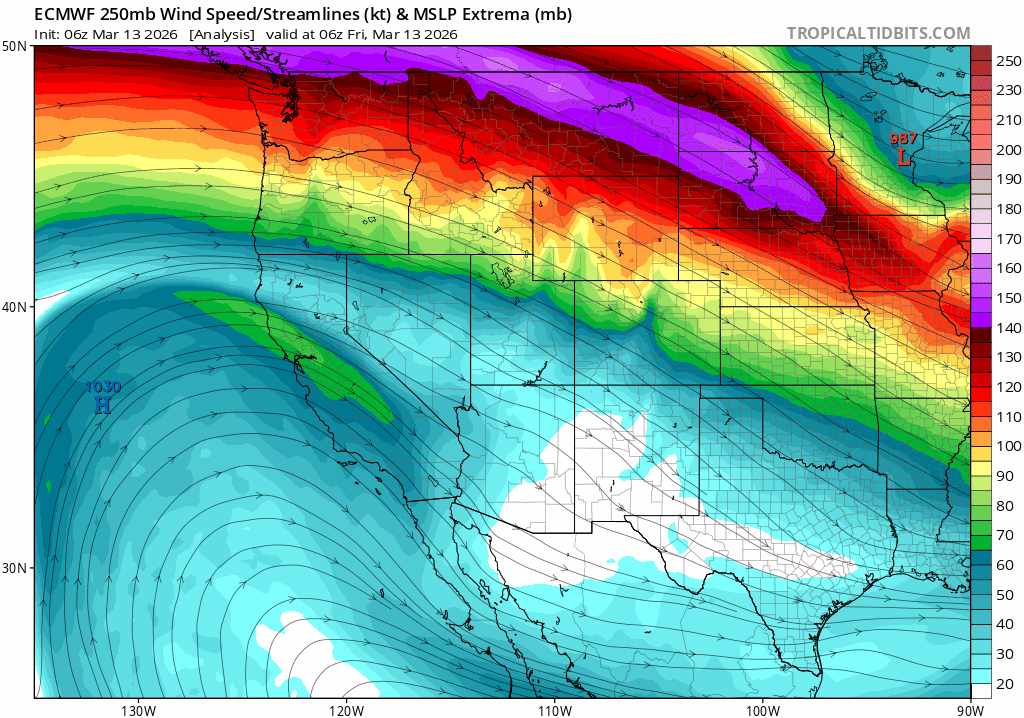
On Saturday, a sharp trough will dig rapidly into Colorado from the Pacific Northwest. This feature will deepen explosively into a major low‑pressure system that races across the central U.S. this weekend.
While our biggest local impacts will be wind and fire danger, the northern Plains and Great Lakes are staring down a full‑blown blizzard — with some spots looking at up to 3 feet of snow and extreme winds.
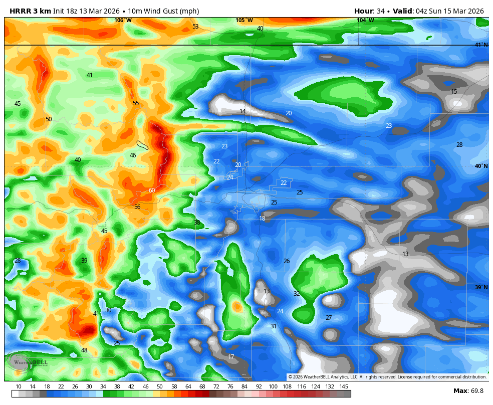
As this trough digs in on Saturday, a tight pressure gradient will develop in the mid-levels over Colorado alongside deep atmospheric mixing with temperatures soaring into the 70s in the Boulder-Denver area. This will allow for fast-moving winds (~65 MPH) from near mountain-top level to broadly mix down to the surface Saturday afternoon and early evening for several hours.
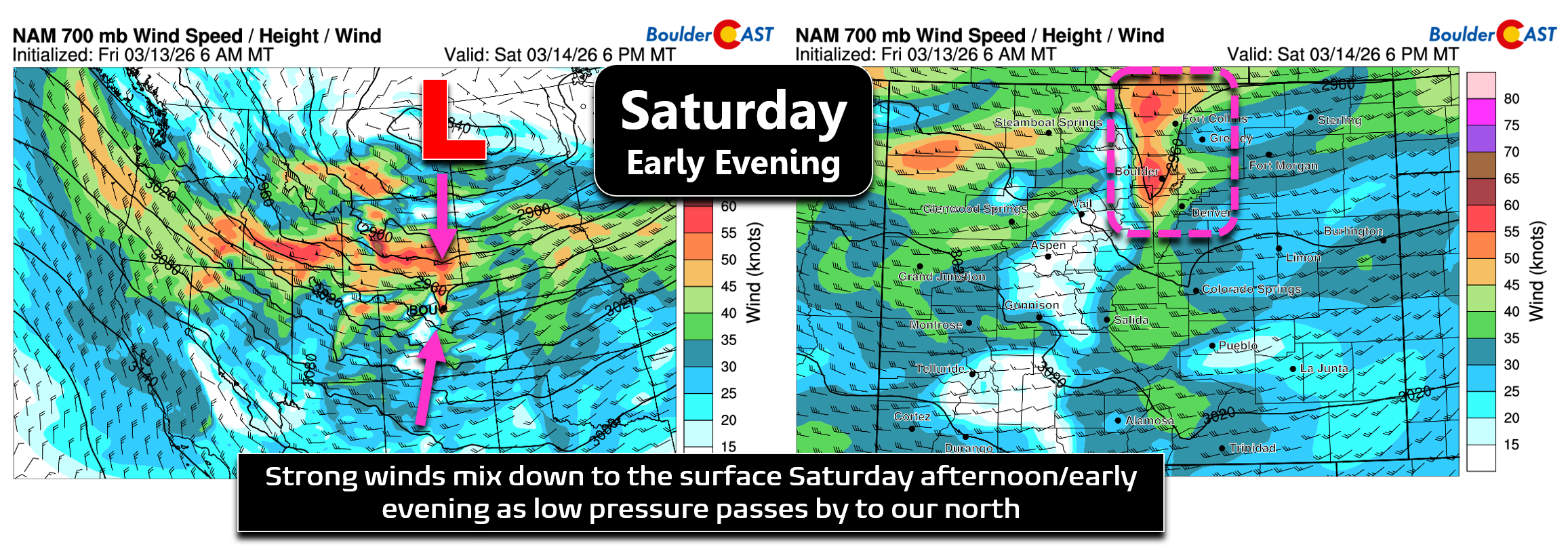
The wind threat on Saturday will come in two distinct waves, somewhat similar to the first of two historic windstorms we had back in mid-December, though this time around will be much lower intensity.
WIND ROUND #1: Chinook / Mix‑Down Winds
Timeframe: Saturday Midday → Early Evening
Saturday starts deceptively calm — at least compared to what’s coming. Temperatures will surge into the 60s and 70s, and with deep mixing in place, those fast mid‑level winds will have no trouble mixing down to the surface.
Short‑range models hint at minor mountain‑wave enhancement, but the setup isn’t ideal for a classic downslope windstorm. Instead, the main driver will be brute‑force downward mixing. Expect widespread gusts of 35–55 MPH, with the usual suspects — Boulder, Rocky Flats, and Arvada — favored for isolated 65–75 MPH gusts if a brief wave does materialize and crashes eastward.
Fire Weather: About as Bad as It Gets in March
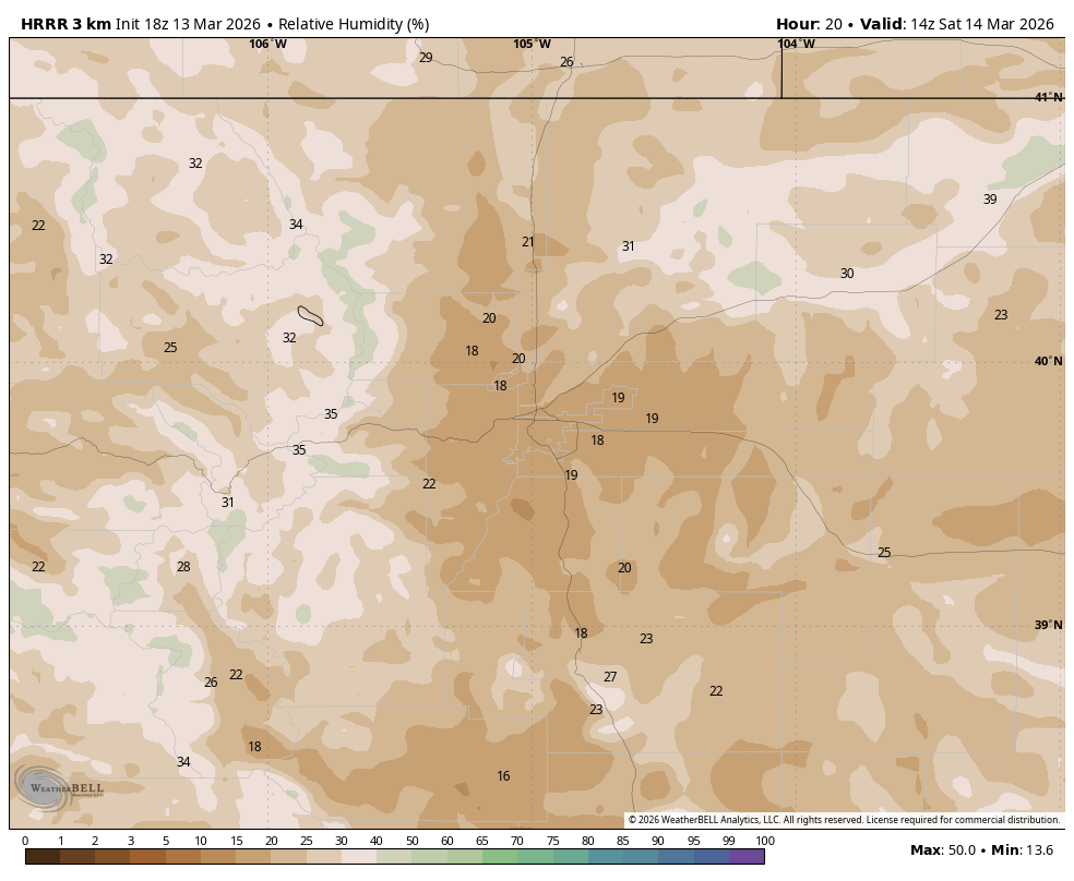
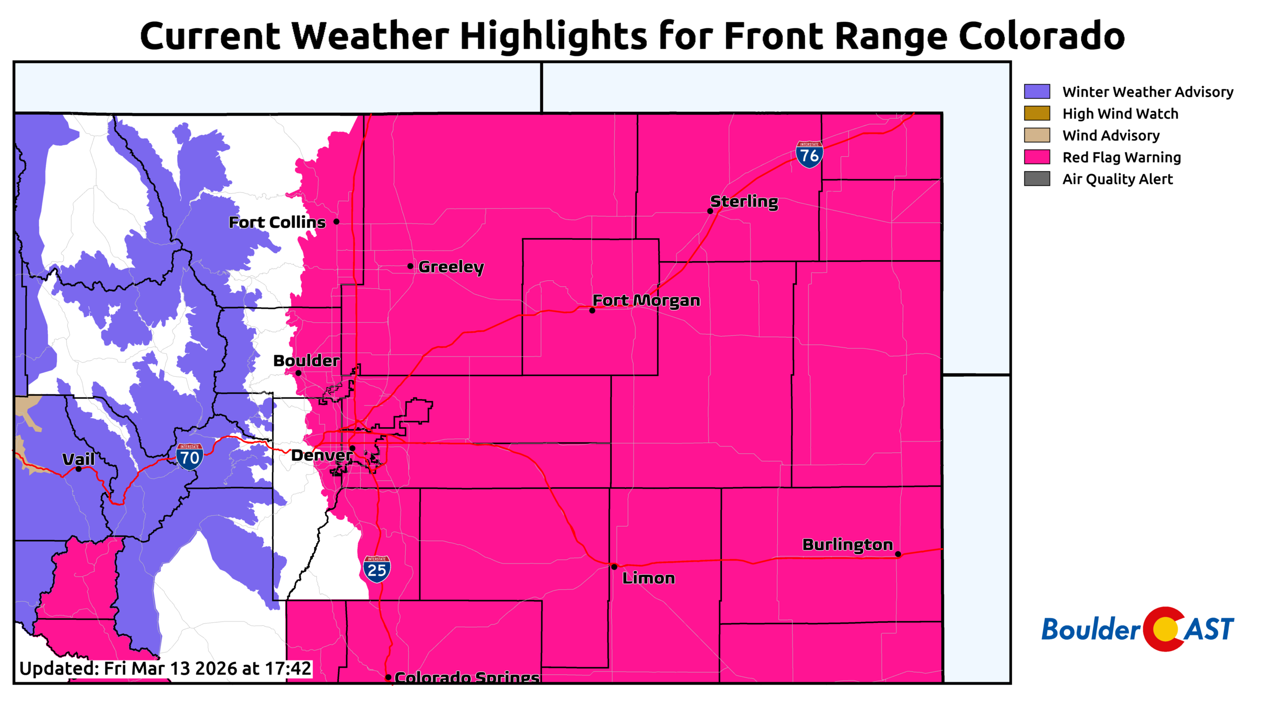
At the same time as the wind, very dry air will be in place across the entire area — drier than any day so far this week. Humidity recovery Friday night will be terrible, only rebounding to ~25% by sunrise. Once temperatures spike Saturday, RH values will crash toward 10% or even slightly below. Combine that with strong winds and cured fuels, and you get very high to extreme fire danger.
It’s for this very reason that Xcel Energy is advertising a likely Public Safety Power Shutdown (PSPS) during the day Saturday for parts of Boulder and Jefferson Counties. Their latest update was published around 4PM Friday and is included below:
Could Wave Clouds Help?
The one thing that could end up helping out on Saturday are clouds. The last several warm and windy fire weather days have seen some of the fire risk mitigated by extensive wave cloud coverage. These clouds kept temperatures a bit lower and humidity a tad higher, while at the same time also helping to reduce mixing in the boundary layer. Red Flag Warnings (RFWs) were issued Tuesday (which was cancelled midday due to chilly temps), Thursday (too many clouds, that RFW didn’t verify with RH 20%+) and Friday (cloudy but just barely reached RFW criteria).
We’ll see almost identical conditions on Saturday with an extensive shield of wave cloud coverage in the lee of the Continental Divide, blanketing the entire Denver Metro area much of the day (i.e. a Chinook arch cloud deck). These clouds, will limit solar heating, keep humidity a bit higher and reduce overall atmospheric mixing (lessen wind potential). Like so many other days this week, models may be overshooting the fire risk Saturday afternoon. It’s something we’ll be watching as the day unfolds, and could help out in what otherwise looks like a dire fire situation.
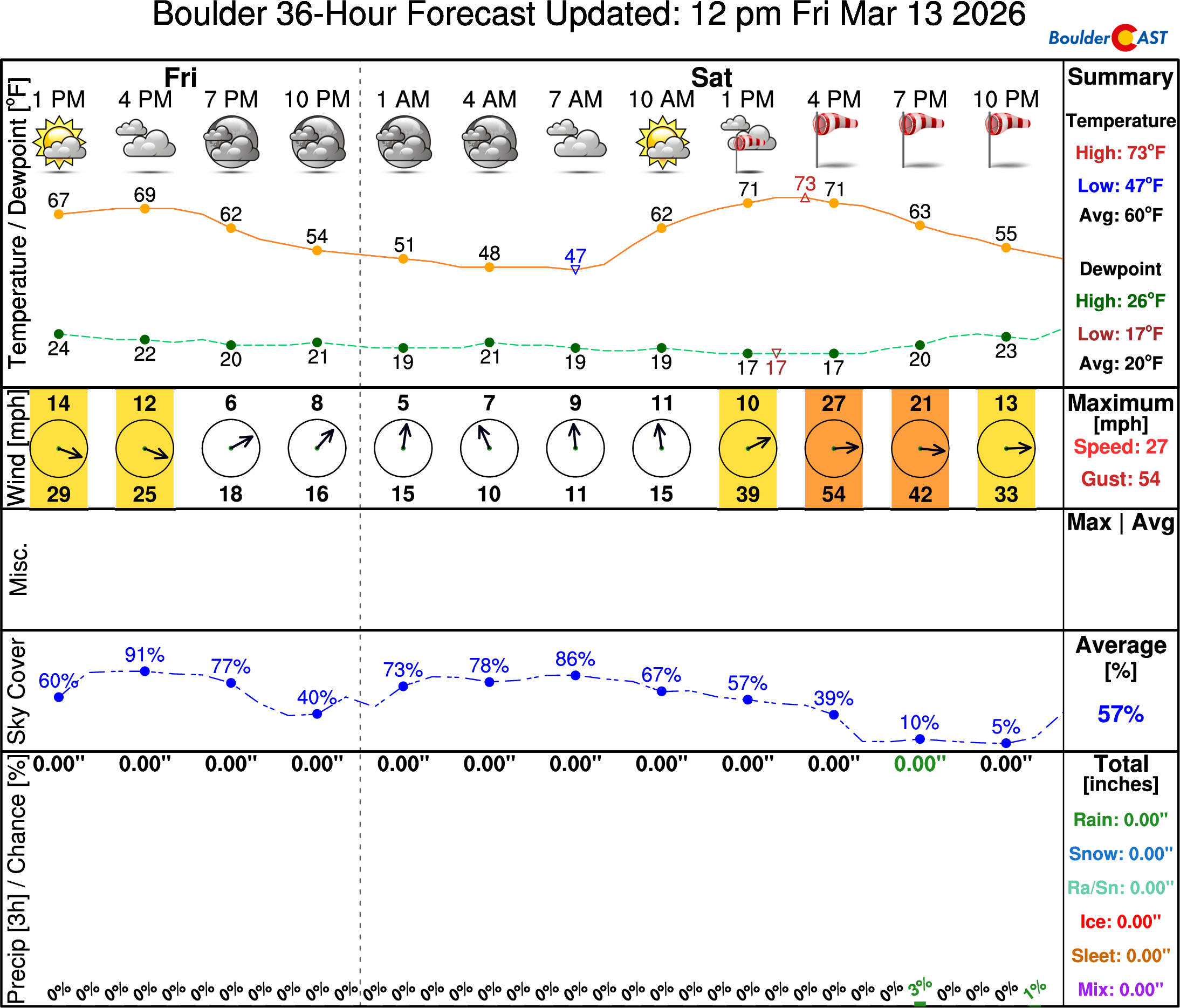
The strongest winds will wane as the sun goes down Saturday evening, but that slight lull won’t last.
WIND ROUND #2: The Bora Front
Timeframe: Late Saturday Evening → Sunday
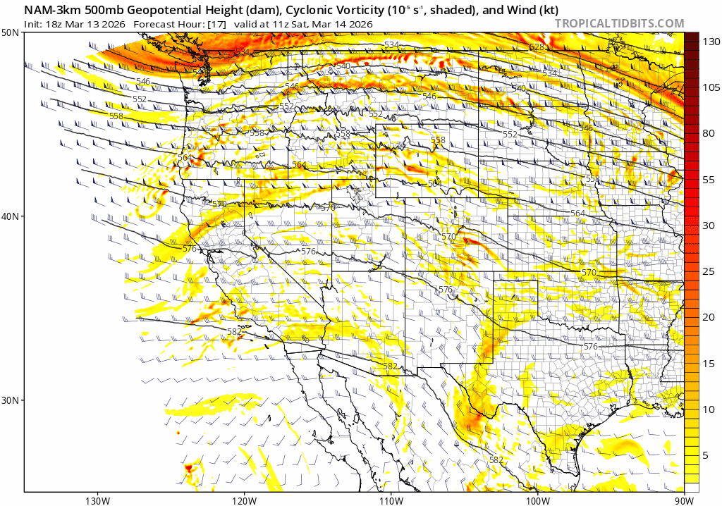
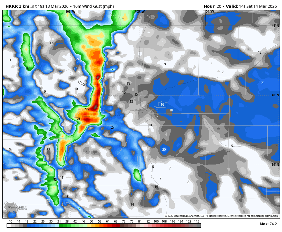
Later Saturday evening our second round of strong winds will commence across eastern Colorado as a potent bora cold front blasts in from the north and northwest. You can see this well-defined wall of wind coming in like a freight train in the forecast animation below for Saturday night. Winds along the leading edge of this front could top 60+MPH, with post frontal winds remaining strong in the 30 to 50 MPH range throughout Saturday night into Sunday as the intense surface low wraps up out across the Great Plains and cold air funnels into our area. Lingering winds will be strongest across the farmlands of eastern Colorado through the day Sunday where gusts over 55 MPH will last much of the day.
Fortunately this front will usher in moisture so the fire danger will drastically subside almost immediately after the frontal passage. That said, a similar bora front back in December ignited a slew of large wildfires due to downed powerlines in far eastern Colorado, but those occurred right with the initial front, not behind it.
Then Comes the Snow
Timeframe: Late Saturday Night → Early Sunday
As hard as it is to believe, our warm, fiery and wind-blown Saturday will culminate with a burst of rain changing to snow Saturday night across the area. Brief but strong frontal and jet forcing will combine Saturday night just behind the bora front, with bands of precipitation expected to pass through the Boulder-Denver area from the northwest.
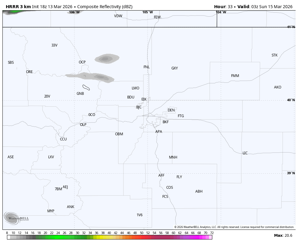
The forcing will be screaming through the Front Range rather quickly, and strong subsidence will take over by early Sunday morning bringing a rapid end to any snow potential. However, there does appear to be a few hour window for bands of rain changing to snow, with potentially heavy snowfall rates in the higher terrain. Blended model solutions don’t spit out much snow for us, with generally under 1 inch favored, though some outliers like the Euro have up to 3 inches. The GFS ensemble has a mean around 1 inch in Boulder, and up to a few inches in the Mountains and Foothills.
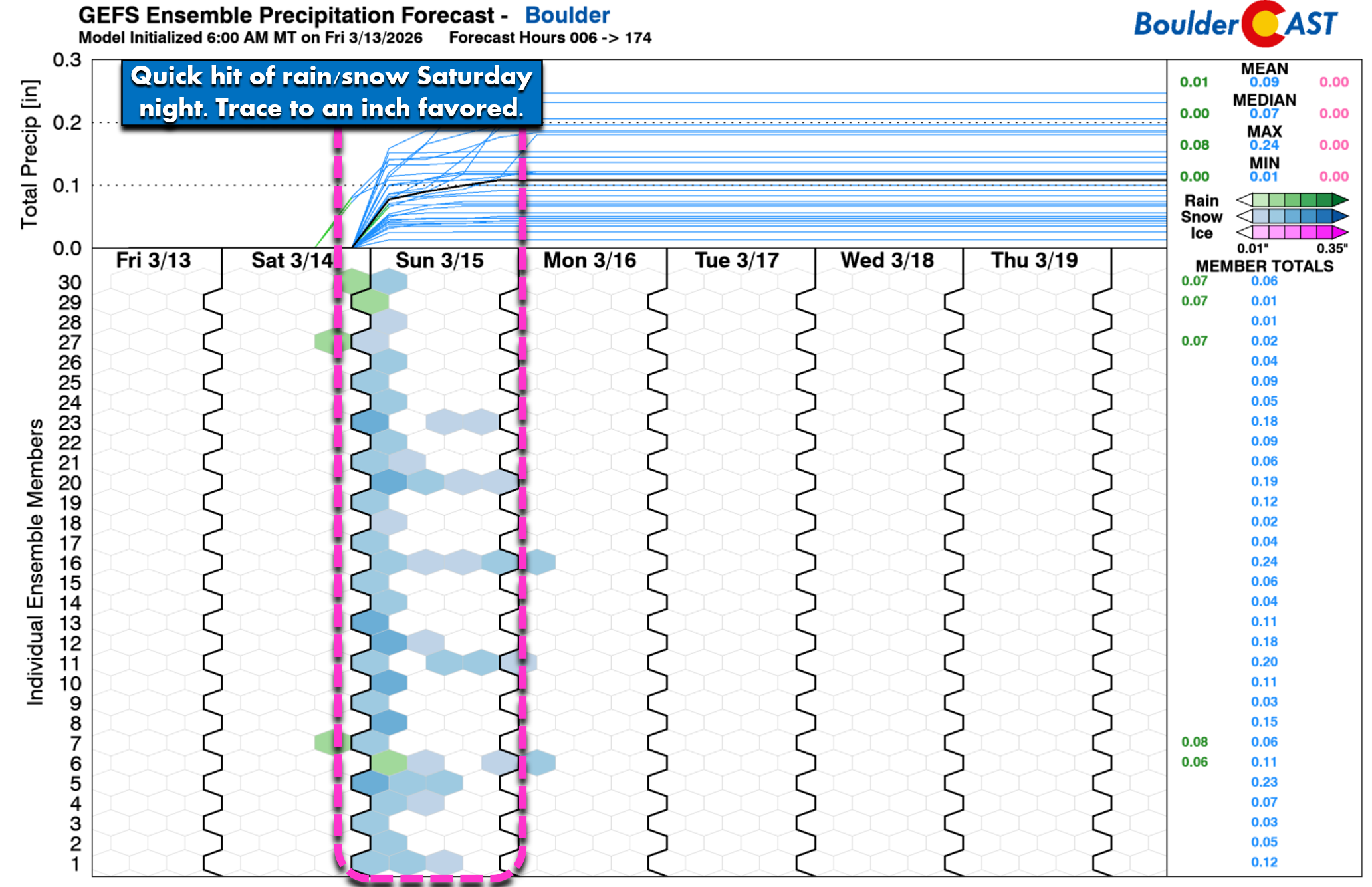
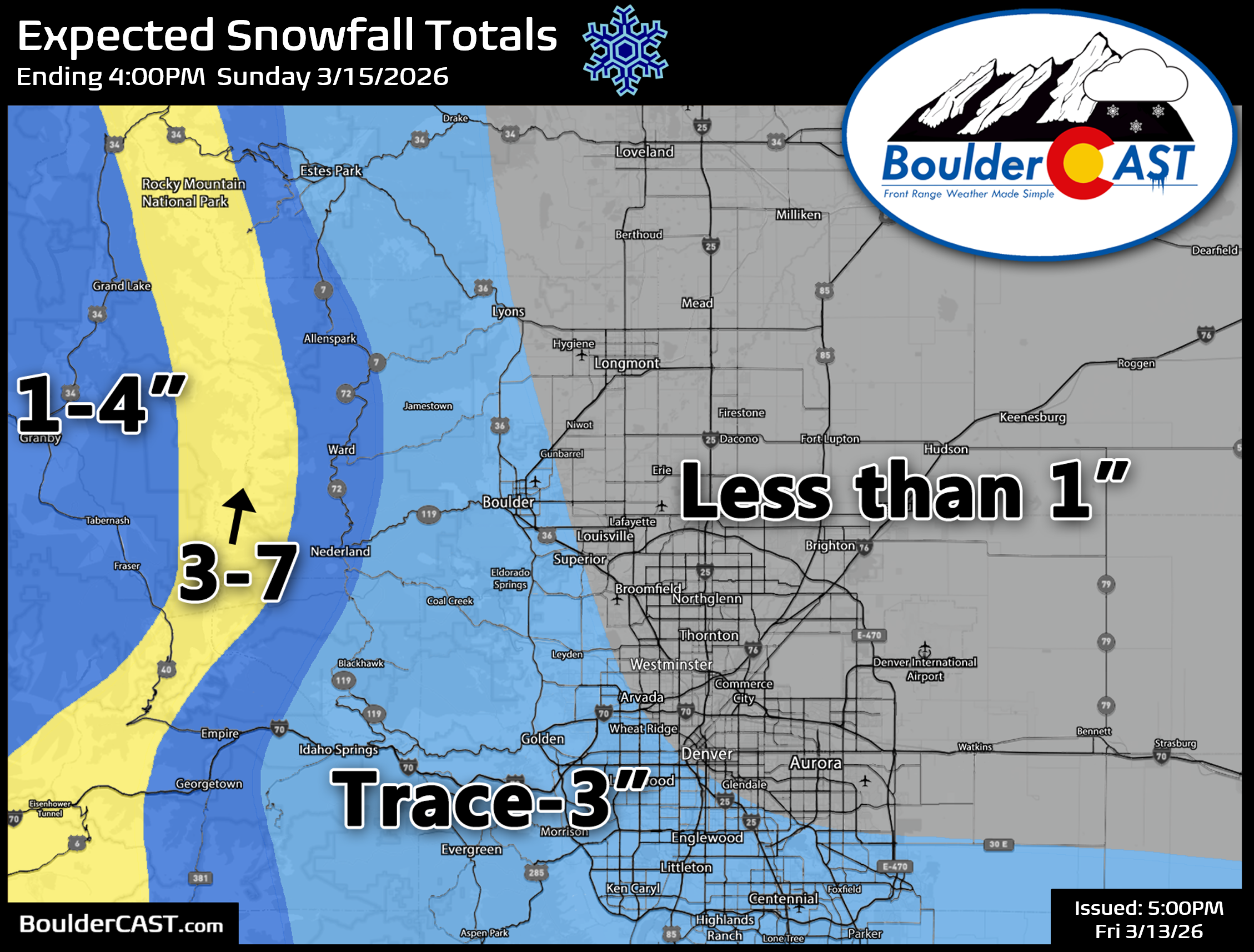
Bora fronts rarely produce much precipitation east of the Mountains, but given the potential for banding, we can’t discount the decent chance of light snow accumulations across the entire Denver Metro area late Saturday night. The best chance for rain changing to snow comes from ~10PM to 6AM during the overnight period. Our snowfall forecast map for the event is shown below, with most areas likely to land below 1 inch but locally higher 2 to 4 inch totals are possible, mainly in the Foothills and south over the Palmer Divide where northerly winds will kick off upslope. The Mountains along the Continental Divide will see rough travel conditions develop around midnight with whiteout conditions are possible as gusty snow bands blast through. We’re predicting 3 to 7 inches in the Mountains, including the I-70 passes and Rocky Mountain National Park.
Sunday: Cold, Blustery and Unpleasant
Cold, blustery northerly flow will linger across the area all of Sunday. Daytime highs will range from 30 to 36 degrees in Boulder and Denver. Yes, 40 degrees colder than Saturday. Those aforementioned winds will push wind chills as low as the single digits and teens at times, especially well east of Denver where winds will be strongest.
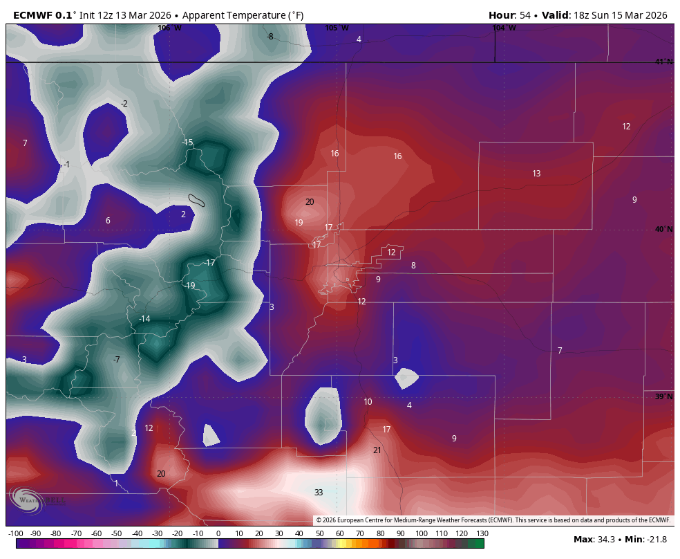
Midday wind chill forecast for the Denver area. Brr!
Next Week: A Record‑Shattering March Heatwave
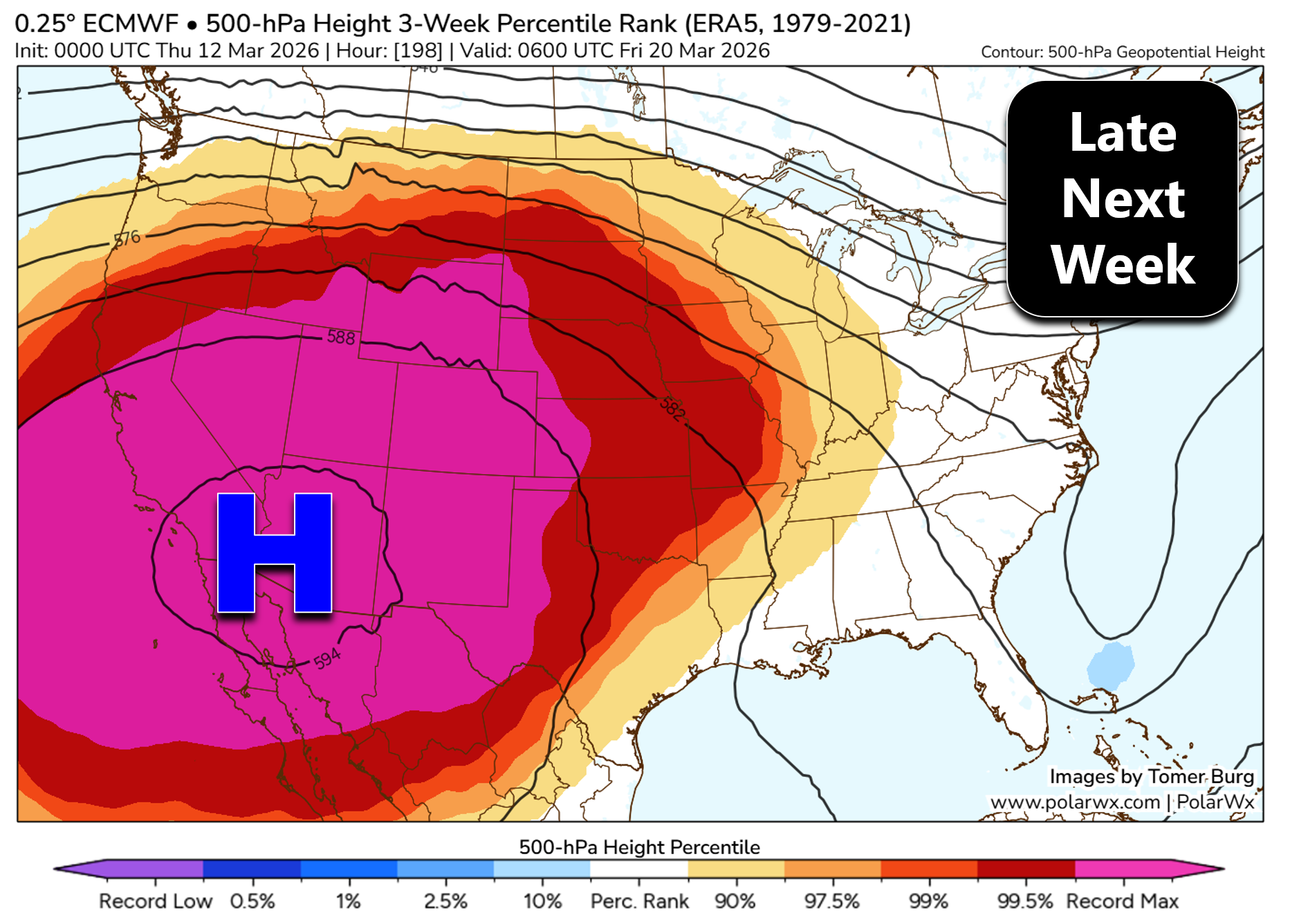
Next week we shift into a completely different weather pattern, one that is essentially unmatched in the historical record for March across the western United States, but one that doesn’t seem that out of place in this “Year Without Winter”. An extraordinarily strong and concentric ridge of high pressure will build in across the Desert Southwest — setting the stage for a widespread, long-duration Western heatwave beginning on Tuesday and peaking around the first day of Spring on Friday March 20th. The Euro model forecast at 500mb is jaw-dropping for late next week, with an unbelievably strong 5950 meter high parked over Arizona, with record heights extending through all of Colorado. This beast ranks as top dog in this climatology data set which dates back 1979. There has not been anything this strong in the last ~50 years in March, and likely way longer than that.
Though we’re still pretty far out from this heatwave, every single model has been locked into this feature for a long time now and none have budged. It’s going to be ridiculously warm next week with highs pushing into the 80s for several days. In March.
Though unlikely, there are even some model runs which have Denver hitting 90 degrees. If that happens it would become Denver’s earliest 90-degree day by nearly six weeks. Multiple days of record highs will be toppled in Denver and Boulder, and really, the entire western half of the country. All-time monthly record highs for March will be shattered — an extreme feat to happen in the middle part of the month. Boulder’s March monthly record high is 83° — that is highly likely to be busted, maybe even multiple times. It’s probably not a bad idea to make sure your air conditioner works before every HVAC company in Denver is slammed by cooling service calls during next week as we round out the final days of winter.
West-wide snowpack, which is already at historic lows, will be further decimated by this heatwave. Honestly, that aspect is too depressing to think about right now with everything else going on, so we’ll save that discussion for another update. There’s a lot of other more pressing weather troubles to get through between now and then.
Wrap-Up
Colorado weather is firing on all cylinders this weekend. We’ll jump from extreme fire danger and intense winds to a quick burst of snow, only to pivot straight into a historic March heatwave next week. Stay vigilant Saturday (no flames or sparks!), bundle up Sunday, and brace for a level of early‑season heat never before seen in Colorado during the month of March, let alone April…
Spread the word, share our crazy Colorado weather:
Go Premium, get all the perks.
Daily Forecast Updates
Get our daily forecast discussion every morning delivered to your inbox.
All Our Model Data
Access to all our Colorado-centric high-resolution weather model graphics. Seriously — every one!
Ski & Hiking Forecasts
6-day forecasts for all the Colorado ski resorts, plus more than 120 hiking trails, including every 14er.
Smoke Forecasts
Wildfire smoke concentration predictions up to 72 hours into the future.
Exclusive Content
Weekend outlooks every Thursday, bonus storm updates, historical data and much more!
No Advertisements
Enjoy ad-free viewing on the entire site.


You must be logged in to post a comment.