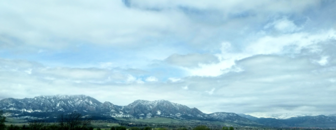
In stark contrast to what transpired last week, the next handful of days will be warm and pleasant across the region with only minor chances of late-day thunderstorms. However, late in the week, a Pacific storm system will slide into the area, though it’s not exactly clear what the impacts will be across the Front Range. Read on for our complete forecast of the week ahead.
Category: Winter Weather (Page 94 of 139)
These posts contain some discussion of the white stuff, whether it be mountain snow pack or a Front Range snowstorm.
Another year, another CU Boulder graduation with terrible weather. They seem to go hand-in-hand, dont they? We discuss totals from this week’s snow event and take a look at brighter weekend weather ahead.

Forecast Update: A rainy Wednesday will turn snowy Wednesday night
Widespread rain showers will develop through the day Wednesday and turn to snow Wednesday night for everyone. We discuss the timeline of the storm and provide our snowfall forecast map. When will winter end?
The weather pattern over the next few days is one that will be favorable for widespread and persistent precipitation across the Front Range. We’re even predicting temperatures to cool enough early Thursday to allow for a change-over to snow. Read on for a complete forecast on the prolonged, dreary weather expected in the coming days and our thoughts on preliminary snow amounts.

A wet and unsettled week is in store for the area as a slow-moving system moves across Colorado. There’s even have a chance of snowflakes Wednesday night into Thursday. We also detail the forecast for the CU commencement this Thursday. Read on for more details.

We’ve entered the month of May and Spring is now in full-swing. We review May’s climatology and highlight a few aspects of the weather to watch in what is typically our gloomiest month of the year.

Mother Nature does some of her best work this of year! No other place and time can offer the extremely rapid changes in weather like Front Range Colorado can during the month of April. We take a look at how Boulder went from near 80 degrees on Sunday afternoon to a blanket of snow in just over 24 hours.

Live View of Boulder

Current Conditions

Live Radar

Recent Premium Posts

BoulderCAST Daily – Fri 06/05/26 | A streak of 90s set in through the weekend
🥵 A streak of 90s today through the weekend with low to middle …
This Weekend in Colorado Weather: Early-Season Heat Ramps Up — First 90s of the Year on the Horizon
🌬️ West–northwest flow Thursday supports high‑based convection with gusts to 35 MPH; virga …
BoulderCAST Daily – Wed 06/03/26 | Scattered P.M. storms again as moisture peaks for the week
🌬️ Weak westerly flow aloft today with no major synoptic features nearby; only …
3-Day Forecast

Trending Content

© 2026 Front Range Weather, LLC