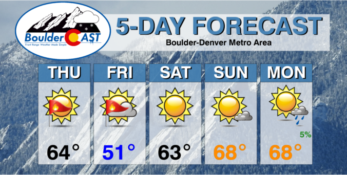
This first major heatwave of 2023 will unfold this week across the Front Range as a broad ridge of high pressure produces bountiful sunshine and an influx of warm air from the southwest to Colorado. Multiple days of record high temperatures are expected as most of us soar into the 80s. However, late week a big cooldown is taking shape with rain/snow likely returning on Friday. Read on for all the details of the crazy weather week ahead.
Category: Winter Weather (Page 39 of 134)
These posts contain some discussion of the white stuff, whether it be mountain snow pack or a Front Range snowstorm.
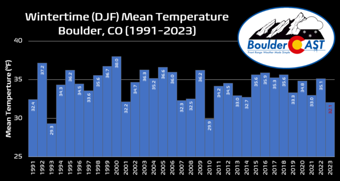
This winter has definitely felt longer and colder than any in recent memory. We review some temperature statistics to show that not only has it been an exceptionally cold winter overall, but the lack of any true warm days thrown into the mix made things feel even more extreme.


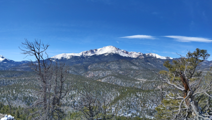
March 2023 concluded as the coldest March in more than 50 years in Boulder and was our fifth consecutive month with below normal temperatures — this winter has been atypically long and brutal. Despite heavy snow fueled by atmospheric river events in the Mountains, very little precipitation reached east of the Continental Divide during March with fire danger and blowing dust increasing substantially by month’s end. Here’s a quick and colorful graphical recap of our weather during March and how it relates to climatology.
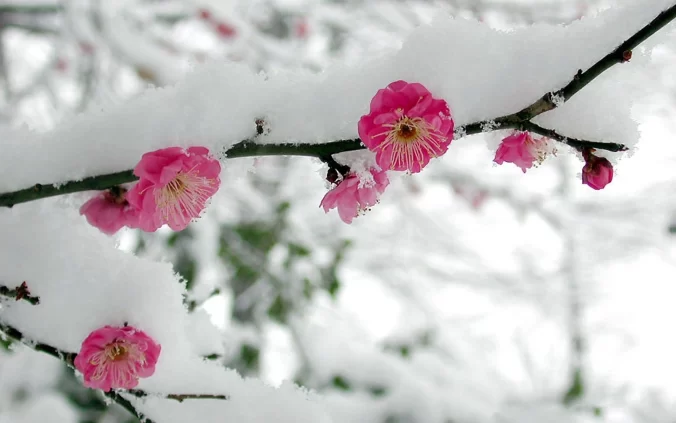
After another glorious springlike Monday across the Front Range, much colder and gloomier weather will arrive early Tuesday as our next storm system enters the picture. While we will sadly be missing out on the feet of snow and blizzard conditions hitting Wyoming, there are some snowflakes in the forecast. Let’s take a look at the timing of the snow, the most likely snowfall amounts, and the potential travel impacts as winter weather returns to the area.
Following another elevated fire danger day on Monday, a late-season snowstorm will trek from the Rockies into the Dakotas in the coming days. While the brunt of this massive winter storm will be felt in the Mountains and well to our north in Wyoming, there are enough ingredients coming together to bring light snow to the Front Range during this time as well. Another chance of snow may develop on Wednesday. Unseasonably cold temperatures will transition back above normal by week’s end with a warm and dry outlook shaping up for much of the extended.

Live View of Boulder

Current Conditions

Live Radar

Recent Premium Posts

BoulderCAST Daily – Fri 01/16/26 | High wind event gives northeast Colorado a rare day with critical fire danger AND cold temperatures–stay weather aware!
🌡️ Cold front crash‑landing: Temps plunged ~20° in minutes last night as a …
BoulderCAST Daily – Thu 01/15/26 | Fire Danger Today Before a Cold Front Tonight
🔥 Fire danger rising — Warm and windy today ahead of a strong …
BoulderCAST Daily – Wed 01/14/26 | A gorgeous Wednesday ahead of increasing fire danger & a stronger cold front tomorrow
🌬️ Weak front overnight — A weak cold front slipped through around 9:30 …
3-Day Forecast

Trending Content

© 2026 Front Range Weather, LLC