This week NOAA announced that the GOES-17 weather satellite has passed its final examination! It now operational as GOES-West at an orbital position of 137.2°W longitude…basically in the middle of the Pacific Ocean. We discuss how this new data will benefit our weather forecasts, the status of the catastrophic hardware issue discovered post-launch, and the type of stunning imagery we can look forward to for years to come.
Category: Weather in the News (Page 8 of 16)
These posts cover interesting weather phenomena from around the world, and won’t be specific to Boulder County. However, Earth is very diverse in the world of weather, so you will surely learn a thing or two.
Check out seven unique graphics we created recapping 2018’s weather!
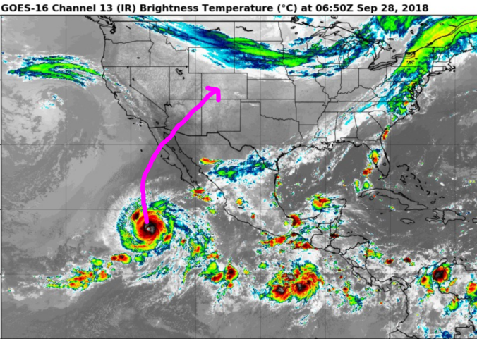
We discuss the very chilly temperatures for your Friday, the quick warm-up headed our way for the weekend, and the possible impacts of Hurricane Rosa’s remnants early next week.
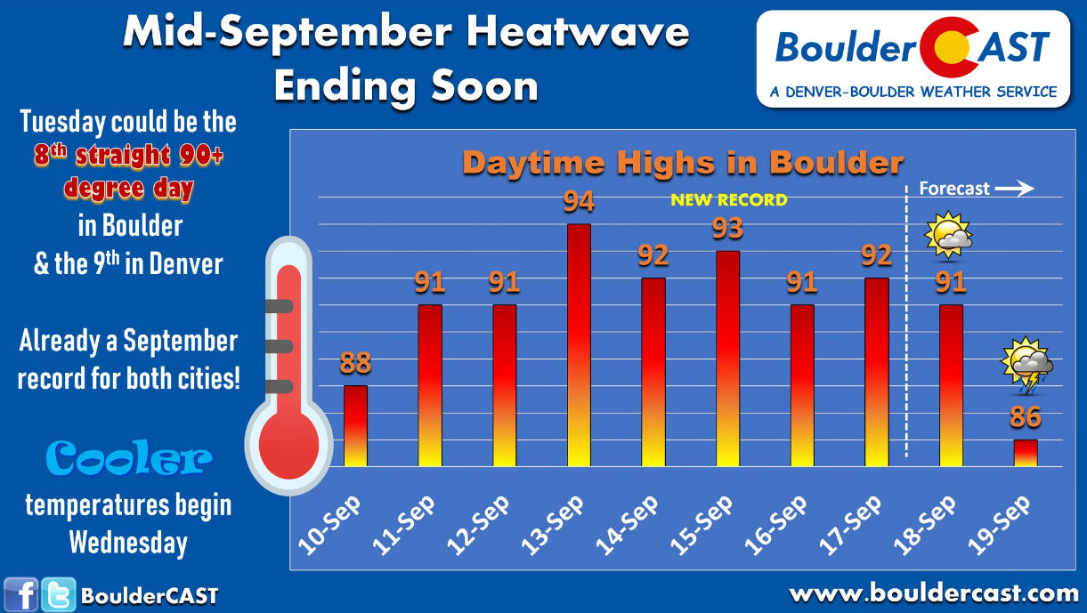
More 90’s are in the forecast to begin the week, but the longest heat wave of 2018 comes to an end for the Front Range by mid-week.
Hurricane Florence has weakened to Category 2 level this morning and is not expected to strengthen much further as it sluggishly moves towards the coast through the day. The latest track from the National Hurricane Center has the storm making landfall just north of the South Carolina border in North Carolina late tonight or Friday morning. Make no mistake, Florence is a dangerous storm and will be a hurricane upon landfall. However, the legacy of the event will most certainly be the prolonged period of heavy tropical rainfall beginning today and continuing late into the weekend and beyond. We may very well have another Harvey on our hands…20 to 30″ of rain is not out of the question for some locations.
One of the many cutting-edge solutions that my company (Harris Corporation) offers is a machine learning weather platform called Helios, which turns any camera pointed at a roadway into a real-time weather station. Helios ingests more than 30,000 traffic cameras from around the world and provides detailed weather-related information at each location using only the image of the roadway and surroundings. Current parameters include partial or full snow, rain, or ice coverage of the roadway, visibility degradation, and rainfall intensity.
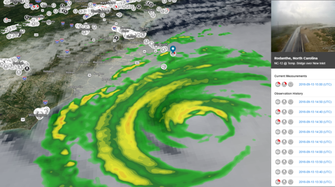
Below is what the Helios web app looks like in action. All of the dots over land are Helios weather stations (i.e. traffic cameras). In this case, our road weather analytic is shown. Red dots are wet roads, grey dots are dry roads, and black dots the algorithm can’t tell (or the camera has gone dark).
If you click on one of the dots, it will load up a live camera feed there and also show the current weather reported from Helios. In the example below, I have chosen a camera on the coast of North Carolina from yesterday evening. Some clouds from the outer bands of Florence are visible and not even a single car. This area is a ghost town due to mandatory evacuations.
Of course, conditions at this location have started to deteriorate since then…
In an effort to assist in disaster relief during Hurricane Florence, we have made Helios temporarily available for everyone. Even for those of us that are no where near the Carolinas or don’t hold an important public safety role for that area, Helios is an exceptional tool just to scan through available webcams and monitor just how crazy the weather truly is in real time! I urge you to check it out, especially tomorrow and through the upcoming weekend as historical flooding unfolds from Florence.
Try Helios: https://helios.earth/
The track and speed of the storm are somewhat uncertain at this time, but here is the latest timeline for Hurricane Florence:
- Thursday: Outer rain bands of the storm will reach coastline and should show up on Helios.
- Friday: The track and speed uncertainty mean landfall timing of the eye are not known. It could be between early Friday morning and Friday afternoon before the eye comes ashore. Nonetheless, the eye will be close enough that widespread heavy rainfall and hurricane force winds will be observed during the day.
- Saturday: Florence will be over land, moving slow, and weakening during the day. Heavy rainfall continues in North and South Carolina with some wind. This will probably be the best time to capture flooded roadways with Helios.
- Sunday: More heavy rain in basically the same areas. Flooding worsens. Rain spread northward into Virginia and West Virginia.
- Monday: The remnants of Florence will move northeastward inland over the Appalachian Mountains. Rain is expected to continue in the same areas as the prior 3 days so flooding is still likely.
Let me know if you have any questions in the comments. Enjoy!
NOTE: Helios is a product of Harris Corporation and is not affiliated with BoulderCAST in any way.
Weather in Colorado will be calm but hot for the last full-week of summer. Many areas will be flirting with record heat multiple times in the coming days. Elsewhere, the Carolinas are preparing for major Hurricane Florence which is likely to make landfall later this week.
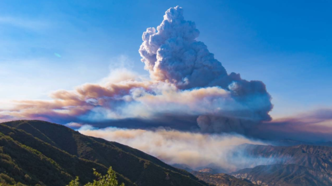
There has been a dramatic drop in visibility and air quality across Colorado as smoke from several large wildfires burning in California and Oregon moved in on Wednesday. We discuss the smoke’s path to get here, how many acres have burned so far in 2018, and the potential weather impacts wildfire smoke can have.
© 2025 Front Range Weather, LLC







You must be logged in to post a comment.