Today was the 17th consecutive day of above average temperatures and dry conditions in Boulder and Denver. It’s about time for a change…don’t you think? Several atmospheric ingredients will be coming together over the next several days to bring cloud cover, much cooler temperatures, and the potential for significant rainfall to the state of Colorado. The atmospheric moisture content statewide will be close to all-time record levels for the month of June. With so much moisture involved, some areas could see heavy rainfall capable of producing flash flooding. Read on for details.
Atmospheric ingredients coming together this weekend, as described below.
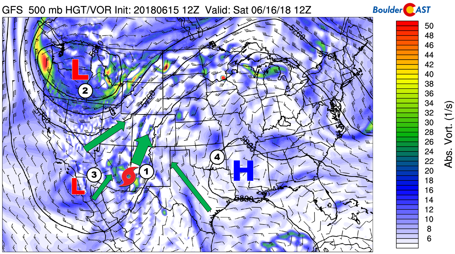
LIST OF INGREDIENTS:
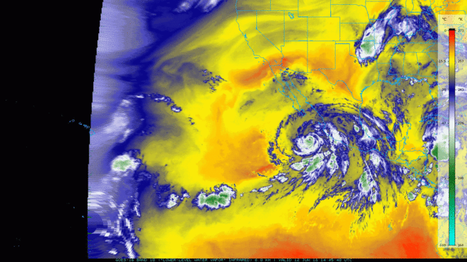
- The remnants of Hurricane Bud and his juicy tropical airmass will be moving northward from Mexico into our region on Saturday and Sunday. We discussed this aspect in great detail in a post on Wednesday.
- An unseasonably strong trough will remain stationary across the Pacific Northwest through the weekend and early next week. This will continue to pump moisture northward and also bring a series of cold frontal boundaries into northeast Colorado during this time. These cold fronts will deliver bouts of low-level moisture and upslope to the Front Range Sunday, Monday, and Tuesday.
- A small but potent cut-off low pressure system is coming ashore near the California/Mexico border, merging with the remnants of Hurricane Bud.
- High pressure across the southeastern United States is drawing Gulf of Mexico moisture northwestward into Colorado. It’s also working in tandem with the Pacific Northwest trough to amplify southerly flow overall into Colorado.
All of these ingredients will essentially be merging across the Four Corners region this weekend. Widespread rain is already beginning to fall across southern Arizona in what is a typically dry time of year for this region. Literally if any rain occurs in some cities, it will set a new rainfall record for the date. The deluge of rainfall will push northward into southern Colorado by Saturday morning and into the northern half of the state by Saturday evening.
The more widespread stratiform precipitation on Saturday will remain confined to areas west of the Continental Divide. Outdoor plans in the High Country this weekend are absolutely not advised. A few storms will push into the Metro area Saturday afternoon and evening. Despite the steering flow aloft being speedy, given the extraordinary amount of moisture available statewide, storms on Saturday and even Sunday could produce localized heavy rainfall and flash flooding, especially across any burn scars created in the last 5 to 10 years. Flash Flood Watches are already issued for parts of New Mexico and southwestern Colorado (green highlighted areas below).
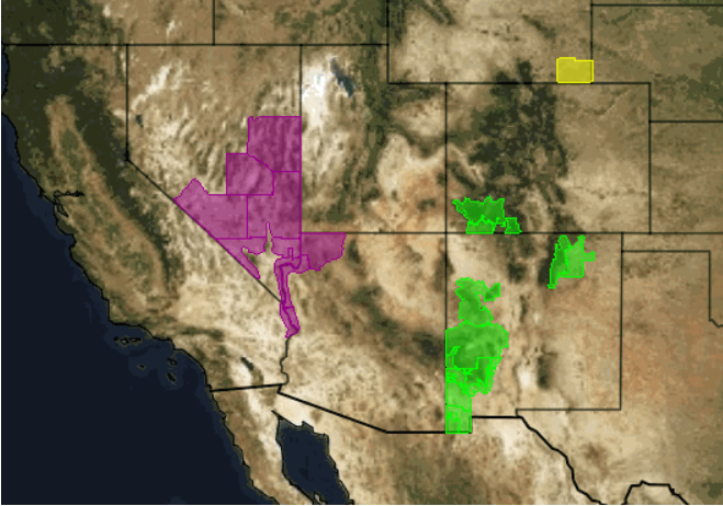
Current Advisories as of Friday afternoon. Flash Flood Watches are in green.
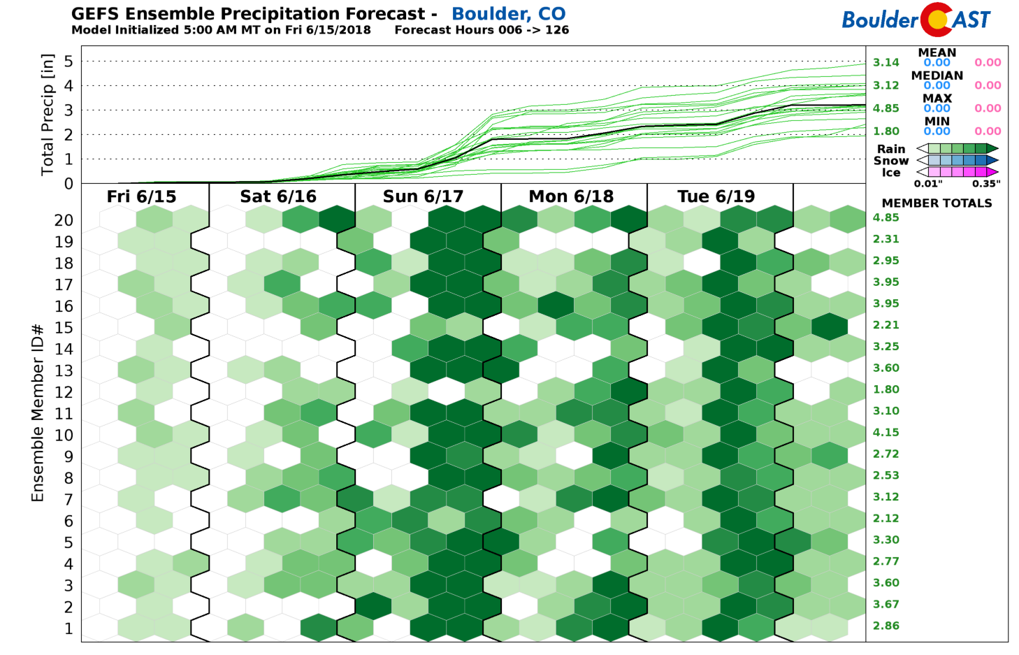
While the Metro area could mostly miss out on the initial wave of precipitation from Hurricane Bud’s remains, things will stay favorable for heavy rainfall into early next week. With plenty of background moisture around and daily cold fronts moving into northeast Colorado, we expect low-level moisture to pool significantly across the Front Range. This will keep the atmosphere unstable and capable of producing scattered to widespread afternoon and evening showers and storms each day. The GFS ensemble precipitation forecast shows the potential for lots of rainfall over the next five days in Boulder….anywhere from 1 to 4″. There is good agreement now between all the major models on this heavy rainfall potential. If we do see any Flash Flood Watches posted for the Front Range, it will probably be for Sunday or early next week.
There is great potential for beneficial rains across the entire Four Corners and western Great Plains regions this weekend. Even without seeing much rainfall, the added moisture and clouds should help fire-fighting efforts. Even better, there is so much moisture and clouds progged this weekend that convection will be noticeably hampered, providing rainfall with lessened chances for lightning that could potentially spawn more fires.
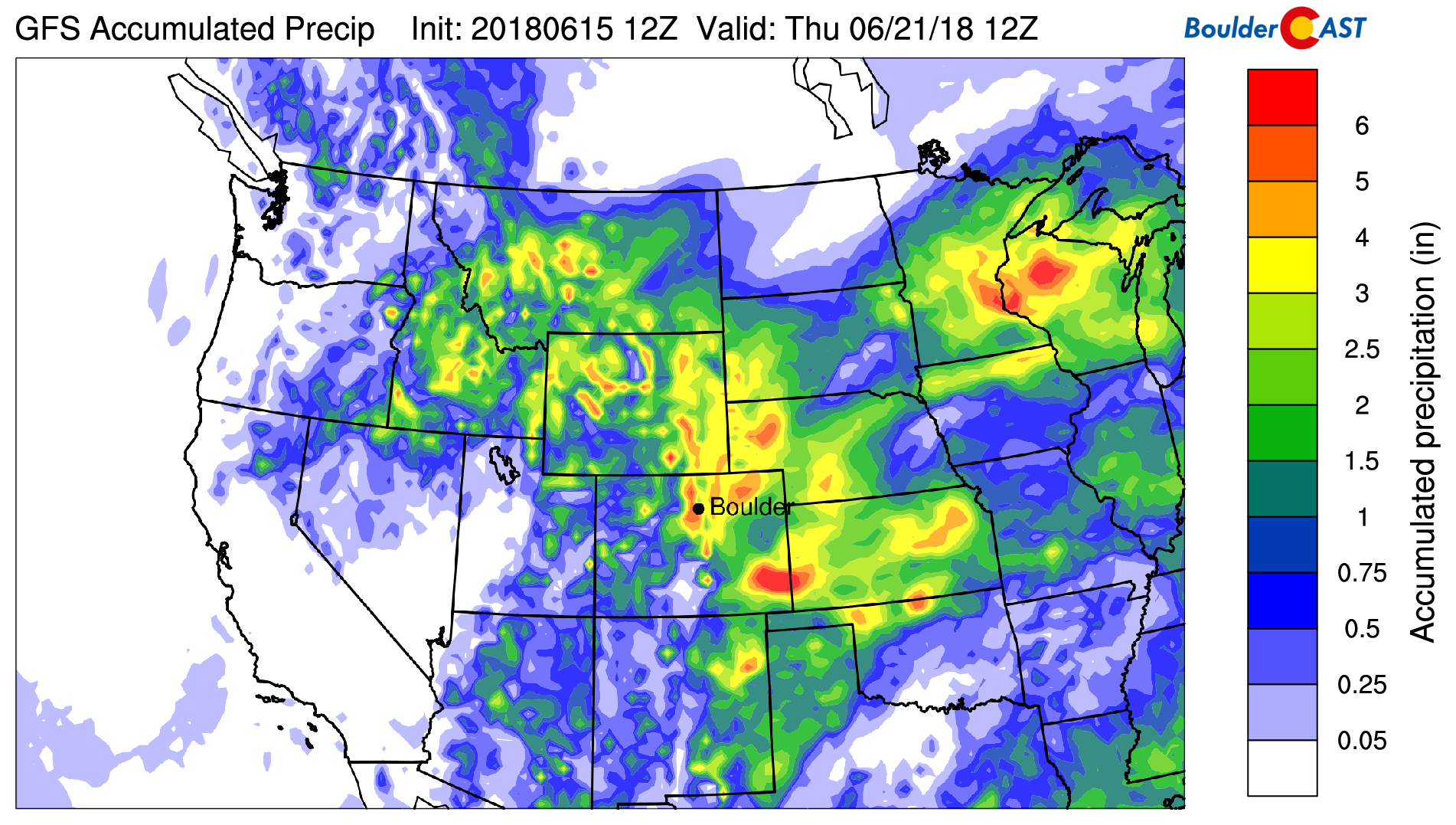
GFS total accumulated precipitation forecast through the middle of next week.
After highs in the lower 80’s Saturday, we’ll drop back into 70’s for Sunday and beyond. Take advantage of the clouds, cooler temperatures, and rain in the coming days! It may be a foreshadow of monsoon season, which by the way isn’t far off now…


You must be logged in to post a comment.