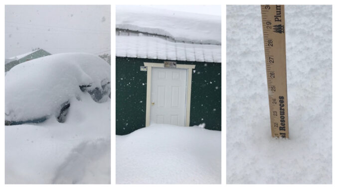
Moderate to heavy snow arrived to the Denver Metro area right on-schedule Tuesday making for a messy morning commute. While most of us received our allocated amount of snowfall, localized ridiculous totals were observed in far eastern Colorado on Tuesday — up to 30″ in some cases near the Kansas border. This region was expecting much less snow than this which created a dangerous situation for livestock and on the roadways. We review the storm totals and discuss why this historic snow fell in that region.
Category: Verification (Page 20 of 53)
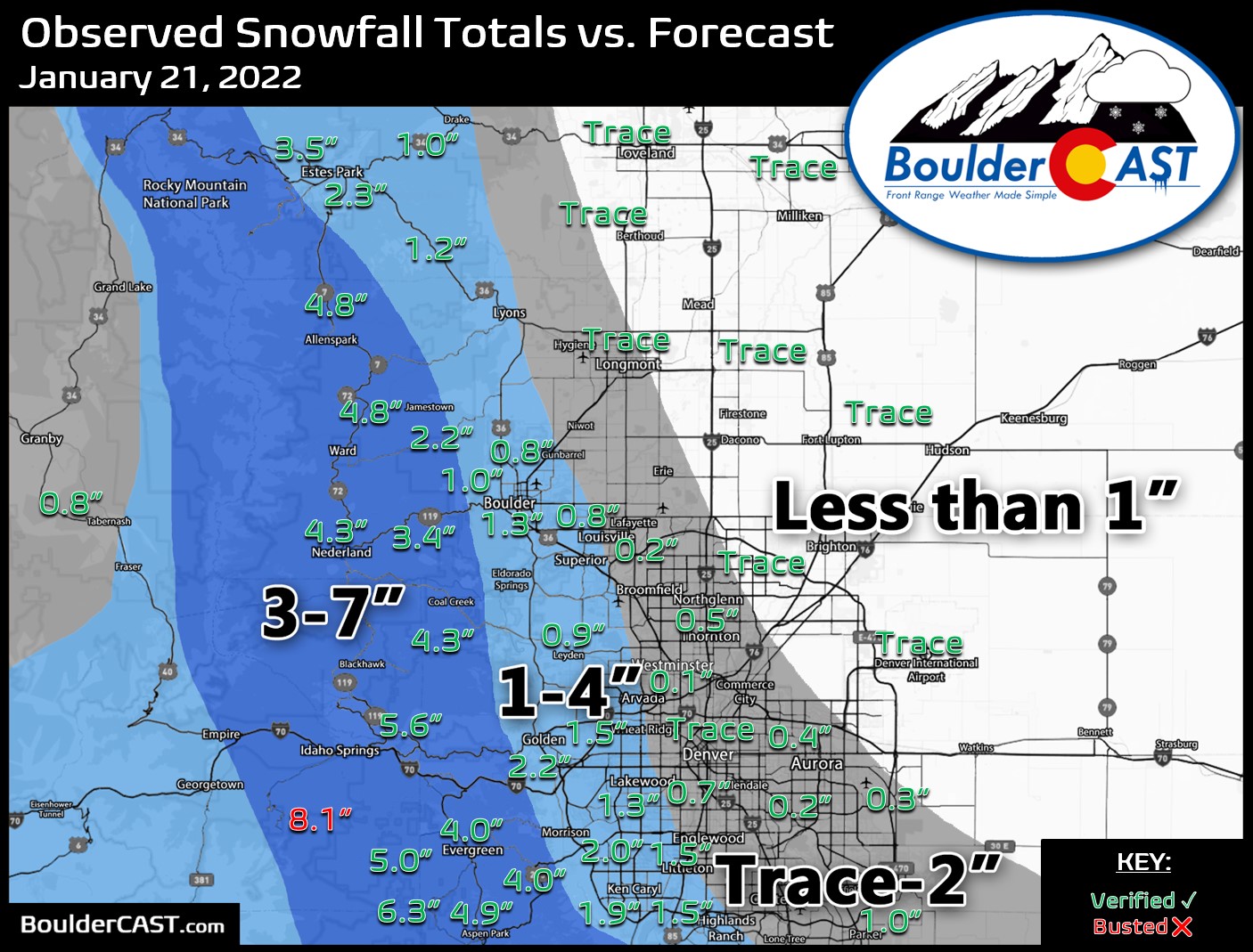
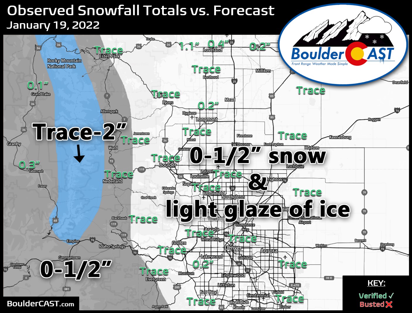
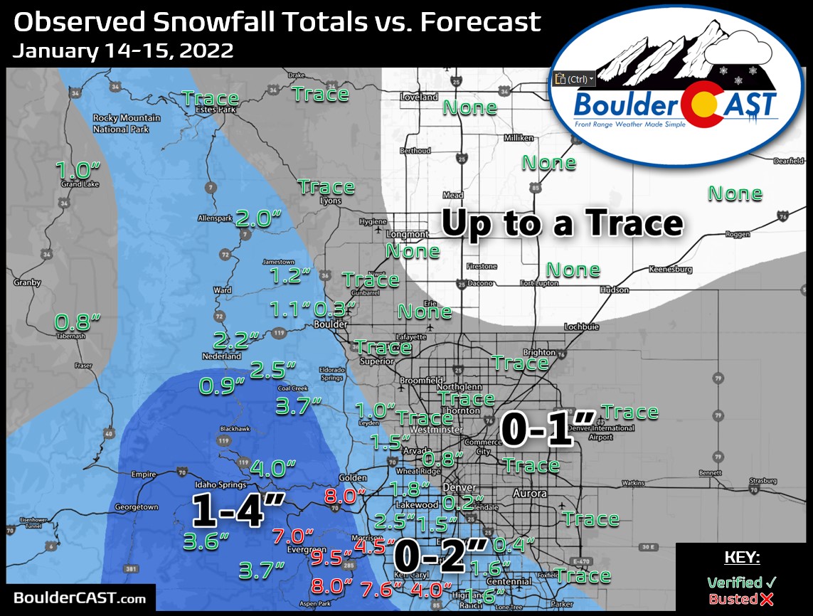
These posts take a look back at recent weather events, like snow storms or severe weather outbreaks, and evaluate how the forecast played out. We evaluate how well the models predicted what actually occurred, and offer insight into what can be learned and applied moving forward.

An unsettled weather pattern the last few weeks has brought heavy snow to the Mountains and a couple of decent snow events to the Denver Metro area as well. We’re now starting to get back on-track for snow. However, the week ahead will be mild and sunny for the most part, but we are watching a system set to move in on Friday for cooler temperatures and a chance of light snow.

Well, Denver’s snowless streak finally came to an end as a dusting of frozen precipitation was reported at Denver International Airport this past Friday morning. Unfortunately, the week ahead will not continue the trend with a largely dry week expected. We are closely watching a quick-moving storm set to race across the area on Wednesday which could bring white-out conditions to the Mountains and very strong winds to the Denver Metro area. The meager chance of rain/snow with this mid-week system will offer little reprieve for the extreme drought which now encompasses the entire area.

Live View of Boulder

Current Conditions

Live Radar

Recent Premium Posts

BoulderCAST Daily – Sun 05/31/26 | Dry and warm today but rain chances increase this week
🌦️ Overall dry and warm Sunday, though cannot rule out a very widely …
BoulderCAST Daily – Sat 05/30/26 | A stray shower today as most activity resides well east of Denver
🌦️ Spotty showers today, mainly well east of the Denver Metro area, where …
BoulderCAST Daily – Fri 05/29/26 | A Marginal Risk of Severe Isolated Storms
🌦️ Spotty showers this afternoon, mainly noon and 4 PM, with highs in …
3-Day Forecast

Trending Content

© 2026 Front Range Weather, LLC
You must be logged in to post a comment.