After a mostly quiet and warm weekend, things will more-or-less remain unchanged for the first full week of June. Temperatures will stay warm to hot with only a small chance of rainfall this week. We’ve managed to dodge the nineties so far in 2024, but that bout of good fortune will run out later this week with multiple days soaring above 90 degrees. Read on for all the details.
Category: Severe Weather (Page 8 of 21)
The posts contain discussion of severe weather in our region, including forecasts, outlooks, and recaps of events involving large hail, damaging winds, and tornadoes.
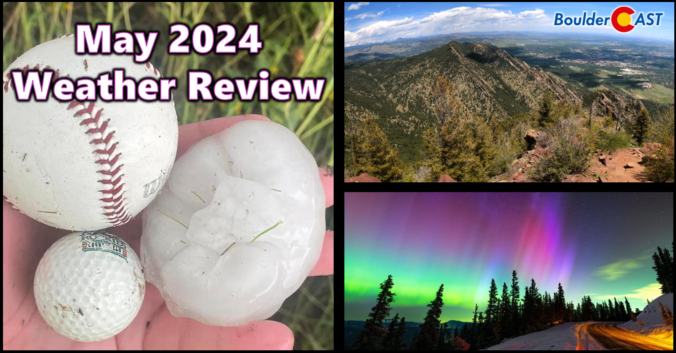
2024 began very soggy across the Front Range, but the month of May did a complete one-eighty concluding as Boulder’s driest in 50 years and 2nd driest since record-keeping began in the late 1800s. Other notable weather events during the month include the once-in-a-lifetime northern lights display visible across almost the entire United States and also what is likely to be yet another “billion-dollar hailstorm” which slammed parts of the Denver Metro area on May 30th. Here’s a quick and colorful graphical recap of our weather during May and how it relates to climatology.
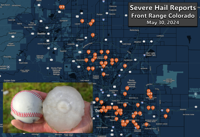
A pair of severe, supercell thunderstorms exploded across the northern Front Range late Thursday evening with very little advanced notice for residents. Hail larger than baseballs caused significant property damage on the northern and northeastern Metro area — roofing, siding, car windows and gardens stood no chance against the onslaught. The hail repair and insurance scammers are probably already knocking on doors this morning or making cold calls! We take a look at where the largest hail fell and why the forecast was so poor.

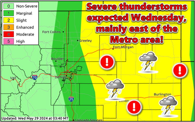

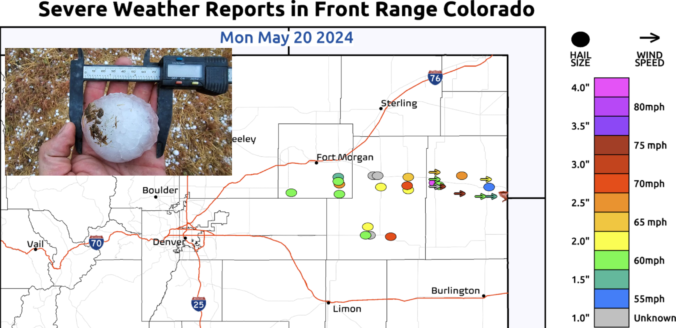
Mother Nature will continue to pummel the western United States with storm systems this week, including plenty of activity here in the Front Range. Monday will provide the most substantial severe weather outbreak in Colorado so far in 2024, but fortunately that will go down east of the Denver Metro area. Another system will bring a good chance of widespread rain for us Tuesday alongside chilly temperatures. The rest of the week into the weekend will stay somewhat active with daily chances for showers and thunderstorms. Read on for all the details.

Live View of Boulder

Current Conditions

Live Radar

Recent Premium Posts

BoulderCAST Daily – Sun 01/11/26 | A mild Sunday with readings reaching the 50s
🌤️ Mild & Melty Sunday: Light winds and patchy clouds, with lingering snowpack …
BoulderCAST Daily – Sat 01/10/26| Widespread sunshine and moderating temperatures this weekend as our recent snow melts off
🌤️ Calm Saturday: Winter storm systems have departed the state, leaving behind a …
BoulderCAST Daily – Fri 01/09/26| Snow ends quickly this morning with a quieter weekend in store
❄️ Overnight snow bands: A second push of upslope after midnight sparked narrow …
3-Day Forecast

Trending Content

© 2026 Front Range Weather, LLC