Category: Monsoon (Page 9 of 12)
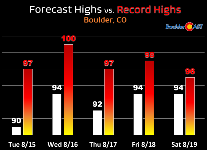
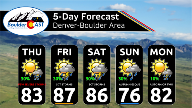
The week begins on the cooler side, but don’t be fooled! Hot weather, including potential record-breaking heat, is lurking right around the corner as temperatures return to the 90s by Tuesday and stay there the rest of the week. Rainfall will also be hard to come by during this toasty stretch. Let’s take a look at the hot and dry weather week ahead…
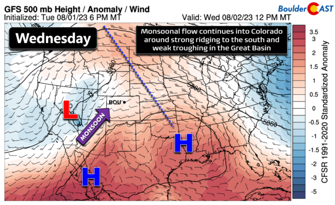
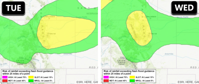
The week ahead will remain somewhat cooler and drier than normal as a weak trough stays entrenched and monsoon moisture continues to be difficult to come by. However, a favorable setup for severe thunderstorms will exist across northeast Colorado early in the week with hail the main risk. Overall temperatures will stay mostly below normal in the days ahead but they will trend back towards 90 degrees by week’s end.
Temperatures and precipitation ended up about as close to normal as possible for July in Boulder. The month began active with numerous severe weather outbreaks, some of which produced landspout tornadoes in parts of Denver. The last few weeks turned up the heat with a total of fifteen 90-degree days during the month. Here’s a quick and colorful graphical recap of our weather during July and how it relates to climatology.

Live View of Boulder

Current Conditions

Live Radar

Recent Premium Posts

BoulderCAST Daily – Sat 05/02/26 | A pleasant and warm first weekend in May
☀️Warming up for the first weekend in May, with upper 60s to near …
BoulderCAST Daily – Fri 05/01/26 | Warming up this weekend
🌡️ Warming up this weekend, from the upper 50s-60 today to the upper …
BoulderCAST Daily – Tue 04/28/26 | Staying cool with a couple showers, the late-week storm is still the main event despite trending south
🌧️ Morning wave = main show, with light rain showers and Foothills wet …
3-Day Forecast

Trending Content

© 2026 Front Range Weather, LLC