Category: Forecast (Page 40 of 169)
With the Great Arctic Blast of 2024 starting to wrap up across Front Range Colorado, the weather week ahead will be comparatively less eventful. However, there are multiple disturbances lined up in the coming days which will bring waves of moderate to heavy snow in the Mountains as well as a small chance of wintry precipitation to the Metro area. A thawing trend will ensue in the coming days, but temperatures won’t get back above normal until late in the weekend or early next week.
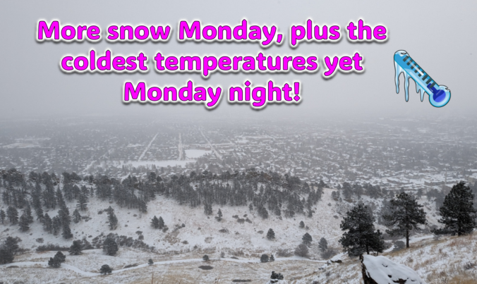
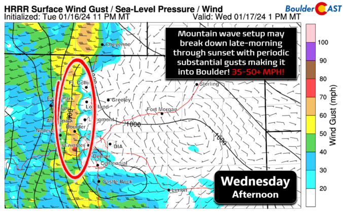
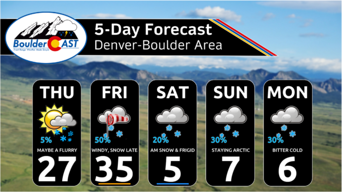
Just when you might have thought things were turning warmer, a secondary Arctic front and more snow will arrive to the Front Range on Monday. Additional snow accumulations and slick travel are expected during the day with the coldest temperatures we’ve seen yet developing Monday night. Let’s take a look at the latest as the ongoing Arctic blast delivers one final blow on MLK Day!
The Arctic air has arrived in the Front Range and it’s here to stay for several more days. We take a quick look at the overnight snow totals, the record low temperatures set already Saturday morning, and update you on the forecast for the rest of the weekend. More accumulating snow and even colder temperatures are on the way!
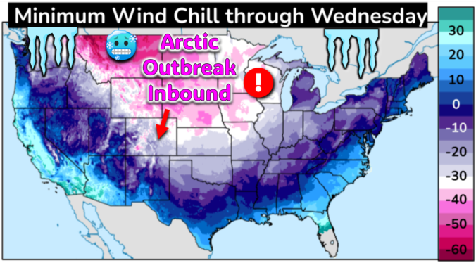
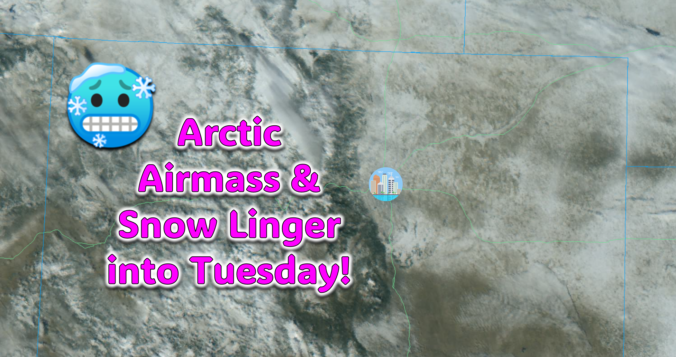
The most significant Arctic outbreak for the Front Range since 2022 is brewing! The initial cold front will blast through Friday early evening ushering in sub-zero wind chills which will persist all the way into at least Tuesday morning. While the extreme cold is all but certain at this point, the snowfall potential is a bit trickier of a forecast as there will be three separate chances for snow mixed into the polar plunge. However, the Mountains will be getting absolutely showered in powder. Let’s take a look at bitter cold and snowy forecast heading into the MLK holiday weekend.
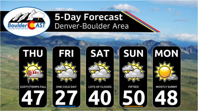
Breezy conditions and chilly temperatures will kick off the week behind a departing winter storm which brought a thin blanket of snow to the Metro area last night. Highs below freezing on Monday will trend slightly warmer in the coming days, but with gusty winds remaining. The tail-end of the week will turn more active with a few chances at light snowfall. There are also signs in the extended that an Arctic airmass will ooze into the region during the upcoming weekend turning things even colder for us. Read on for more details

Live View of Boulder

Current Conditions

Live Radar

Latest Smoke Forecast

Recent Premium Posts

BoulderCAST Daily – Tue 07/14/26 | The Front Range Continues to Bake Under Expansive Ridge
🔥 Heat streak continues — Boulder hit 97°F for the third time in …
BoulderCAST Daily – Sun 07/12/26 | Hot weather for a good chunk of the coming week
🥵 🔥 Heat for a good chunk of the week: Upper 90s through …
BoulderCAST Daily – Sat 07/11/26 | Here comes the heat!
🥵 Heat start today: Upper 90s start today and continue well into next …
3-Day Forecast

Trending Content

© 2026 Front Range Weather, LLC