After the holiday cold and dumping of snow, temperatures this week will trend back above normal by midweek with low to perhaps middle 50s taking hold. A cold front moves south late Wednesday into Thursday, with temperatures then falling back below average to close out the week. While chances of precipitation appear limited at this point, we do have to keep our eye on two potential systems late in the week and into the weekend. Read on for more details.
This week’s highlights include:
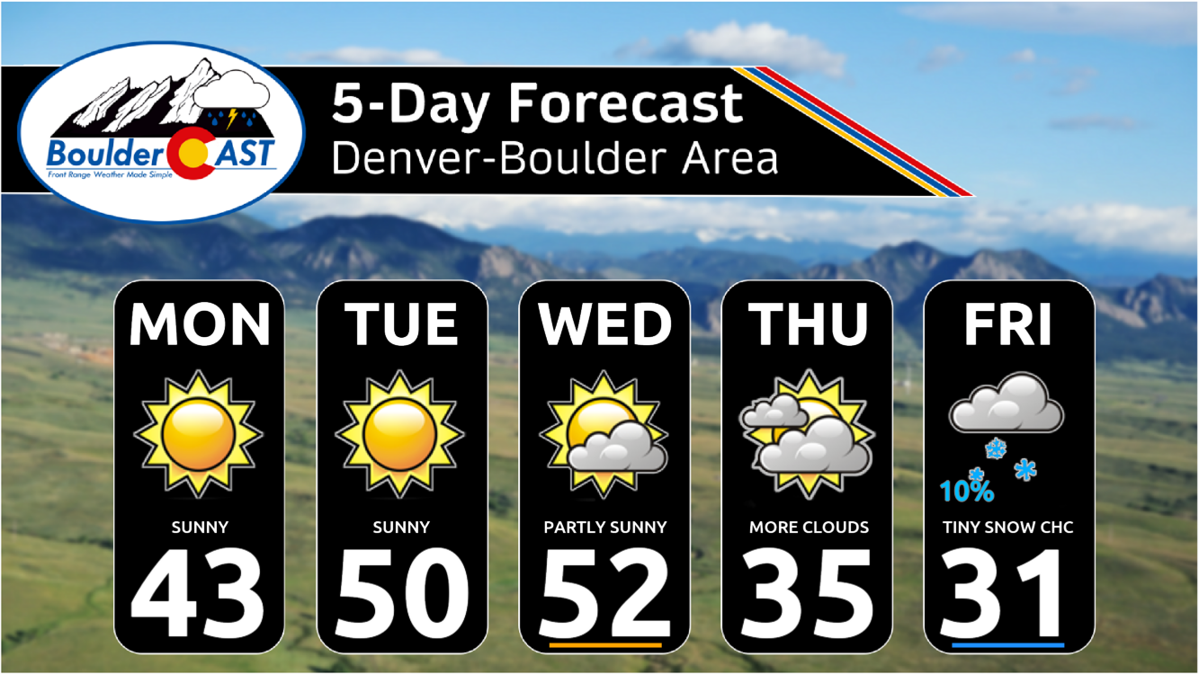
- Thawing continues to start the week, highs in the 40s Monday, followed by low to mid 50s Tuesday into Wednesday under warm downslope winds
- A cold front dives down late in the week, resulting in highs falling back to below normal Thursday and Friday
- Overall the extended period looks largely dry across the area, but we need to keep an eye on two potential areas of low pressure for later this week and weekend
DISCLAIMER: This weekly outlook forecast is created Monday morning and covers the entire upcoming week. Accuracy will decrease as the week progresses as this post is NOT updated. To receive daily updated forecasts from our team, among many other perks, subscribe to BoulderCAST Premium.

Go Premium, get all the perks.
Daily Forecast Updates
Get our daily forecast discussion every morning delivered to your inbox.
All Our Model Data
Access to all our Colorado-centric high-resolution weather model graphics. Seriously — every one!
Ski & Hiking Forecasts
6-day forecasts for all the Colorado ski resorts, plus more than 120 hiking trails, including every 14er.
Smoke Forecasts
Wildfire smoke concentration predictions up to 72 hours into the future.
Exclusive Content
Weekend outlooks every Thursday, bonus storm updates, historical data and much more!
No Advertisements
Enjoy ad-free viewing on the entire site.
Thanksgiving weekend snow totals
Snowfall began Thanksgiving evening, continued into Black Friday with a slight resurgence occurring Saturday morning — it was roughly a 48-hour snow event. For the most part, snowfall rates were rather light and travel was only marginally impacted over the extended holiday weekend. Overall, a dusting up to 12″ of snow fell across the Front Range. As expected, the heaviest totals were across the northern Front Range from Boulder to Fort Collins and in the nearby Foothills. Basically 1-3″ of snow was recorded in most of Denver, but 6-12″ piled up in much of Boulder County. Shown below is our snowfall forecast map issued early Thursday morning with actual storm totals overlaid. Green values indicate that our forecast verified to within one inch of the observed snowfall total. Red numbers did not. We’re happy with the way the forecast turned out, even with some BOOMING totals in parts of eastern Boulder and Weld Counties. This discrepancy there was mainly due to the Saturday morning burst of snow at tail-end of event which wasn’t easy to predict so far in advance. Some areas picked up another 2-5″ on Saturday alone!
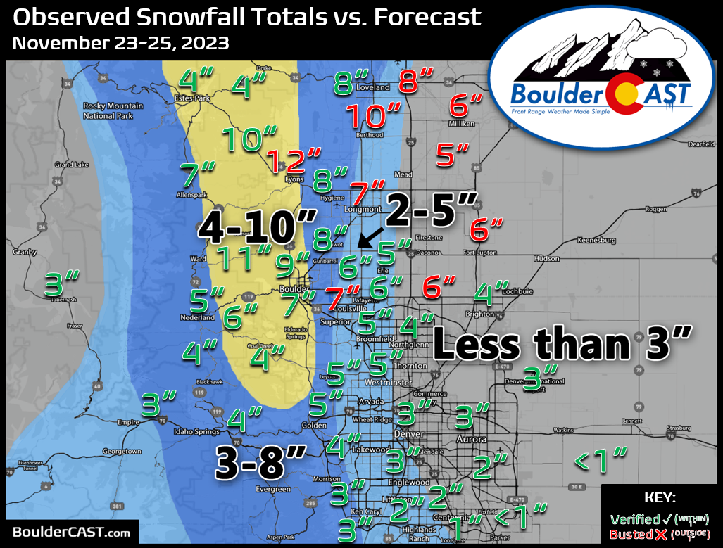
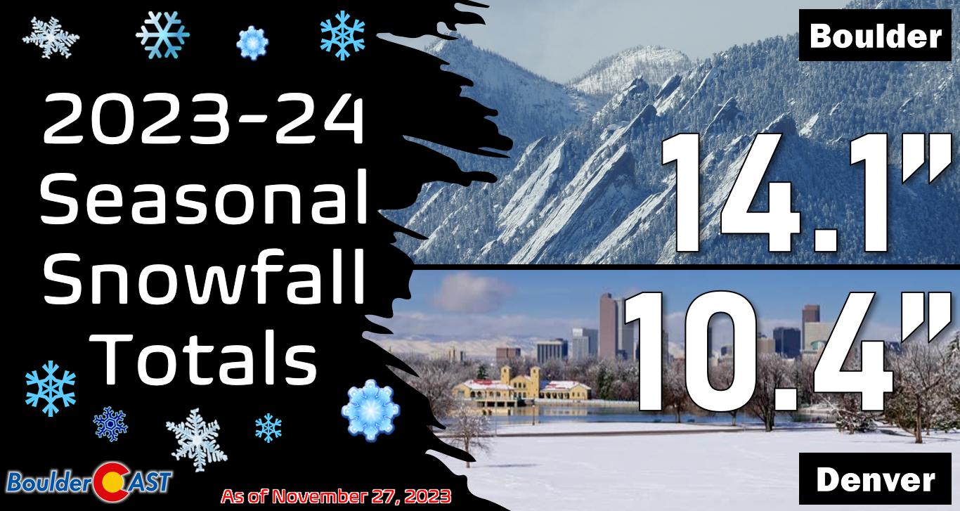
The official storm totals were 7.3″ in Boulder and 2.9″ in Denver (DIA). This storm has boosted Boulder back atop Denver for the season, something that was bound to happen sooner or later. Both cities are running just slightly below normal for the season on snowfall.
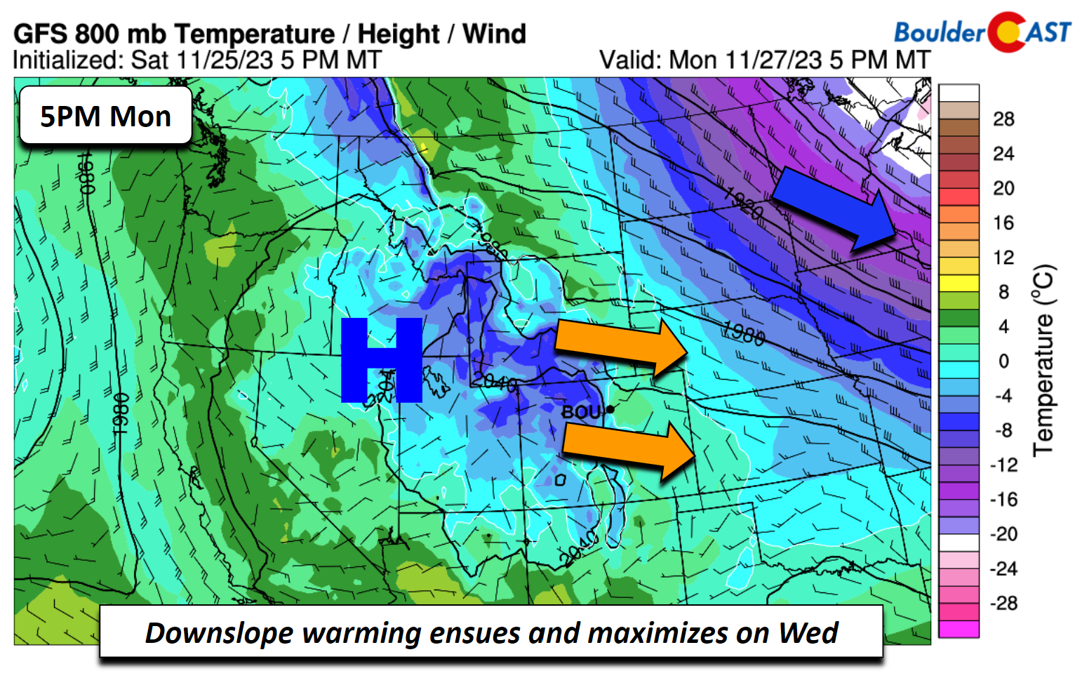
Thawing out & warming above normal into midweek
A pleasant warming trend is in store for the start of the week, at least into Wednesday. A dome of high pressure to our northwest currently over Nevada/Utah/Idaho will slowly side south and east into midweek. The result will be a quick downslope warming and abundant sunshine. In contrast, cold/chilly air will be present across the Northeast US and Mid-Atlantic states.
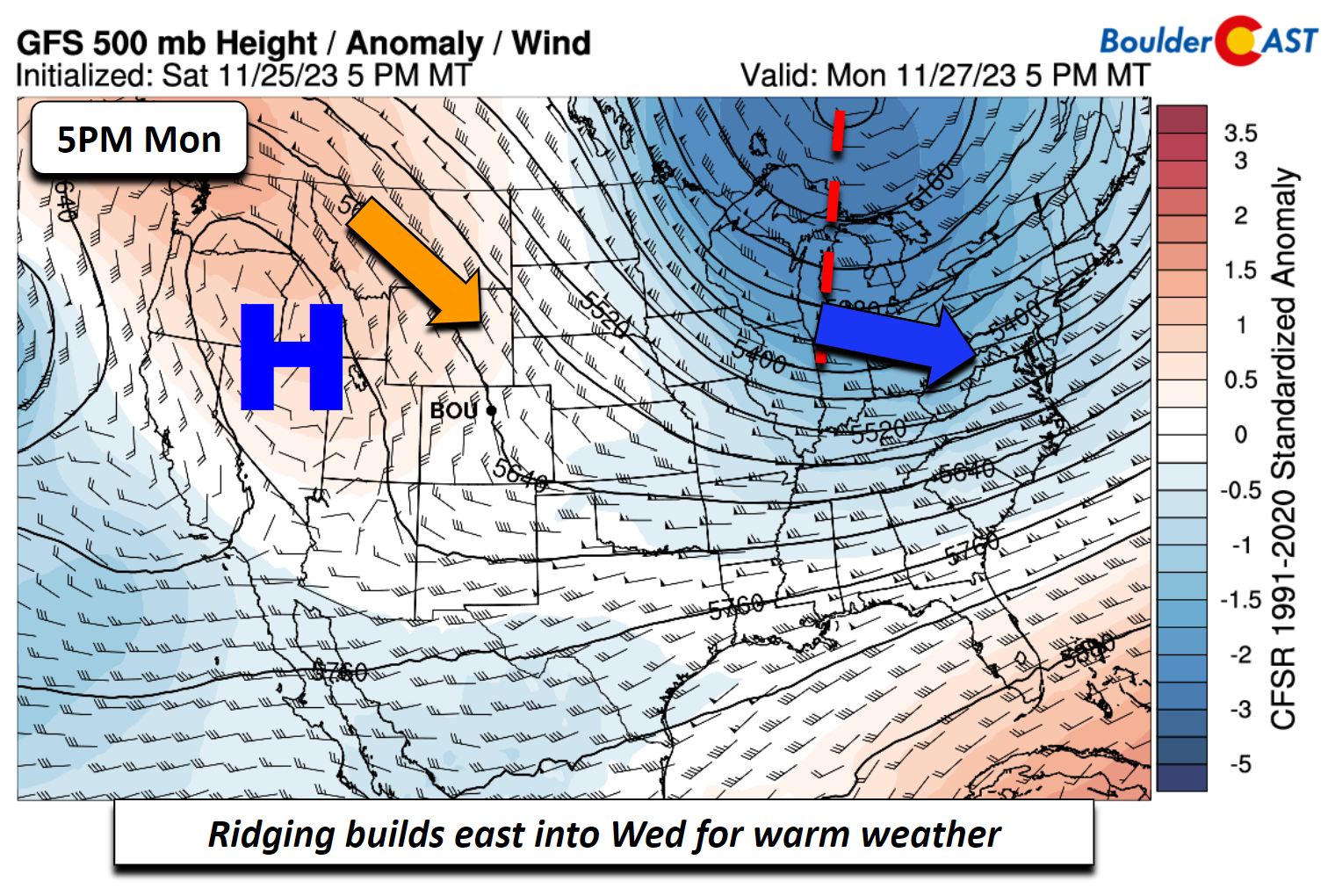
By late Tuesday, the high pressure ridge will be over the Four Corners region, thus directly overhead for all intents and purposes. Note a weak system offshore of California — we’ll discuss this a bit later…
Downslope warming starts on Monday but really doesn’t maximize until Tuesday and Wednesday. Nevertheless, we should get out of the 30s into the lower 40s Monday afternoon with a west-southwest surface wind. The cold air oozes to our east as you can see below.
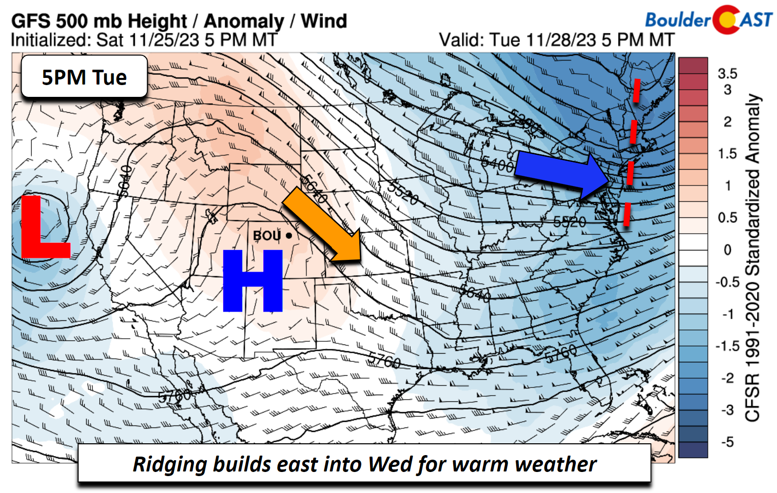
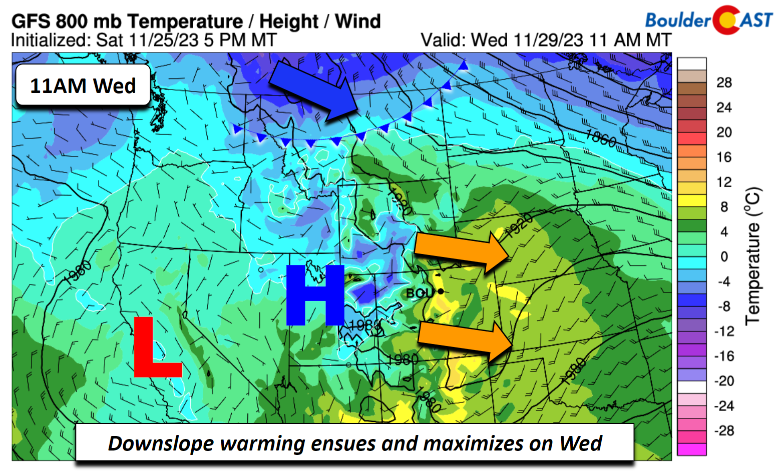
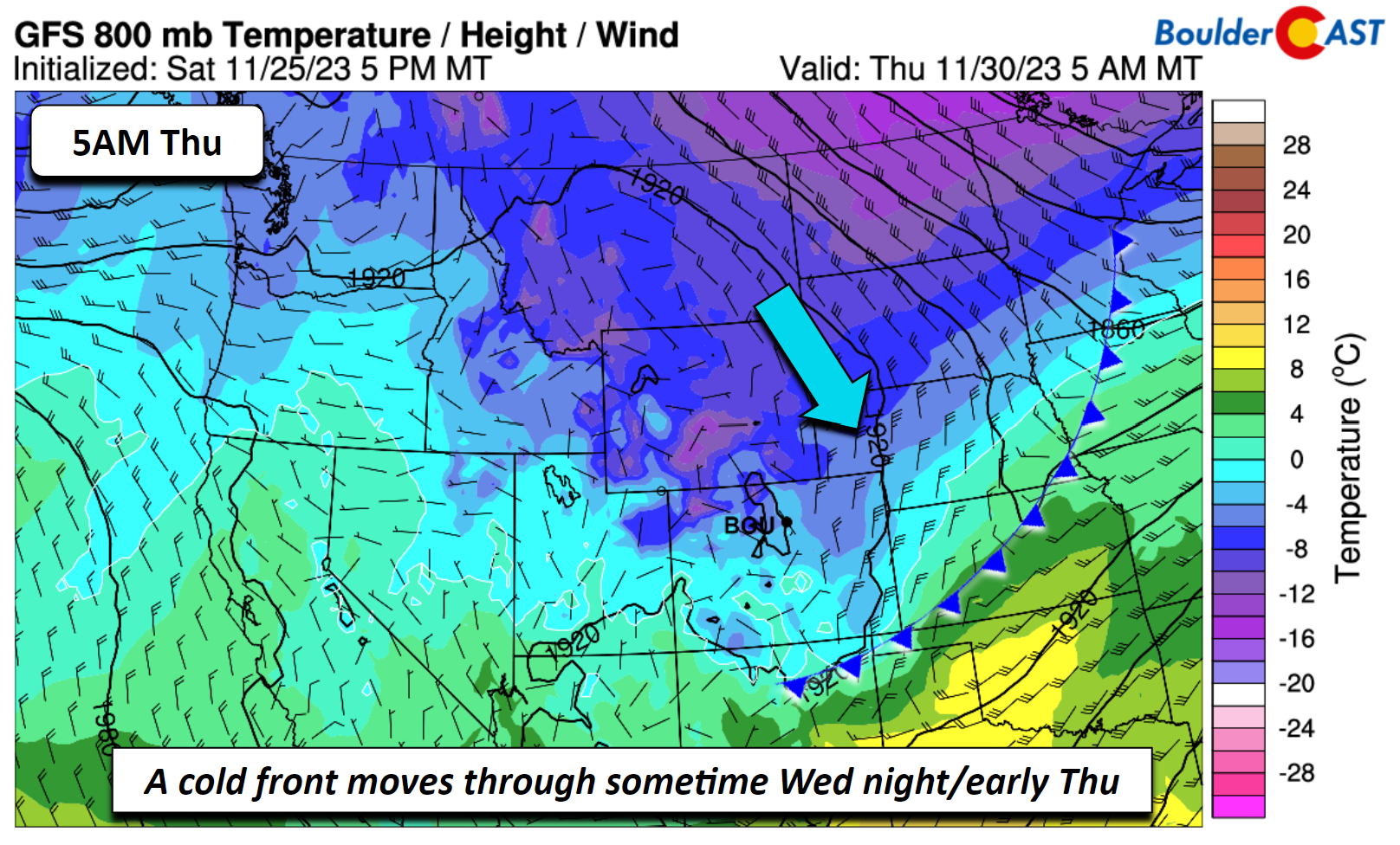
Low to middle 50s are favored Tuesday and Wednesday as downslope warming maximizes. The low-level airmass nears 10°C, supportive of these above normal temperatures. There is a cold front that will move into Montana by the early afternoon and will be a player for us late Wednesday into Thursday.
A dry cold front falls us back to below normal to close out the week
Most models are showing a dry cold front dipping down and through the Front Range sometime late Wednesday night or early Thursday, reaching the New Mexico/Colorado border by 5:00 AM Thursday. This will result in our highs falling back below normal, with upper 30s favored on Thursday and close to the low 40s on Friday.
Watching two systems for Thursday and into the weekend
As the cold front moves through later this week, most ensemble guidance is indicating that the passage is going to be dry. However, we don’t think it’s that clear cut, as we’ll discuss now. The GEFS (below) does show a few members which have snow Thursday and also over the weekend, but certainly these appear to be outliers.
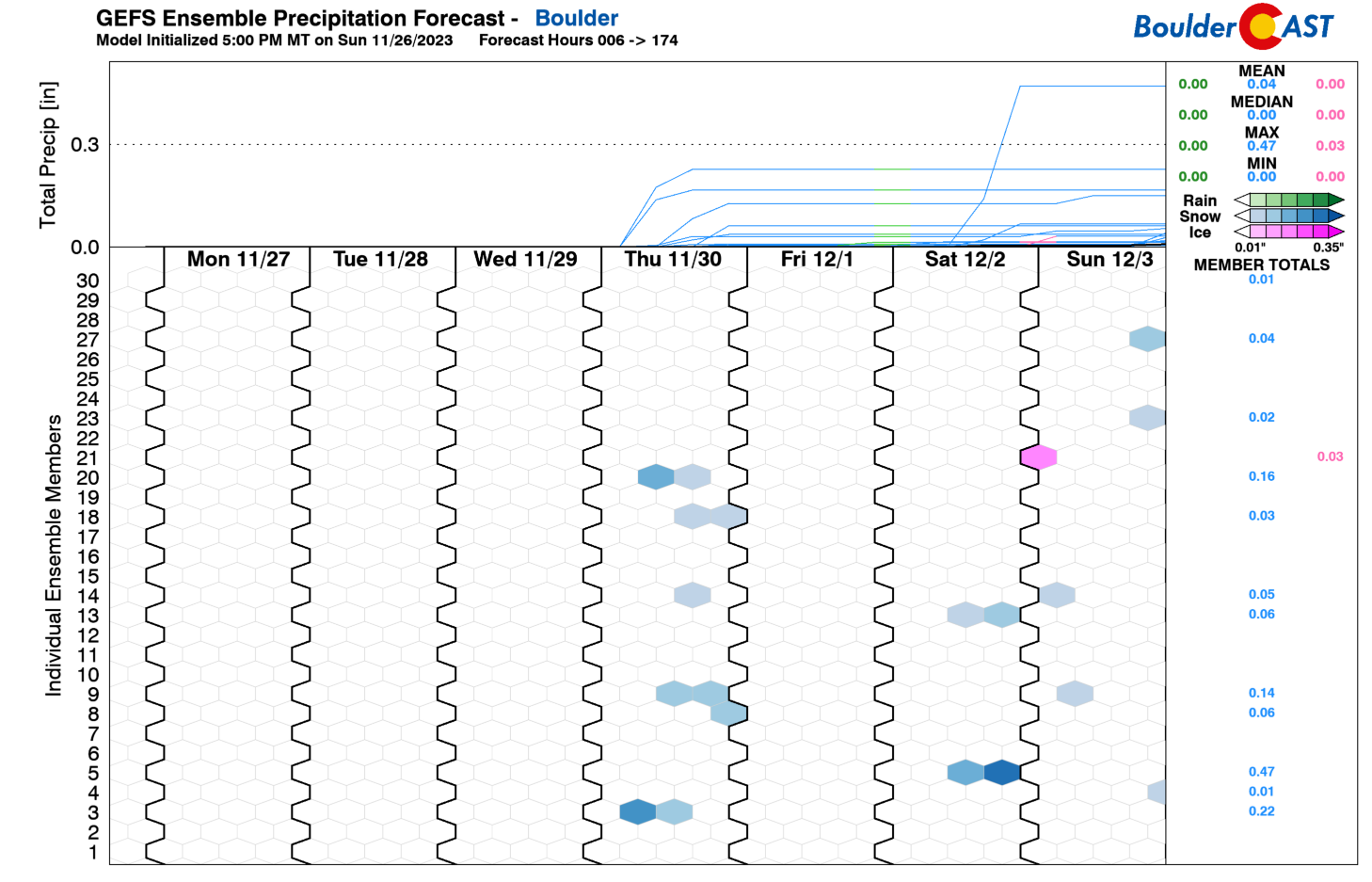
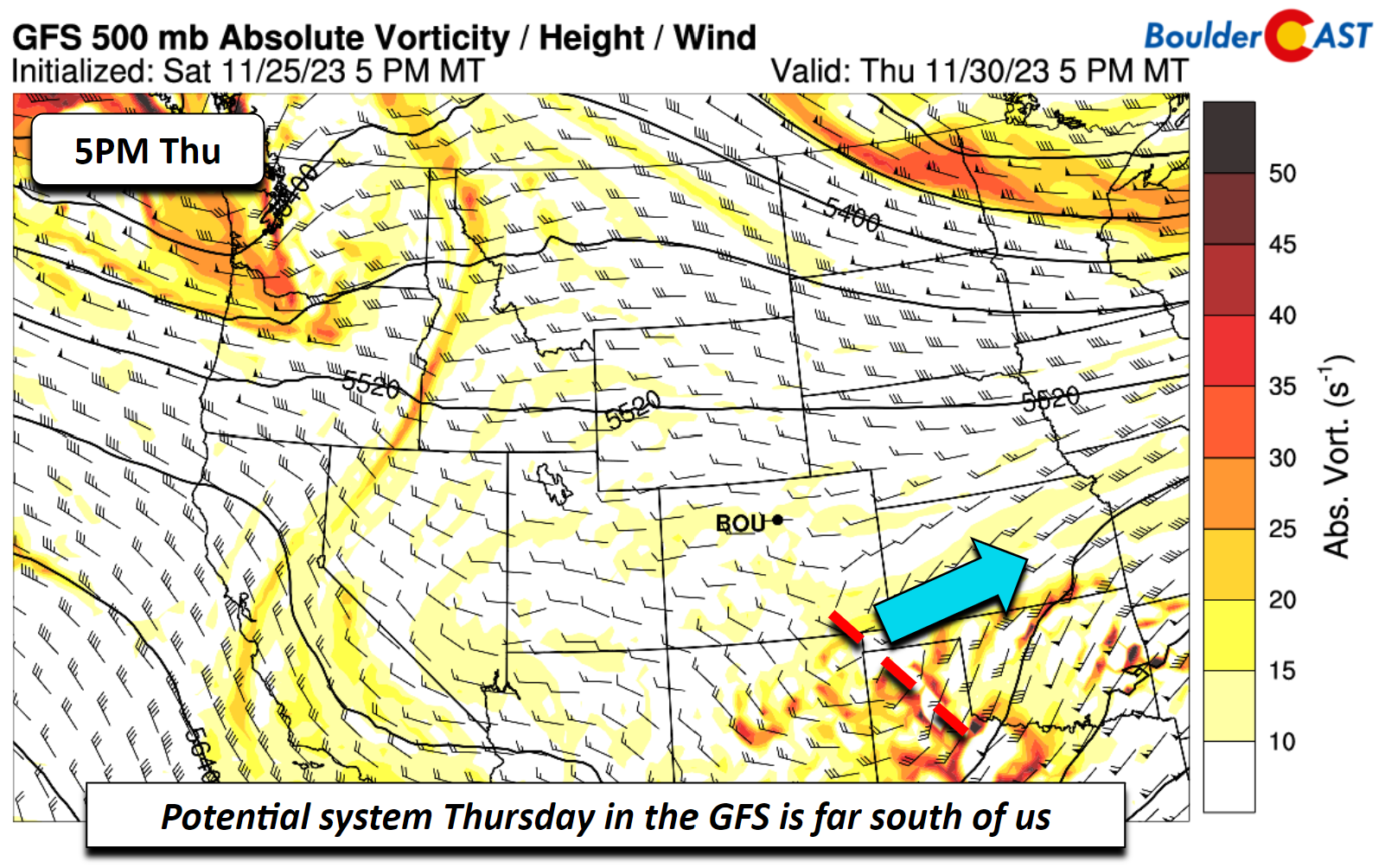
The few members showing precipitation is tied to a few southern stream shortwaves that will track to the east in the Thursday to Saturday timeframe. For the Thursday system, the GFS takes it well south of Colorado, near the Texas panhandle. This track is the driest and keeps any precipitation along the New Mexico border.
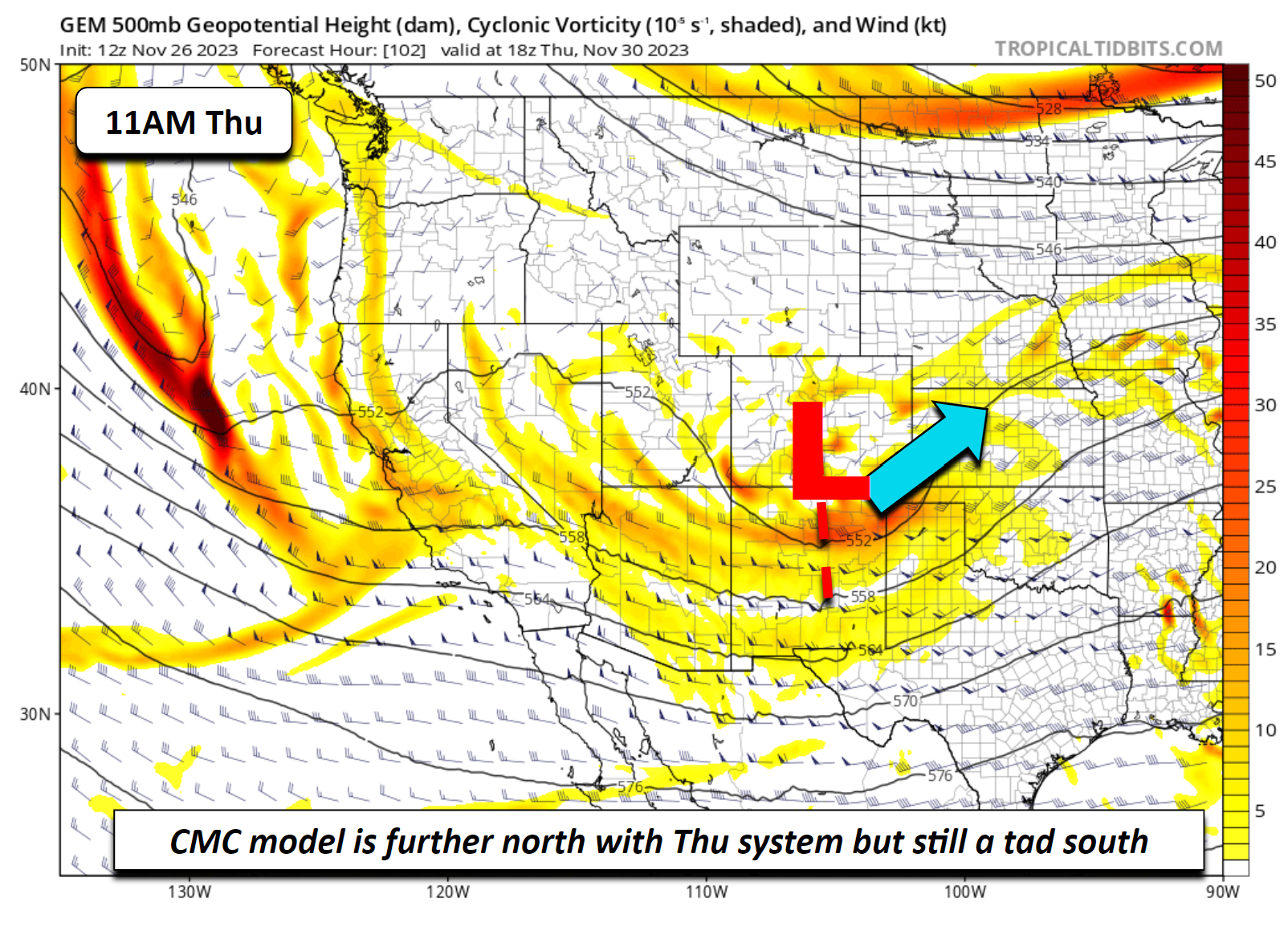
The CMC (below) is further north, tracking the system from the Four Corners area and then into far southeastern Colorado. The result is a good threat of snow in the San Juan Mountains of southwest Colorado, and perhaps a chance of light snow on the Plains. Although this system is further north, it shows limited precipitation chances as well. The ECMWF lands somewhere in between the CMC and GFS solutions. Hence, most guidance is south with this system, keeping us dry. For now it bears watching, but we’re not optimistic for much precipitation on Thursday.
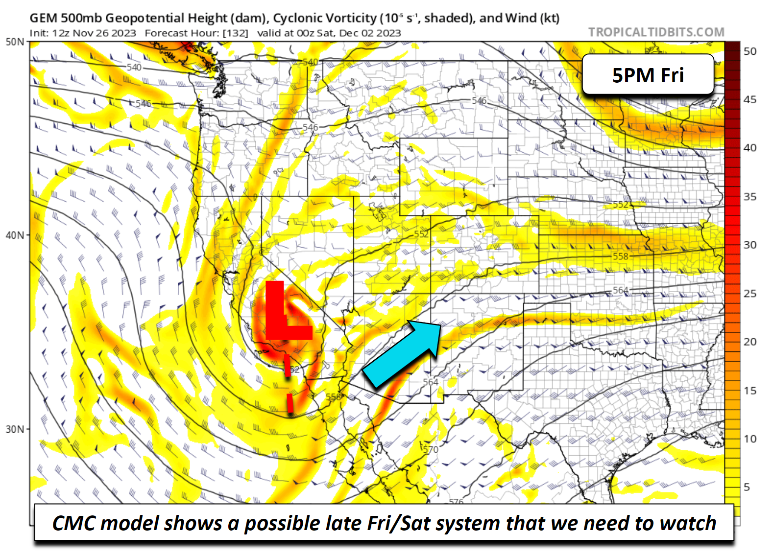
A secondary system could arrive sometime late Friday or during the upcoming weekend on Saturday — there is a bit of spread on timing. The ECMWF takes this second system also to the south, but it is a stronger storm with greater lift.
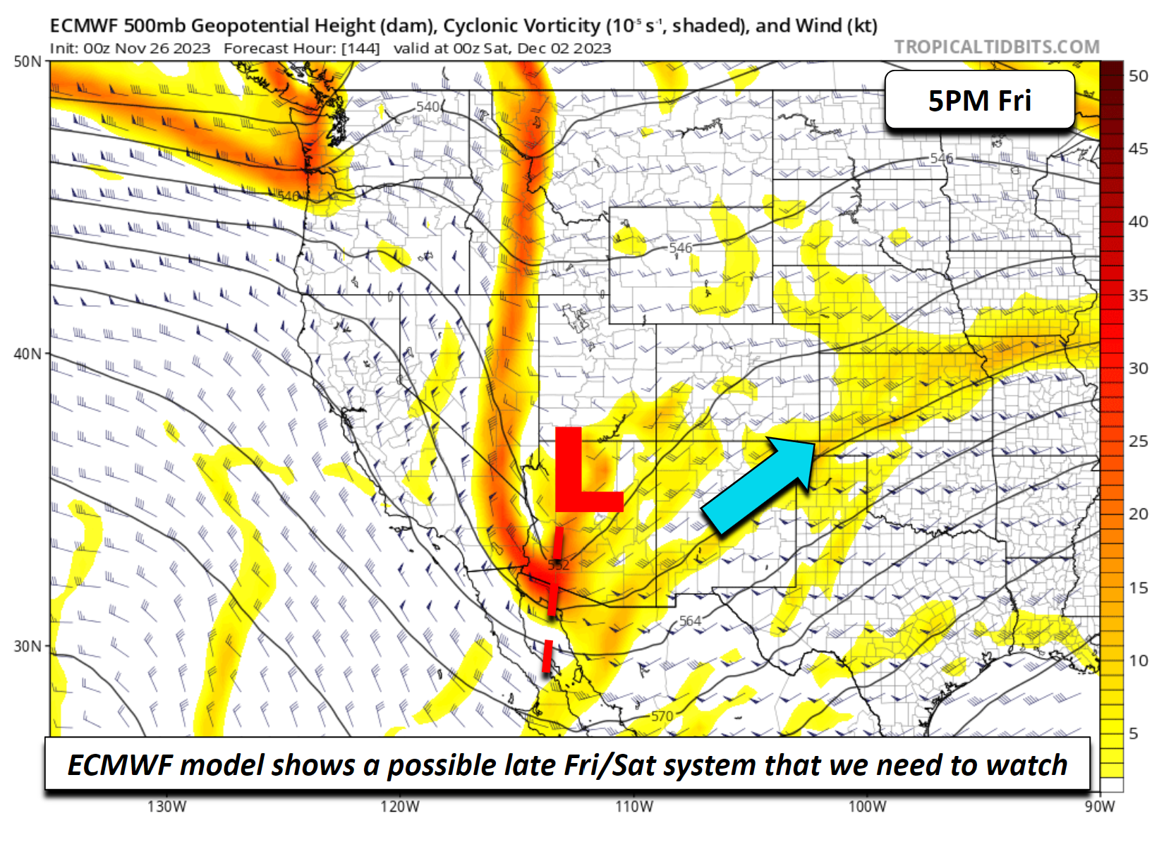
The CMC also shows a southern track strong shortwave, but is much slower, not bringing it east until the weekend. The GFS appears very muted, if at all, with any system at the moment. This means the late week and weekend system is also uncertain and, as of now, are expected to be dry for the Front Range. However, these southern track systems are tough to forecast this far in advance and we will be keeping an eye on it as the week progresses.
Enjoy the warmth and sunshine before the late-week cold front and stay tuned for potential winter weather updates.
Get BoulderCAST updates delivered to your inbox:
Forecast Specifics:
Monday: Mostly sunny and warmer with low 40s on the Plains and low 30s in the Foothills.
Tuesday and Wednesday: Lots of sunshine and mild with low to middle 50s for the Plains and low to middle 40s for the Foothills. More clouds will be around Wednesday.
Thursday and Friday: Increasing clouds and chilly. Highs below normal in the 30s for the Plains and 20s in the Foothills. The current forecast is expected to be mostly dry but we are watching a few southern track systems that could bring a chance of snow either day —- the slightly better chance for light snow is on Friday.
DISCLAIMER: This weekly outlook forecast is created Monday morning and covers the entire upcoming week. Accuracy will decrease as the week progresses as this post is NOT updated. To receive daily updated forecasts from our team, among many other perks, subscribe to BoulderCAST Premium.
Go Premium, get all the perks.
Daily Forecast Updates
Get our daily forecast discussion every morning delivered to your inbox.
All Our Model Data
Access to all our Colorado-centric high-resolution weather model graphics. Seriously — every one!
Ski & Hiking Forecasts
6-day forecasts for all the Colorado ski resorts, plus more than 120 hiking trails, including every 14er.
Smoke Forecasts
Wildfire smoke concentration predictions up to 72 hours into the future.
Exclusive Content
Weekend outlooks every Thursday, bonus storm updates, historical data and much more!
No Advertisements
Enjoy ad-free viewing on the entire site.
Enjoy our content? Give it a share!


You must be logged in to post a comment.