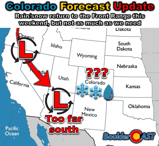
Front Range weather will be tame to start the week with above normal temperatures for our Monday but under extensive wave clouds. However, all eyes are on a developing storm system moving onshore Monday night in California. As the system tracks across the Four Corners and into our area, it will bring the Mountain snowfall, as well as the chance of rain ending as wet snow late Tuesday night into early Wednesday in the Denver Metro area. While the midweek storm will offer a decent chance at our first flakes of the season, amounts are expected to be rather light. We break it all down for you, including the probabilities and our preliminary snowfall map. The first hard freeze of the season is also taking shape for Wednesday night.
Updated (Tue 10/29/2024 7:00AM): Our snowfall map was updated to align with the latest guidance, with details discussed in our Premium update HERE.