Category: BoulderCAST Daily (Page 40 of 465)

This page contains an index of our BoulderCAST Daily forecast updates. If you are NOT a Premium member, you will only see a tiny sample of this content below. Subscribe to BoulderCAST Premium to gain access to all of our daily forecasts which get published every morning.

Premium This Weekend in Colorado Weather: The December that has felt like October continues with bone dry warmth persisting into next week

The stubbornly warm and windy stretch we’ve been living through is finally on its way out—but not before we endure two more days of breezy conditions. The culprit, the polar jet stream, has been parked overhead funneling fast winds into Colorado all week long. By Sunday morning, it will retreat northward, giving us a brief break from the gusts. Winds …

Premium BoulderCAST Daily – Thu 12/11/25 | Wind and Warmth

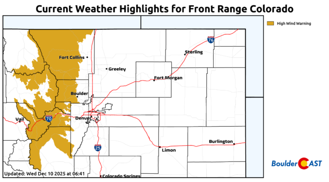
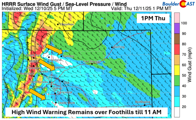
AHigh Wind Warning remains in effect until 11 AM today for gusts up to 80 mph over the Foothills and higher terrain west of the Denver Metro. These high winds are all due to a strong downslope flow. While those of us on the Plains will be sheltered for the most part, gusts of 20-30 mph will be common into …

BoulderCAST Daily – Wed 12/10/25 | A recap of the Foothills windstorm and a look at what’s next (spoiler: more wind)

YTuesday windstorm recap esterday’s winds were nothing short of fierce across the Foothills and Mountains. Gusts topping 70 MPH were widespread above 7,000 feet, and reanalysis data suggests that some pockets likely experienced at least one 90+ MPH gust (shown in purple on the reanalysis map below). Remember, reanalysis blends actual observations with model data to fill in the gaps—and …

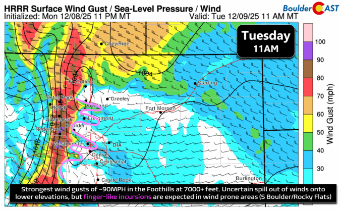
Premium Storm Update – Tue 12/09/25 7:30AM | Downslope winds gusting up to 100 MPH in the Foothills today, less intense winds but still blustery for the lower elevations

All the ingredients have lined up perfectly for a classic mountain wave downslope windstorm, and it’s already flexing its muscles. Overnight, gusts of 70 MPH have been widespread across the Foothills, with a few spots clocking in at an eye-popping 90+ MPH. The setup is textbook: an impressive pressure gradient stretching across the Continental Divide—about 12mb from Boulder to Granby, …

Premium BoulderCAST Daily – Sun 12/07/25 | Quiet end to the weekend

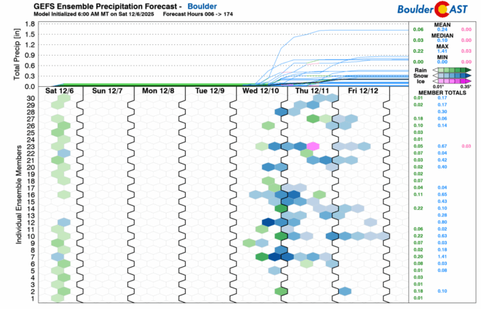
Atranquil Sunday will be felt across the Front Range. Weak ridging will build in aloft and favor a mixture of clouds and sunshine. Highs should top out in the low to middle 40s. Our next chance of snow may come late this coming week Wednesday or Thursday. There is still a great deal of uncertainty with the systems forecast to …

Premium BoulderCAST Daily – Sat 12/06/25 | A breezy Saturday with snow showers in the Mountains and Foothills

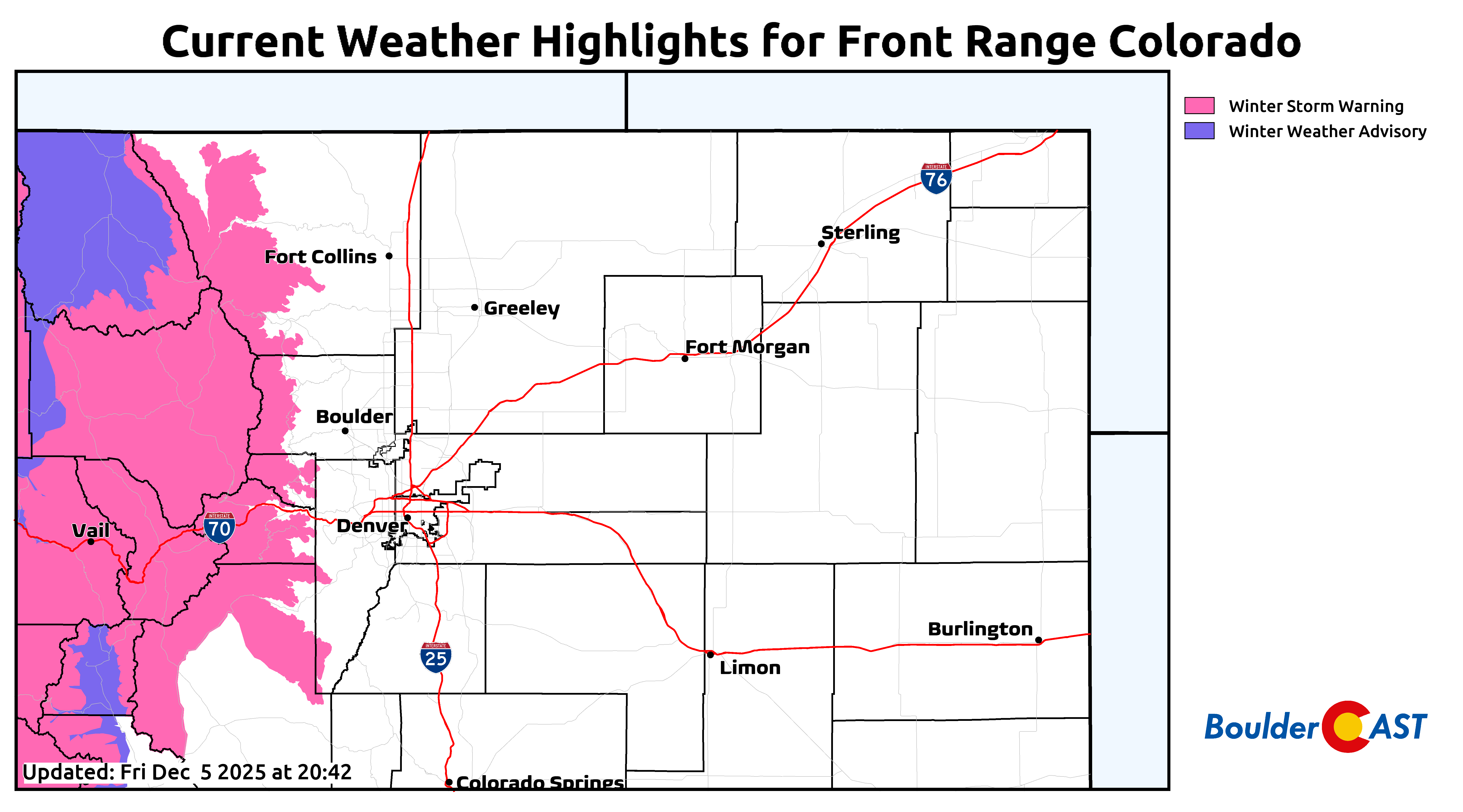
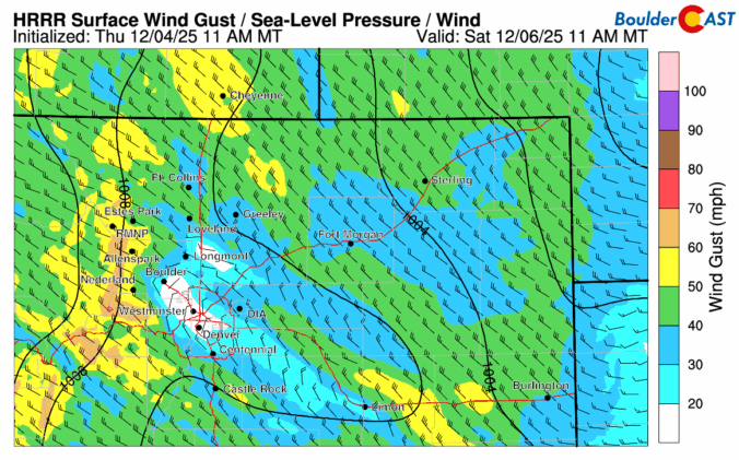
An area of low pressure over Nebraska will set up a lee trough over eastern Colorado. With broad high pressure to the west of the mountains, west-northwest downslope flow will ensue across much of the state. High Country heavy snow will occur and some will spill over into the Foothills, where Winter Storm Warnings are in place. On the Plains, …

Premium BoulderCAST Daily – Fri 12/05/25 | Quiet today but breezy on Saturday

After a snowy midweek, the tail end of the work week is quiet. We'll see a mixture of clouds and sun this afternoon with temperatures largely hovering in the middle 30s. On Saturday, downslope winds will develop as low pressure tracks to our north and west. West-northwest surface winds will ensue on the Plains and Foothills, with the potential for …

« Older posts Newer posts »