Category: BoulderCAST Daily (Page 17 of 465)

This page contains an index of our BoulderCAST Daily forecast updates. If you are NOT a Premium member, you will only see a tiny sample of this content below. Subscribe to BoulderCAST Premium to gain access to all of our daily forecasts which get published every morning.
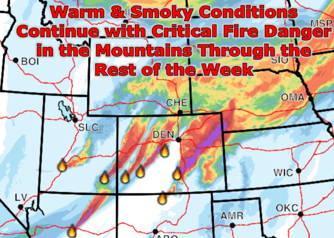
Premium BoulderCAST Daily – Tue 06/30/26 | A Tease of Rain Amid Critical Fire Weather and Continued Smoke

Warm temperatures and smoky skies will hang on through the week across the Front Range, but Mother Nature at least throws us a small meteorological bone today: a non‑zero chance of actual precipitation. Yes, really — the atmosphere might squeeze out a few renegade drops this afternoon as a compact shortwave embedded within the broader western trough slides from near …

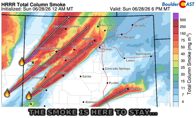
Premium BoulderCAST Daily – Sun 06/28/26 | Another 90° Day—And More Smoke is on the Way

YHot & Smoky Weather Continues esterday’s extreme fire‑weather conditions across the drought‑stricken Four Corners produced several new large ignitions spanning Utah, western Colorado, Arizona, and New Mexico. By sunset, a dense mid‑level smoke wall became visible west of Boulder — an unmistakable brown cloud advancing toward the Front Range. https://twitter.com/BoulderCAST/status/2071067409616973881 Shortly after dark, that smoke mixed down to the surface, …

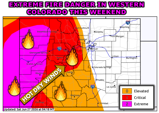
Premium BoulderCAST Daily – Sat 06/27/26 | A Hot & Dry First Weekend of Summer as Extreme Fire Danger Unfolds in Colorado’s Mountains

HGoodbye Storms... Hello Heat & Fire Danger appy Saturday, folks! The past week has delivered a remarkably persistent convective regime across eastern Colorado, with daily severe thunderstorm development anchored by a stagnant, moisture‑rich pattern. From last Saturday through Friday, the environment repeatedly reloaded with ample low‑level moisture, steep lapse rates, and favorable shear, allowing at least a few storms each …

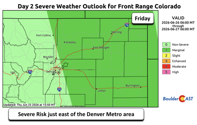
Premium BoulderCAST Daily – Fri 06/26/26 | Trending hotter this weekend

Our work week ends with one more day of scattered storms across the Front Range. The good news is that the severe risk will largely reside east of the Denver Metro. Nevertheless, it is close enough to warrant a risk of damaging winds and hail this afternoon and evening. Temperatures will trend warmer today into the middle 80s. Storm activity …

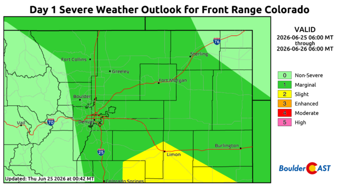
Premium BoulderCAST Daily – Thu 06/25/26 | On-and-Off Showers and Storms with a Lower Severe Threat

Asevere thunderstorm threat will remain in place today across a large swath of the Front Range. The risk is not as high as it was the past few days, but still carries a Level 1 out of 5 Marginal Risk today, a two categorical downgrade from what we had yesterday. Nevertheless, we still are on the hook for damaging winds and …

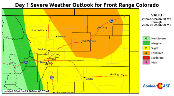
Premium BoulderCAST Daily – Wed 06/24/26 | Another Day of Severe Weather

Asevere thunderstorm threat will remain in place both today and Thursday across a large swath of the Front Range. With easterly upslope flow at the surface and westerly 40 MPH flow at mid-levels, the atmosphere is well-configured for damaging winds, extremely large hail, and isolated tornadoes. That tornado threat will largely focus along/east of I-25. The setup remains quite similar …

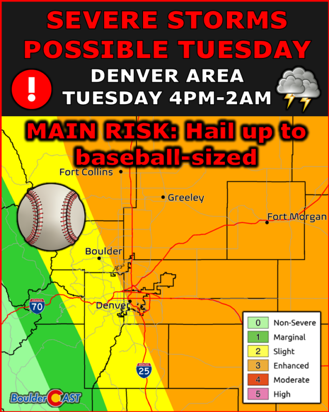
Premium BoulderCAST Daily – Tue 06/23/26 | High‑End Hail Threat Targets the Denver Area, with the Risk Lingering into the Overnight

Avery real severe thunderstorm threat exists both today and Wednesday across a large swath of the Front Range. With easterly upslope flow at the surface and westerly 35-45 MPH flow at mid-levels, the atmosphere is well-configured for damaging winds, extremely large hail, and isolated tornadoes. That tornado threat will largely focus along/east of I-25, away from the influence of the …

« Older posts Newer posts »