Category: BoulderCAST Daily (Page 18 of 465)

This page contains an index of our BoulderCAST Daily forecast updates. If you are NOT a Premium member, you will only see a tiny sample of this content below. Subscribe to BoulderCAST Premium to gain access to all of our daily forecasts which get published every morning.
Premium BoulderCAST Daily – Sun 06/21/26 | First Notable Smoke Plume Arrives for the First Day of Summer

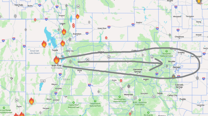
Abrilliantly sunny start across the Front Range comes with an unwelcome companion: a broad veil of haze which has settled in across the area overnight. That haze is actually smoke advecting in from a ~13,500‑acre Iron Fire in central Utah, carried eastward within the broader flow. Aerosol guidance mixes most of it out this afternoon, but another surge from the …

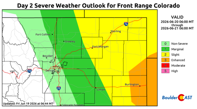
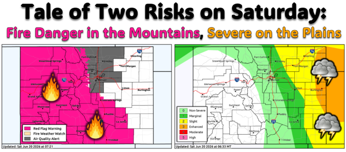
Premium BoulderCAST Daily – Sat 06/20/26 | Supercells on the Plains, Fire Danger in the High Country & Boulder Quiet In Between

Avery dynamic setup is unfolding across Colorado today as two distinct mid‑level shortwaves slide east across the northern Rockies and into the High Plains. GOES‑East water vapor imagery early this morning clearly shows the lead wave over southern Idaho with a second trailing impulse over Oregon — both embedded within a zippy west‑southwest flow regime aloft. These disturbances will traverse …

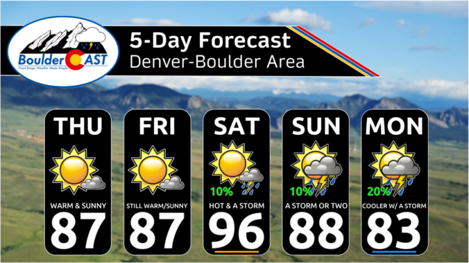
Premium BoulderCAST Daily – Fri 06/19/26 | Quiet end to the week but storms return Saturday, including a significant severe risk towards Kansas

The work week takes a quiet finish. Temperatures this afternoon will top out in the middle 80s under lots of sunshine. A chance of storms will be expected Saturday afternoon and evening as a ripple of energy, or low pressure, tracks through to our north. Energy and moisture south of the system will bring that isolated to scattered storm threat. …

Premium This Weekend in Colorado Weather: Limited Weekend Storms With the Monsoon Still Weeks Away

AQuiet end to the work week quiet weather pattern will take us through the end of the work-week as a weak ridge settles in across Colorado the next couple days from the west. An associated weakening pressure gradient will offer a brief reprieve from the fire danger in the High Country after several breezy days. With subsidence and dry air …

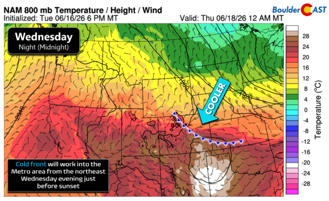
Premium BoulderCAST Daily – Wed 06/17/26 | Hot Again Today, But a Backdoor Front Brings a Breath of Relief This Evening

Hot, dry, and gusty conditions will dominate our weather for one more day before a backdoor cold front slides in this evening and finally knocks temperatures down, even if only for a little while. Colorado sits squarely between a strong West Coast ridge and a deep Great Lakes trough, a setup that is tightening the pressure gradient across the Front …

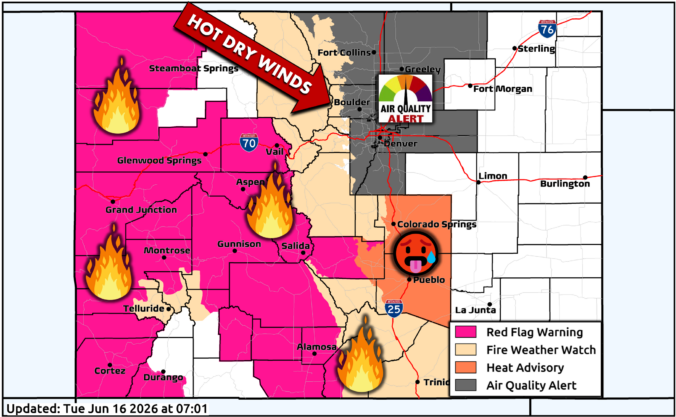
Premium BoulderCAST Daily – Tue 06/16/26 | Colorado Remains Hot, Dry, Gusty, and Primed for Fire Growth Through Mid-Week

Hot, dry, and increasingly gusty conditions will lock in across the Front Range through mid‑week as Colorado sits downstream of a stout mid‑level ridge anchored along the West Coast. That ridge isn’t going anywhere fast, and as several embedded shortwaves dive through the Dakotas and Great Lakes, the pressure gradient will tighten over eastern Colorado. The net effect: a steady …

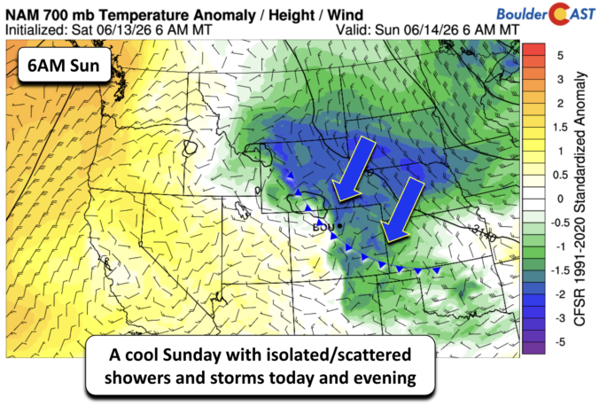
Premium BoulderCAST Daily – Sun 06/14/26 | Isolated storms this afternoon in a cooler airmass

Acool Sunday is on tap across the Front Range. Cooler high pressure will remain entrenched this afternoon from the northeast and bring that upslope flow. Morning clouds will give way to partly sunny skies this afternoon before some isolated to scattered storms develop later today. Highs should reach the upper 60s to lower 70s, with cooler areas northwest and west …

« Older posts Newer posts »