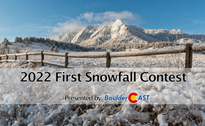
Thanks to everyone that entered our 2022 First Snowfall Contest. We briefly review the entries which actually trend towards a later date than Boulder’s climatology would suggest. We may not have to wait too long for a winner as cooler weather and maybe a few snowflakes are brewing in the extended forecast. Contest prizes and recognition will be awarded in the days following our first dumping of snow — big or small!
Author: BoulderCAST Team (Page 18 of 45)
This post had major contributions from at least two members of our team. The more meteorologists the better, right?
September 2022 followed the trend of the rest of the summer as another hot and somewhat dry month across the Front Range. The month entertained one of the longest and most intense heatwaves for so late in the season. Rainfall was below normal and there was no snow during the month. Smoke from out of state wildfires was also a theme at times. Here’s a quick and colorful graphical recap of our weather during September and how it relates to climatology.
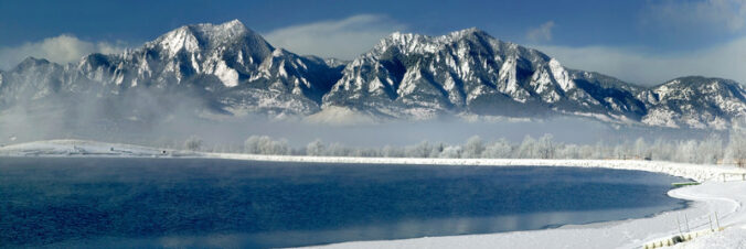
8th Annual BoulderCAST First Snowfall Contest
Are you eager for the first snow of the season? Have you already waxed your skis and purchased your Epic Pass? Our first big snow could be right around the corner! Mother Nature has been throwing wrenches into this annual contest the last few years making an accurate prediction for our first snowfall a monumental challenge! What’s in store for 2022? We provide a brief overview of Boulder’s first snowfall climatology and then pose a question…“When will Boulder’s first measurable snow occur this year?” Submit your guess for a chance to win an assortment of prizes. Those who get closest to the date and amount of our first snow win..
*Sorry. This contest is now closed to entries*
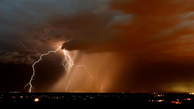
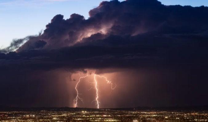
After several dry summers in a row, the 2022 monsoon season has been a breath of fresh air for most of the Front Range, thanks mainly to the recent soggy weather culminating in localized flash flooding earlier this week. As monsoon season begins to wind down across Colorado, we discuss the recent and seasonal rainfall totals, why this year’s monsoon has been atypical, and how climate change may impact future monsoons.
July 2022, a month that falls in the heart of monsoon season, ended up fairly hot and dry across much of the Front Range as a ridge of high pressure dominated our weather. Raindrops were a frequent occurrence, at least in Boulder, but ultimately they didn’t add up to much. A wave of thunderstorms towards the latter part of the month provided soaking rains to much of the Denver area, “saving”many locations from worsening drought for the time being. Here’s a quick and colorful graphical recap of our weather during July and how it relates to climatology.
After one of the driest starts to the summer monsoon season on record across the Front Range, things have started to change somewhat following a surge of monsoon rainfall in the final days of July. We review what has transpired so far this summer, look at where 2022 fits into the historical monsoon climatology, and discuss the temperature and precipitation outlook for the month of August.
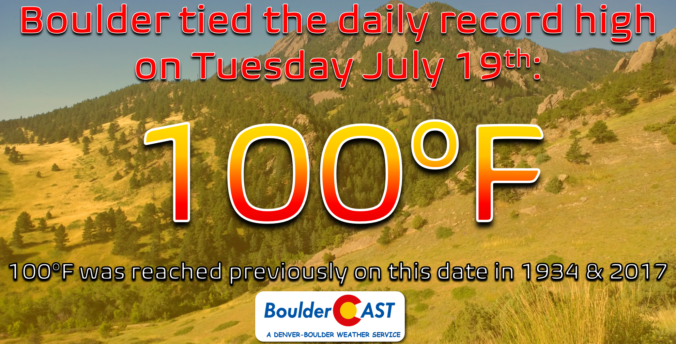
On a day which should have been slightly cooler than recent times on paper, Boulder officially reached 100 degrees Tuesday afternoon. However, other reliable weather sensors around the city came in several degrees cooler and more in-line with forecasts. We take a look at the temperatures measured around the area and weight on what will ultimately go down in the books as a record high temperature and the city’s first triple-digit reading in over two years.

With the monsoon getting suppressed and a hot pattern taking hold this weekend, both Saturday and Sunday could get Boulder to the elusive 100-degree mark for the first time in nearly two years. We discuss the cause of this heatwave, how hot it will get around Boulder and Denver this weekend (and next week), and when we expect cooler temperatures to arrive.

Live View of Boulder

Current Conditions

Live Radar

Recent Premium Posts

BoulderCAST Daily – Sun 01/11/26 | A mild Sunday with readings reaching the 50s
🌤️ Mild & Melty Sunday: Light winds and patchy clouds, with lingering snowpack …
BoulderCAST Daily – Sat 01/10/26| Widespread sunshine and moderating temperatures this weekend as our recent snow melts off
🌤️ Calm Saturday: Winter storm systems have departed the state, leaving behind a …
BoulderCAST Daily – Fri 01/09/26| Snow ends quickly this morning with a quieter weekend in store
❄️ Overnight snow bands: A second push of upslope after midnight sparked narrow …
3-Day Forecast

Trending Content

© 2026 Front Range Weather, LLC