Author: Ben Castellani (Page 95 of 301)
Ben grew up in southwestern Pennsylvania and holds both a bachelor's and a master's degree in Meteorology, the latter being from CU Boulder. His hometown received nearly three feet of snow from the Storm of the Century back in March of 1993, sparking his initial interest in impactful weather. Ben currently works on remote sensing and data analysis software at NV5 Geospatial Software in Boulder.
The ongoing heatwave will last through Monday with near-record high temperatures expected once again. A welcomed cold front Monday night will offer a reprieve from the heat for a couple days, but the sizzling temperatures return in full-force later in the week. We’ll largely be dry the entire week ahead. However, signs are pointing towards a surge of subtropical moisture during the upcoming weekend into the Four Corners region. This will bring the chance of late-day thunderstorms back into the Front Range.
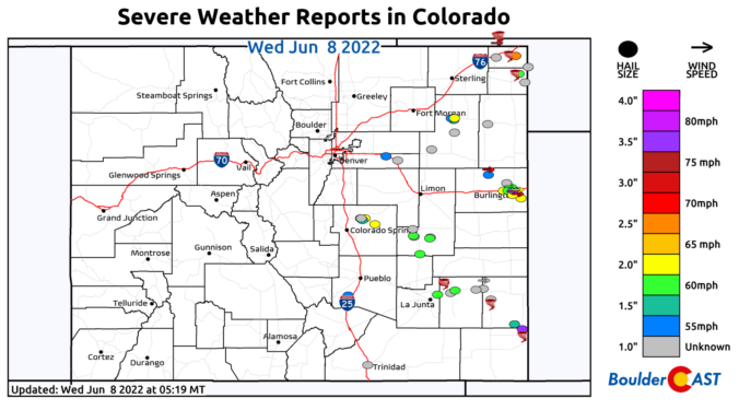
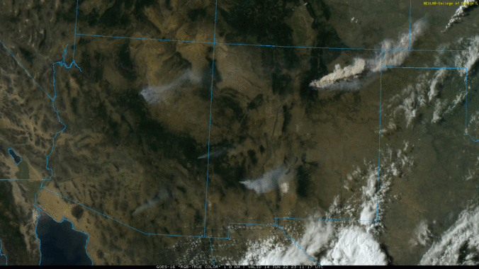
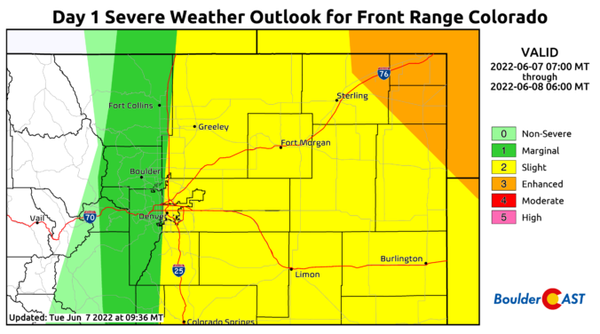
⦁❶⦁ Tuesday was an active severe weather day across Colorado with widespread very large hail, 75+ MPH wind gusts, and numerous tornadoes reported
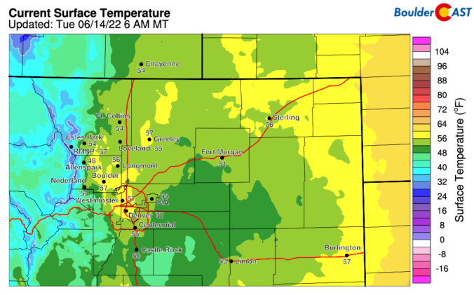
⦁❷⦁ Today will be mostly sunny and seasonal with highs around 80 degrees
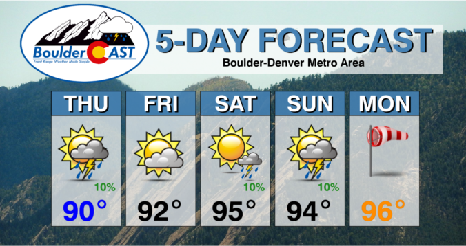
⦁❸⦁ A heatwave is taking shape tomorrow and will last into early next week with daytime highs well into the 90s expected


As the rain soaked the Denver Metro area on the last night of May, temperatures were just cold enough for late-season snow in the Foothills above 7000 feet elevation. Let’s take a look at the snow totals across the Front Range!

Live View of Boulder

Current Conditions

Live Radar

Recent Premium Posts

BoulderCAST Daily – Tue 04/28/26 | Staying cool with a couple showers, the late-week storm is still the main event despite trending south
🌧️ Morning wave = main show, with light rain showers and Foothills wet …
BoulderCAST Daily – Sun 04/26/26 | Showers and some storms later today and this evening
🌧️ A wet afternoon and early evening, with showers and a few rumbles …
BoulderCAST Daily – Sat 04/25/26 | Cooler today and wet Sunday into early next week
🌧️ A wet latter part of the weekend, with showers and a few …
3-Day Forecast

Trending Content

© 2026 Front Range Weather, LLC