


Author: Ben Castellani (Page 5 of 310)
Ben grew up in southwestern Pennsylvania and holds both a bachelor's and a master's degree in Meteorology, the latter being from CU Boulder. His hometown received nearly three feet of snow from the Storm of the Century back in March of 1993, sparking his initial interest in impactful weather. Ben currently works on remote sensing and data analysis software at NV5 Geospatial Software in Boulder.
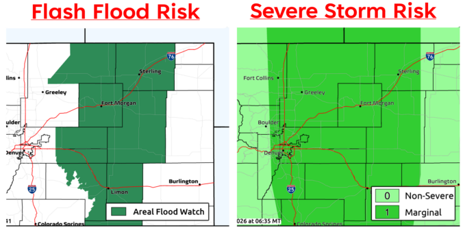
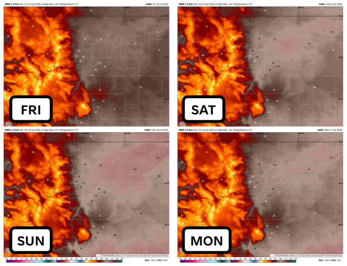
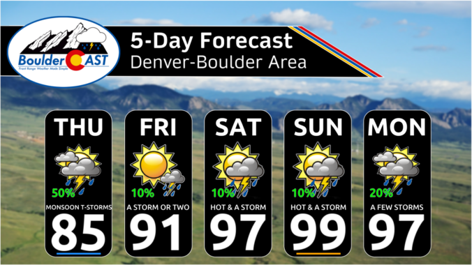
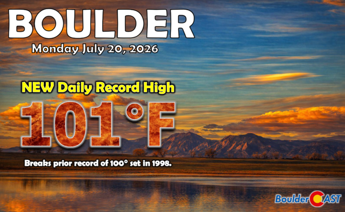
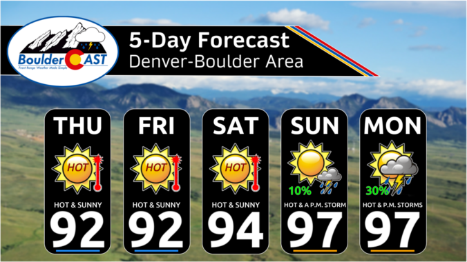
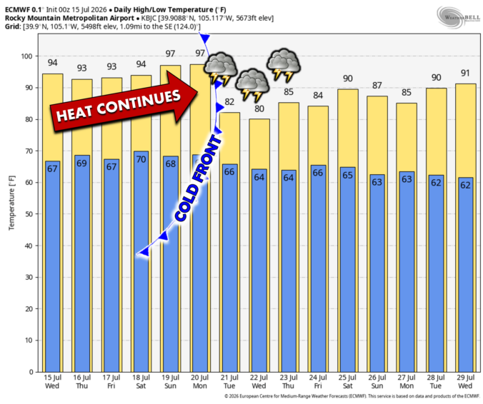
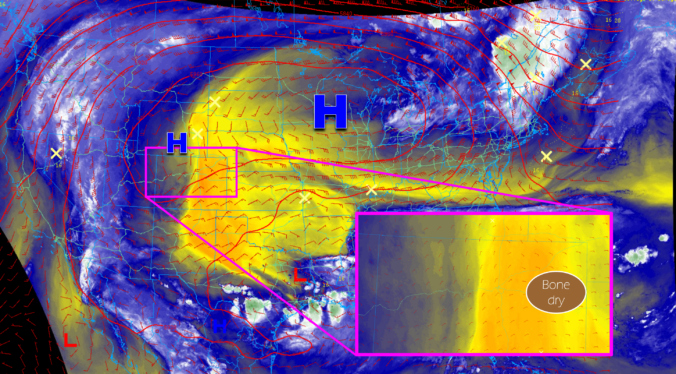
Eastern Colorado just came off a truly blistering weekend, with Denver and Boulder both shattering daily records as temperatures surged past 100°F on back‑to‑back days. Now the pattern is shifting, at least temporarily. An unusually juiced monsoon plume will set the stage for more robust afternoon storms through mid‑week, including a legitimate threat for locally heavy rainfall and burn‑scar flooding. But the faucet will shut off quickly. A rapidly intensifying Southwest heat dome will retrograde into Arizona late‑week, cutting off monsoon flow, drying out northern Colorado, and potentially steering wildfire smoke from the Pacific Northwest into the state as winds shift. By the weekend, the Front Range will sit on the fringe of that expanding heat dome, meaning another round of hot, dry weather and potential triple-digit readings again. Read on for all the details.
*Premium* BoulderCAST Daily – Tue 07/14/26 | The Front Range Continues to Bake Under Expansive Ridge

Live View of Boulder

Current Conditions

Live Radar

Latest Smoke Forecast

Recent Premium Posts

BoulderCAST Daily – Sun 09/27/26 | A Mild Sunday, Followed by Wet Weather This Week
☀️ Mild Sunday — Highs well into the lower 80s with a few …
BoulderCAST Daily – Sat 09/26/26 | Quiet Weather, But Wet Weather Is Brewing Next Week Tied To A Tropical System
☀️ Weekend calm — Weather is quiet this weekend in the lower 80s …
BoulderCAST Daily – Fri 09/25/26 | A Stormy Friday, Followed by a Quiet Weekend
🌧️ Friday storms — Another wave brings afternoon scattered showers and storms ☀️ …
3-Day Forecast

Trending Content



© 2026 Front Range Weather, LLC