Author: Ben Castellani (Page 214 of 301)
Ben grew up in southwestern Pennsylvania and holds both a bachelor's and a master's degree in Meteorology, the latter being from CU Boulder. His hometown received nearly three feet of snow from the Storm of the Century back in March of 1993, sparking his initial interest in impactful weather. Ben currently works on remote sensing and data analysis software at NV5 Geospatial Software in Boulder.

Despite a generally troughy pattern remaining across the western United States this week, things in Colorado will be relatively quiet. Snow chances will be next to zero for the lower elevations, with only one brief period of light snow expected in the Mountains. Temperatures will also be much warmer this week compared to last.
Don’t let the sunny skies Friday morning fool you. Similar to the snowfall event on President’s Day, atmospheric components will briefly align this evening for banded snowfall to once again form across the Front Range. The Northwest Metro area appears to be favored again by the models, including Boulder, Louisville, Longmont, and Broomfield.
Just as forecast, the overhead jet stream delivered heavy banded snowfall to the Boulder area Monday evening. We review the evolution of the storm and discuss the snow totals from across the region.
Happy President’s Day! A winter storm is impacting northern Colorado with snow and much colder temperatures today through Wednesday. Models are latching onto a track the will produce a sharp gradient in snow amounts across the Denver Metro area. Read on for our full forecast.

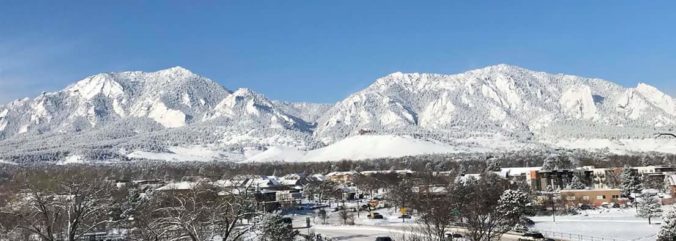
Live View of Boulder

Current Conditions

Live Radar

Recent Premium Posts

BoulderCAST Daily – Sun 05/10/26 | Cooler today but the 80s are not far behind
☀️ Sunshine and pleasant temperatures with upper 60s for our Sunday 🌡️ Trending …
BoulderCAST Daily – Sat 05/09/26 | Watching some late-day showers ahead of a cold front tonight
🌧️ Scattered showers this afternoon and evening ahead of a cold front setting …
BoulderCAST Daily – Fri 05/08/26 | Warmer weather takes hold
☀️ Warmer and calmer skies ahead: Expect lots of sunshine from the upper …
3-Day Forecast

Trending Content

© 2026 Front Range Weather, LLC