Author: Ben Castellani (Page 211 of 301)
Ben grew up in southwestern Pennsylvania and holds both a bachelor's and a master's degree in Meteorology, the latter being from CU Boulder. His hometown received nearly three feet of snow from the Storm of the Century back in March of 1993, sparking his initial interest in impactful weather. Ben currently works on remote sensing and data analysis software at NV5 Geospatial Software in Boulder.
Despite the warm weather of late, snow is once again headed to our region Monday evening and night. We provide details on the timing and potential snowfall amounts for this quick-moving spring storm.
Premium Storm Update (Mon Mar 26 at 7:00 AM) Minor northward adjustments for tonight’s rain/snow: READ NOW
We often include at least some discussion in our wintry forecasts about snow-to-liquid ratios. In this post, we explain what they are, why they matter, and examine the historical snow ratio record for Front Range Colorado.
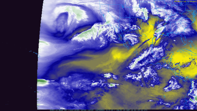
As we mentioned in our weekly outlook, a true atmospheric river event is underway, pumping deep tropical moisture into the southwestern United States right now! The moisture influx will mainly be impacting California and Nevada, but Colorado won’t escape totally unscathed. Plus we take a look ahead to a soggy/snowy forecast for early next week.

Live View of Boulder

Current Conditions

Live Radar

Recent Premium Posts

BoulderCAST Daily – Sun 05/10/26 | Cooler today but the 80s are not far behind
☀️ Sunshine and pleasant temperatures with upper 60s for our Sunday 🌡️ Trending …
BoulderCAST Daily – Sat 05/09/26 | Watching some late-day showers ahead of a cold front tonight
🌧️ Scattered showers this afternoon and evening ahead of a cold front setting …
BoulderCAST Daily – Fri 05/08/26 | Warmer weather takes hold
☀️ Warmer and calmer skies ahead: Expect lots of sunshine from the upper …
3-Day Forecast

Trending Content

© 2026 Front Range Weather, LLC