Author: Ben Castellani (Page 125 of 301)
Ben grew up in southwestern Pennsylvania and holds both a bachelor's and a master's degree in Meteorology, the latter being from CU Boulder. His hometown received nearly three feet of snow from the Storm of the Century back in March of 1993, sparking his initial interest in impactful weather. Ben currently works on remote sensing and data analysis software at NV5 Geospatial Software in Boulder.


For the third time in less than two weeks a significant spring storm will spread a hefty helping of precipitation to the Front Range in the coming days. Initially it will be all rain across the Plains Sunday and during the day Monday, but we are concerned about a change-over to snow Monday night into early Tuesday for the lower elevations. Let’s take a look at the storm timeline and how much May snow everyone can expect!
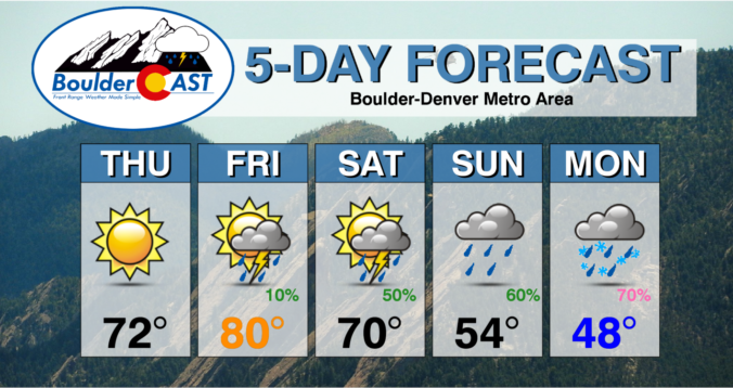
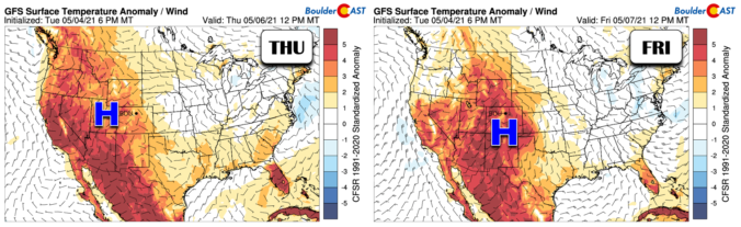

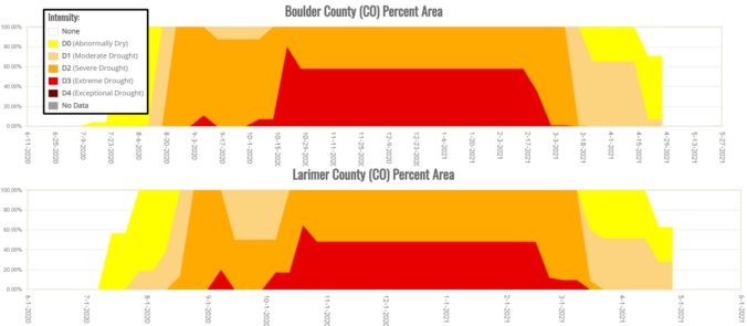
We begin very cold, rainy and snowy for some, but things will improve through the week slowly with a chance at hitting 80 degrees again by week’s end. Overall, though, the week remains fairly unsettled which is typical for this time of year and is welcomed considering the lingering drought. Let’s take a look at the forecast.
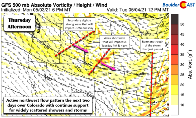
After our first real taste of summer the last few days, the weather will revert to more seasonal conditions Sunday into Monday. For Front Range Colorado in early May, that means severe weather, soaking rainfall and snow in the higher terrain. Let’s take a look at the latest on the stormy, soggy and snowy weather about to unfold!

Live View of Boulder

Current Conditions

Live Radar

Recent Premium Posts

BoulderCAST Daily – Fri 05/01/26 | Warming up this weekend
🌡️ Warming up this weekend, from the upper 50s-60 today to the upper …
BoulderCAST Daily – Tue 04/28/26 | Staying cool with a couple showers, the late-week storm is still the main event despite trending south
🌧️ Morning wave = main show, with light rain showers and Foothills wet …
BoulderCAST Daily – Sun 04/26/26 | Showers and some storms later today and this evening
🌧️ A wet afternoon and early evening, with showers and a few rumbles …
3-Day Forecast

Trending Content

© 2026 Front Range Weather, LLC