Author: Ben Castellani (Page 114 of 301)
Ben grew up in southwestern Pennsylvania and holds both a bachelor's and a master's degree in Meteorology, the latter being from CU Boulder. His hometown received nearly three feet of snow from the Storm of the Century back in March of 1993, sparking his initial interest in impactful weather. Ben currently works on remote sensing and data analysis software at NV5 Geospatial Software in Boulder.
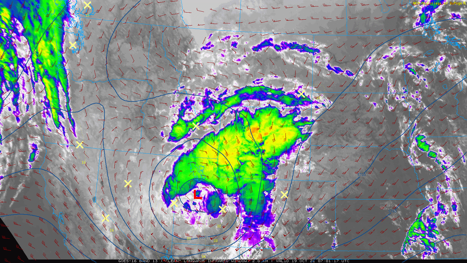
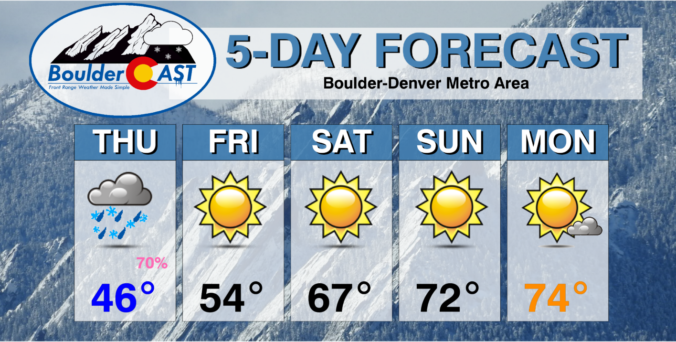
A boring week of weather will ensue across the Front Range as the only storm system of note skirts just to our north through Wyoming. The lower elevations will be bone dry all week long, but light snow will impact the Mountains on one occasion. Read on for our complete (though abbreviated) outlook of the week ahead.
After a lull in the weather on Wednesday, the action picks up quickly again on Thursday with the arrival of a swift-moving but ultimately weak storm system that will bring another round of rain and snow to the Front Range. We discuss which areas are favored this time around to potentially see their first snow of the season and detail when widespread freezing temperatures will arrive.

Things are about to get interesting for Colorado as our weather finally starts to take a turn away from never-ending summer. The weekend ahead will see the polar jet stream dip southward with strong winds and bouts of Mountain snow. The main event, however, will arrive Tuesday into Wednesday of next week when the atmosphere could align to produce the first snow of the season for many Front Range locations. While uncertainty is still quite high with the incoming winter storm, we discuss the latest forecast details and what to expect heading into next week.

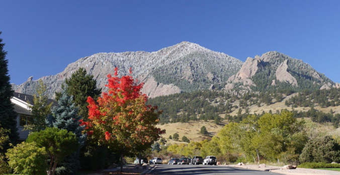
Live View of Boulder

Current Conditions

Live Radar

Recent Premium Posts

BoulderCAST Daily – Tue 04/28/26 | Staying cool with a couple showers, the late-week storm is still the main event despite trending south
🌧️ Morning wave = main show, with light rain showers and Foothills wet …
BoulderCAST Daily – Sun 04/26/26 | Showers and some storms later today and this evening
🌧️ A wet afternoon and early evening, with showers and a few rumbles …
BoulderCAST Daily – Sat 04/25/26 | Cooler today and wet Sunday into early next week
🌧️ A wet latter part of the weekend, with showers and a few …
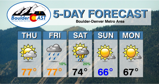
3-Day Forecast

Trending Content

© 2026 Front Range Weather, LLC