Author: Ben Castellani (Page 113 of 301)
Ben grew up in southwestern Pennsylvania and holds both a bachelor's and a master's degree in Meteorology, the latter being from CU Boulder. His hometown received nearly three feet of snow from the Storm of the Century back in March of 1993, sparking his initial interest in impactful weather. Ben currently works on remote sensing and data analysis software at NV5 Geospatial Software in Boulder.
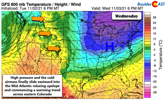
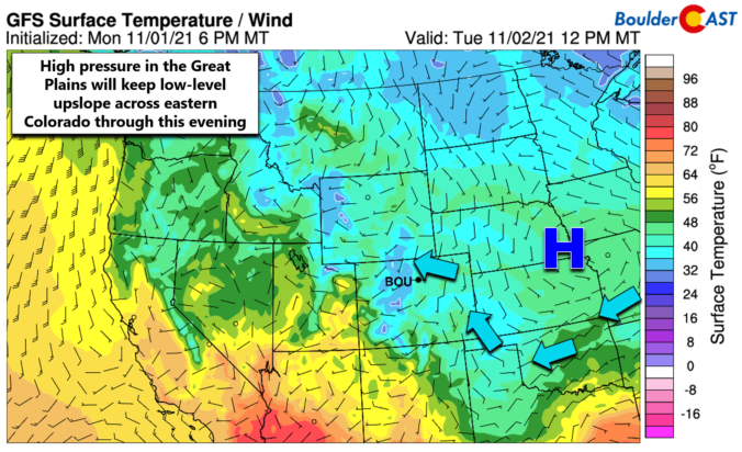
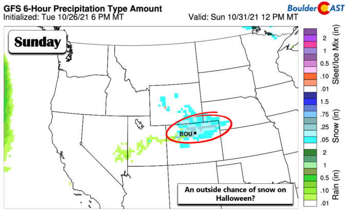
The week kicks off with cold and unsettled conditions lingering across the Front Range. A combination of chilly upslope and the nearby jet stream will produce scattered rain and snow showers for the entire region with a chance some areas could see minor snow accumulations. After a wave of heavier Mountain snow on Tuesday, things begin to quiet down and warm up midweek and beyond. Read on for our complete outlook of the week ahead including a look at potential snow amounts.

Live View of Boulder

Current Conditions

Live Radar

Recent Premium Posts

BoulderCAST Daily – Tue 04/28/26 | Staying cool with a couple showers, the late-week storm is still the main event despite trending south
🌧️ Morning wave = main show, with light rain showers and Foothills wet …
BoulderCAST Daily – Sun 04/26/26 | Showers and some storms later today and this evening
🌧️ A wet afternoon and early evening, with showers and a few rumbles …
BoulderCAST Daily – Sat 04/25/26 | Cooler today and wet Sunday into early next week
🌧️ A wet latter part of the weekend, with showers and a few …
3-Day Forecast

Trending Content

© 2026 Front Range Weather, LLC