The week kicks off with cold and unsettled conditions lingering across the Front Range. A combination of chilly upslope and the nearby jet stream will produce scattered rain and snow showers for the entire region with a chance some areas could see minor snow accumulations. After a wave of heavier Mountain snow on Tuesday, things begin to quiet down and warm up midweek and beyond. Read on for our complete outlook of the week ahead including a look at potential snow amounts.
This week’s highlights include:
- Cold and gloomy weather will persist through Tuesday with a chance of rain and snow showers across the Front Range
- The best shot of accumulating snow will come Monday evening as spotty jet-forced snow bands develop
- Less than 1″ of snow possible in Boulder and Denver, but up to a foot in the Mountains this week
- Seasonal temperatures develop Wednesday and beyond with sunshine returning
- The upcoming weekend and early next week look dry and mild across Colorado
DISCLAIMER: This weekly outlook forecast is created Monday morning and covers the entire upcoming week. Accuracy will decrease as the week progresses as this post is NOT updated. To receive daily updated forecasts from our team, subscribe to BoulderCAST Premium.

Scattered rain & snow showers Monday into Wednesday
Acold front blew into the Front Range over this past weekend making for a sharp contrast in weather conditions between weekend days. Saturday was warm and mostly sunny with temperatures reaching the lower 70’s. Sunday was a completely different ballgame with low clouds, drizzle, and even a few convective snow showers closer to the Wyoming border. Temperatures on Sunday were some 20 to 40 degrees colder across all of eastern Colorado as the cool and moist airmass banked up against the terrain from the east.
We just hit 40°F in #Boulder after a little drizzle earlier this morning. Yesterday we were in the lower 70's. This chilly airmass is banked up against the terrain, with the Mountains seeing no change in weather from yesterday #COwx #ColdFront pic.twitter.com/W67NCG8qKZ
— BoulderCAST Weather (@BoulderCAST) October 31, 2021
The culprit for this drastic change in weather was a gigantic storm system located in the Great Lakes area whose influence was able to reach all the way into our neck of the woods via upslope flow around a center of high pressure at the surface. This high pressure will sag south and east through early Wednesday with upslope flow largely continuing across eastern Colorado. This will set the stage for a chance of rain/snow early the week with unseasonably cool and gloomy weather staying the course.
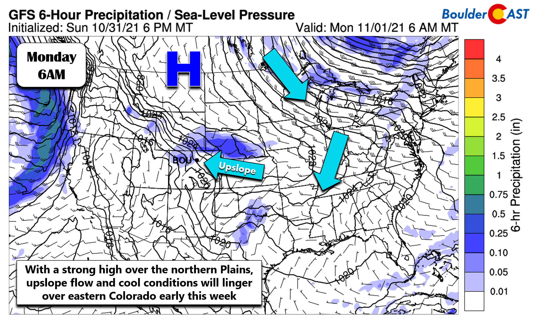
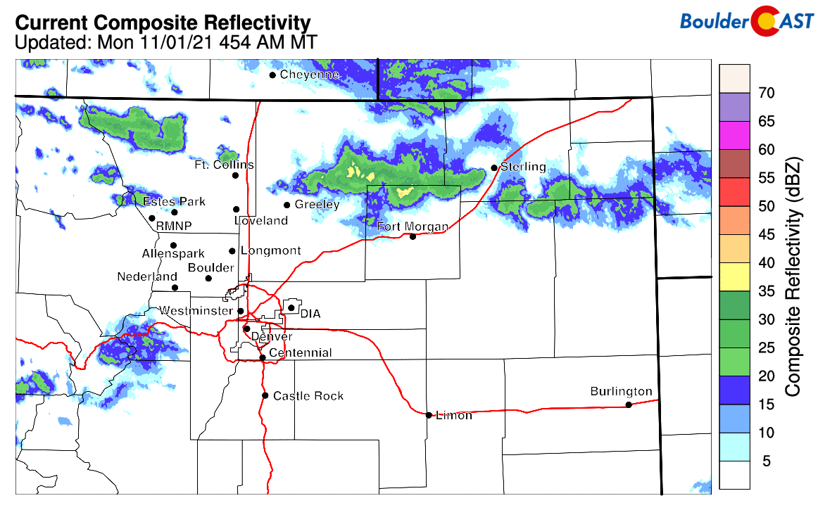
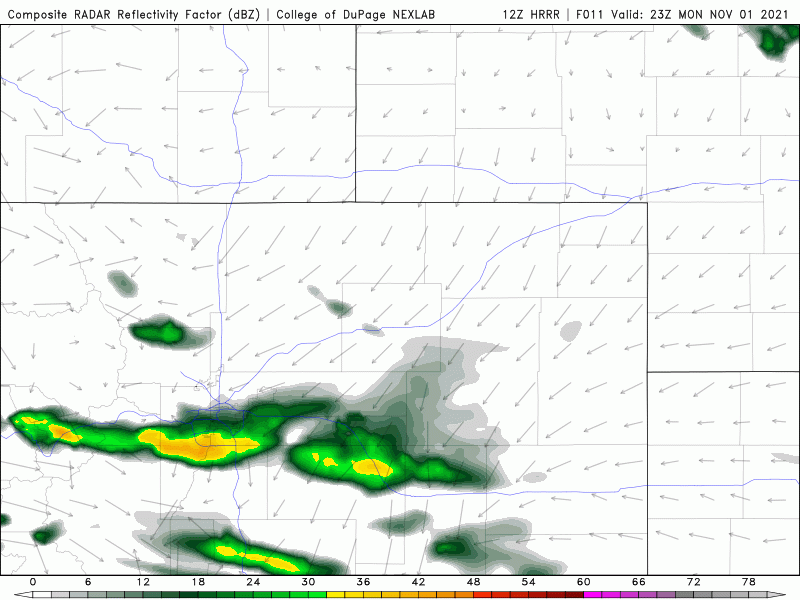
At the same time, a couple weak jet features will be passing through our area during the day Monday into Tuesday. These jet features will add fuel to the fire and help spawn isolated bands of convective rain and snow showers. A look at the radar early Monday morning shows a few bands already developing between Fort Collins and Fort Morgan.
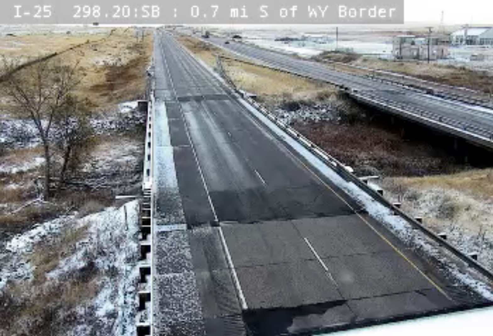
This area has seen some light snow accumulations overnight already…generally a dusting or less. This is the view from along the Wyoming border early Monday morning where temperatures have fallen into the upper 20’s…
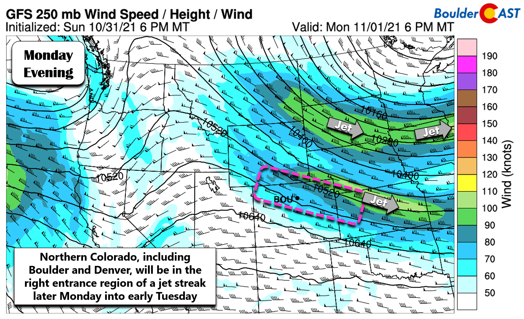
Monday afternoon into Monday night a jet feature will align in such a way to spread the chance of banded rain/snow showers to the entire Denver Metro area and adjacent Foothills. As shown in the graphic below, Boulder will reside in the favorable right-entrance region of a jet streak with banded precipitation likely to form as a result.
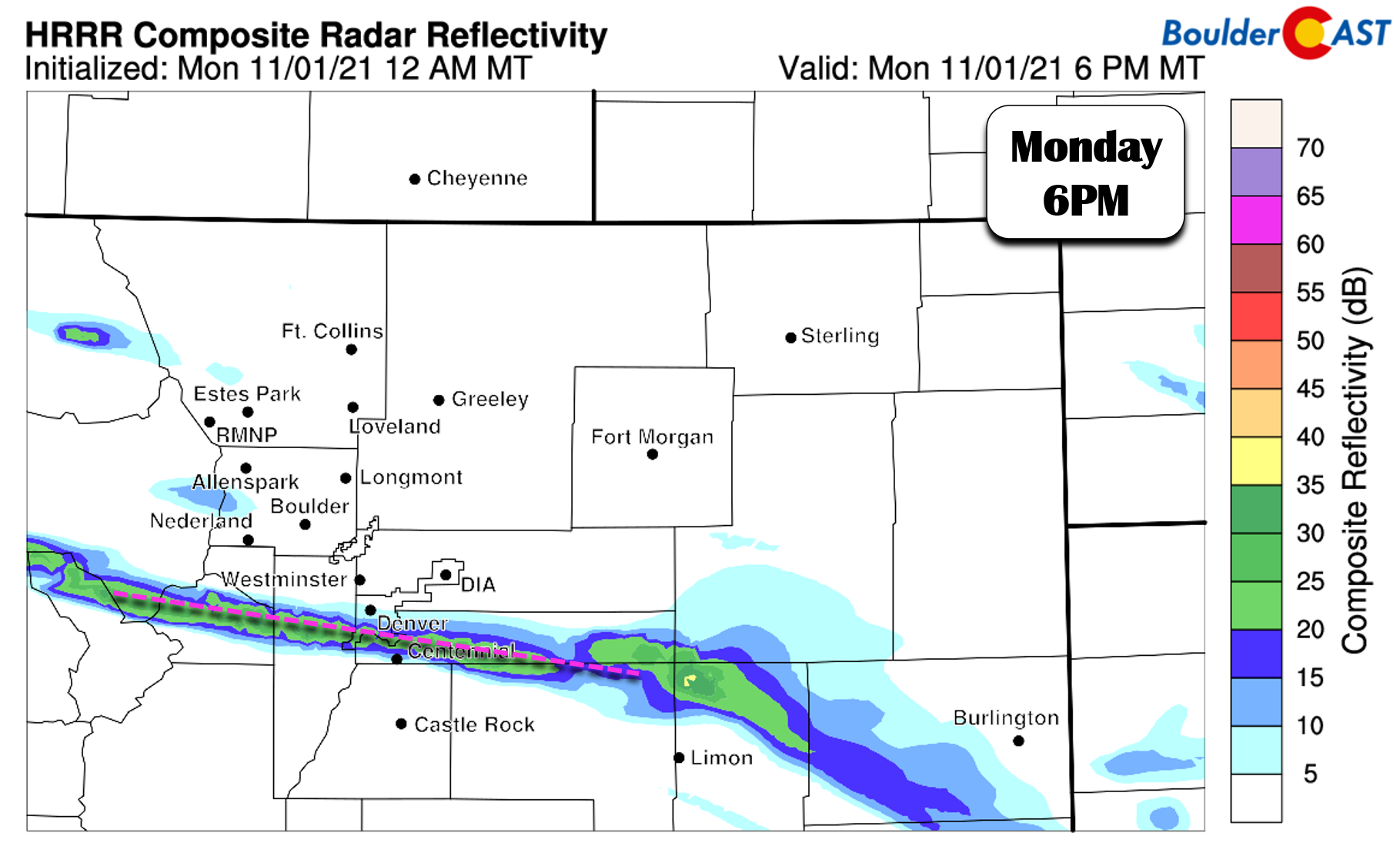
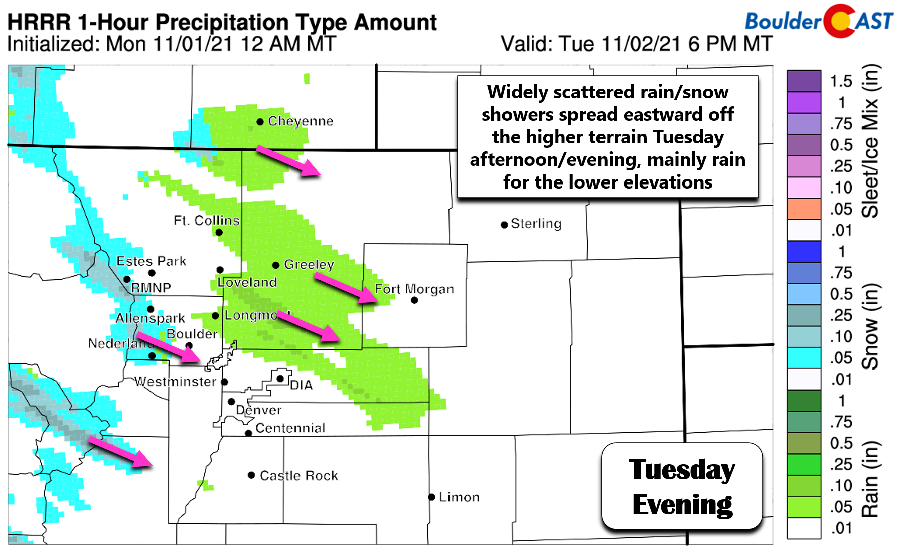
Despite moisture being somewhat limited, high-resolution models are indeed showing the potential for at least one scraggly, west-to-east oriented rain/snow band to develop later in the day Monday across the Front Range. Below is the HRRR model-simulated radar forecast for 6PM Monday evening. The long and narrow nature of the band in this forecast doesn’t breed confidence in our minds, but nonetheless the model is showing the band impacting southern Denver at this time.
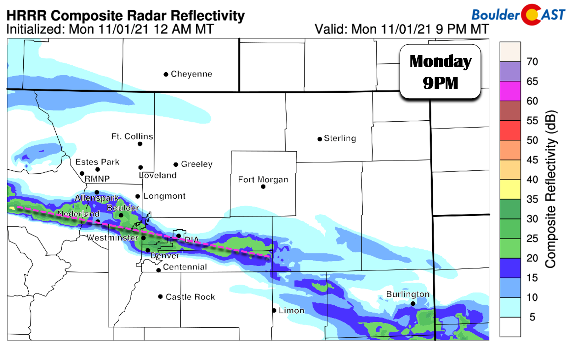
The band is then forecast to slowly drift northward through the evening and reach the Boulder area during the middle evening into the overnight hours. Overall, confidence in the banding location is low, but at least some areas should see a burst or two of snow Monday into Monday evening!
Precipitation within this band will be a mix of rain and wet snow initially but quickly changing to all snow over the course of the evening. Light accumulations will be possible throughout the entire Denver Metro area as a result….a potential first snow of the season for those still waiting! Any accumulation will mainly be confined to grassy and elevated surfaces.
HRRR model-simulated radar animation Monday evening and night showing banded precipitation developing across the area
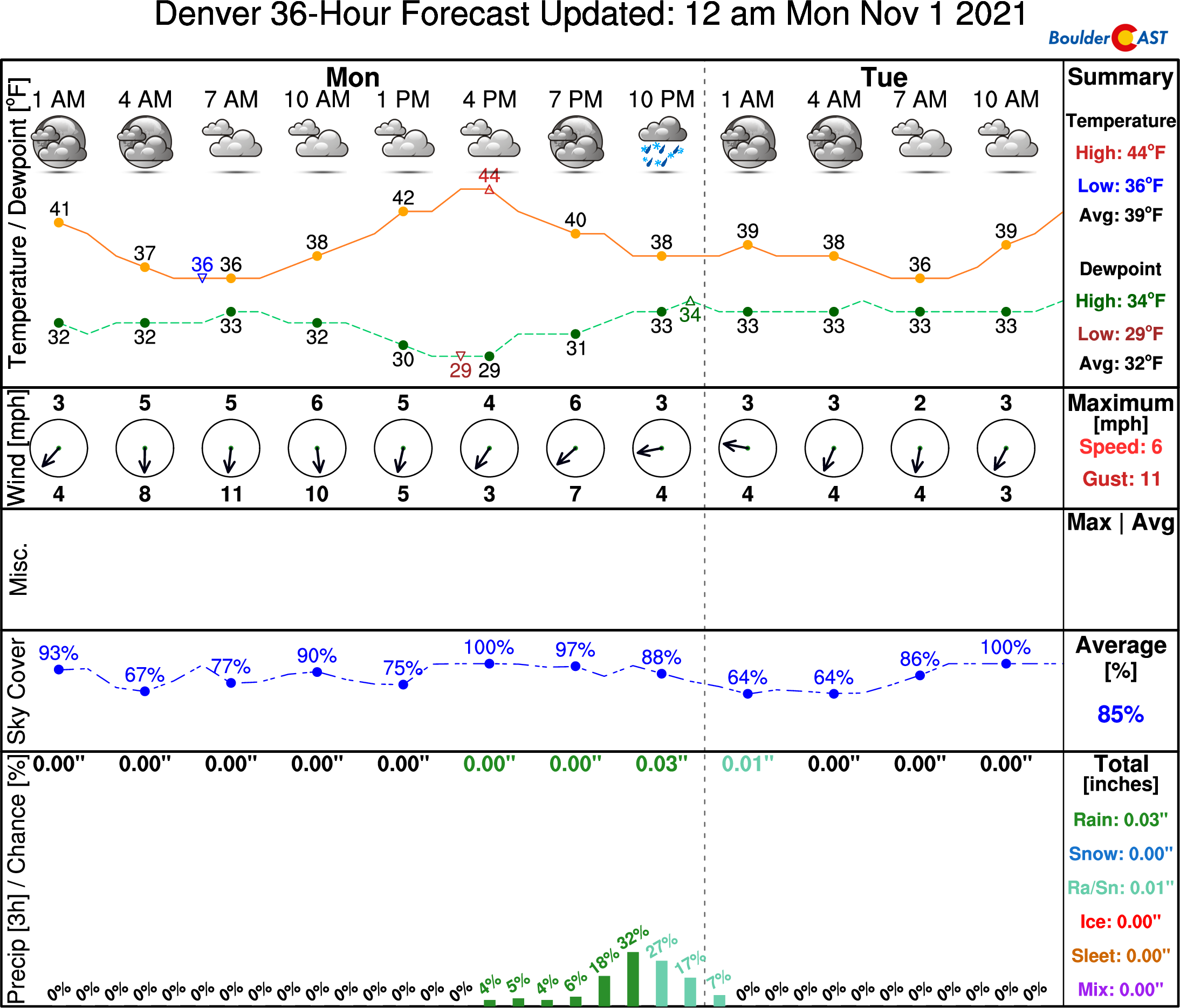
There will be a break in the action early Tuesday before another wave of rain and snow showers pushes across the Metro area off the terrain. Temperatures should warm enough on Tuesday that whatever materializes during the afternoon/evening hours will fall in the form of rain for the lower elevations. The Foothills will stand a chance at more snow showers, however, but it shouldn’t amount to much.
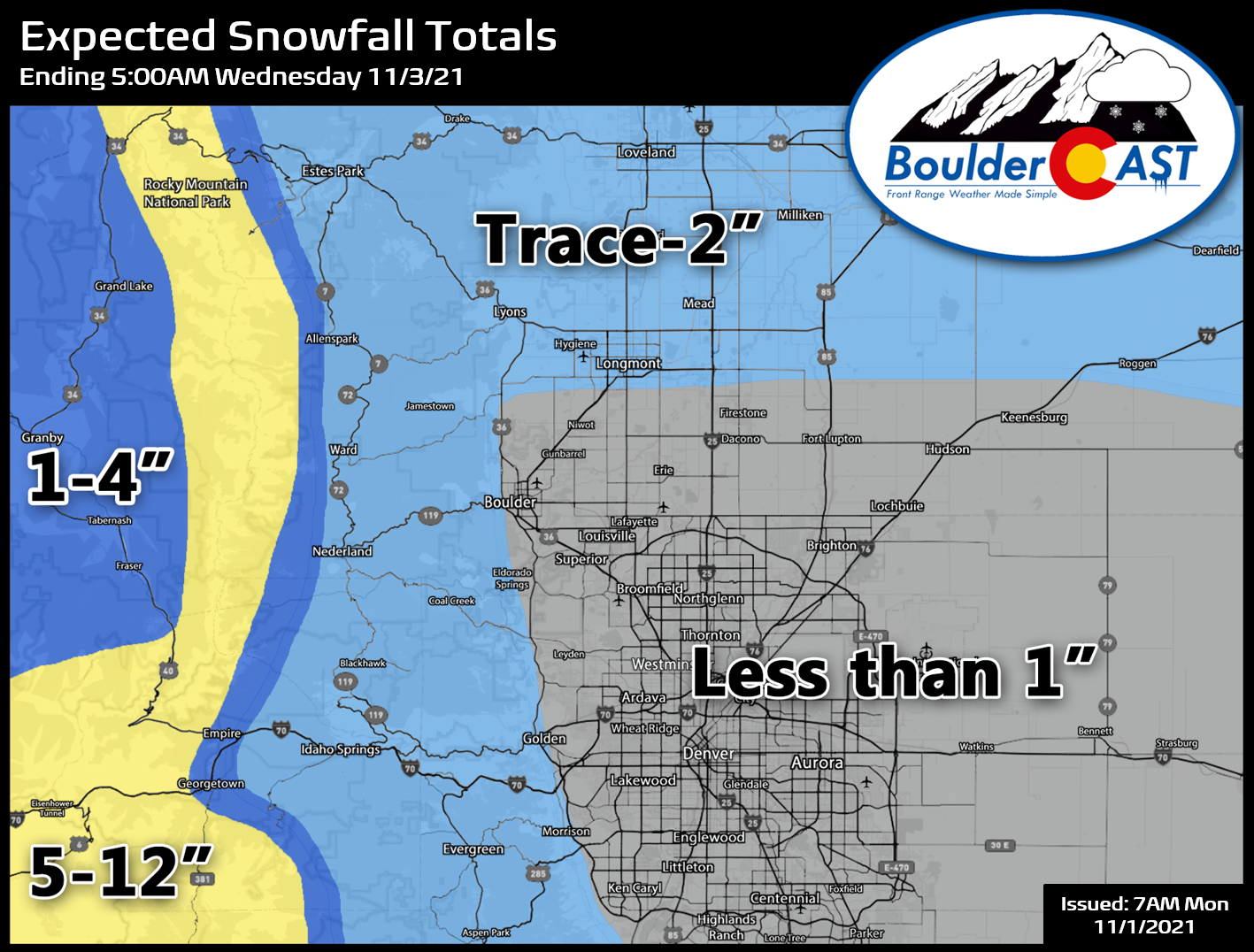
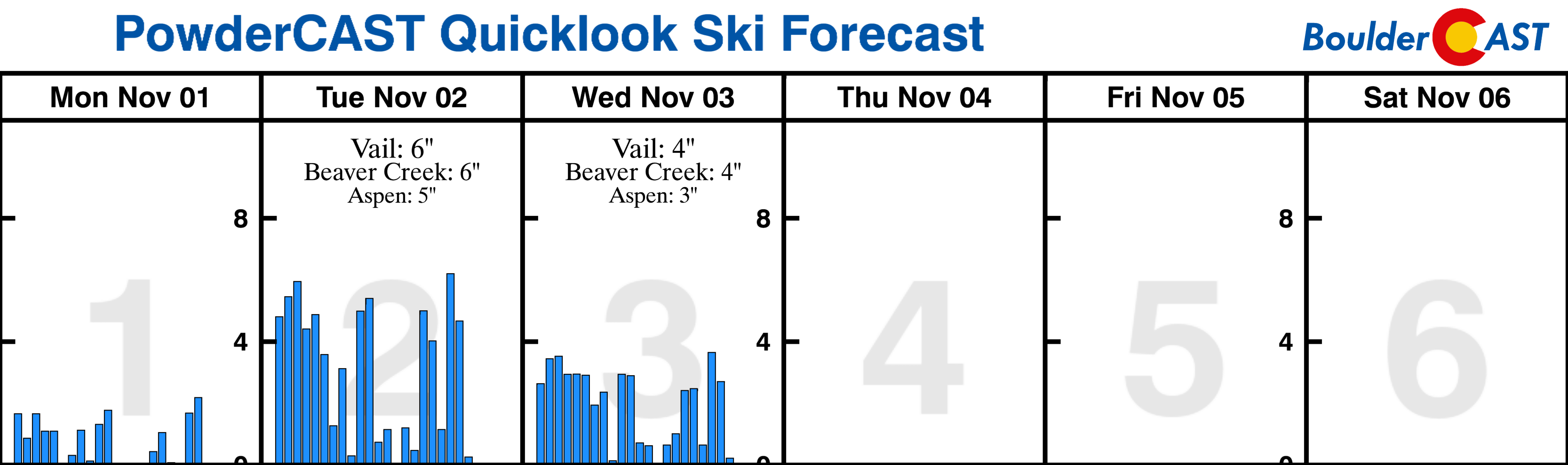
Our snowfall forecast map for the multi-day event is shown below. This covers all snow falling through Tuesday night. We’re mainly looking at a trace up to 2″ east of the Continental Divide, with up to a foot of new snow expected above treeline along the Divide where orographics will help wring out the moisture. If traveling along any of the mountain passes do be careful, especially on Tuesday!
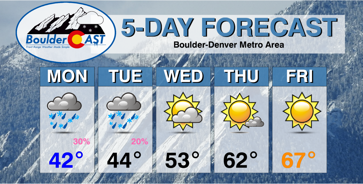
High temperatures Monday and Tuesday will be in the low to middle 40’s only.
Drying out & warming up
Wednesday will be a day of transition under northwest flow across Colorado. A few Mountain snow showers may linger, but it will be dry around Boulder and Denver. Skies look to begin cloudy but should clear to reveal some sunshine through the day with temperatures rebounding back into the 50’s.
A ridge axis aloft will be pushing across the Rockies on Thursday with return flow from the southwest developing. This will lead to a quick warm-up back into the 60’s under downslope with mostly sunny conditions.
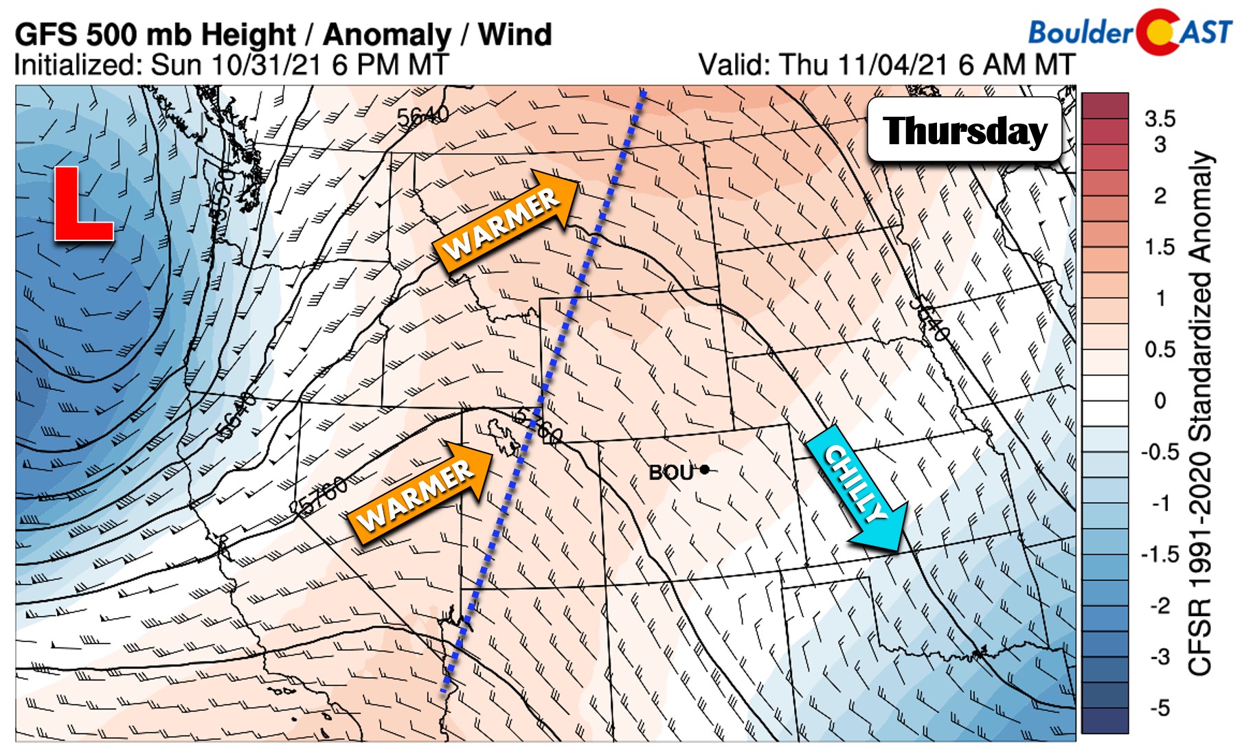
Most weather models are advertising a weak storm system scooting across the northern Rockies for Friday, but the timing and track is not set in stone yet. It looks like the wave would likely miss our area to the north having little to no impacts for the Front Range outside of gusty downslope, though there may be a weak cold front to contend with but no precipitation or clouds. Highs Friday will be in the mid to upper 60’s as long as the weak cold front holds off. Otherwise, it could be a tad cooler.
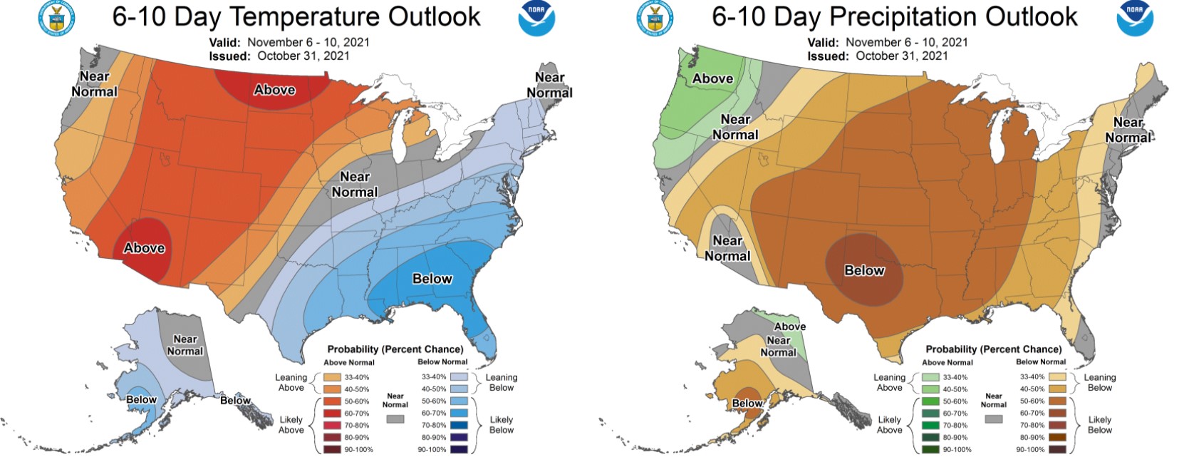
Things will remain quiet across Colorado through the upcoming weekend and into early next week with near normal or above normal temperatures in the extended. Models don’t show any real chance of rain or snow for our area until the middle to late part of next week.
Stay up to date with Colorado weather and get notified of our latest forecasts and storm updates:
We respect your privacy. You can unsubscribe at any time.
Forecast Specifics:
Monday: Overcast skies with widely scattered rain/snow showers through the day, changing to all snow during the evening. Up to 1″ of snow will be possible across the area. Highs in the lower 40’s across the Plains and middle 30’s in the Foothills.
Tuesday: Clouds and cold with widely scattered afternoon and evening rain/snow showers. Little to no snow accumulation is expected as highs reach the middle 40’s on the Plains and the middle 30’s in the Foothills.
Wednesday: Decreasing clouds but dry. Temperatures in the lower 50’s across the Plains with upper 30’s in the Foothills.
Thursday: Mostly sunny and seasonal with highs in the lower 60’s on the Plains and upper 40’s in the Foothills.
Friday: Sunny, mild and gusty with temperatures reaching the middle 60’s on the Plains with lower 50’s in the Foothills.
Mountains: The Mountains will see seasonal temperatures on Monday with scattered rain/snow showers. Widespread heavier snow develops on Tuesday as a burst of moist northwest flow moves through. 4-12″ of snow are expected above treeline on ranges with northwest exposure, with lesser amounts lower down. A few light snow showers may linger on Wednesday, but a drying trend will ensue the rest of the week.
Help support our team of Front Range weather bloggers by joining BoulderCAST Premium. We talk Boulder and Denver weather every single day. Sign up now to get access to our daily forecast discussions each morning, complete six-day skiing and hiking forecasts powered by machine learning, first-class access to all our Colorado-centric high-resolution weather graphics, bonus storm updates and much more! Or not, we just appreciate your readership!
.
Spread the word, share the BoulderCAST forecast!
.


You must be logged in to post a comment.