Over the last day or so, the majority of the weather models have shifted the track of the approaching Pacific storm system further south. This now provides us with high confidence that our entire region will see accumulating snow Wednesday afternoon, evening, and night. Read on for more details and our preliminary snowfall forecast map.
Help support our team by subscribing to BoulderCAST Premium for less than $4 per month. If you love weather, you’ll love Premium. We promise! It truly helps support our team’s efforts to add new features and forecasting content on a daily basis, as well as growing our suite of weather instrumentation across the Front Range.

he storm system has just come ashore in the Pacific Northwest this morning and it will progress southeastward into southern Colorado by Wednesday evening. Watch the storm strengthen in the latest GFS 500 mb height animation below…
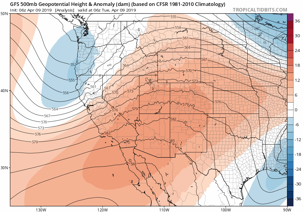
GFS 500mb height anomaly animation for today into Thursday morning
The graphics below show how the GFS and Euro models have shifted southward in the last 24 to 36 hours with the storm’s track, which is something we cautioned could happen in our weekly weather update yesterday. The latest GFS brings the storm into a prime position for Front Range snow (top left), with the center of the 500 mb low in southeastern Colorado. The Euro model is a little further north, but this is still a decent location for snow in our region.
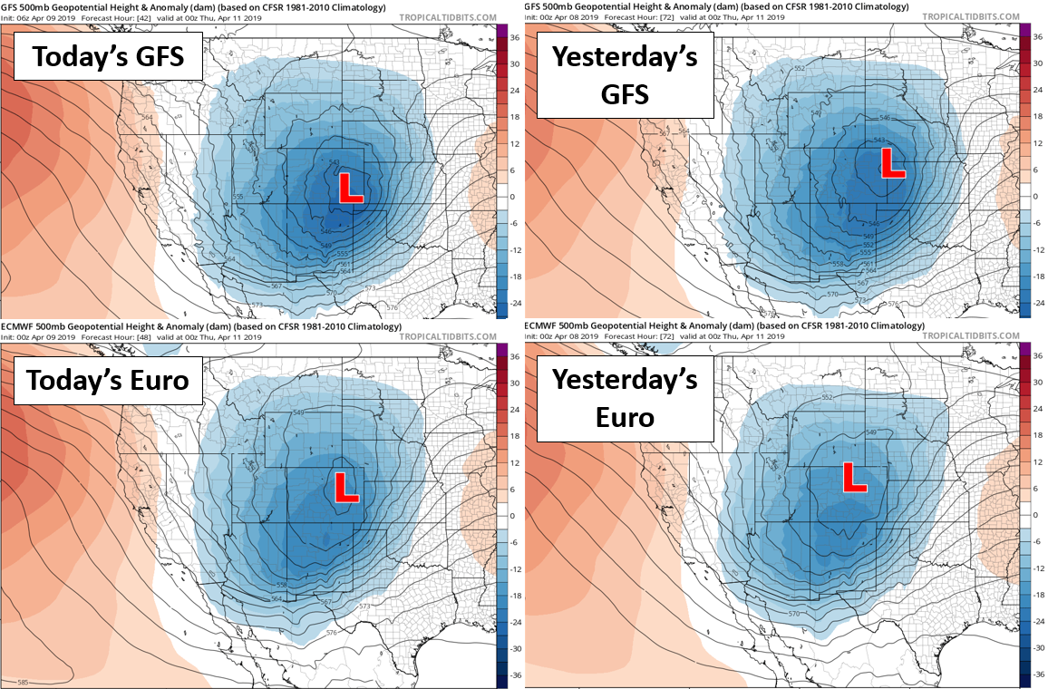
Panels showing the southward shift in the storm’s track over the last day or so.
You can see the spin of the storm coming onshore near Seattle this morning in the GOES-East water vapor animation below. Also, there is a linear pipeline of deep moisture spanning across the Four Corners region today. This is associated with a potent Pacific jet streak wrapping around the base of the approaching trough. This jet and moisture will aid in filling our skies on Tuesday with high clouds and also producing breezy conditions at times across eastern Colorado.
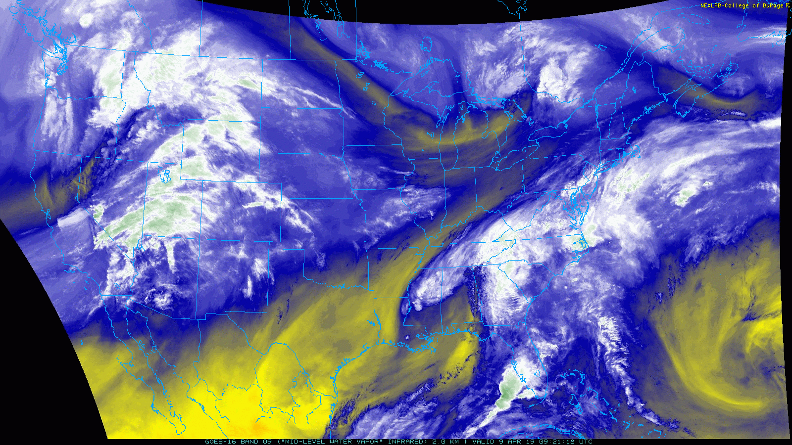
GOES-East water vapor animation from Wednesday morning
The airmass in place right now is extremely warm for this time of year. If it wasn’t for the thick cloud cover today, we’d almost certainly see temperatures soar into the lower 80’s with record highs up and down the Front Range. However, given the clouds, many areas will likely come up a few degrees short of records. Nonetheless, we’re still anticipating highs in the mid to upper 70’s today. Enjoy the last of the warmth….big changes come in less than 24 hours!
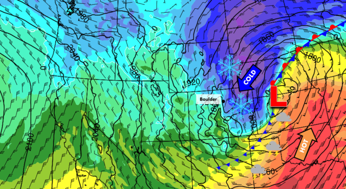
Another blizzard for the Metro area?
The approaching winter storm shares many similarities with the bomb cyclone that slammed our region back on March 13th. While this system won’t be quite as strong, it does have these facets in common:
- A similar track across the central Rockies
- It will undergo rapid strengthening via lee cyclogenesis in eastern Colorado
- It’s pulling south plenty of cold air to turn rain over to snow on the backside of the storm
- Strong pressure gradients will aid in producing intense winds and likely blizzard conditions across portions of Colorado, Kansas, Nebraska and South Dakota
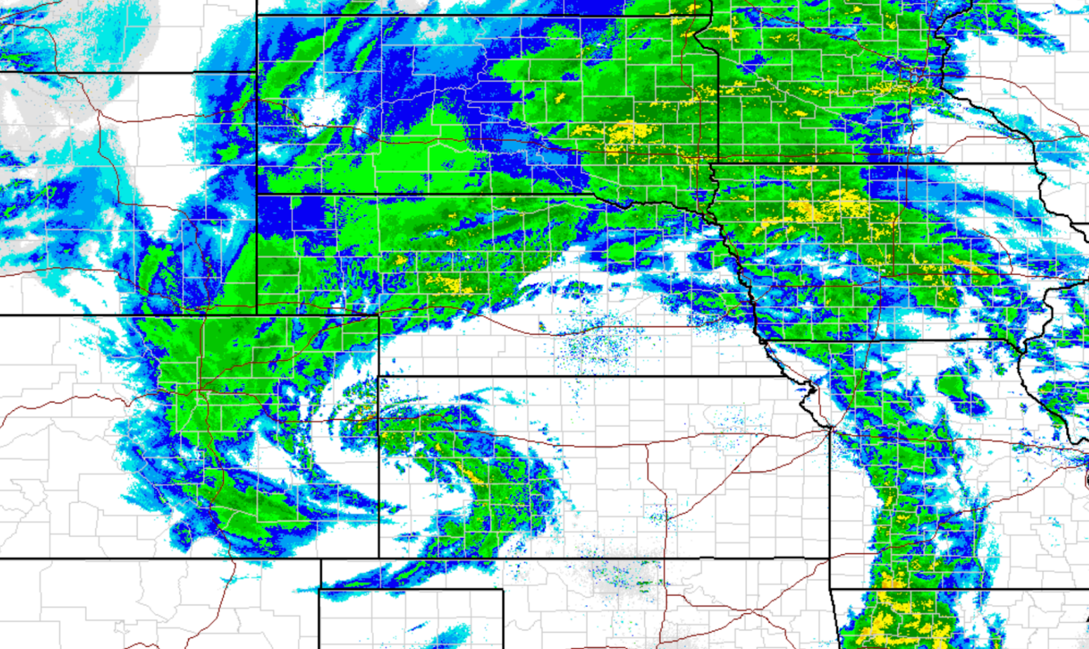
Radar imagery from the March 13, 2019 bomb cyclone.
This week’s storm comes exactly four weeks after the bomb cyclone. We’re now well within the spring season; the sun is higher and moisture is more plentiful. So despite this storm technically being weaker on paper, the impacts could be just as significant given the added moisture and instability available due to the change in seasons. Also keep in mind the March 13th blizzard wasn’t all that bad around Boulder. The peak wind gust was only 44 mph and only 2″ of snow fell. Things could actually be worse this time around for B-town…
With that said, the are still some differences in the models which lead to varying weather conditions across the Metro area. Foremost, there is a difference in intensity of the surface low between the GFS and Euro. The GFS produces a stronger low with a central pressure of 977 mb. The Euro is weaker at 983 mb. This results in stronger winds being forecast by the GFS at this time. Under the GFS scenario, winds gust to 35 to 50 mph around Boulder and Denver during the peak in the heavy snow Wednesday afternoon and evening, with even more intense gusts east of Interstate 25. The Euro is only showing 20 to 35 mph gusts around the Metro area, but near 60 mph well southeast of Denver. This disagreement should hopefully be ironed out before the storm arrives. In either case, winds during this storm will be tamer than the bomb cyclone last month. That’s not to say they should be taken lightly, but there should not be nearly as many power outages or extreme drops in visibility as we had before.
Here is our current timeline:
- Cooler air will begin filtering into the area early Wednesday morning. Temperatures could reach into the middle 40’s to lower 50’s before cold air advection wins out and temperatures begin to go downhill
- The pre-frontal airmass is noted to be quite unstable and will support scattered to widespread rain showers and a few thunderstorms Wednesday morning into the early afternoon. Any storms could produce small hail.
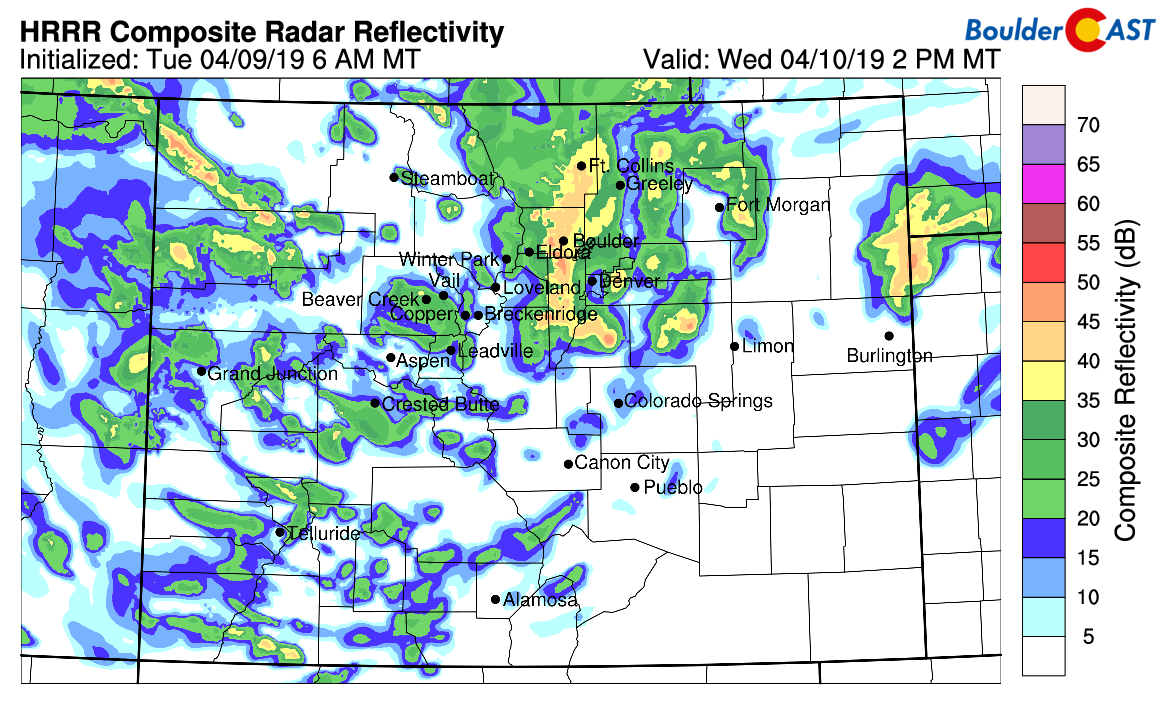
HRRR model radar for Wednesday afternoon. Convective showers and storms will change to heavy snow
- As the surface low explodes across east-central Colorado around mid-day Wednesday, a stronger cold front will surge southward bringing very cold air into the Front Range along with gusty north and northeast winds. This surge will quickly transition rain over to all snow for everyone across the region. Our current best guess on timing of the change-over is between 1 and 4 PM for everyone.
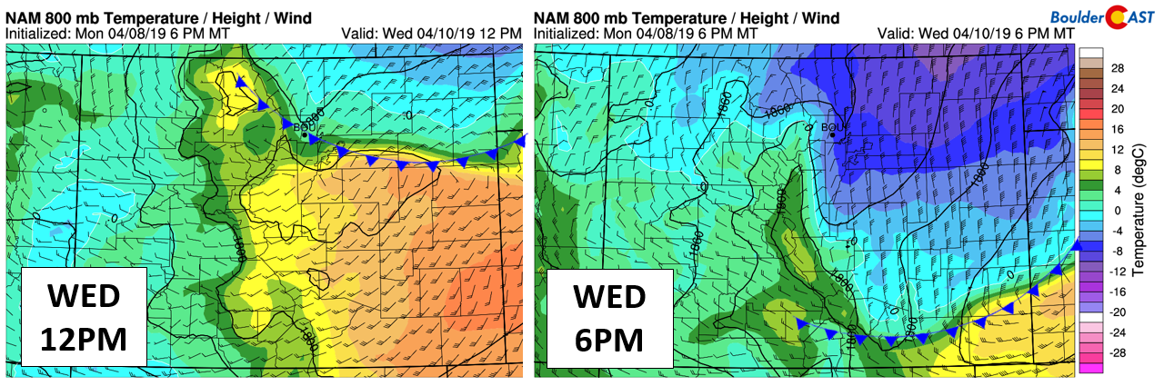
NAM near-surface temperature and wind forecast for Wednesday at noon (left) and 6PM (right)
- The combination of moderate to heavy wet snow and strong winds Wednesday afternoon and evening will lead to white-out conditions at times, with significant impacts on the evening commute. Given the recent summer-like temperatures and April sun, there will be a lot of melting initially, which will become problematic later Wednesday evening due to icing. The surge of cold air on the backside of the storm is no joke. Temperatures are expected to fall into the low to middle 20’s with icy roads likely to develop, especially on bridges and overpasses.
- The heaviest snow will occur in the hours following the change-over, primarily before 10PM. It’s difficult right now to pin down here the heaviest bands will set-up. Just about everyone has a chance at embedded heavy snow from the Wyoming border to the Palmer Divide, from the Continental Divide to the Kansas border. This is something that should come into focus tonight and early tomorrow when we get more coverage from the higher resolution models.
- As the storm pulls eastward and eventually northward into Nebraska, lift will decrease across the Metro area with winds turning northwesterly. Snow should taper off from west to east Thursday morning.
- Post storm, below normal temperatures will linger into the weekend. Highs Thursday are set for the upper 30’s, with mid to upper 40’s Friday. We actually have another storm and snow chance to talk about for Friday night. That, however, will be a topic of discussion for later…
Preliminary snowfall amounts
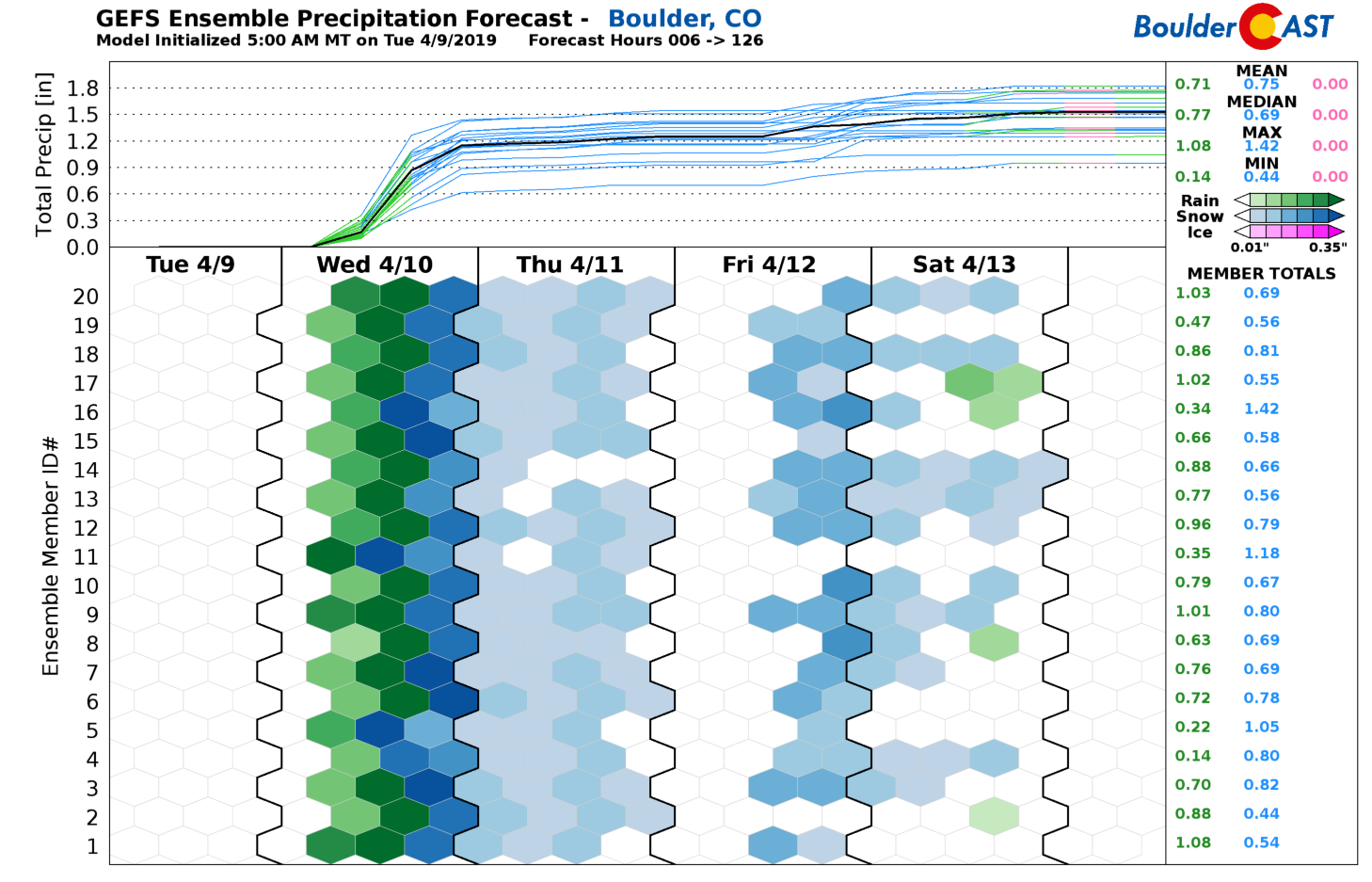
With the track of the storm becoming more favorable for our region, it’s not surprising that forecast precipitation amounts have jumped alongside this shift. We’re now expecting somewhere between 0.5 to 1.5″ of liquid for the entire Metro area. A decent chunk of this will fall in the form of rain across the lower elevations Wednesday morning and early afternoon. However, the change-over to snow is guaranteed to happen swiftly Wednesday afternoon, with about half of this liquid likely to fall as wet snow.
Even with the warm ground temperatures, everyone stands a chance to pick-up at least a few inches of snow. Higher amounts are definitely on the table in the Foothills and east of Denver where we believe snow intensity will be greatest and last the longest. We also could see a few localized areas in the Metro area pick-up 6 to 9″ if a stronger band hits hard for several hours.
Our PRELIMINARY snowfall forecast map is shown below. Depending on how the models trend tonight and tomorrow morning, we may issue an amended map, so be sure to check back for updates.

The key take-aways:
- Rain will QUICKLY change to snow Wednesday afternoon with travel conditions deteriorating just as rapidly. If possible, limit travel after 2PM on Wednesday. Things will get nasty in short order, especially when the rain and initial snow melts and freezes Wednesday night as temperatures fall into low to middle 20’s.
- Winds will be strong, but not as strong as the bomb cyclone just one month ago. Regardless, expect “blizzard-like” conditions at times late Wednesday afternoon into the evening hours with intermittent and significant drops in visibility. Winds will be worst east of Interstate 25 and tamer near the base of the Foothills.
- Despite the hype for this storm, there will be a lot of melting initially. We’re still only looking at about 2 to 6″ of dense snow across the lower elevations. Outside of the few hours of intense snowfall rates and gusty winds, this storm won’t bring the area to a total halt. It will be business as usual Thursday and beyond. By keeping your expectations tempered, you won’t be disappointed come Thursday morning, which seems to have been the overwhelming consensus from the bomb cyclone last month in Boulder, despite our near-perfect forecast…
Spread the word about the storm. Share our forecast:
Check back for updates or subscribe:
We respect your privacy. You can unsubscribe at any time.
.


You must be logged in to post a comment.