


September is finally starting to feel like September again — but not before one last burst of late‑summer heat today. A sharp pattern shift arrives tonight, opening the door to cooler temperatures, daily storm chances, and a midweek surge of moisture that could make things interesting across parts of Colorado. We’ll also check in on a small wildfire in the San Luis Valley, track where the heaviest rainfall is most likely to fall, and look ahead to a weekend that may line up perfectly with rapidly peaking fall colors. Read on for all the details.
This week’s highlights include:
-
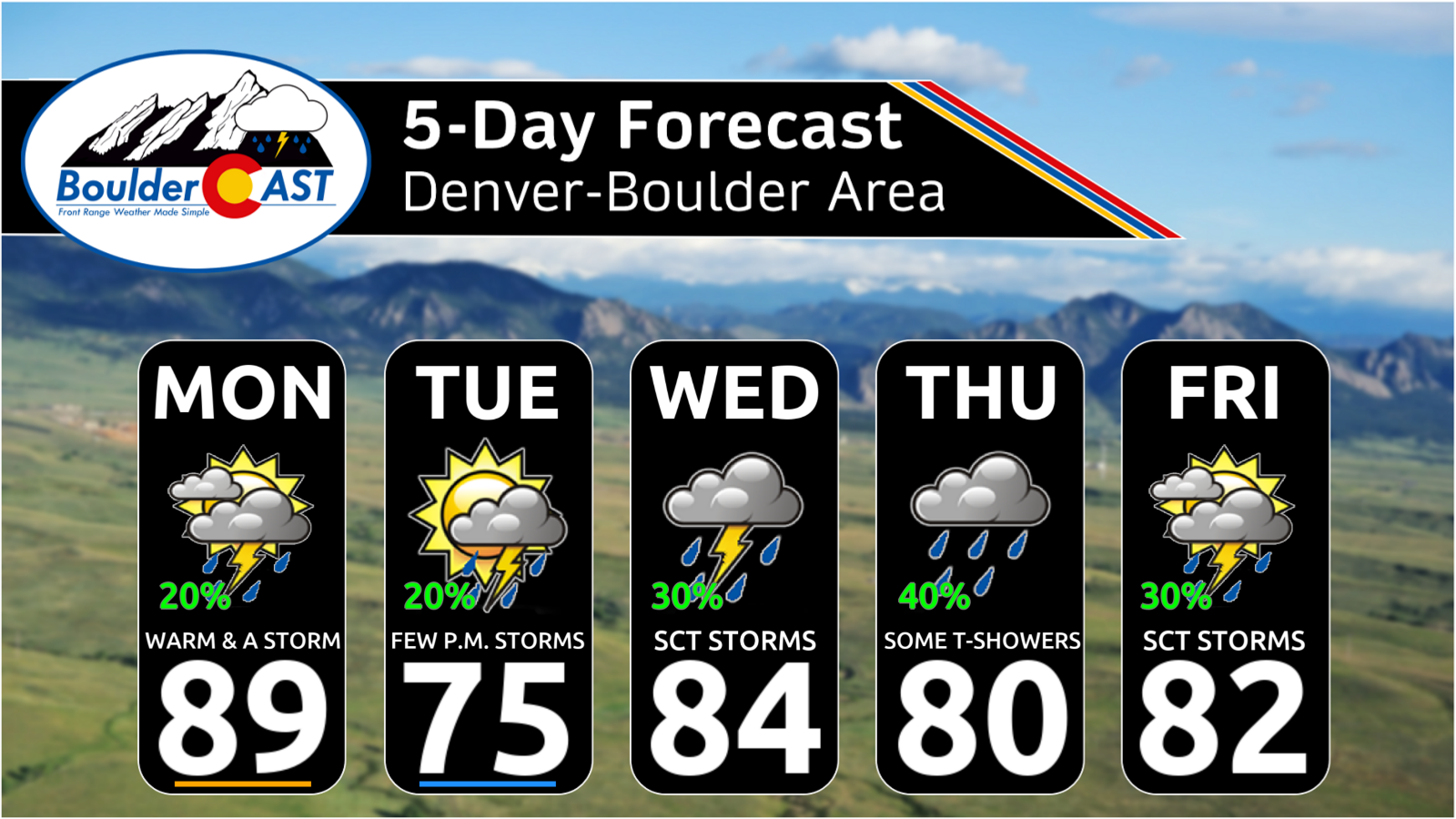
🌡️ Temperature shifts: Expect a warm start in the upper 80s Monday before a cold front drops highs into the low-to-mid 70s Tuesday. Temperatures will then largely settle into seasonal upper 70s and mid-80s for the remainder of the week.
-
🌧️ Storm potential: Unsettled conditions bring daily chances of showers and embedded storms, with activity peaking from midweek onward as upper-level moisture and energy increase.
-
💧 Rainfall totals: Precipitation amounts will remain limited across the Boulder-Denver area, but the High Country in the western and southern Mountains could accumulate over an inch of rain by the end of the week (with snow on the highest peaks).
-
🍂 Peak fall color incoming: Aspen change is happening ~10 days early due to summer drought stress; this weekend’s weather should offer excellent peak‑color viewing across many Mountain areas.
-
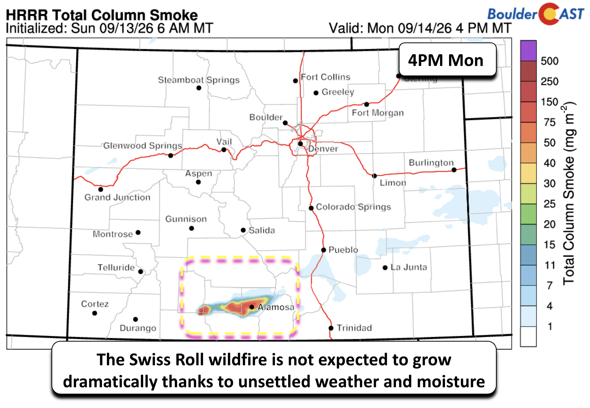
🔥 Smoke and visibility: The Swiss Roll wildfire burning in southwest Colorado is not expected to impact air quality or visibility across the Denver Metro area.
DISCLAIMER: This weekly outlook forecast is created Monday morning and covers the entire upcoming week. Accuracy will decrease as the week progresses as this post is NOT updated. To receive daily updated forecasts from our team, among many other perks, subscribe to BoulderCAST Premium.

Go Premium, get all the perks.
Daily Forecast Updates
Get our daily forecast discussion every morning delivered to your inbox.
All Our Model Data
Access to all our Colorado-centric high-resolution weather model graphics. Seriously — every one!
Ski & Hiking Forecasts
6-day forecasts for all the Colorado ski resorts, plus more than 120 hiking trails, including every 14er.
Smoke Forecasts
Wildfire smoke concentration predictions up to 72 hours into the future.
Exclusive Content
Weekend outlooks every Thursday, bonus storm updates, historical data and much more!
No Advertisements
Enjoy ad-free viewing on the entire site.
Hot For One More Day
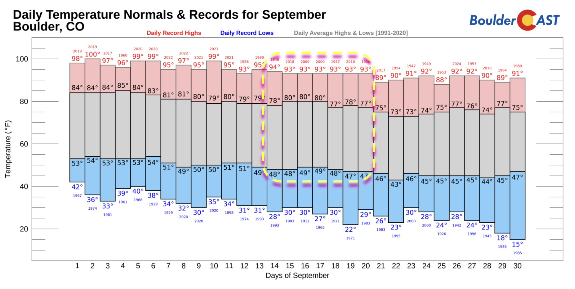
Temperatures for mid‑September should typicall be in the upper 70s to around 80° for daytime highs and the upper 40s for overnight lows. The late‑summer anomalous warmth we’ve been riding is finally about to let up. Monday will be the warmest day of the stretch, with upper 80s common across Denver and the Front Range. That brief spike of heat becomes a transient blip by Tuesday as a more meaningful pattern shift takes hold.
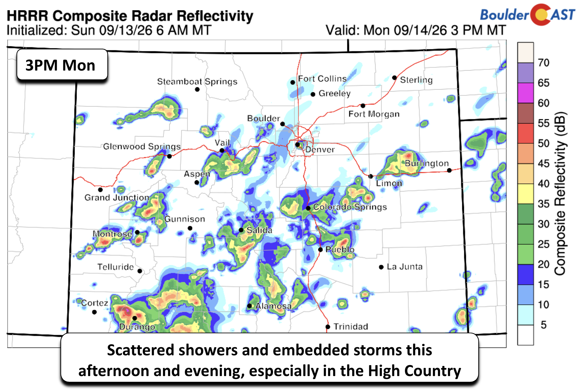
Moisture continues to increase Monday as a broad western trough lingers to our west. Expect waves of afternoon and evening showers with embedded thunderstorms. Coverage across the Plains will be isolated (10–20%), but greater instability over the High Country will support more widespread convection there, especially across southwest and south‑central Colorado. This unsettled, terrain‑favored pattern persists much of the week.
A small but notable item: the Swiss Roll Fire (~800 acres) in far south‑central Colorado west of Alamosa, sparked by lightning. With daily storm activity and rising moisture, meaningful growth of this new fire is unlikely. Visibility or air quality impacts in the Denver area are not anticipated, though we’ll continue monitoring.
Turning More Seasonal Tuesday
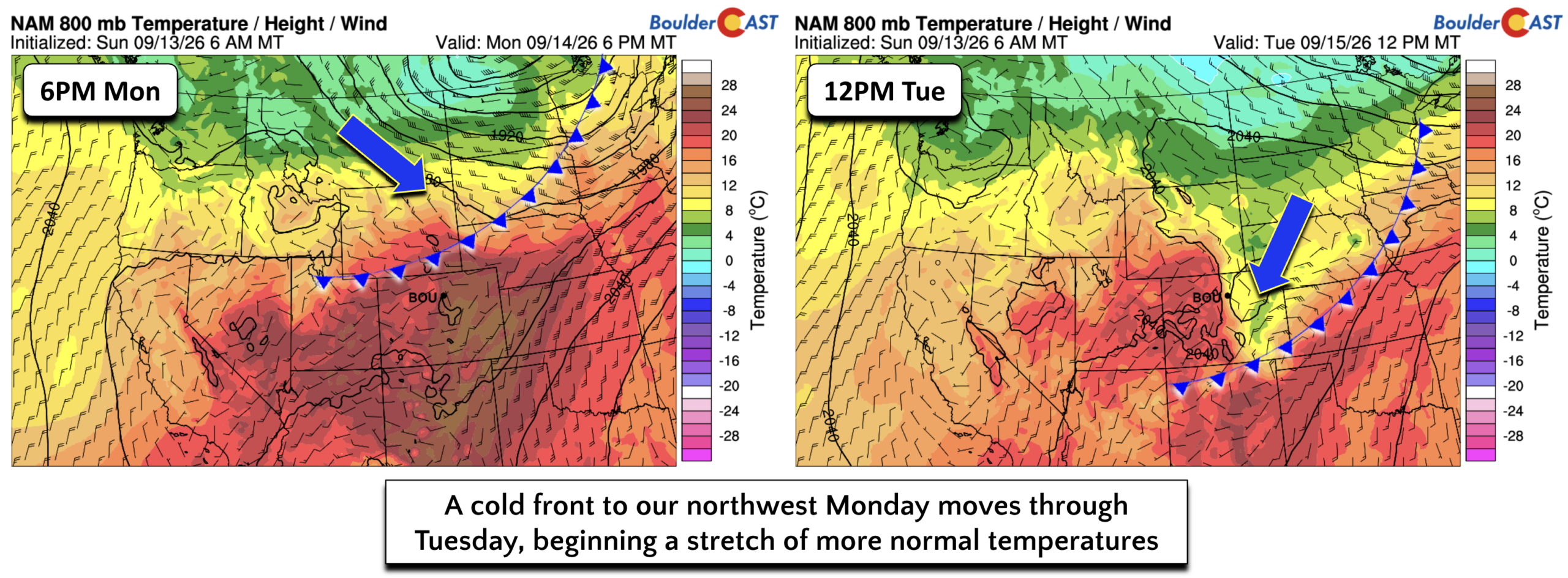
A cold front currently draped across the northern Rockies will finally slide through Monday night, delivering a sharp pattern change. While a few days may still flirt with the mid‑80s, most afternoons settle into upper 70s to low 80s the rest of the week — squarely seasonal. In the immediate wake of the front, potential cloud cover and afternoon showers will hold Tuesday’s highs in the low to mid‑70s, and recent model trends continue nudging cooler. Tuesday appears to be the coolest day of the week.
Daily Unsettled Conditions, But Limited Actual Rainfall
As noted earlier, daily shower and storm chances remain in the forecast. The driver: a series of upper‑level troughs pinwheeling through the West. Guidance shows persistent south to southwesterly flow over Colorado — a combined result of counter‑clockwise circulation around the western trough and clockwise flow to our south and east. Timing each shortwave will be a challenge, but the overall theme is clear.
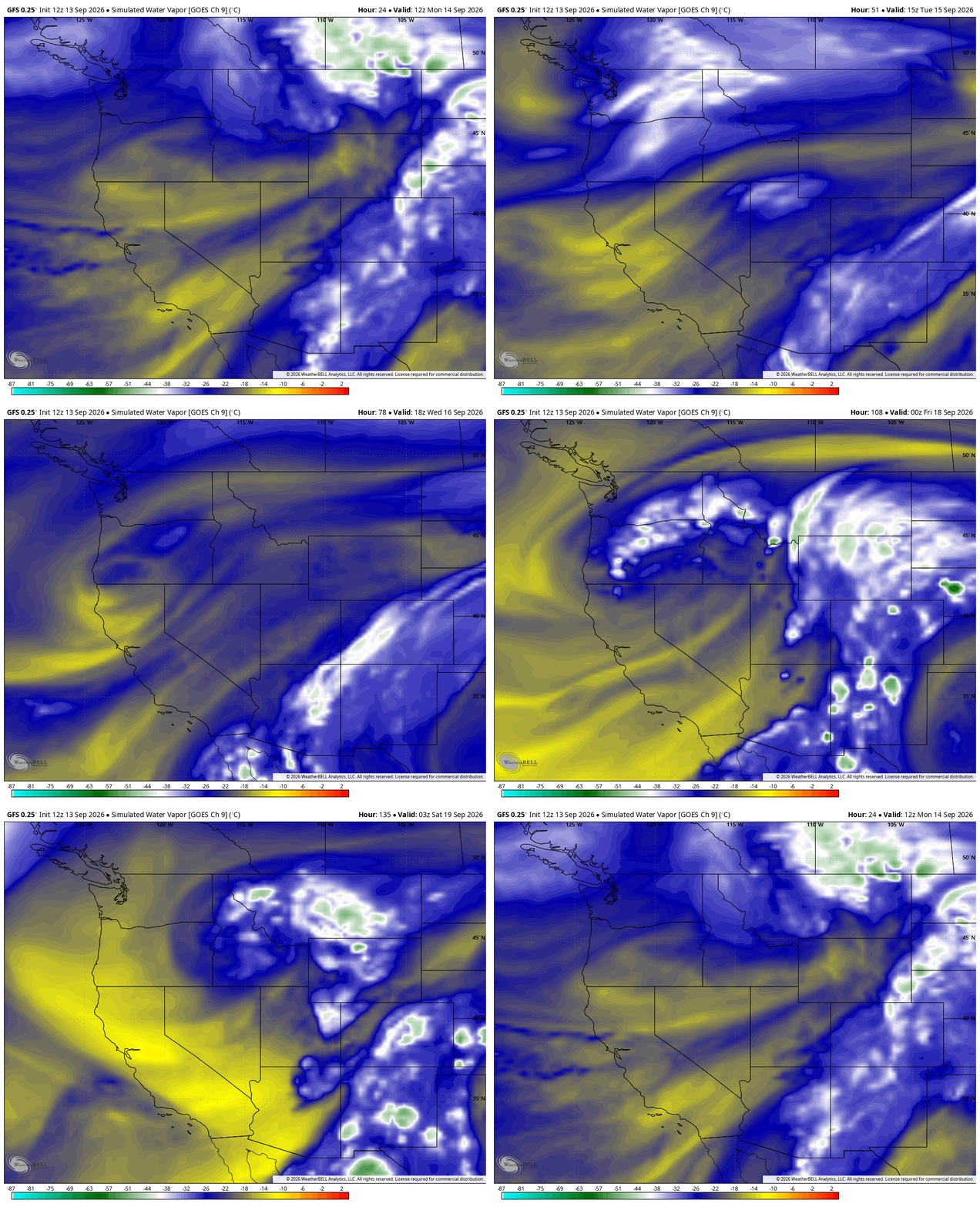
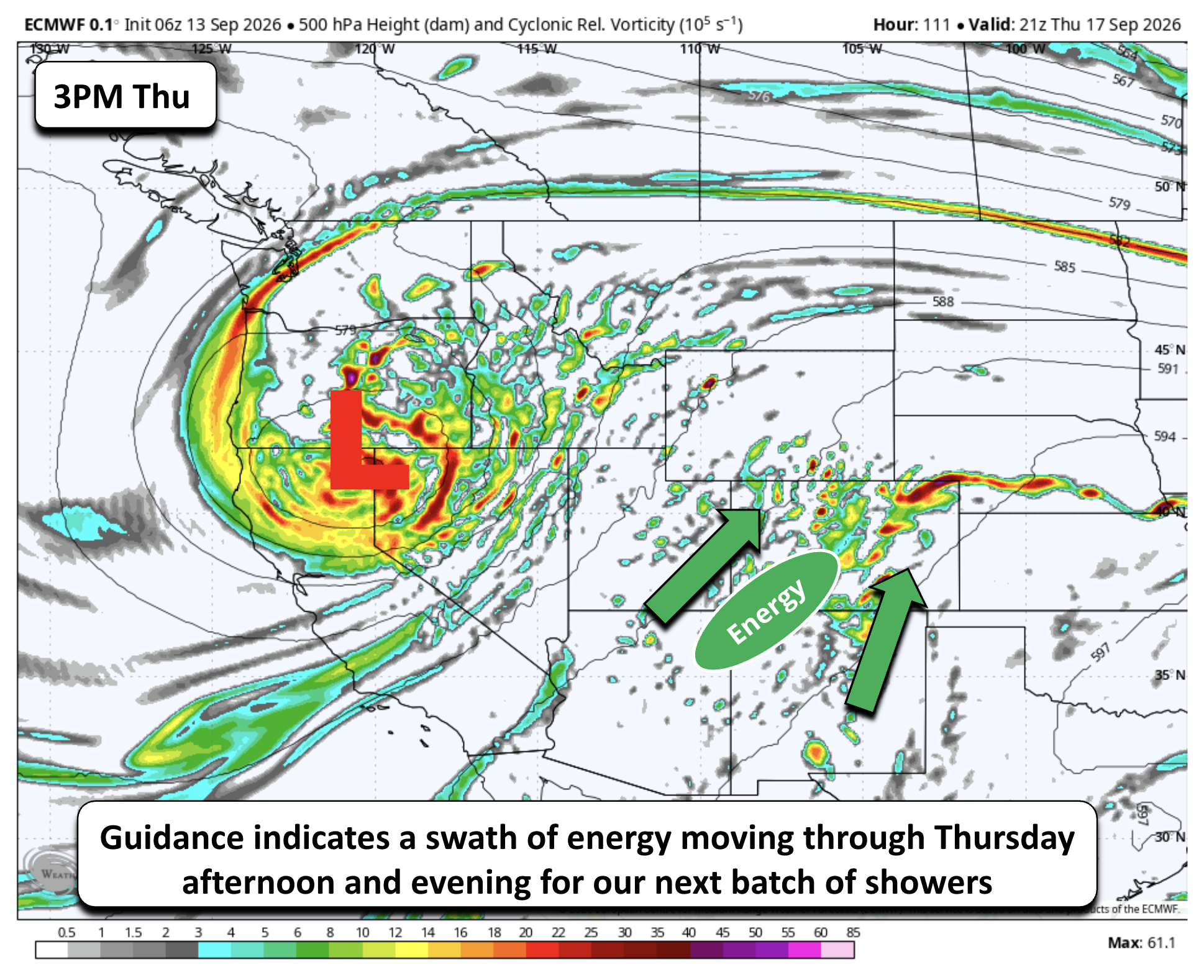
Global models are not bullish on widespread Plains rainfall, though mid‑level energy continues to traverse the region. The strongest wave arrives after midweek, when a deeper trough digs into the Great Basin. This pulls a moisture‑rich plume and enhanced vorticity northward out of New Mexico into Colorado likely on Thursday.
Precipitable water values Wednesday night into Thursday climb into highly anomalous territory, per the NAM — a strong signal for efficient rainfall.
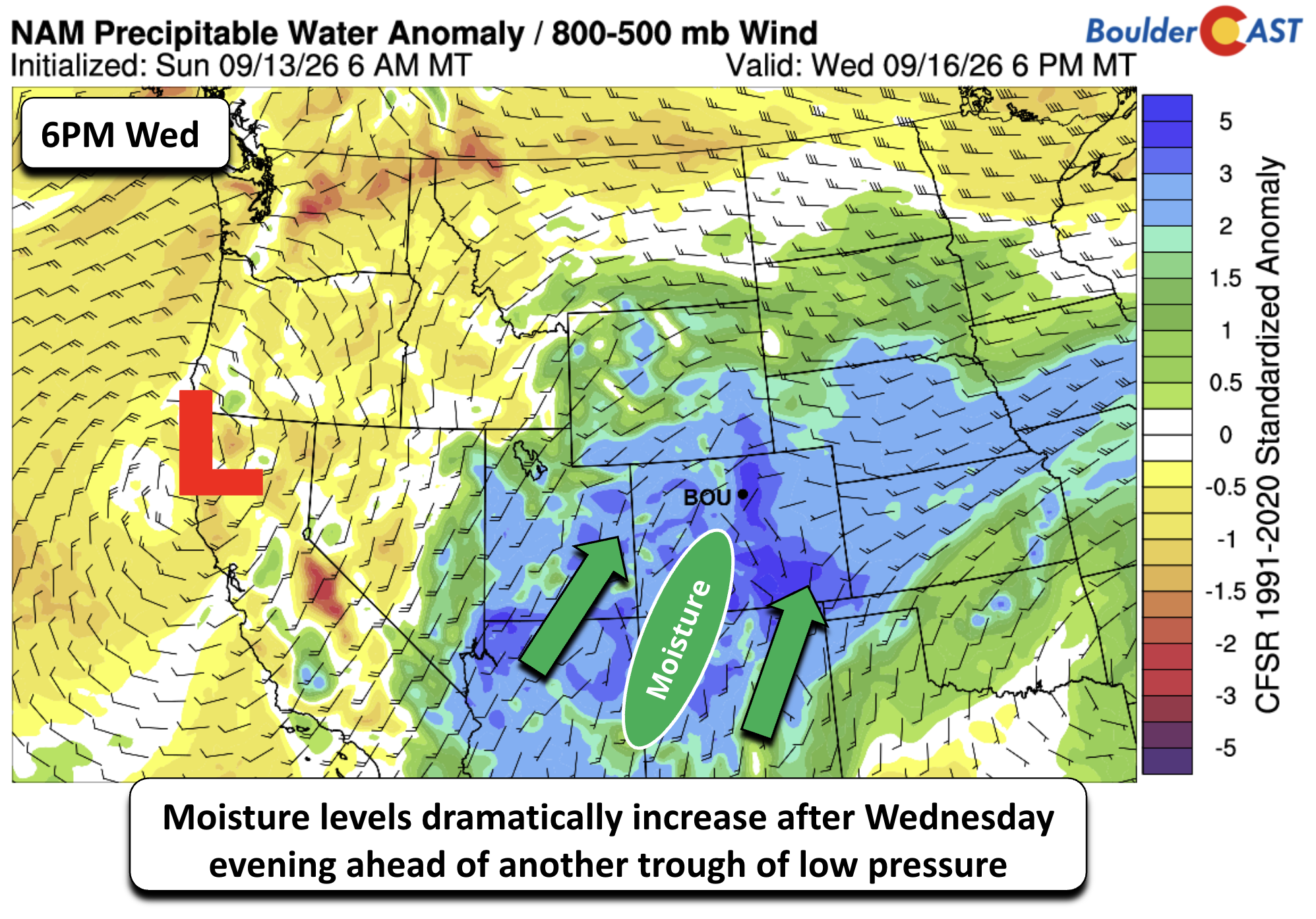
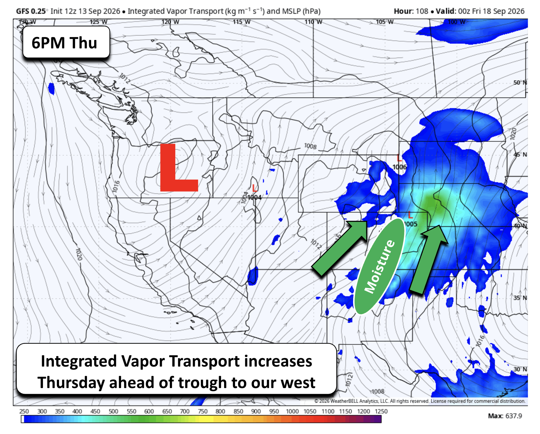
While daily showers remain possible, more organized Plains rainfall looks favored midweek onward, coinciding with stronger forcing and moisture transport. Integrated vapor transport highlights this same signal Thursday afternoon and evening, potentially tied to a mesoscale low lifting into the Northern Plains.
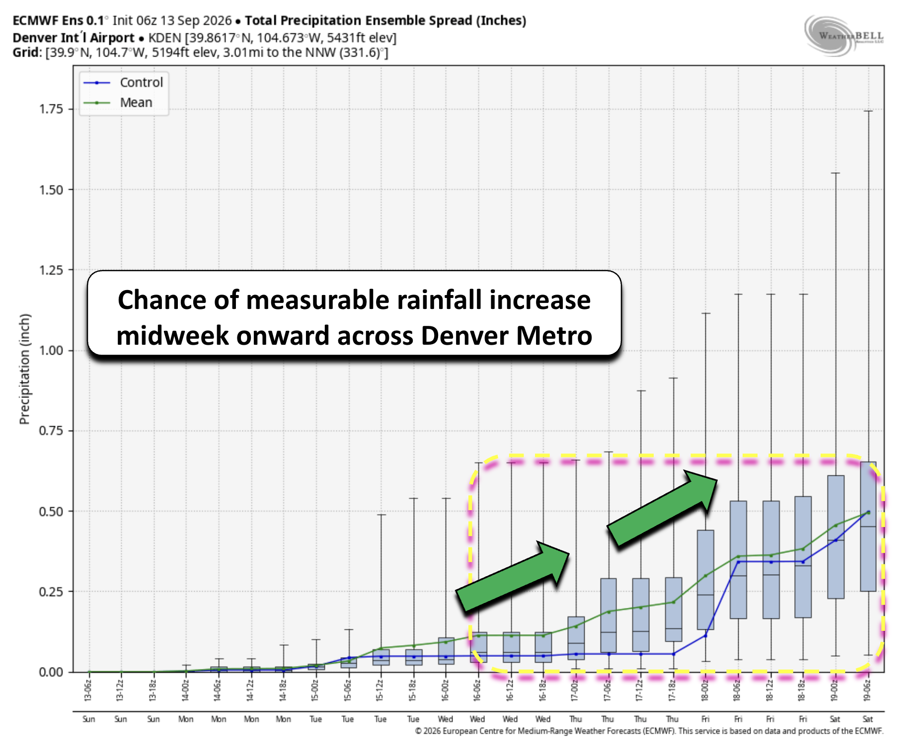
Ensemble meteograms from the Euro suite for Denver show small daily precipitation potential, but a notable uptick after Wednesday that persists into the weekend.
While rain chances will increase through the week, the guidance is not painting much rainfall through Friday for the Denver Metro area. Below shows the ECMWF probabilities of 0.5 and 1.0″ of rainfall over the Central Plains and Colorado through the work week. Over the Front Range, probabilities of a half inch or more top out around 40%, and decrease to about 10%or less for an inch or more.
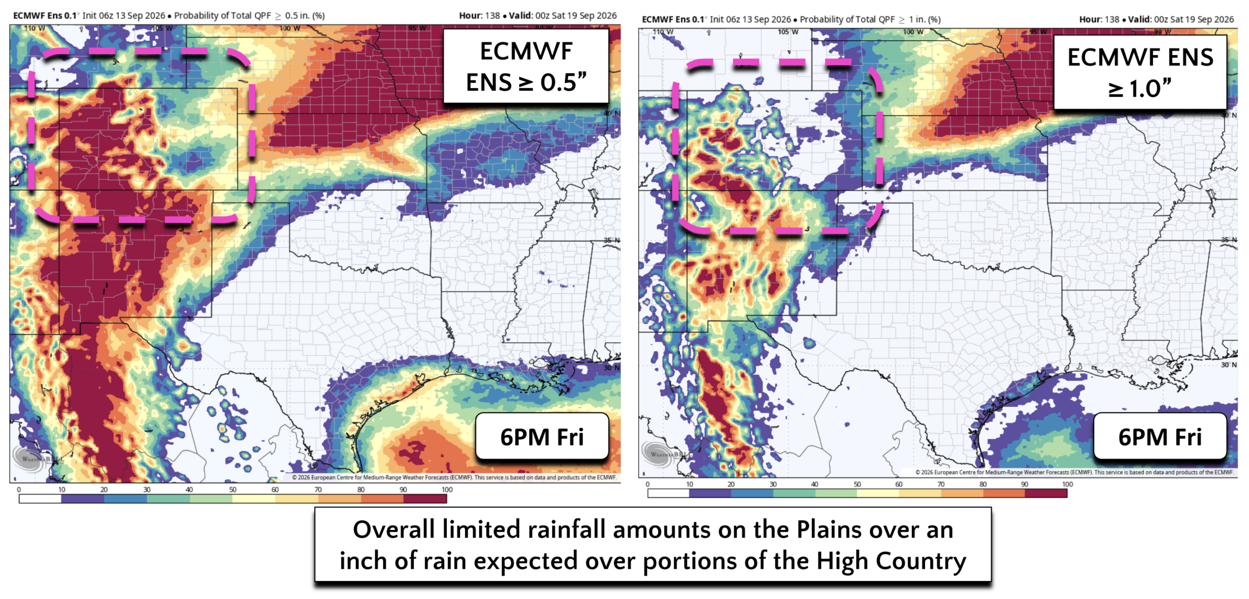
Contrary to the Plains, the probability of an inch of rain or more reaches over 80% in portions of of the Mountains and especially in southwest Colorado where the Weather Prediction Center has issued a Slight Risk of Excessive Rainfall on Thursday. As cooler fall air begins to take hold, some of the showers this week will produce light accumulating snow in the state’s highest peaks.
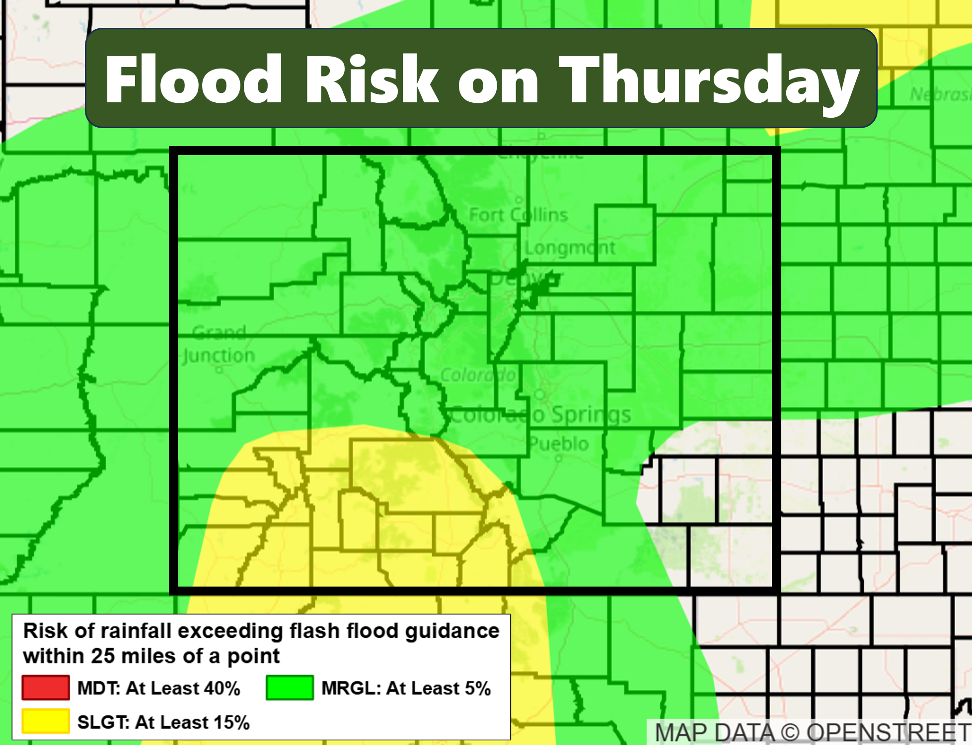
Despite hesitation surrounding how much rain we’ll actually see, we do have rain chances in the forecast each day this week with highs much closer to normal than recent weeks.
Weekend Outlook
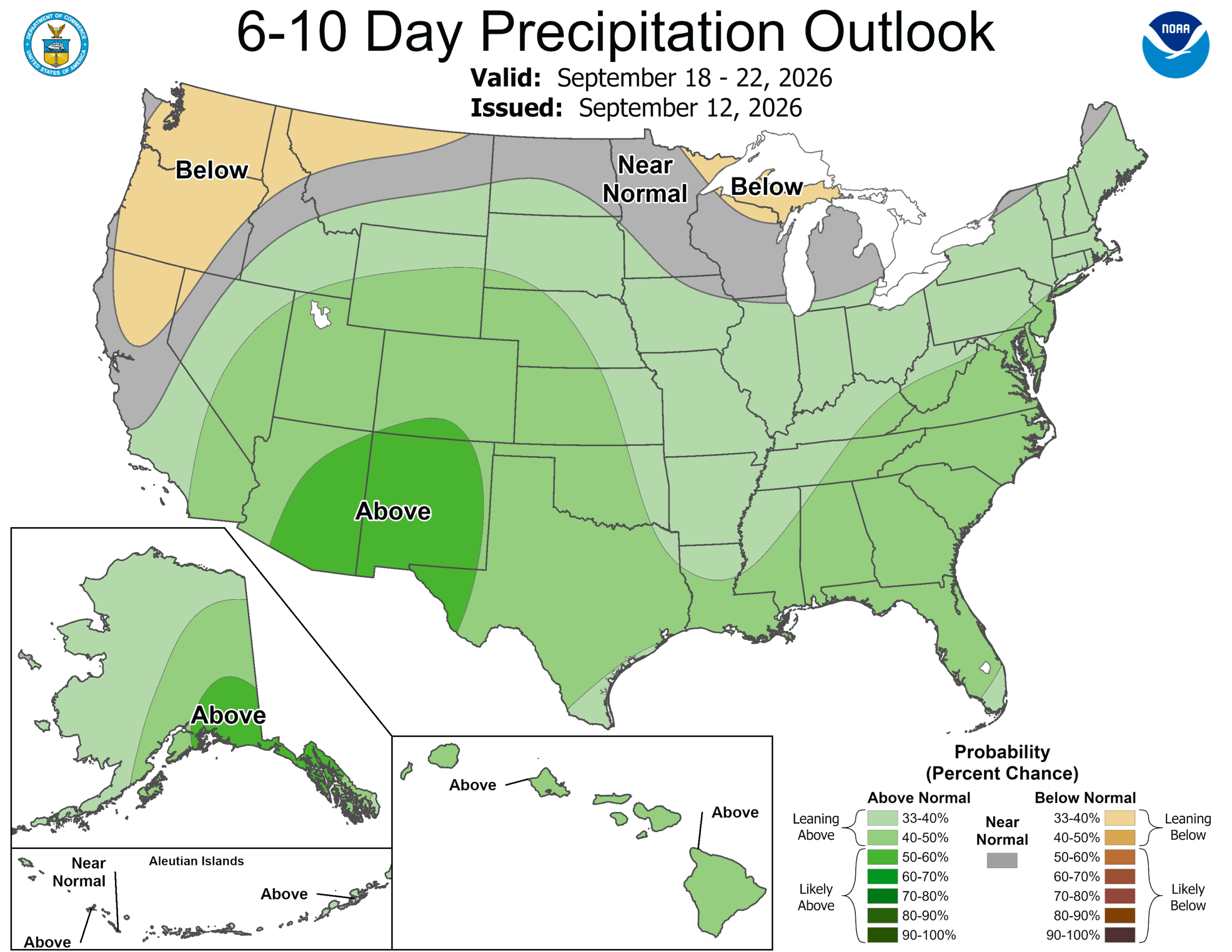
The weekend pattern remains similar, with the Climate Prediction Center highlighting a 40–50% chance of above normal rainfall.
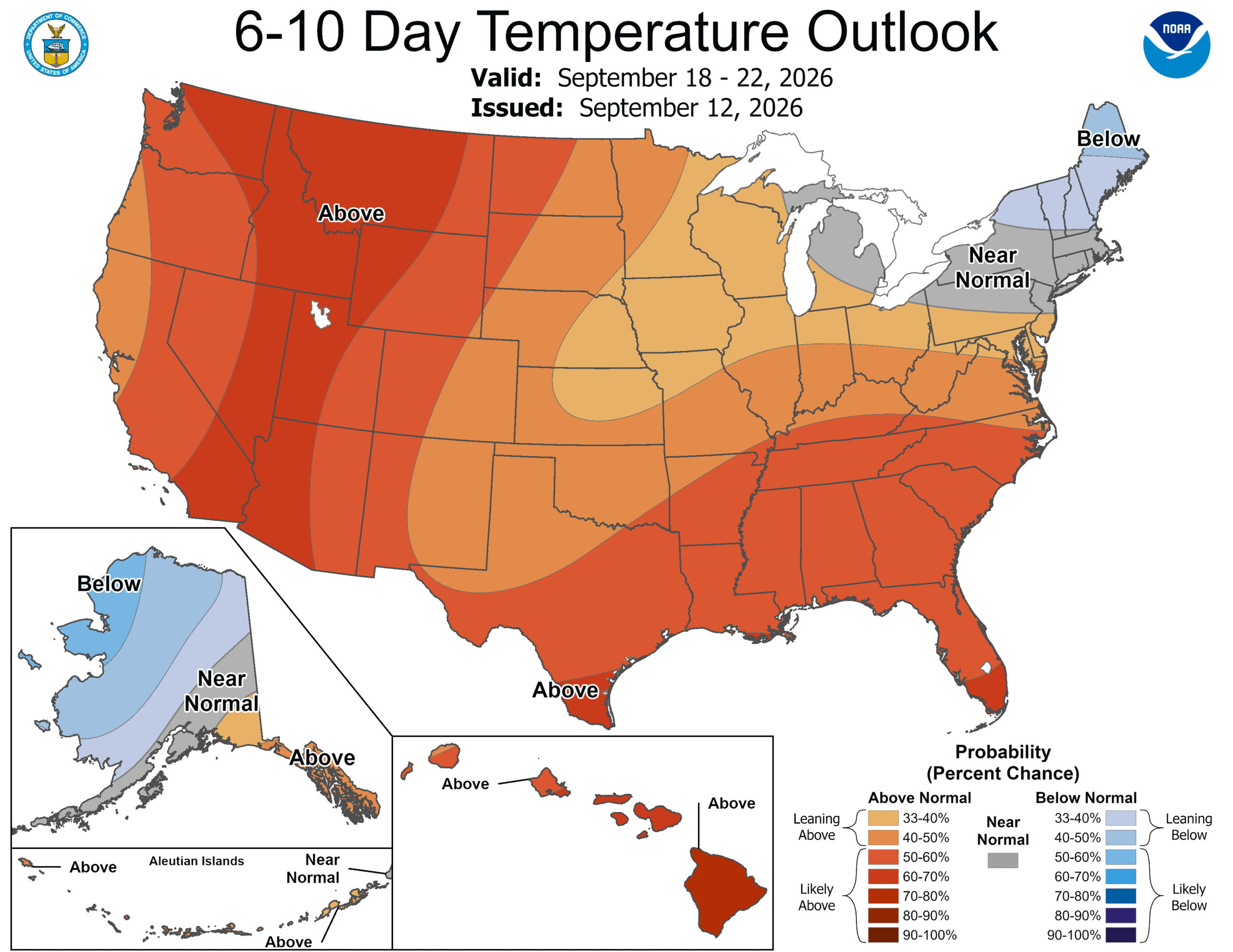
Temperature probabilities lean slightly above average (~40–50%), though not strongly — unlike the Great Basin, where anomalous warmth is more favored. While still fairly uncertainty, for now expect highs near 80° this weekend, give or take a few degrees.
Colorado’s aspens are rapidly transitioning, roughly 10 days ahead of schedule due to prolonged summer drought stress. The upcoming weekend should offer excellent viewing conditions, potentially aligning with peak color in many areas.
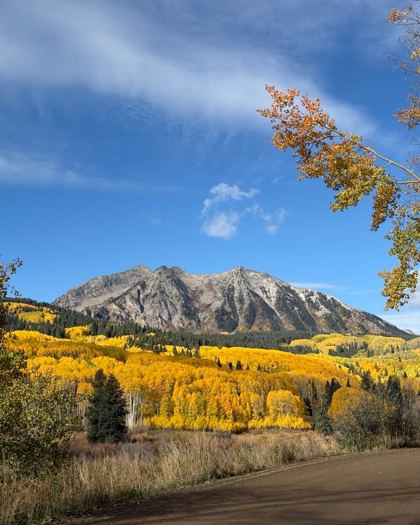
Photo by Threads user @soulfulstefanie
Finally, we can’t forget to mention that this past Saturday was the 13th anniversary of the all-time wettest calendar day in Boulder’s history (9.08″) in what ended up being the all-time wettest week (16.90″), month (18.16″) and year (34.15″). Yes, we’re talking about the September 2013 Flood.

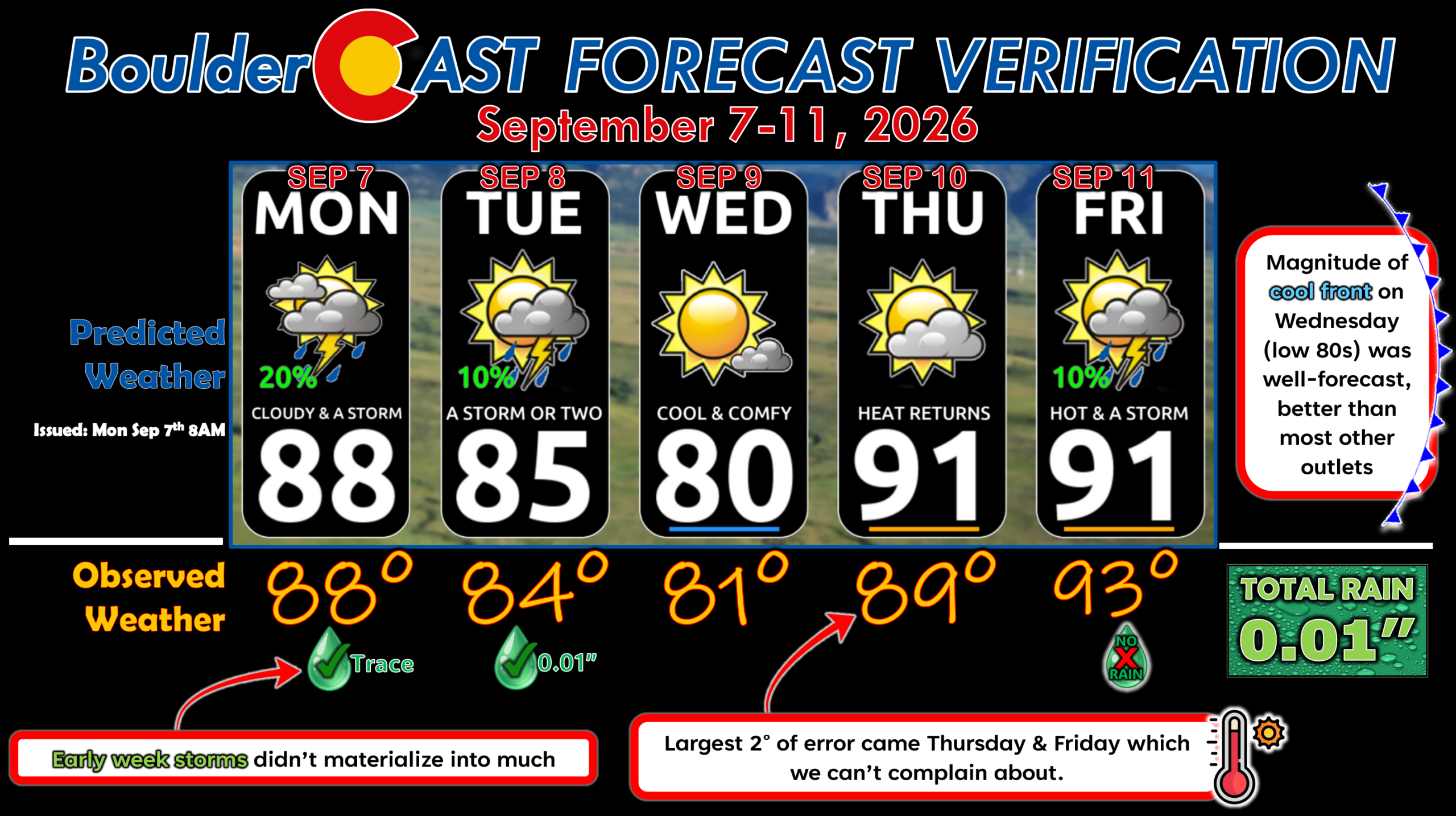
Forecast Verification: September 7-11, 2026 (Last Week)
- 2 days of rain totally 0.01″
- One 90° day, we’re inching very close to the record amount in a calendar year
- Magnitude of mid-week cold front was predicted perfectly.
- Largest temperature error was 2° on Thursday and Friday.
DISCLAIMER: This weekly outlook forecast is created Monday morning and covers the entire upcoming week. Accuracy will decrease as the week progresses as this post is NOT updated. To receive daily updated forecasts from our team, among many other perks, subscribe to BoulderCAST Premium.
Go Premium, get all the perks.
Daily Forecast Updates
Get our daily forecast discussion every morning delivered to your inbox.
All Our Model Data
Access to all our Colorado-centric high-resolution weather model graphics. Seriously — every one!
Ski & Hiking Forecasts
6-day forecasts for all the Colorado ski resorts, plus more than 120 hiking trails, including every 14er.
Smoke Forecasts
Wildfire smoke concentration predictions up to 72 hours into the future.
Exclusive Content
Weekend outlooks every Thursday, bonus storm updates, historical data and much more!
No Advertisements
Enjoy ad-free viewing on the entire site.
Enjoy our content? Give it a share!












Leave a Reply
You must be logged in to post a comment.