With our last measurable precipitation occurring nearly four weeks ago, enough is enough. After enduring a few days of near-record heat to start the week, our focus will shift to a potent storm system approaching Colorado on Thursday. Though uncertainty remains elevated, the Plains do have a chance of seeing their first accumulating snowfall of the 2016-17 season. Read on for all the details.
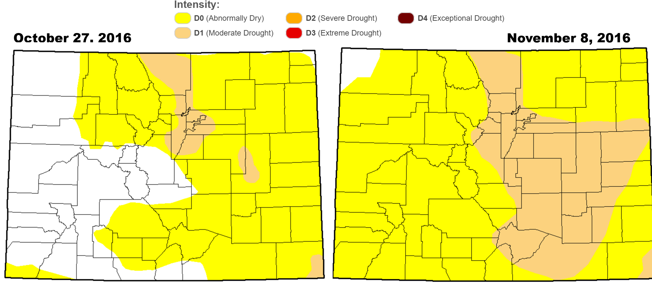
Through the mid-point of November, Boulder sits nearly eight degrees above normal for the month, with our last measurable precipitation having occurred back in the middle of October. The United States Drought Monitor has increased Colorado’s areal drought coverage to 31%, up from just 6% two weeks ago. This region contains 76% of our state’s entire population….
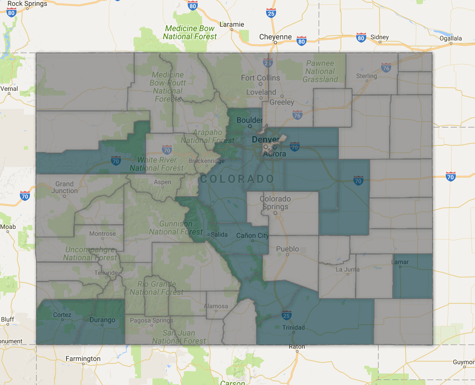
Fire bans have expanded as well…
There has been little good news of late, but our November outlook called for cooler temperatures and more active weather during the second half of the month. While we’re not convinced on the cooler part just yet, we are tracking a potent storm system which will have at least some impact on the Front Range near the end of this week. Let’s get to it.
Ridgy Monday through Wednesday
First, before we get to the fun stuff, we’ll have to “endure” three more days of warmth and sunshine with Colorado under the influence of yet another ridge of high pressure and dry downslope flow. The 500 mb map below shows the ridge on Monday afternoon, with a center in southern California, and northwest flow in place across our state.
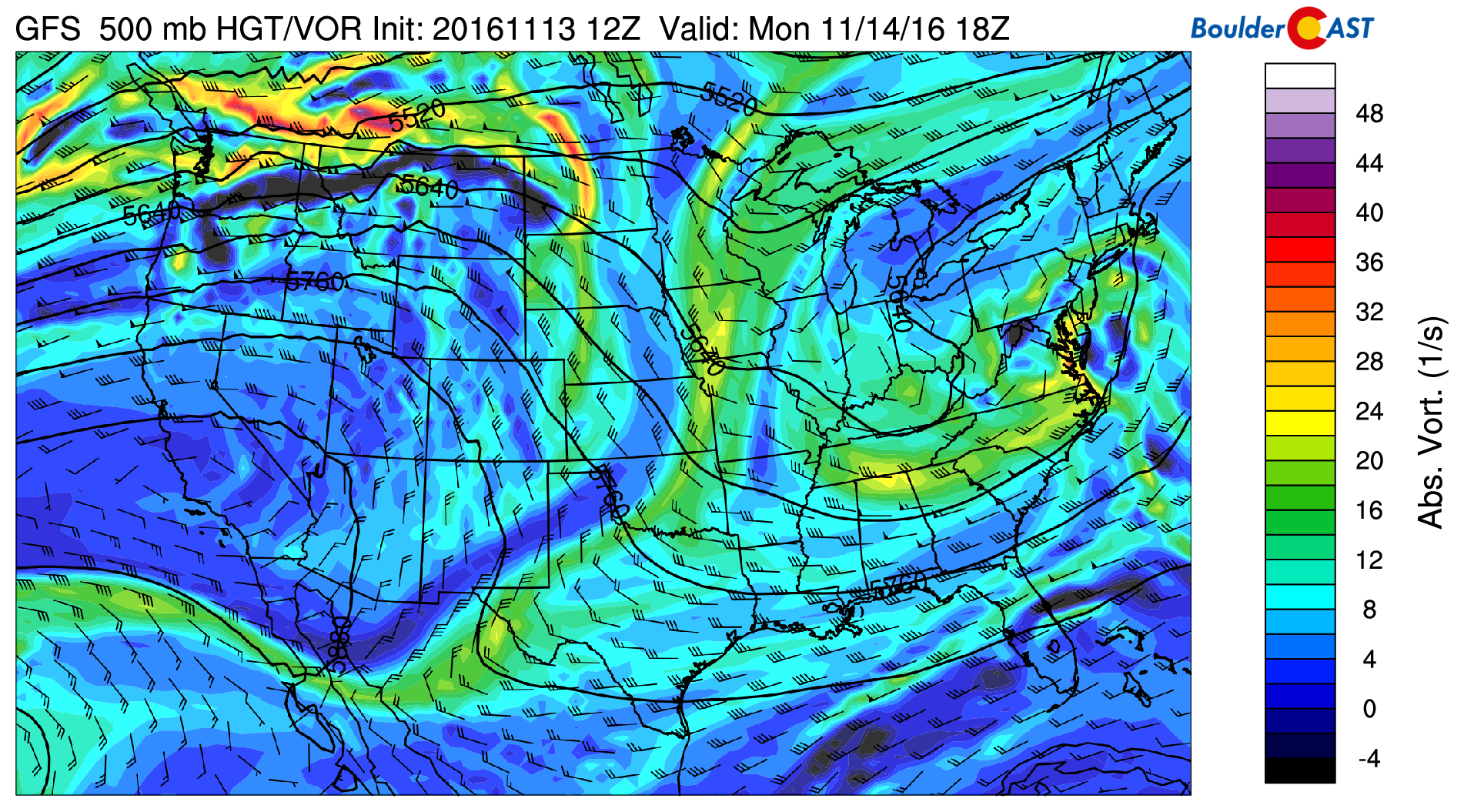
GFS 500mb vorticity map for Monday afternoon, showing a ridge building in from the west into California
The ridge shifts east of the region by Wednesday, with our storm-of-the-week already coming ashore in California.
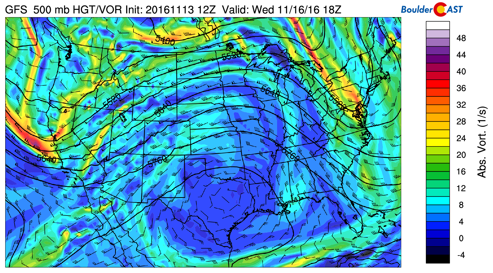
GFS 500mb vorticity map for Wednesday afternoon. The ridge has pushed east of Colorado, and our main storm system to watch is coming ashore
Under this well-defined ridge, we’ll approach record temperatures for mid-November during the first half of this week. We’ll particularly need to watch for shattering historical values Tuesday and maybe Wednesday. All three days will be 15 degrees or more above normal in to 70’s.
The first signs of the impending storm will be increasing late-day clouds on Wednesday as southwest flow and some moisture work their way into the state. We don’t think any precipitation will reach beyond extreme western Colorado on Wednesday. Therefore, we’ll continue to remain dry.
Will we see our first snow this week?
Thursday into Friday, we’re expecting the first “winter” trough to dig across the Northern Rockies, with plenty of cold air and good dynamics to work with.
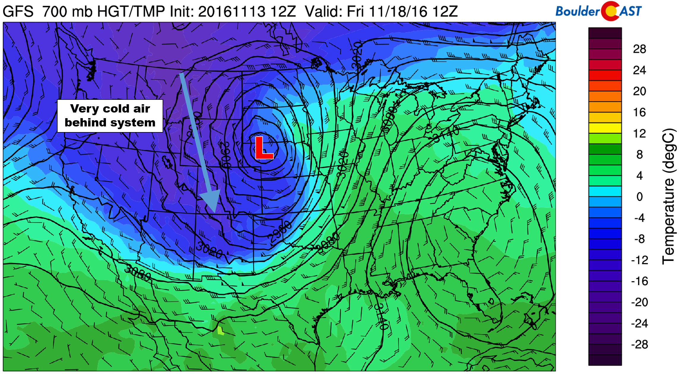
GFS 700 mb temperature forecast for Friday morning, showing very cold air on the backside of the system. Temperature will be in the teens (or colder) at 10,000 feet.
We first alerted you to this weather system last Thursday. We were impressed with the potential, but cautioned that model uncertainty was way too large to put much thought into the system that far out. Unfortunately, much of what concerned us before, hasn’t gotten resolved yet. With the storm still four or five days away, this isn’t that surprising. We are fairly confident someone is in store for a big snow storm, but as of now, it doesn’t look to be the Front Range.
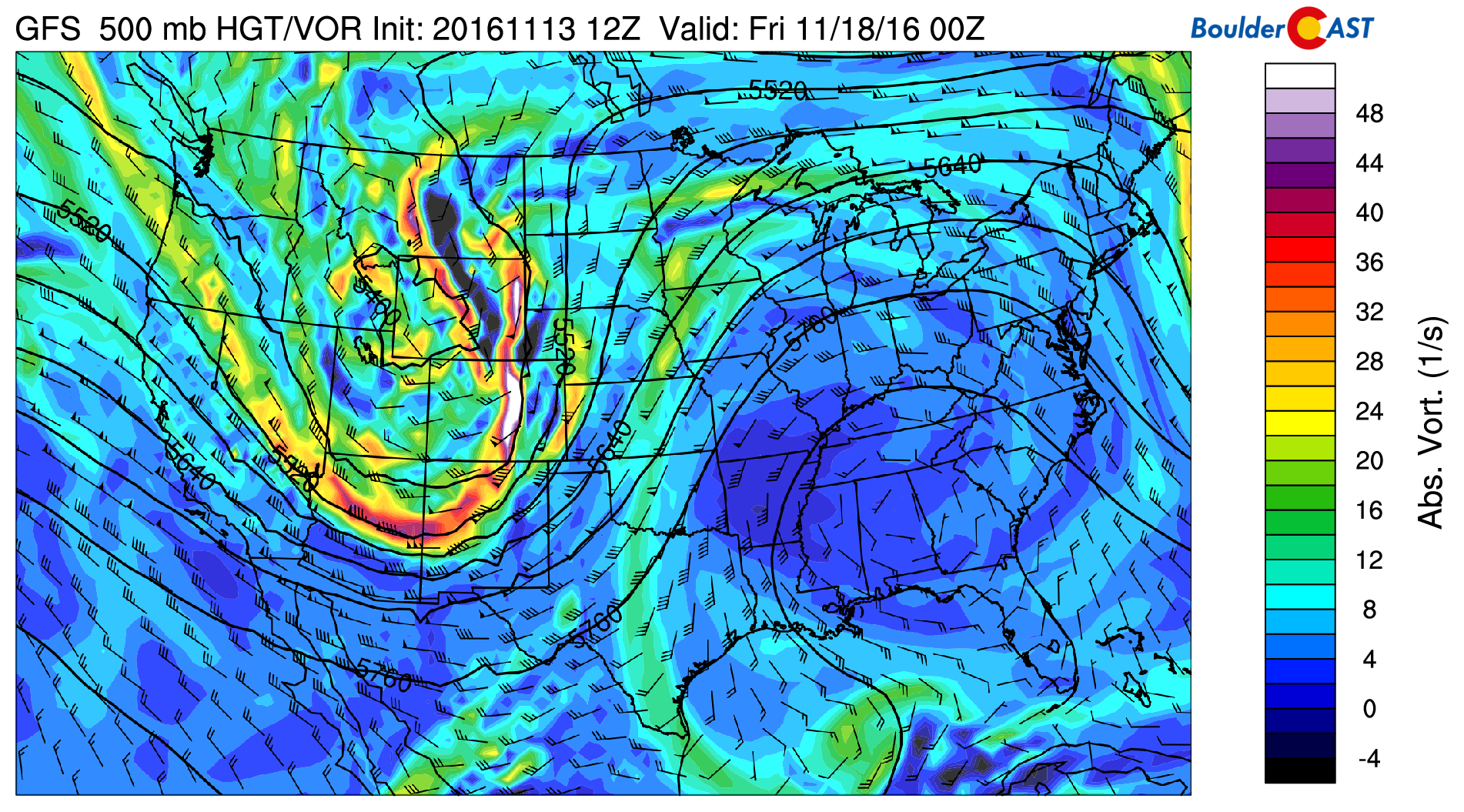
As the trough moves across the Rockies, a surface low will develop somewhere on the lee side the Mountains. Here’s the latest GFS forecast at 500 mb for Thursday evening:
Most guidance points the surface low forming in extreme northeast Colorado. The latest run of the GFS model (shown below) is quite similar to what both the Euro and Canadian models are leaning towards as well.
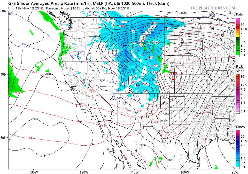
GFS forecast sea-level pressure and precipitation for Thursday evening depicting a developing surface low in eastern Colorado and widespread snow
Following the formation, the surface low will likely quickly track north and eastward and intensity into a powerful winter storm. This scenario leaves the Denver Metro area with only downslope and residual angst for what could have been. The tight pressure gradients shown above around the developing low could bring some blustery winds to the region as well.

Total forecast snowfall from the GFS model (assuming 10:1 ratio) for the storm. Montana and the Dakotas are set to be the “big winners”
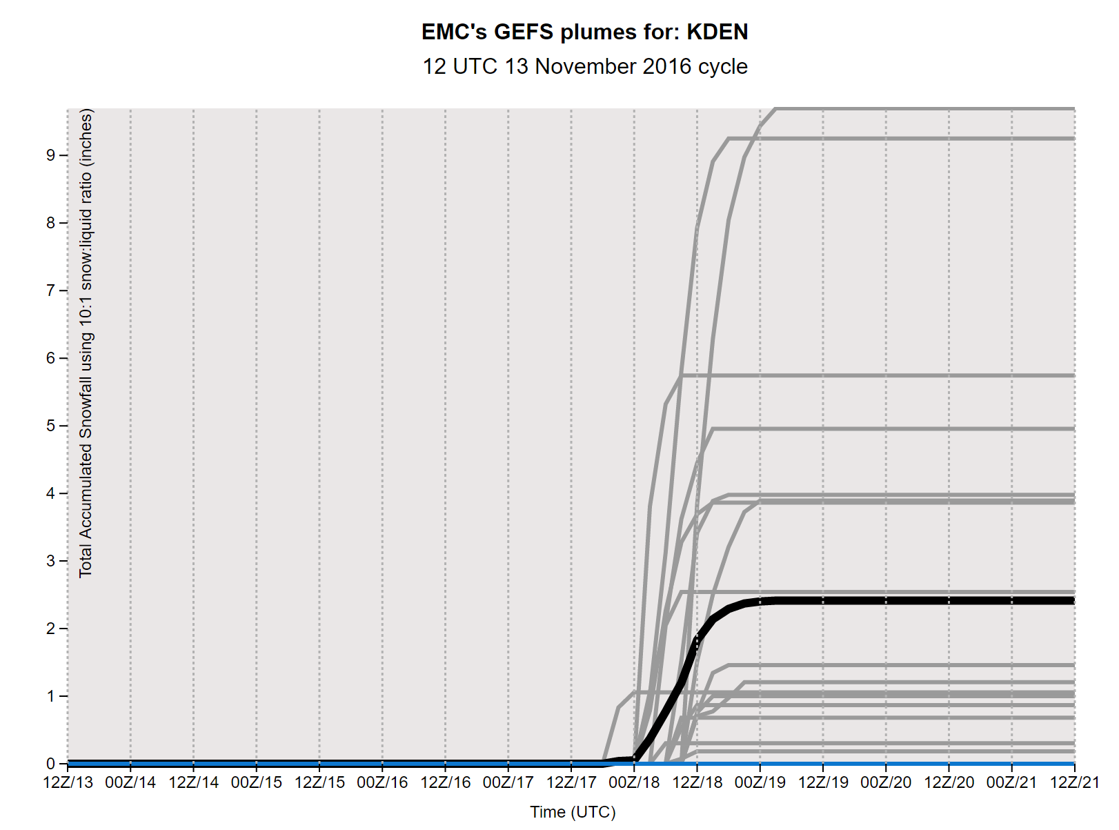
We won’t dash your hopes of snow just yet! We’re still seeing considerable variation from run-to-run, and model-to-model for how this potential beast may behave to end the week. The spread on the GFS ensemble is large. The current maximum snow total for DIA is 10″ and a mean of about 2″. Furthermore, a third of all runs show more than 3″.
So despite the downsloping (and no snow at all!) shown by the operational GFS, we still think there is a fair chance of something frozen materializing for us…
Here’s what we’ll say for now:
- Thursday will be a day of transition. We know there will be a strong cold front at some point. The precise timing will determine how warm we get. Currently, it looks to pass during the afternoon. This would allow highs to get into the 50’s.
- There will be a slight chance of spotty rain showers around the time of the frontal passage, but with cooler air working in, we should see a change over to snow showers by Thursday evening. With the best upslope likely remaining to the north in Wyoming, we’ll have to rely on a quick shot of some synoptic lift/jet forcing for our precipitation. Exactly how that is going to look is impossible to tell this early on.
- Our thoughts now are that this storm will either be just a few non-accumulating flakes, or 1-2″ for the Denver Metro area. The chances of a significant storm are very small for us.
- The Mountains near and west of the Divide will do just fine from this storm, regardless of how the track ultimately plays out. At minimum, we’d expect around 3-6″ in many of the ski resorts. If things become more favorable over the next few days, double that may be possible.
- Friday will be chilly..probably our coldest day thus far this year. Depending on how much snow and cloud-cover linger, highs will either be in the 30’s or low 40’s. Lows should drop into the teens Friday night.
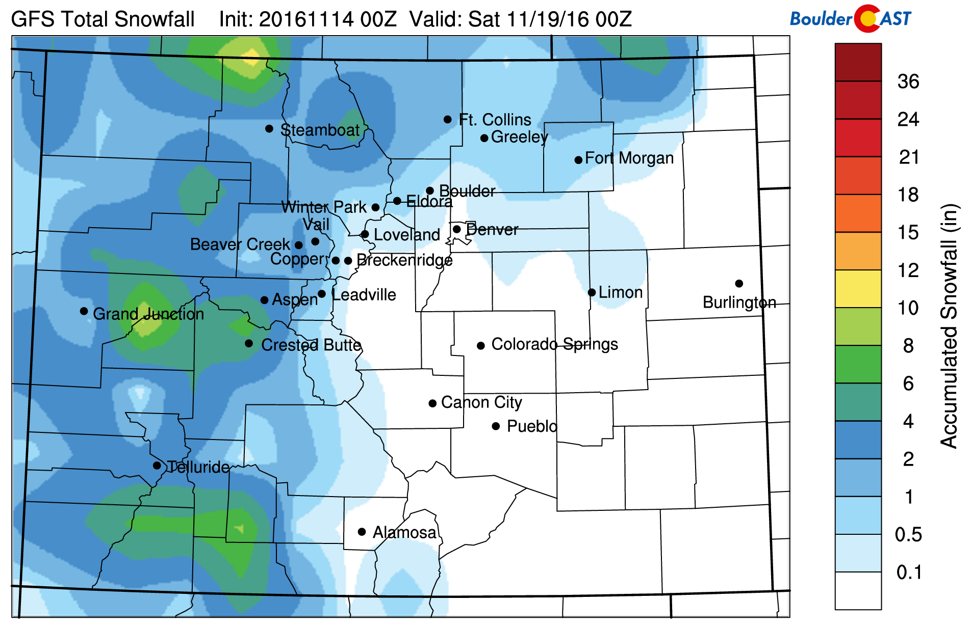
Current snowfall forecast using our snowfall algorithms and GFS data. Light snow may be possible on the Plains
We’re sorry we can’t divulge more just yet! There are just too many unknowns. If we DON’T manage to pick up some measurable snow this week, both Denver and Boulder will be primed to make a run at the record for the latest accumulating snowfall. For that, we’ll need to get through most of next week as well.
With that said, you’ll surely find an update from us later in the week as this system comes more into focus. We have a feeling the more seasonable temperatures may be the bigger story than snow…we could be talking teens for Saturday morning, and single digits higher up. Stay tuned and enjoy the week!
Forecast Specifics:
Monday: Mostly sunny and warm. High temperatures in the low 70’s over the Plains and upper 50’s in the Foothills. Windy in the Foothills with gusts exceeding 45 mph.
Tuesday: Sunny with near-record heat. High temperatures on the Plains will be in the mid to upper 70’s, with mid 60’s in the Foothills. Gusty winds in the Foothills may exceed 35 mph.
Wednesday: Sunny early, with increasing clouds through the day. The warmth continues as the Plains reach into the low to middle 70’s, with low 60’s in the Foothills.
Thursday: Partly to mostly cloudy. Cooler with highs somewhere in the 50’s with falling temperatures as a cold front moves through the region. Expect a chance of a few rain showers changing to snow showers Thursday evening, along with breezy conditions. Accumulation potential and amounts to be determined, but likely will be small.
Friday: Colder with isolated morning snow showers. Cloudy early with clearing through the day. High temperatures in the low 40’s over the Plains and upper 20’s in the Foothills.
High Country: Sunny, albeit breezy conditions will dominate Monday and Tuesday with temperatures well above normal. Clouds increase Wednesday, with much colder and snowy conditions arriving Thursday morning and afternoon. Snow will linger through late day Friday, with 4″ of snow or more possible above 10,000 feet near and west of the Divide.
Extended: After the storm system pulls away, model ensembles show gradually warming temperatures as another ridge of high pressure builds in across the Mountain West through the weekend into next week. There are hints of a system or two next week or weekend, but not anything as impressive as the trough this week.
Mon
Tue
Wed
Thu
Fri


Temperature
70
76
72
54
41


Precip Chc (Plains)
0%
0%
0%
30%(pm)
10%(am)




You must be logged in to post a comment.