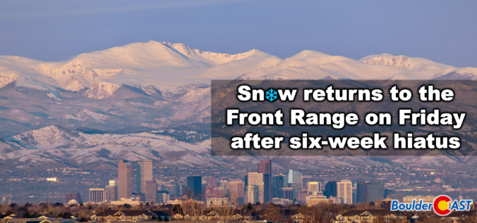
A quick shot of winter weather is finally lining up for the Front Range, and this one has just enough cold air, upslope, and atmospheric ingredients to make things interesting. After weeks (months?) of springlike warmth and storms that couldn’t quite commit to generating lower elevation snow, this late‑week system is poised to break that streak—though not without a few twists. We discuss who is likely to get the most accumulation of wet snow, who gets skunked by downslope, and how fast we’ll bounce right back to sunshine and 60s once the flakes stop flying.
UPDATE (Friday 3/6/26 8:00AM): The majority of models have slowed our storm down allowing for a longer period of ideal snow ingredients to linger over the Front Range on Friday when moderate snow bands will impact the area. Snow amounts have been increased a tad regionwide, with slushy roads now favored for the lower elevations, and difficult travel in the Mountains/Foothills. Snow will continue all day Friday before tapering off Friday evening. Temperatures near and slightly above freezing will allow for a lot of melting. We discuss the changes to the forecast and the latest developments in Friday’s Premium Storm Update HERE.
What You Need to Know
- ❄️ Winter finally returns: After six snow‑less weeks, a complex split storm will deliver cold air and widespread snow back to the Front Range to end the week.
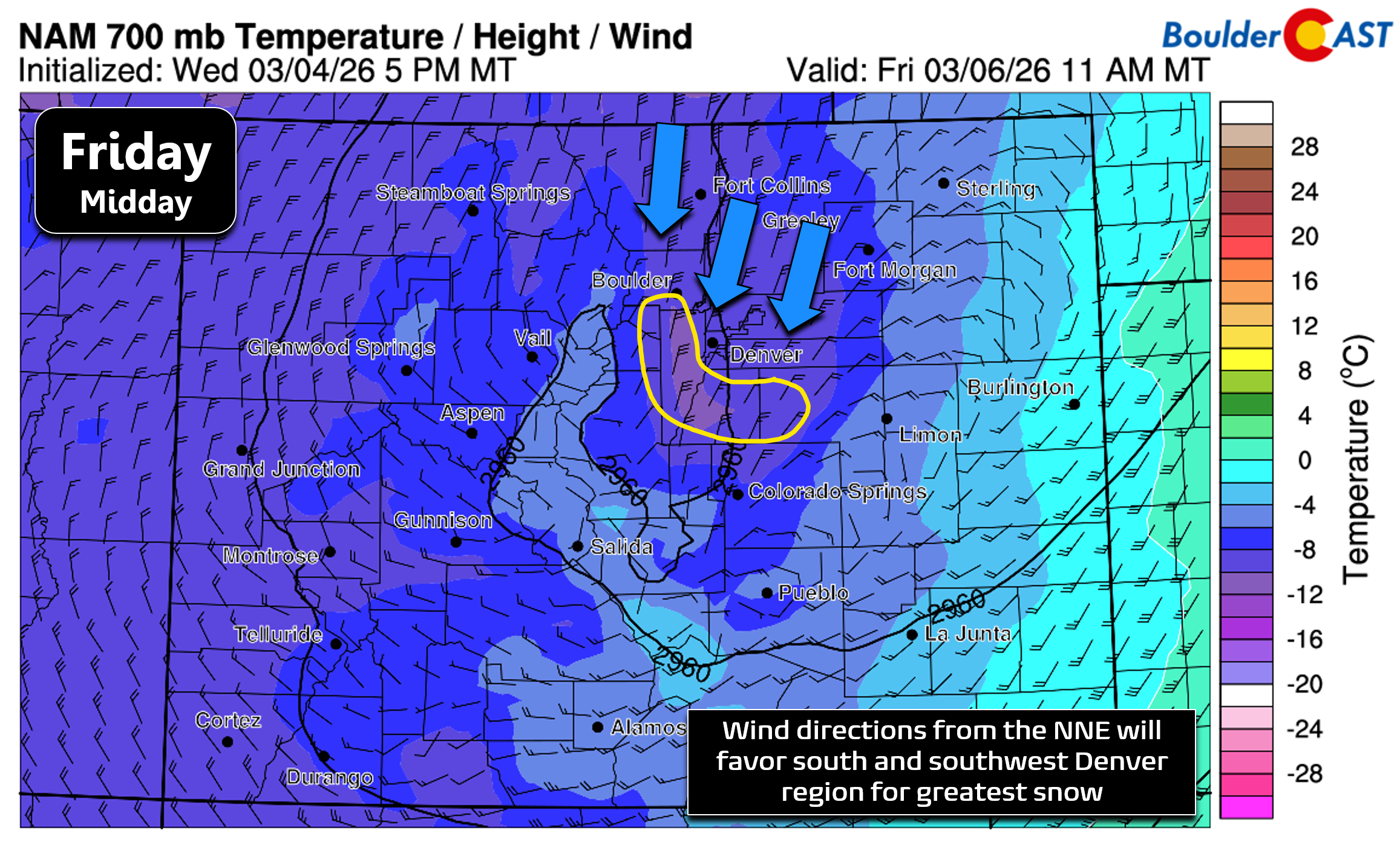
- 🌬️ Cold NNE upslope: A stalled mid‑level low will funnel chilly north‑northeast flow into Denver/Boulder late Thursday night through Friday, favoring the Palmer Divide and JeffCo Foothills for the most snow.
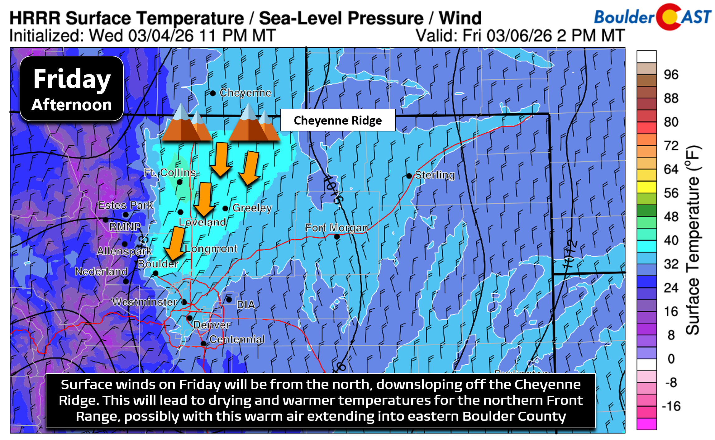
- 🏜️ Downslope north of Denver: Fort Collins–Greeley–Longmont will sit in a low-level downslope regime, keeping temps a bit warmer and limiting accumulation—this warm air may nudge into northeast Boulder too.
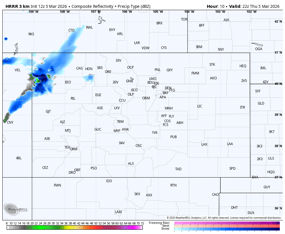
- 🌧️➡️🌨️ Timing: A strong cold front Thursday night flips brief rain overnight, with steady wet snow through the day Friday. Snow tapers off Friday evening.
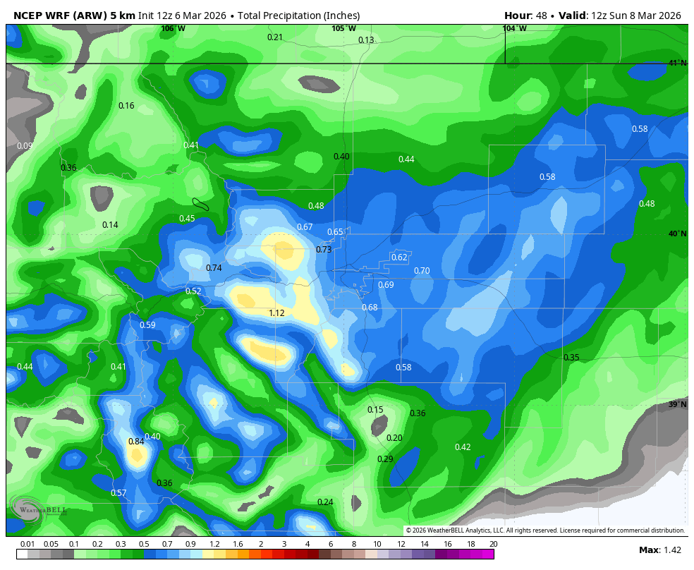
- 💧 Healthy moisture: Most areas should pick up 0.3–0.7″ of liquid (higher in the Foothills), giving the region a much‑needed moisture boost despite variable snow totals.
- 🌤️ Classic March whiplash: Friday stays in the low to middle 30s with wet snow, but sunshine returns Saturday and temps rocket into the 60s–lower 70s by Sunday and Monday.

Go Premium, get all the perks.
Daily Forecast Updates
Get our daily forecast discussion every morning delivered to your inbox.
All Our Model Data
Access to all our Colorado-centric high-resolution weather model graphics. Seriously — every one!
Ski & Hiking Forecasts
6-day forecasts for all the Colorado ski resorts, plus more than 120 hiking trails, including every 14er.
Smoke Forecasts
Wildfire smoke concentration predictions up to 72 hours into the future.
Exclusive Content
Weekend outlooks every Thursday, bonus storm updates, historical data and much more!
No Advertisements
Enjoy ad-free viewing on the entire site.
Winter returns to the Front Range
Awintry pattern is finally returning to the Front Range, and this one arrives with a setup that’s been unusually strange even by March standards. After six straight weeks without measurable snow in Boulder or Denver, a slow‑moving trough will slide into Colorado late Thursday and then undergo a dramatic split on Friday—one piece peeling southwest toward the Baja as a closed low, the other getting swept northeast into the upper Midwest. That complex split is the root of the model uncertainty we’ve been wrestling with all week.
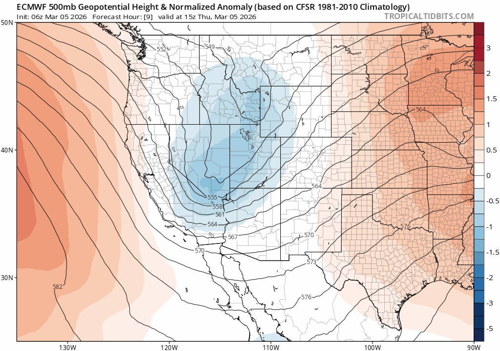
Before the system fully fractures, guidance keeps a closed mid‑level low nearly stationary over southwest Colorado from late Thursday night through most of Friday. That positioning is key: it funnels north‑northeasterly flow straight into the Front Range, dragging in the coldest air we’ve seen in weeks along with a decent injection of moisture.
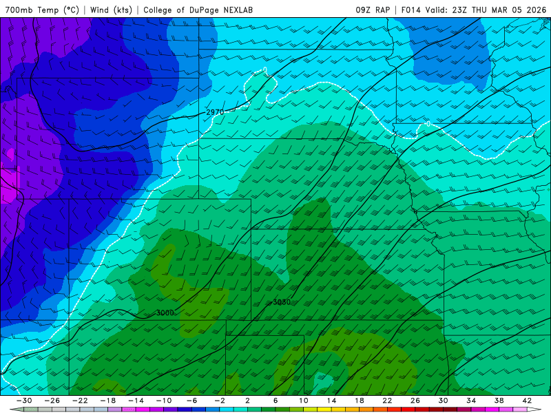
After a winter dominated by marginal temperatures and more rain than snow, this storm will finally bring a sufficiently cold column of air. 700 mb temperatures are forecast to fall below –7°C Friday, cold enough to lock in snow as the dominant precipitation type for our entire area. That north-northeasterly upslope flow will favor the southern and southwestern portions of the Denver Metro area (i.e. Palmer Divide and the Jefferson County Foothills).
Downslope complications north of Denver
That same northerly flow will work against snow production farther north. Areas from Fort Collins → Greeley → Longmont sit in the downslope shadow of the Cheyenne Ridge, a pattern that often warms and dries the near‑surface layer. Short‑range models are already hinting that this pocket of warmer air may push as far south as Gunbarrel and northeast Boulder during the day Friday. Given how cold it will be aloft, we’re not expecting to have any issues with rain spoiling the party, but surface temperatures near or above freezing will chew away at accumulations, especially on pavement. Expect plenty of melting even as the snow continues to fall during the day.
Timing: a quick flip from rain to snow
A strong cold front arrives between 8–10 PM Thursday evening accompanied by gusty NNE winds. A brief period of rain is possible overnight, but temperatures drop fast enough that snow should take over quickly well before sunrise on Friday.
- Snowfall will continue all day Friday, occasionally moderate to heavy in the morning to early afternoon.
- Snow will taper off Friday evening as the system finally splits and ejects.
Moisture totals: a meaningful drink for our dry region
Moisture looks healthy for the area (updated):
- 0.3–0.70″ across most of the Front Range
- Lower totals north/east (downslope)
- Higher totals south/west (most upslope‑favored terrain for NNE winds)
- Some of the Foothills could exceed 1″ liquid
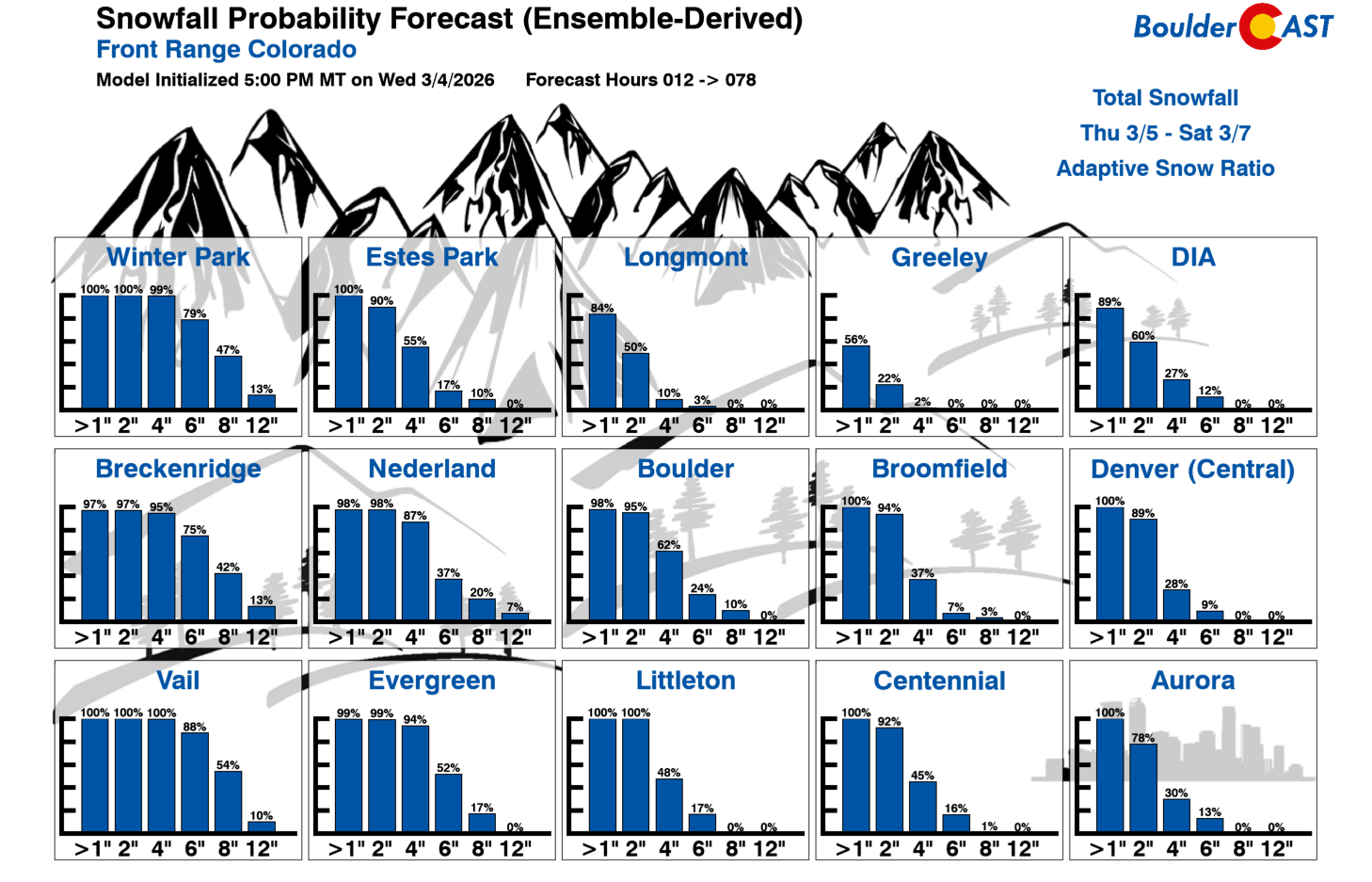
For Boulder, the GFS ensemble clusters tightly around 0.25–0.50″, with a median near 0.44″. There are really no “complete miss” solutions, but roughly a quarter of members foretell a more robust precipitation event—something to watch as the storm evolves.
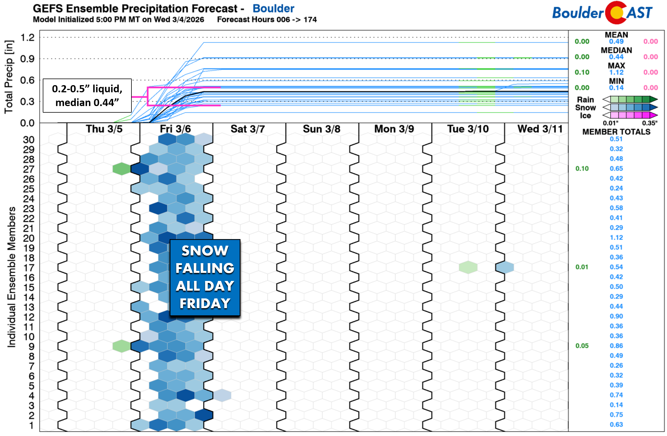
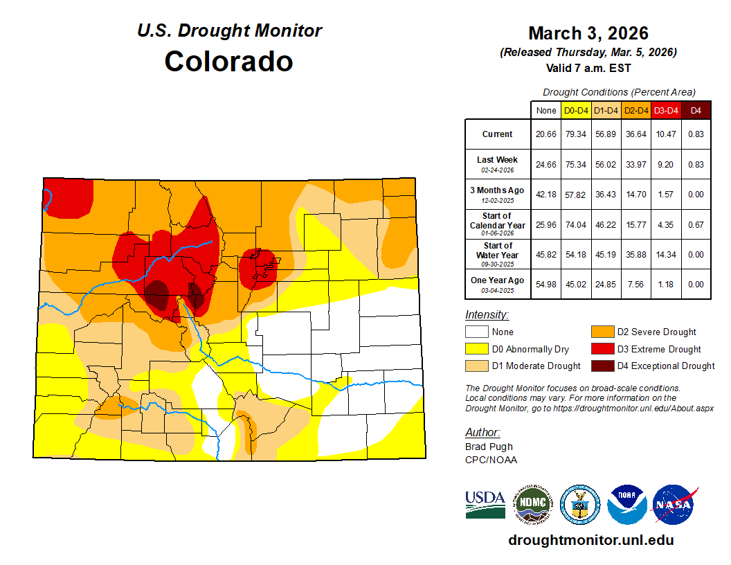
Overall, this is a solid helping of a precipitation for our drought-stricken area which desperately needs it.
Snow amounts: highly elevation and temperature‑dependent
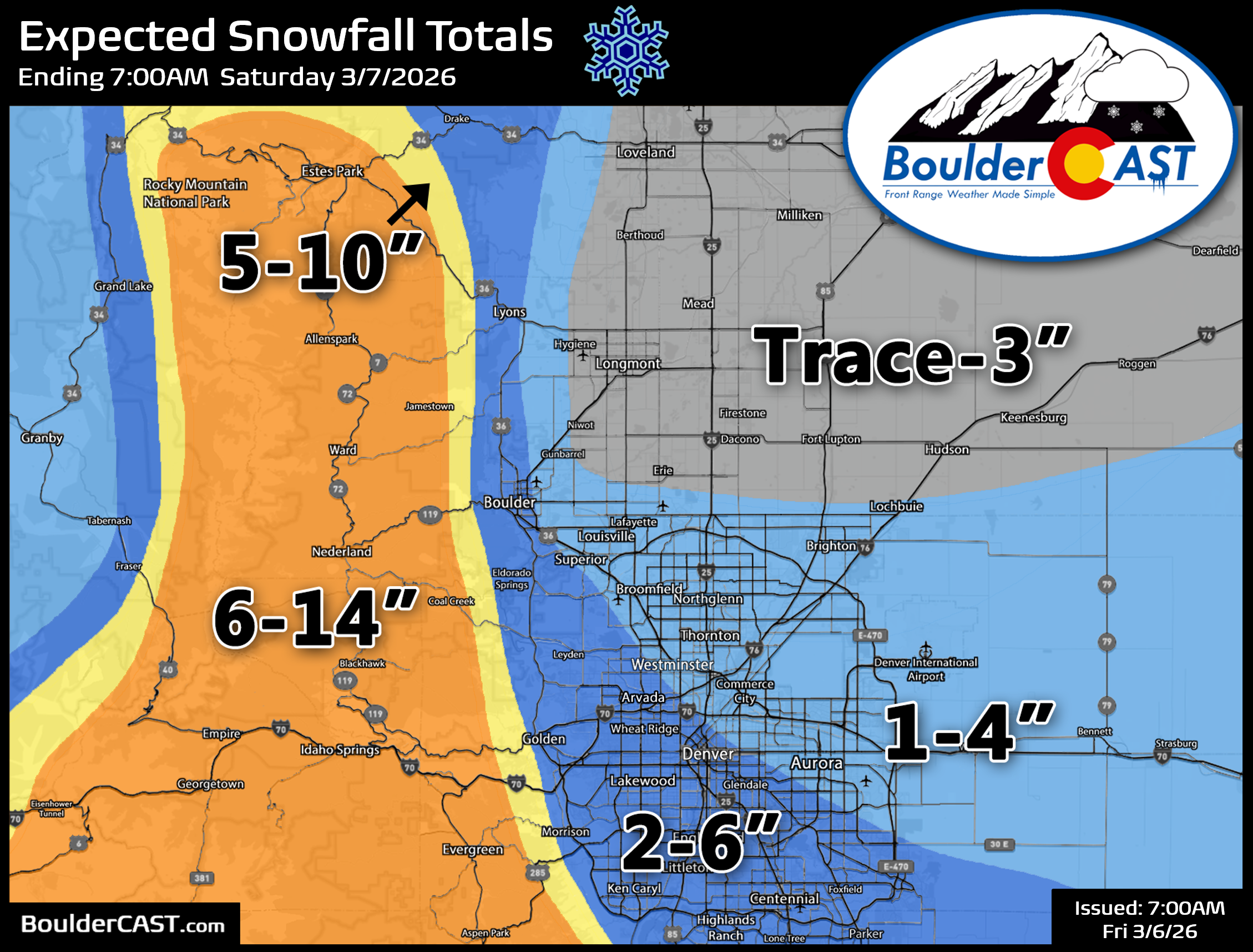
For snow amounts, that is a bit trickier. Temperatures will be near of above freezing during the day Friday so despite all the falling snow, there will be lots of melting, aided in part by the increasingly strong early March sun angle. Snow accumulation will favor the grassy and elevated surfaces for this event. In general, we’re forecasting anywhere from a trace to 6 inches of snow for the lower elevations, with 6 to 14 inches in the Foothills and Mountains (highest south). Our latest snowfall forecast map is shown below. The gradient in snow will be particularly tight in the Boulder area, where low-level warm air may invade from the northeast during the day into Gunbarrel, while the slightly higher elevation southwest part of Boulder stays colder and receives good upsloping. The heart of Denver should be safe from the warmer air, especially the further south and west you go.
Warm ground and road temperatures will limit accumulation, and the falling snow will be on the wetter end with a lower snow ratio. Impacts are not expected to be too bad across the lower elevations, with largely wet and slushy roadways. There could be some minor slick spots for the Friday morning commute due to locally heavy snow, but there will improvement through the day as temperatures warm slightly and the sun helps out.
Temperature roller‑coaster
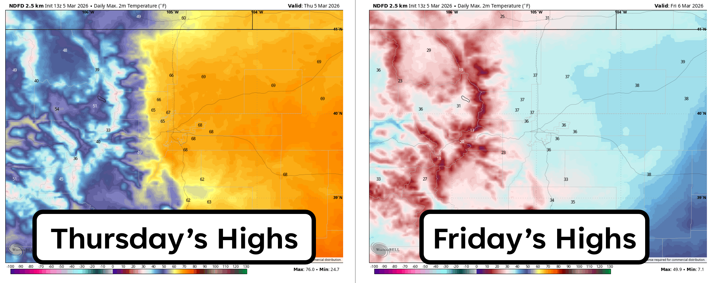
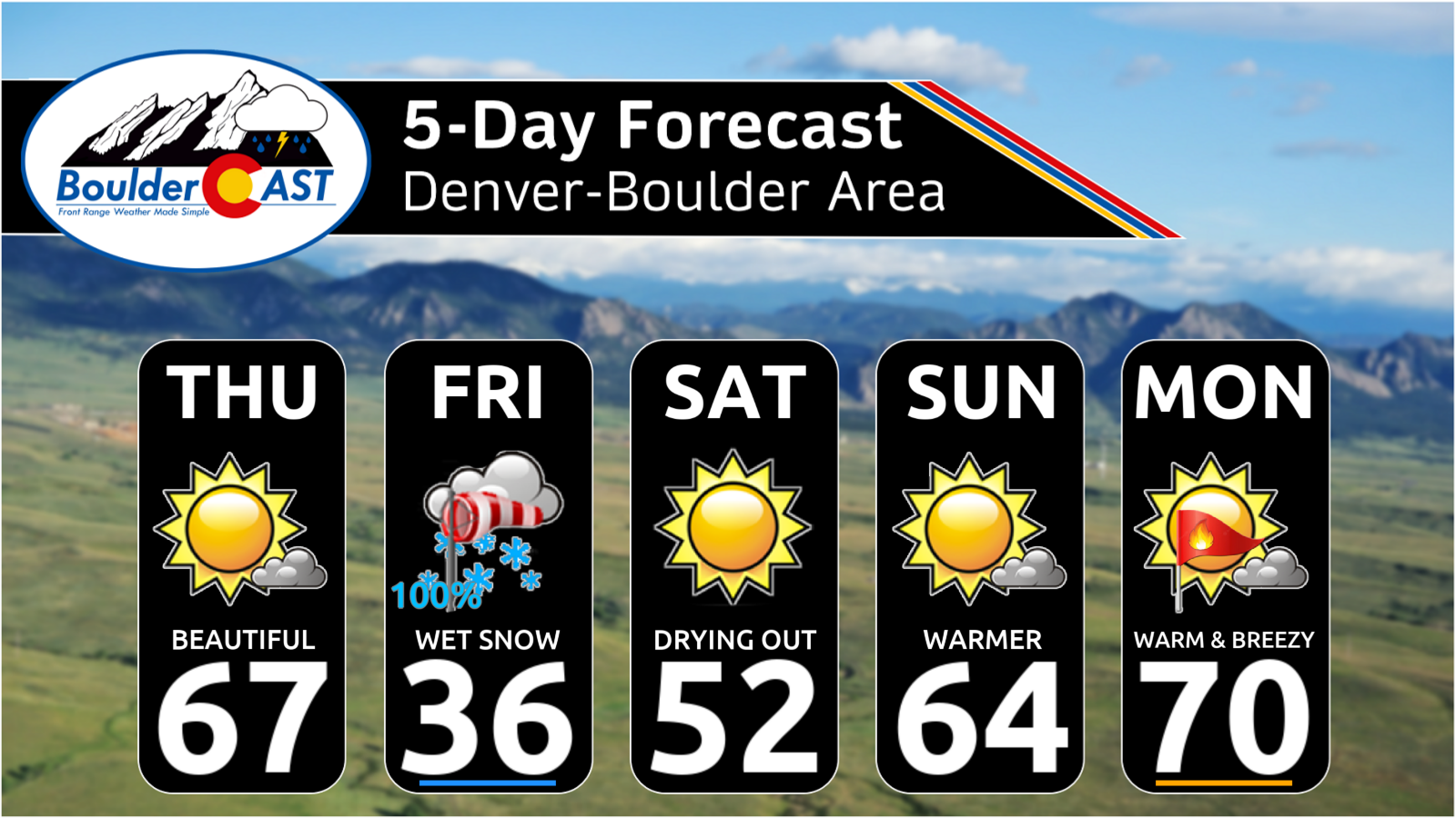
Speaking of temperatures, they’ve been have been up and down this week like a roller-coaster and that trend will continue. Thursday will feature very warm readings once again as southwest flow increases into Colorado ahead of our approaching winter storm. Highs will land in the mid to upper 60s for Boulder and Denver—another springlike affair. Things will look much different on Friday with highs about 30 to 35 degrees colder and only in the 30s!
After the warm afternoon with occasional clouds, a strong cold front will move in between 8 and 10PM late Thursday evening with gusty north-northeast winds commencing. Brief rain may occur during the overnight before changing over to snow quickly after midnight and before sunrise on Friday. Wet snow will be falling all day Friday before coming to an end Friday evening.
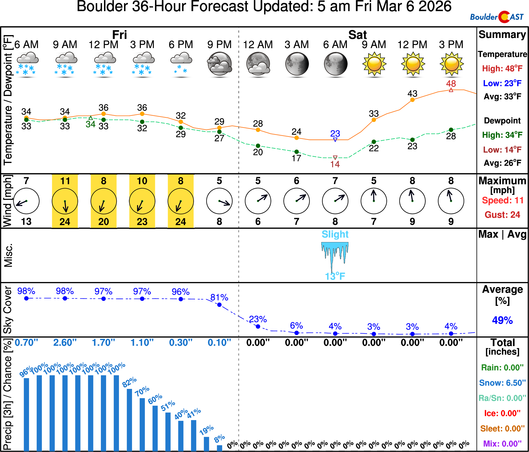
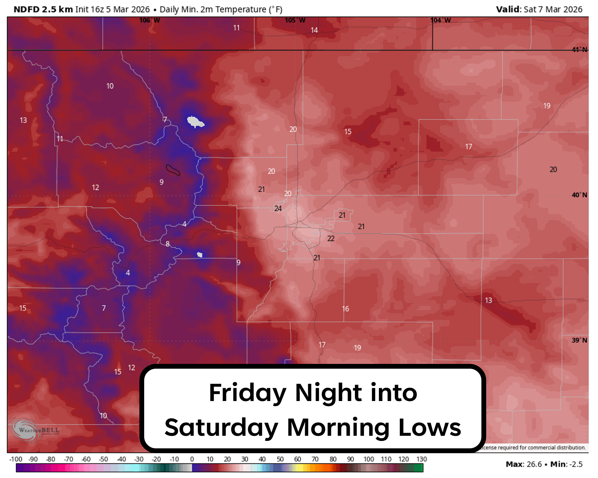
With skies likely to at least partially clear out Friday night and with fresh snow covering much of the area, low temperatures will drop towards 20 degrees across the lower elevations, with teens and single digits in the higher terrain. Keep in mind this is only a few degrees below normal for this of year, but the plethora of trees budding weeks ahead of schedule may not like it!
Things will quickly clear out on Saturday as the storm splits and the two pieces take their leave from the Front Range in a hurry. Sunshine will return with highs in the lower 50s on Saturday, before surging into the 60s and even lower 70s by Sunday and Monday.
Bottom Line
Despite the quirks of this storm—its split structure, the pesky downslope north of Denver, and the narrow temperature margins in spots—it’s poised to deliver something the Front Range has been sorely missing: meaningful moisture and a legitimate round of wintry weather. Snowfall totals will vary dramatically over short distances (especially around Boulder), and some lower‑elevation areas will struggle to accumulate snow (sorry Greeley/Longmont). More importantly though, the liquid equivalent will be solid across the board, offering a much‑needed boost to our parched soils and reservoirs, while the nearby Mountains will get a nice jolt to their struggling snowpack. By Saturday the sun will already be back, and by Sunday and Monday we’ll be rocketing into the 60s and 70s. After a dismal winter defined by near‑misses and rain, this one at least reminds us what the winter season should feel like in Colorado, even if only for a day…
Spread the word, share our crazy Colorado weather:
Go Premium, get all the perks.
Daily Forecast Updates
Get our daily forecast discussion every morning delivered to your inbox.
All Our Model Data
Access to all our Colorado-centric high-resolution weather model graphics. Seriously — every one!
Ski & Hiking Forecasts
6-day forecasts for all the Colorado ski resorts, plus more than 120 hiking trails, including every 14er.
Smoke Forecasts
Wildfire smoke concentration predictions up to 72 hours into the future.
Exclusive Content
Weekend outlooks every Thursday, bonus storm updates, historical data and much more!
No Advertisements
Enjoy ad-free viewing on the entire site.


You must be logged in to post a comment.