
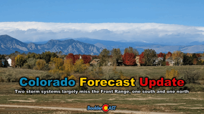
Clouds roll in Thursday as a compact storm system approaches from the southwest—but don’t expect much more than a few sprinkles and high mountain snow. Boulder and Denver stay mostly dry, with mild temps in the 60s and a sunnier stretch ahead for Friday and Saturday. A stronger trough will arrive Sunday into early next week, bringing gusty winds and a taste of cooler fall air, but once again little in the way of meaningful rain or snow east of the Mountains. Read on for all the details.
At a Glance:
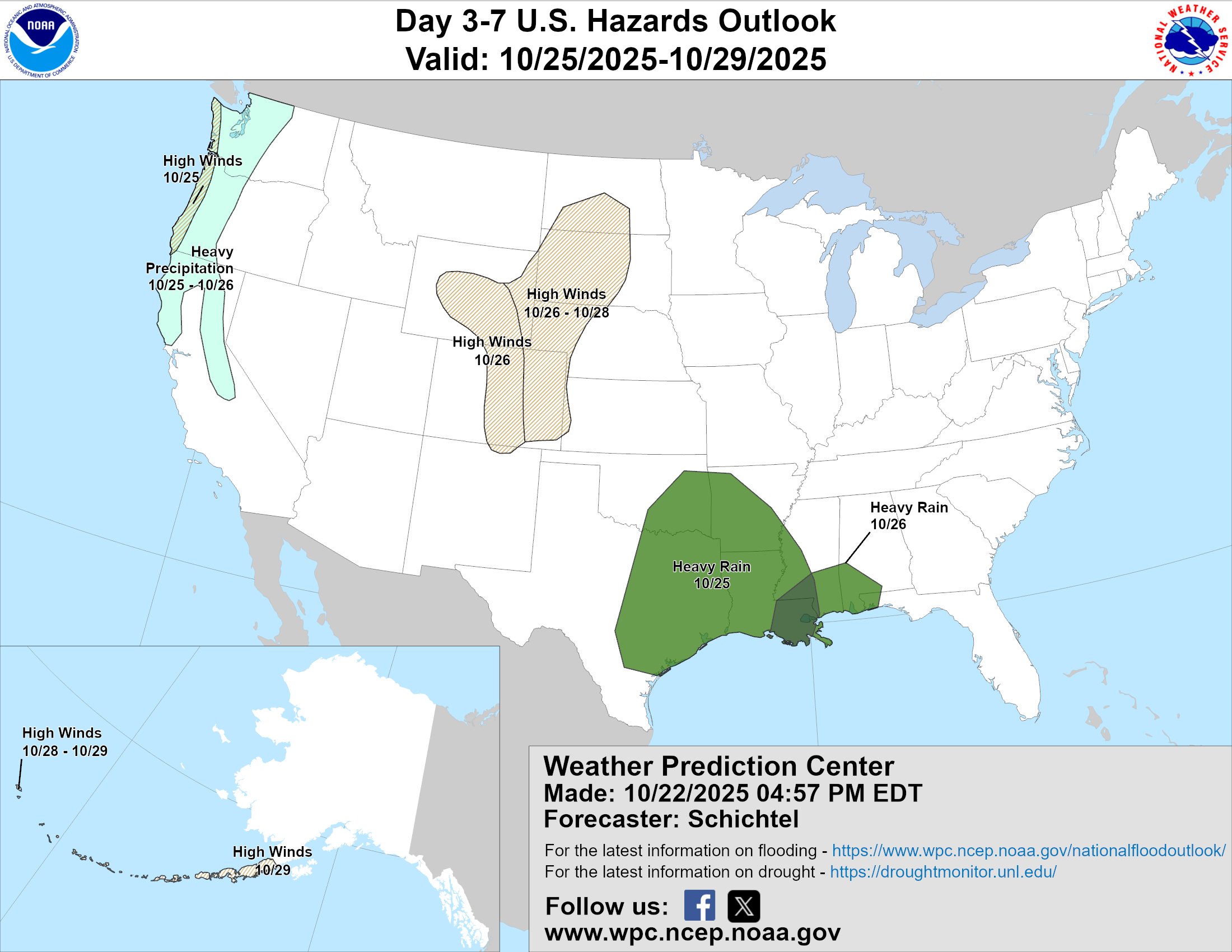
- Incoming Southern-Track Low: A compact upper-level low is approaching Colorado from the southwest, bringing increased cloud cover but limited moisture; most precipitation will stay south of Denver and I-70.
- Mountain Snow Totals: Light snow is expected along I-70 mountain passes today and tonight, with rain below 9,000 feet and minimal accumulation.
- Small Rain Risk Down Low: Boulder and Denver will remain mostly dry under overcast skies, with only isolated showers possible tonight; surface upslope is lacking, though some elevated upslope exists.
- Trending Quiet Friday & Saturday: Thursday will reach the middle 60s, slightly cooler due to increased cloud cover; Friday and Saturday will be dry and warmer, with highs climbing toward 70 by Saturday.
- Next Windy Trough Late Sunday: A stronger trough arrives Sunday into early next week, likely staying north of Colorado; expect gusty west-northwest winds and cooler temperatures, but little chance of rain or snow. Fire danger will increase.

Go Premium, get all the perks.
Daily Forecast Updates
Get our daily forecast discussion every morning delivered to your inbox.
All Our Model Data
Access to all our Colorado-centric high-resolution weather model graphics. Seriously — every one!
Ski & Hiking Forecasts
6-day forecasts for all the Colorado ski resorts, plus more than 120 hiking trails, including every 14er.
Smoke Forecasts
Wildfire smoke concentration predictions up to 72 hours into the future.
Exclusive Content
Weekend outlooks every Thursday, bonus storm updates, historical data and much more!
No Advertisements
Enjoy ad-free viewing on the entire site.
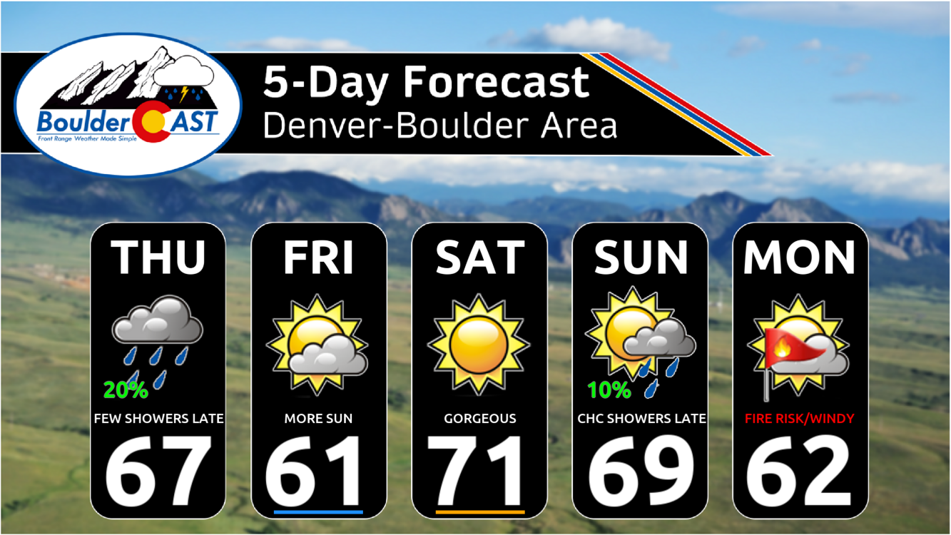
Thursday: Cloudier skies, staying mild
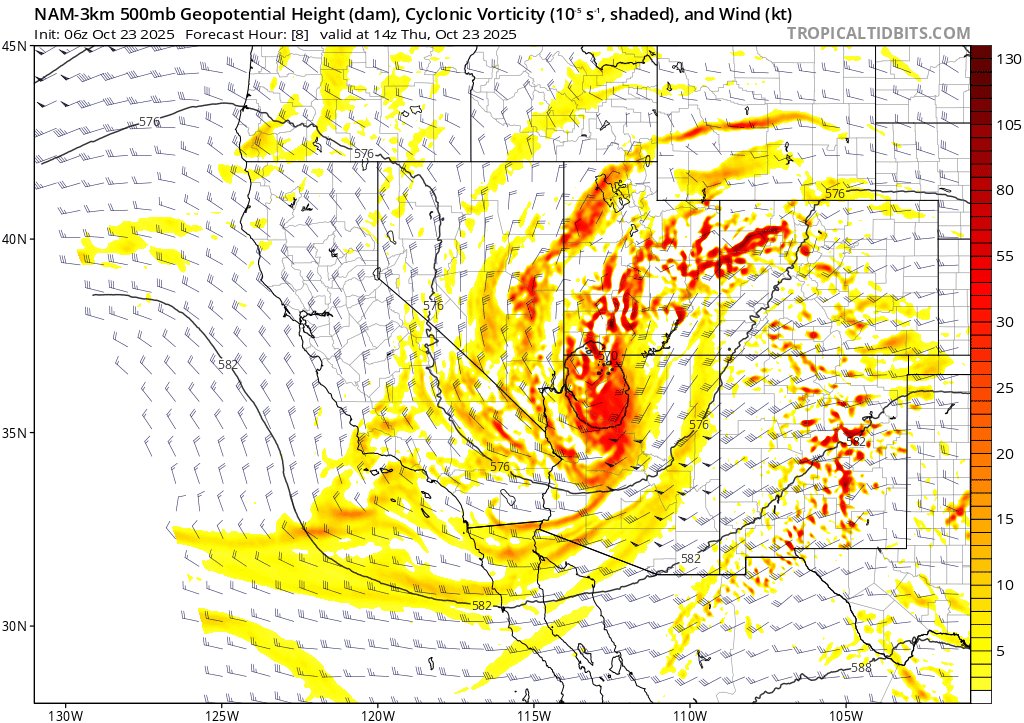
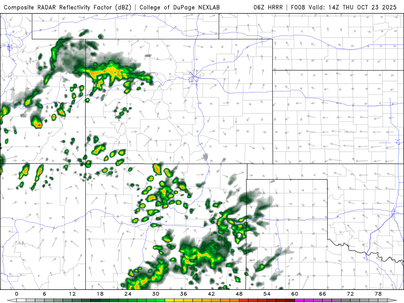
Clouds will thicken across the Front Range today as a compact upper-level low spins its way northeast from the Desert Southwest. GOES-East water vapor imagery shows the low currently parked near Las Vegas, and it’s sending a steady stream of mid and upper-level moisture into Colorado.
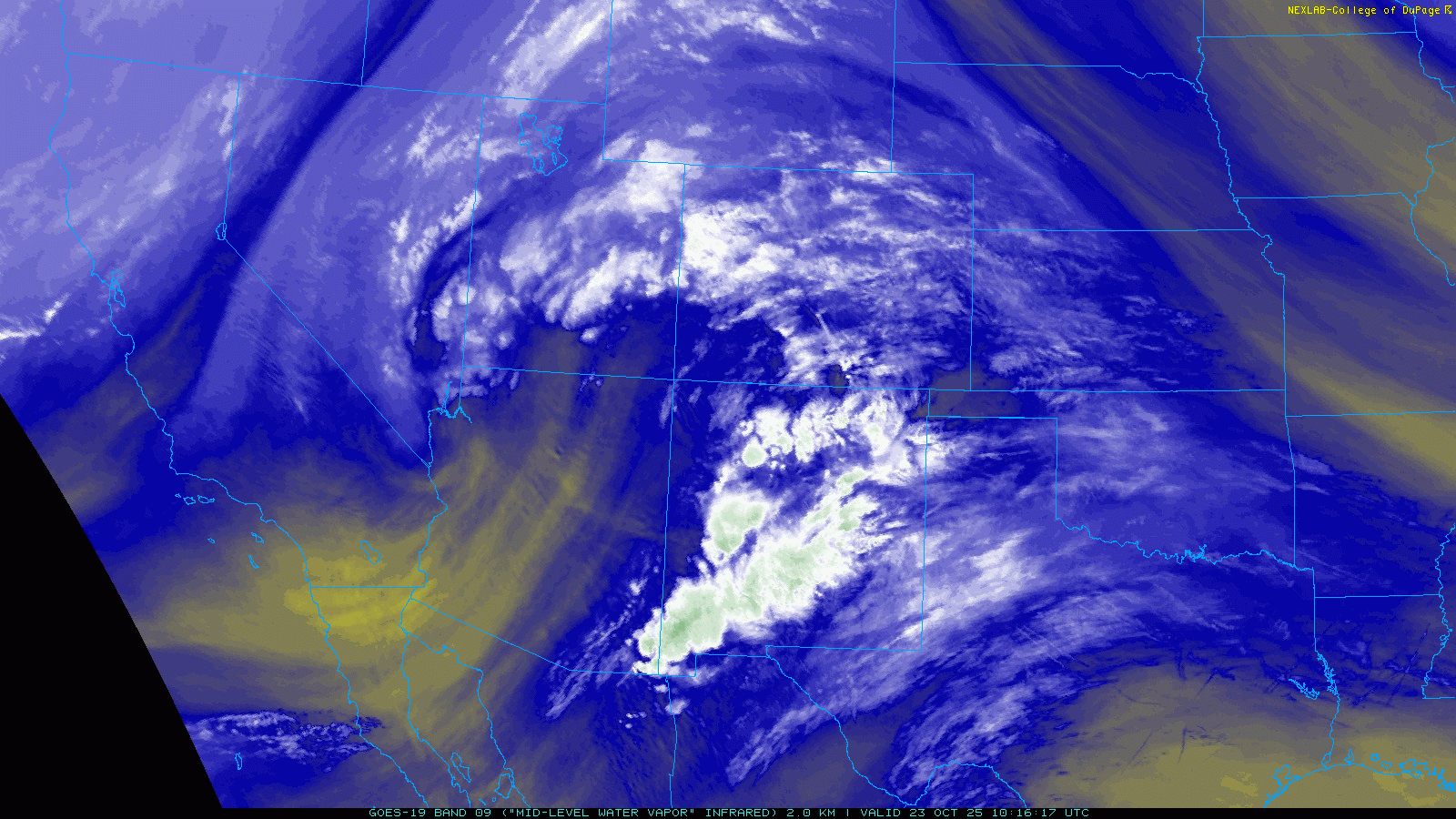
The petite low pressure is expected to track almost due eastward over the next 48 hours, across the Four Corners region Thursday night, across southern Colorado on Friday, and then into the Oklahoma Panhandle by Friday night.
While the satellite view looks impressive—and the storm’s track is typically ideal for Front Range impacts—the system itself is small, weak, and moisture-starved. Most of the meaningful precipitation will stay south of Denver, with rain chances increasing toward Pueblo and snow confined to the higher peaks along and south of I-70.
Expect light snow today and tonight along the I-70 passes, with rain below about 9,000 feet. Accumulations will be modest—maybe a couple inches in most cases. Some higher peaks in central Colorado may see up to 6 inches.
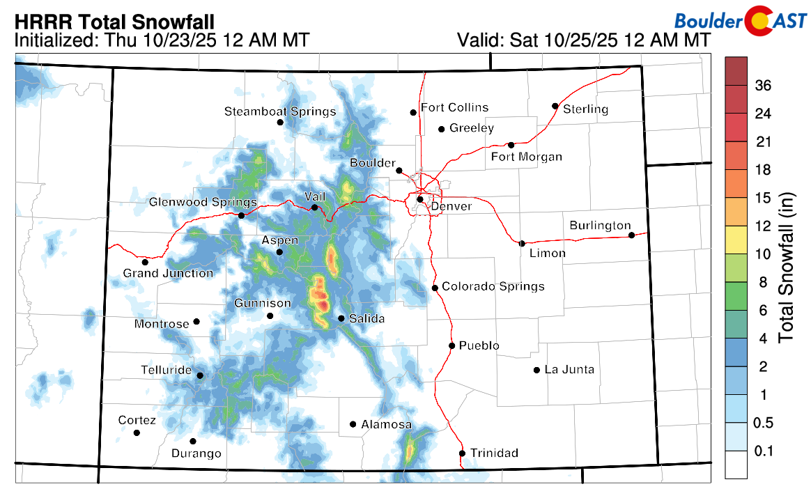
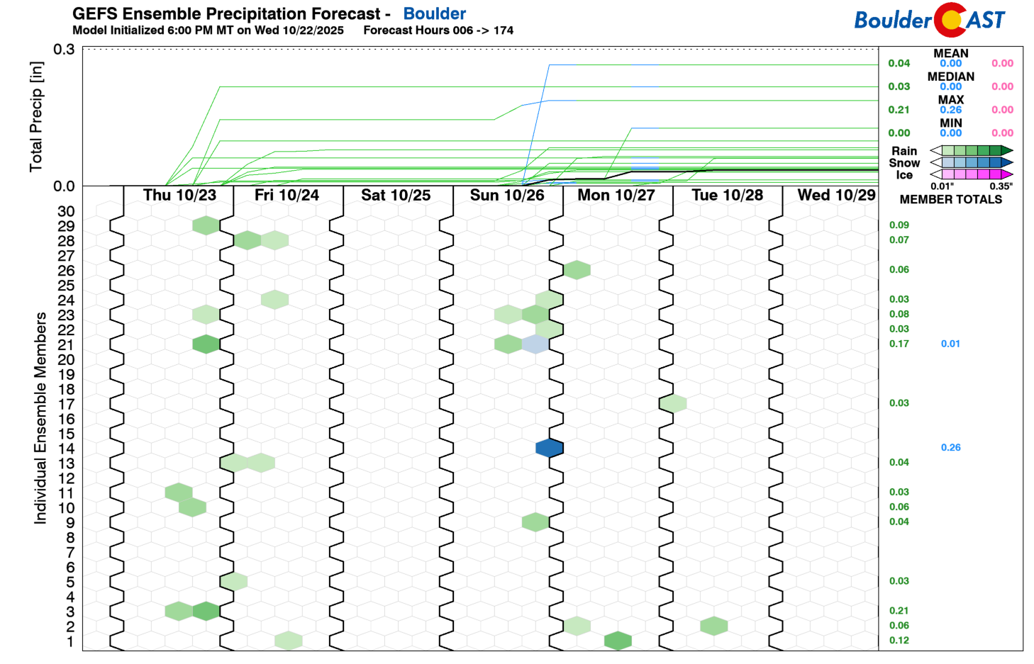
Boulder and Denver will stay mostly dry under largely cloudy skies. A few spotty showers or sprinkles could pop up Thursday evening and overnight as the low drifts into southwest Colorado. Surface moisture remains limited, and there’s little to no upslope at ground level. Interestingly, there is decent upslope aloft, an unusual setup, but it’s unlikely to squeeze out much precipitation at lower elevations.
Highs today will land in the mid to upper 60s, a touch cooler than recent days thanks to the increased cloud cover. If we catch a few breaks of sun this afternoon, as most models show, that’ll help nudge temps toward the warmer end of that range or even above 70°.
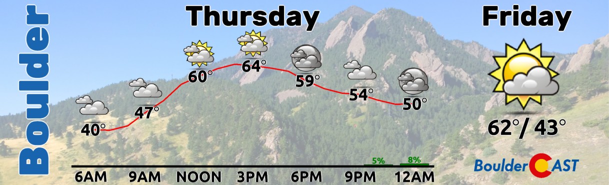
Friday & Saturday: A return to pleasant
By Friday afternoon, the storm in question will exit eastward, and we’re left with dry, stable conditions. Friday will top out in the lower 60s, while Saturday warms nicely toward 70°F under mostly sunny skies.
Sunday & beyond: Downslope winds, mountains snow
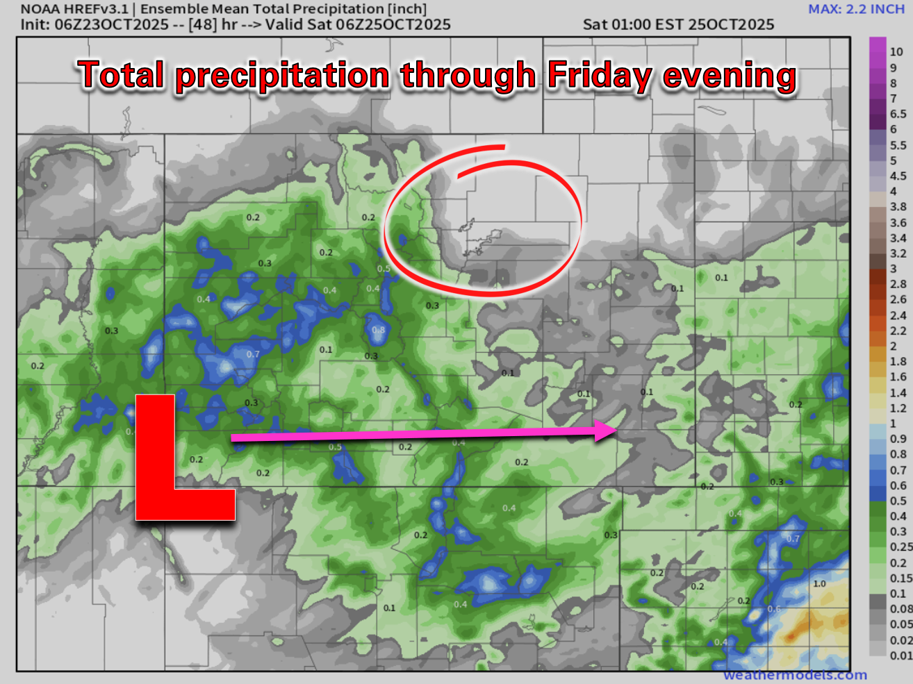
Sunday into early next week the next significant trough will come ashore into the Pacific Northwest. The latest ensemble guidance tends to keep the storm track well north of Colorado in Montana, so at this point it doesn’t look like this trough will bring any risk of rain or snow to the Denver Metro area. More than likely it would just provide strong westerly flow to northern Colorado, with orographic snow in the northern Mountains and dry downslope winds into Boulder and Denver.
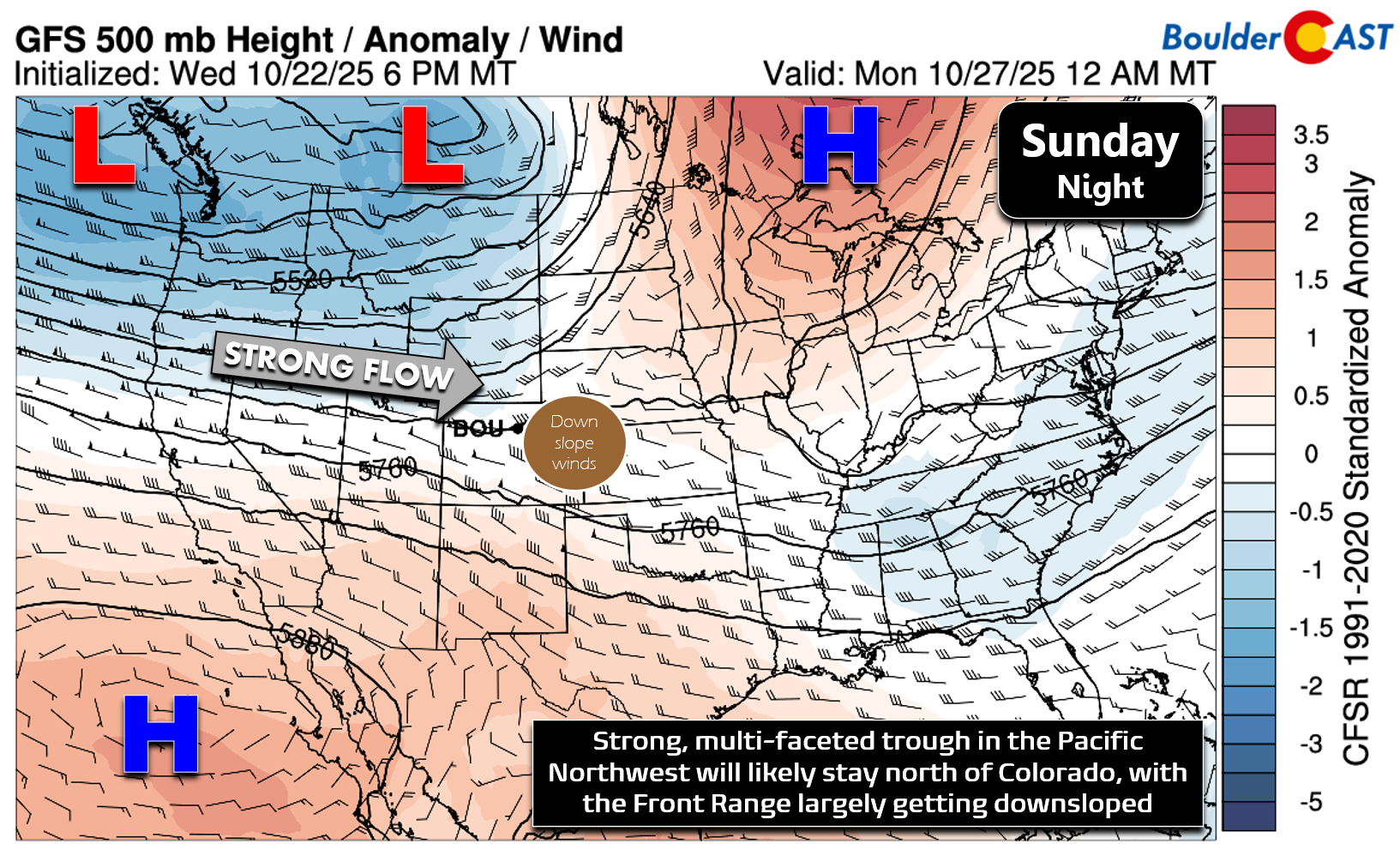
The Weather Prediction Center is already flagging a risk for high winds Sunday through Tuesday, with the most likely window for gusty west-northwest winds being Sunday night into Monday night for our immediate area. Gusts of 50+ MPH are not out of the question for favored windy locations. Given the dry fuels, this will likely translate into increased fire danger for a chunk of eastern Colorado.
As mentioned, under this largely downslope pattern, the risk for any rain and snow looks quite low with the trough next week. There’s only a few sporadic ensemble members producing precipitation in Boulder with next week’s trough, mainly showing up late in the day Sunday or Sunday night.
Even without precipitation, the trough will usher in cooler air. Expect highs to dip into the 50s and low 60s starting Monday and those below normal readings will stick around for several days.
Though our team is always looking forward to a return of winter weather (who isn’t really?!), there’s still no end to our 2025 First Snow Contest in sight, with the normal (median) date of our first snow now squarely in the rearview mirror. We’ll likely have to wait until sometime in November for our first flakes.

Spread the word — share Colorado weather:
Go Premium, get all the perks.
Daily Forecast Updates
Get our daily forecast discussion every morning delivered to your inbox.
All Our Model Data
Access to all our Colorado-centric high-resolution weather model graphics. Seriously — every one!
Ski & Hiking Forecasts
6-day forecasts for all the Colorado ski resorts, plus more than 120 hiking trails, including every 14er.
Smoke Forecasts
Wildfire smoke concentration predictions up to 72 hours into the future.
Exclusive Content
Weekend outlooks every Thursday, bonus storm updates, historical data and much more!
No Advertisements
Enjoy ad-free viewing on the entire site.


You must be logged in to post a comment.