It’s going to be a scorcher across the Front Range this week—with temperatures climbing fast and flirting with triple digits by midweek. But just as the heat peaks, a pattern shift arrives that will bring cooler weather and a chance of storms again by Friday. Read on for all our full outlook of the weather week ahead.
This week’s highlights include:
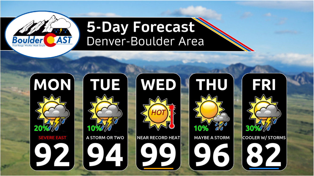
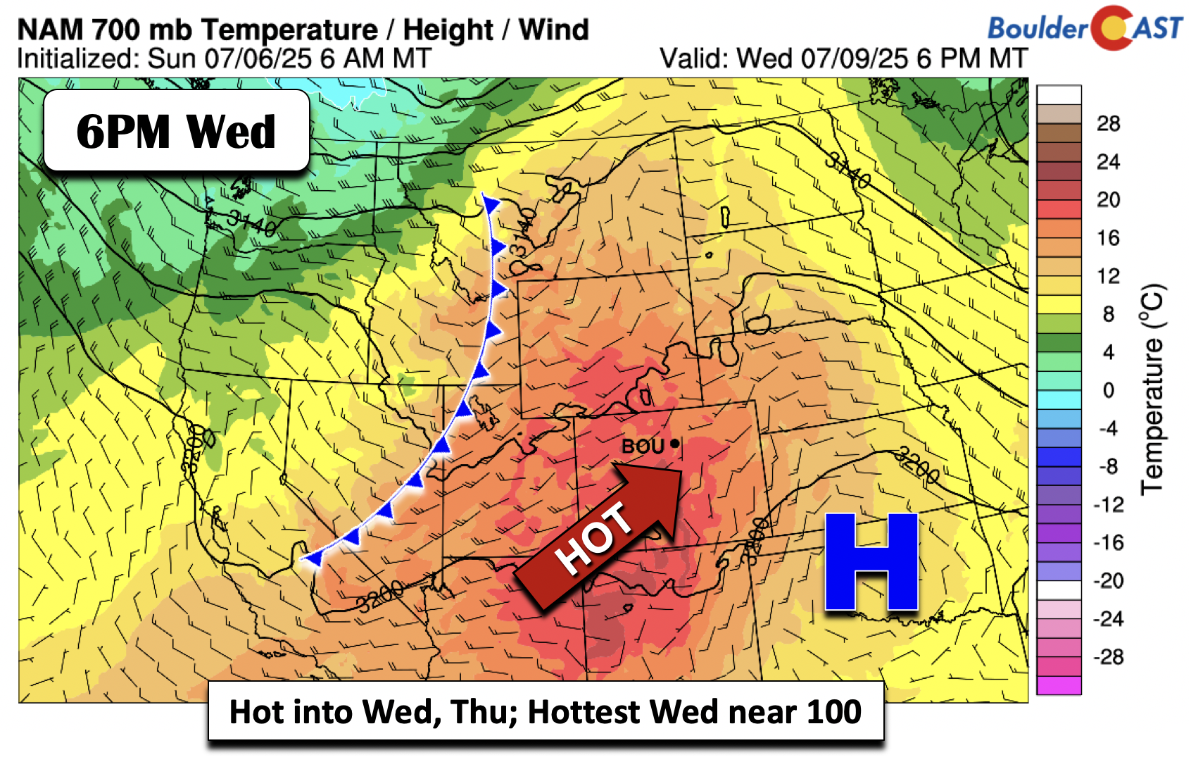
- Blistering Heat Builds: A strong ridge moves in from the Desert Southwest, pushing highs into the upper 90s and possibly near 100°F by Wednesday—potentially breaking Boulder’s daily temperature record.
- Storm Risk Early Week: While most areas stay dry, isolated storms (10–20% chances) are possible through midweek, with the greatest severe threat east of I-25, especially Monday in far northeast Colorado.
- Cold Front Arrives Late Week: A front moves through Thursday night into Friday, bringing cooler temps (highs in the 80s) and increased chances for storms, some possibly severe.
- Active Pattern Potential into Weekend: Post-frontal upslope flow and instability may set up a somewhat stormier, unsettled weekend—but forecast confidence is low that far out.
DISCLAIMER: This weekly outlook forecast is created Monday morning and covers the entire upcoming week. Accuracy will decrease as the week progresses as this post is NOT updated. To receive daily updated forecasts from our team, among many other perks, subscribe to BoulderCAST Premium.

Go Premium, get all the perks.
Daily Forecast Updates
Get our daily forecast discussion every morning delivered to your inbox.
All Our Model Data
Access to all our Colorado-centric high-resolution weather model graphics. Seriously — every one!
Ski & Hiking Forecasts
6-day forecasts for all the Colorado ski resorts, plus more than 120 hiking trails, including every 14er.
Smoke Forecasts
Wildfire smoke concentration predictions up to 72 hours into the future.
Exclusive Content
Weekend outlooks every Thursday, bonus storm updates, historical data and much more!
No Advertisements
Enjoy ad-free viewing on the entire site.
Heat Builds Early This Week, Record Temps Possible by Wednesday
We’re kicking off the workweek under mostly dry and increasingly hot conditions. A strong high-pressure ridge is taking shape over the Desert Southwest and will push northward over the next few days, reaching peak intensity in Colorado by Wednesday. That means temperatures will climb steadily—starting in the low to mid 90s early in the week and likely pushing into the upper 90s, even flirting with 100°F by midweek. Boulder could come close to breaking a record on Wednesday; the current record high for July 9th is 99°F, set in 2022.
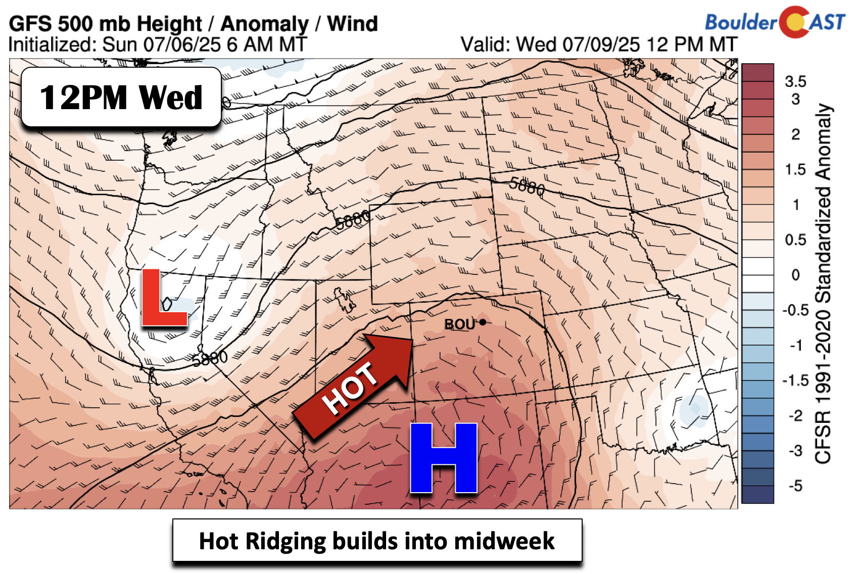
Ensemble data from the GFS model below also supports that midweek sizzle for the Denver Metro area. This graphic also shows a late-week cool down tied to a cold front.
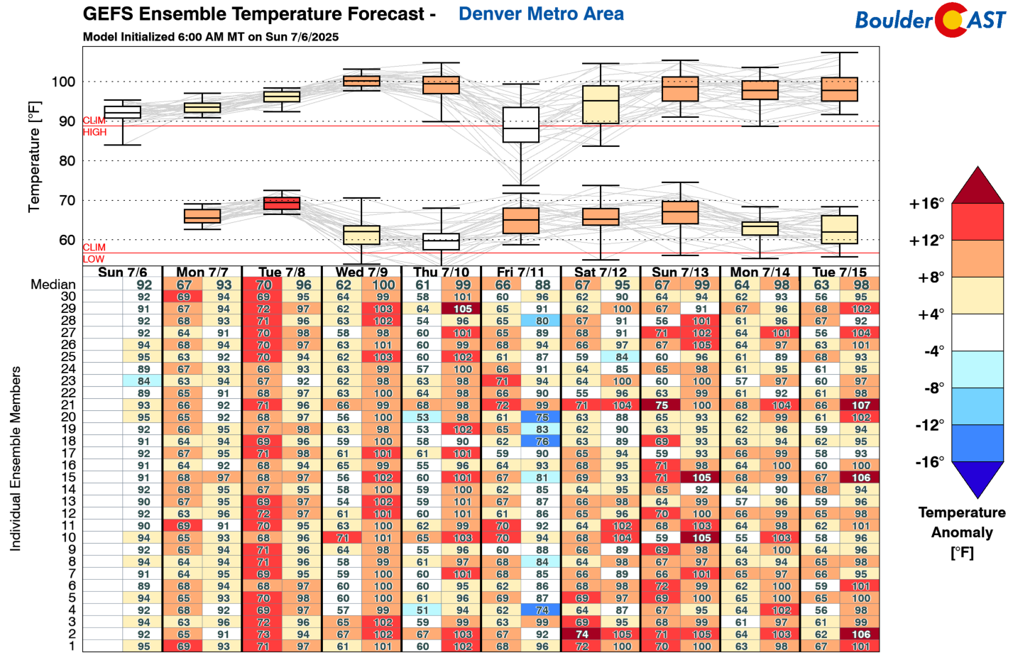
The GFS model suggests temperatures at mid-levels of the atmosphere will be very warm, helping drive those surface highs toward the triple digits. But there’s some relief in sight—a cold front will begin to move across the Rockies late Wednesday, eventually sliding through our area Thursday night or early Friday. That transition will help cool us down and bring a renewed chance of storms late in the week.
Slight Early-Week Storm Risk, Mainly East
Despite the dry start, there’s still a modest 10–20% chance of isolated afternoon and evening storms through Wednesday. The best storm dynamics—instability, lift, and forcing—will be concentrated in far eastern Colorado, especially on Monday. The Storm Prediction Center has placed the northeast corner of the state under an Enhanced Risk for severe storms.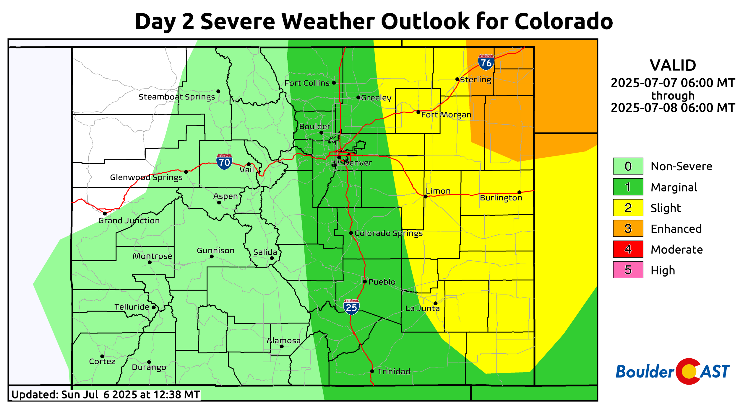
Damaging straight-line winds, large hail, and even a few tornadoes will be possible over far eastern Colorado as the squall line/MCS develops Monday evening. Closer to Boulder, we’re under a Marginal Risk today—so while not zero, the threat is significantly lower.
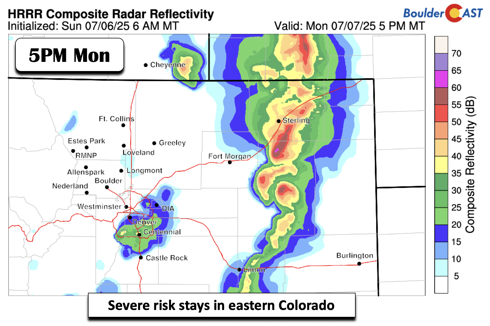
There will be continued risk of severe storms on Tuesday, but that risk will be lower with further reduced storm chances and again the concern will be greatest east of Denver. Tuesday will only have about a 10% chance of storms here.
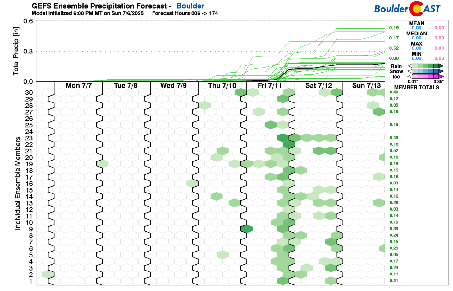
Pattern Shift Late Week: Storms and Cooler Air
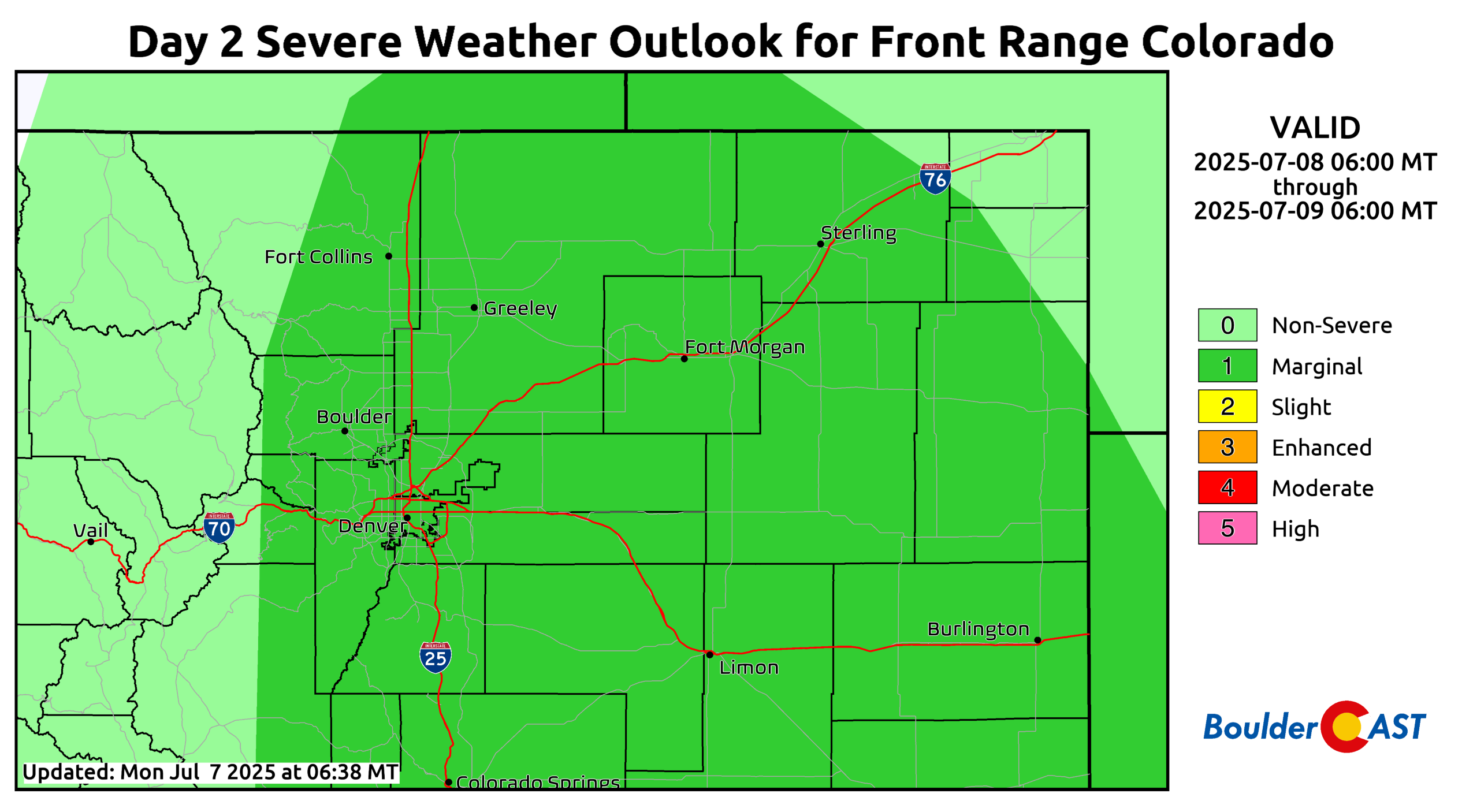
By Thursday, that hot ridge starts to retreat south as the cold front makes its move. Expect one more hot day in the 90s, but with increasing storm chances, some of which could turn severe.
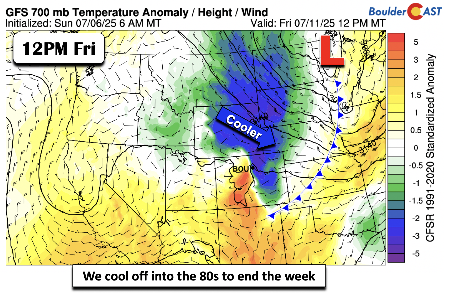
Friday looks like the best bet for more widespread storms—thanks to upslope flow behind the front combining with daytime heating.
Model guidance also strongly leans toward that scenario, giving us cooler temps (highs in the 80s) to close out the week. Won’t that feel nice?
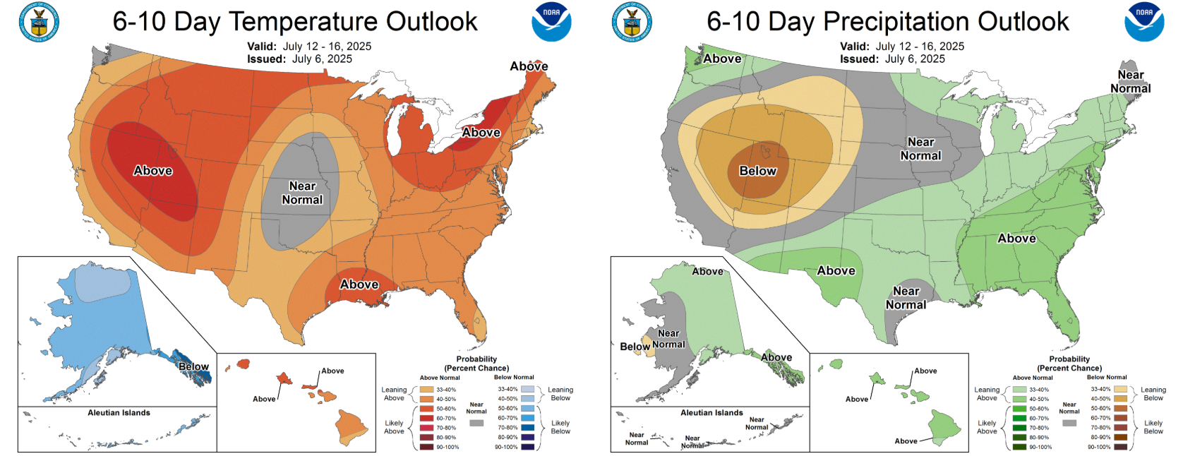
Looking into the weekend, we may be entering a slightly more active pattern overall—but there certainty doesn’t appear to be any significant monsoonal surges gearing up in the pipeline. As always, confidence in the details drops off the farther out we go, so stay tuned.
Forecast Specifics:
Monday and Tuesday: Mostly sunny and warm with highs in the lower to middle 90s for the Plains and low to mid 80s in the Foothills. There will be a chance of afternoon and evening storms, but only about 20%.
Wednesday: Hot and overall dry with near-record highs of near 100 on the Plains and upper 80s in the Foothills.
Thursday: Increasing clouds with a better chance (30%) of late-day scattered showers and storms. Highs in the mid to upper 90s for the Plains and lower 80s in the Foothills.
Friday: Much cooler and below normal with 40% chance of showers and storms. Highs in the low to mid 80s on the Plains and low 70s over the Foothills.
DISCLAIMER: This weekly outlook forecast is created Monday morning and covers the entire upcoming week. Accuracy will decrease as the week progresses as this post is NOT updated. To receive daily updated forecasts from our team, among many other perks, subscribe to BoulderCAST Premium.
Go Premium, get all the perks.
Daily Forecast Updates
Get our daily forecast discussion every morning delivered to your inbox.
All Our Model Data
Access to all our Colorado-centric high-resolution weather model graphics. Seriously — every one!
Ski & Hiking Forecasts
6-day forecasts for all the Colorado ski resorts, plus more than 120 hiking trails, including every 14er.
Smoke Forecasts
Wildfire smoke concentration predictions up to 72 hours into the future.
Exclusive Content
Weekend outlooks every Thursday, bonus storm updates, historical data and much more!
No Advertisements
Enjoy ad-free viewing on the entire site.
Enjoy our content? Give it a share!


You must be logged in to post a comment.