The Front Range is experiencing an exceptionally quiet and warm early autumn weather pattern that is expected to persist through the weekend and into next week. This prolonged dry spell is due to a stubborn ridge of high pressure over the southwestern United States, preventing any significant weather systems from reaching Colorado. Despite a couple of weak cold fronts, temperatures will remain well above normal throughout the extended, with record highs possible on Saturday. Unfortunately, there is no significant rain or snow in the pipeline, exacerbating the ongoing drought and increasing fire danger across the region. Here’s the latest on what is becoming a dire situation.
At a Glance:
- Persistent Warm and Dry Conditions: The region will continue to experience warm, dry, and sunny weather due to a stubborn ridge over the southwestern United States.
- Temperature Fluctuations: Expect cooler temperatures on Thursday due to a weak cold front, but a rebound into the 80s by Friday and Saturday, with potential record highs.
- Fire Danger: Gusty winds ahead of a cold front on Saturday will create critical fire danger across parts of Colorado.
- Extended Forecast: The warm and dry pattern is expected to persist well past mid-October, with little chance of significant rain/snow

Go Premium, get all the perks.
Daily Forecast Updates
Get our daily forecast discussion every morning delivered to your inbox.
All Our Model Data
Access to all our Colorado-centric high-resolution weather model graphics. Seriously — every one!
Ski & Hiking Forecasts
6-day forecasts for all the Colorado ski resorts, plus more than 120 hiking trails, including every 14er.
Smoke Forecasts
Wildfire smoke concentration predictions up to 72 hours into the future.
Exclusive Content
Weekend outlooks every Thursday, bonus storm updates, historical data and much more!
No Advertisements
Enjoy ad-free viewing on the entire site.
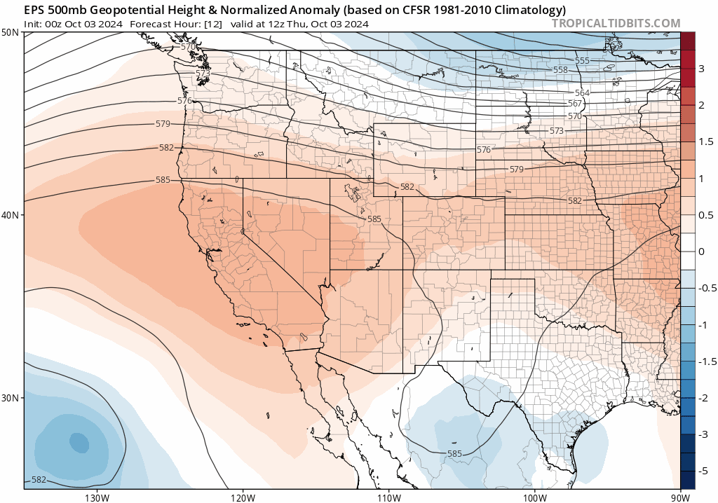
xceptionally quiet and warm conditions will continue to be the main story across the Front Range through the rest of this week, the weekend ahead, and into early next week. The reason for such a lengthy, boring stretch of weather is a pesky ridge which just won’t let go of the southwestern United States. The European ensemble mean 500mb height anomaly forecast animation below runs through Monday evening and shows the aforementioned problematic ridge. Though there will a couple shortwaves clipping along the Canadian border at times, which will deflate the ridge somewhat, it won’t fully release its grasp on Colorado until sometime around the third week of October — if we’re lucky. For now, we’re essentially stuck in this hellish warm, dry, sunny, and worst of all, snowless pattern!
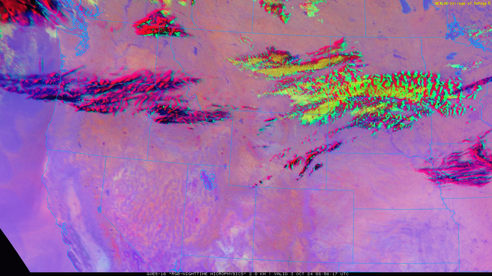
GOES-East shows almost no clouds over the state of Colorado this morning, save for a few streaks up along the Wyoming Border which are associated with the right-entrance region of a jet-streak. There’s certainly not enough moisture for these clouds to produce any rainfall.
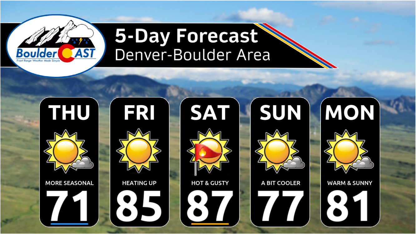
Thursday will be mostly sunny but much cooler behind a weak, secondary cold front (we also had a weak front last evening). Today’s front should pass through the Denver Metro area between 7 and 9AM with little fanfare. Winds out of the north-northeast will make for a reduced warm-up with temperatures only landing only around 69 to 73°F.
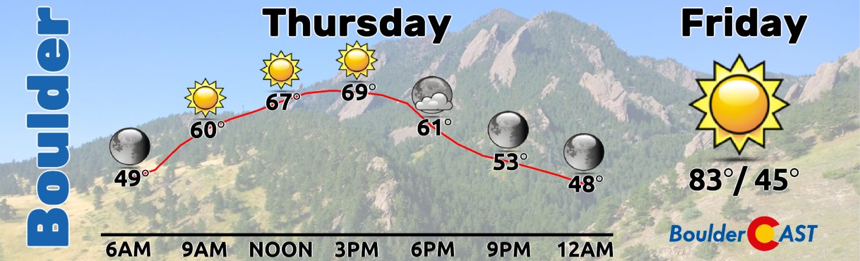
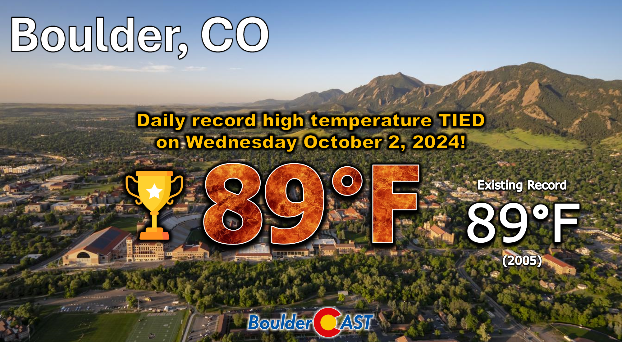
Thursday will be approximately 20° colder than the record high temperature we tied yesterday… both Boulder and Denver hit 89°F tying (Boulder) and breaking (Denver) their existing records for October 2nd. Wednesday was Boulder’s third hottest October day on record and it definitely felt that way!
Friday will see temperatures rebound under sunny skies into the low to middle 80s with light winds.
Saturday we push back towards record heat with highs a few degrees hotter in the upper 80s. The record high for Saturday in Boulder is 90° set in 1947 — don’t see us getting quite that hot, but it is within reach. There will be a cold front working south across northeast Colorado during the day which may nix our chances at seeing record highs. However, currently the front looks set for an afternoon arrival (~1 to 4PM). It’s a weak front overall, but its timing will play a key role in potential record highs. Furthermore, gusty west-southwest winds ahead of the front will create critical fire danger across a portion of Colorado, likely including at least some if not the entire Denver Metro area and nearby terrain.
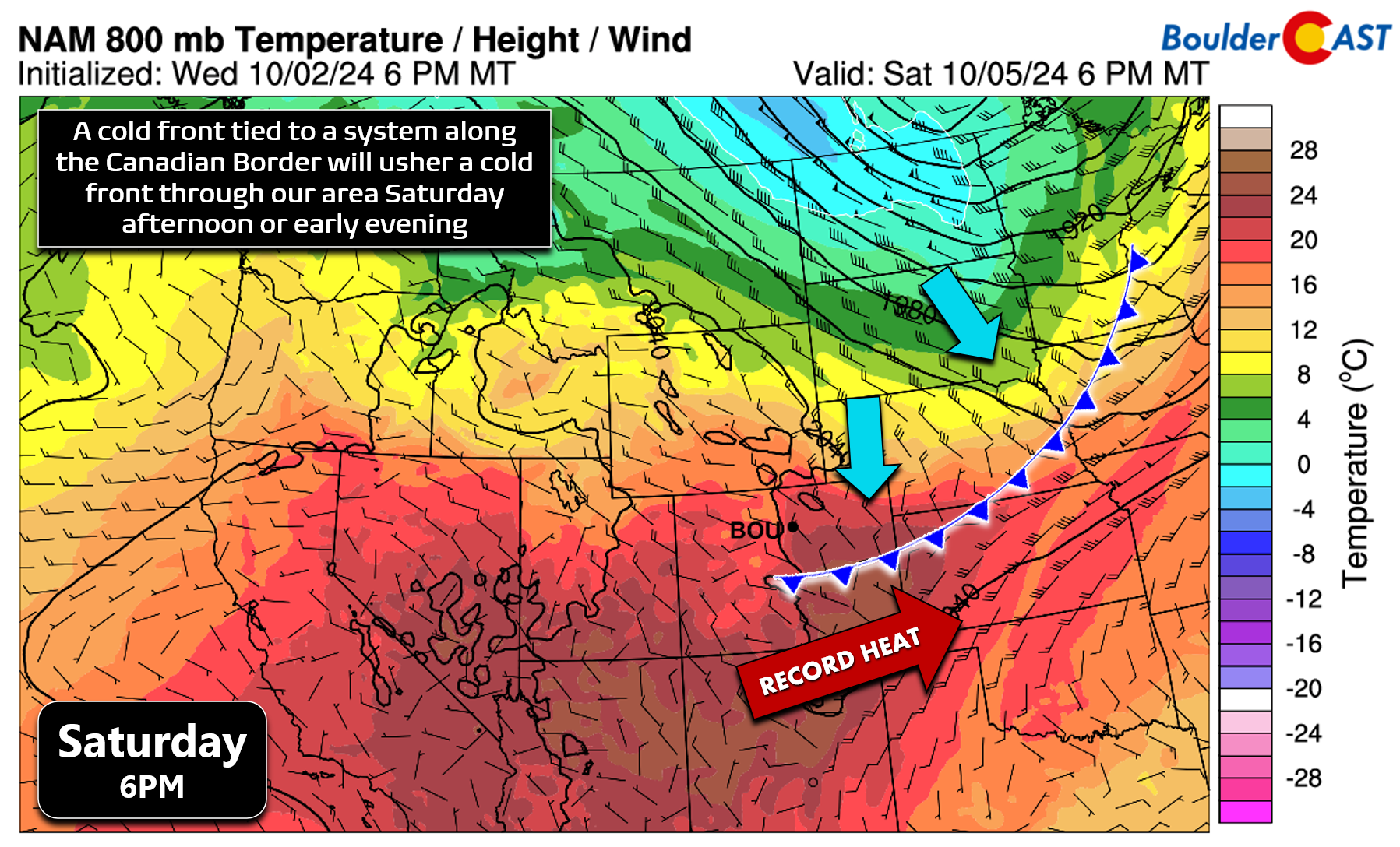
Sunday will be colder on the backside of that front, with highs dropping down into the 70s or lower 80s. It’ll still be mostly sunny and well above normal. Monday will continue the unceasing trend of warm, sunny and dry conditions. We should get back into the lower 80s with no hope for any rain.
The extended forecast looks more like summer than autumn, doesn’t it?
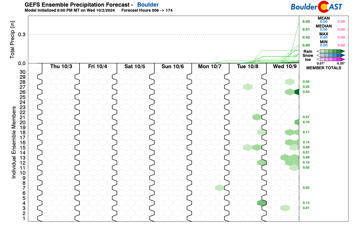
Here’s what the next six days of precipitation look like for Colorado. Yay!
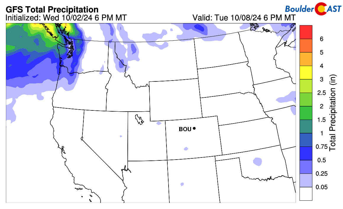
Ensembles are still showing slight rainfall chances returning to our area around the middle of next week, but there is little consensus which usually doesn’t bode well. With the ridge pattern holding so strong, I don’t see how we can manage to get much rainfall under this setup. These would likely be just spotty showers and thunderstorms, if anything at all. There’s no sign of any real storm systems reaching Colorado over the next 10 to 14 days.
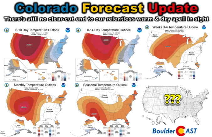
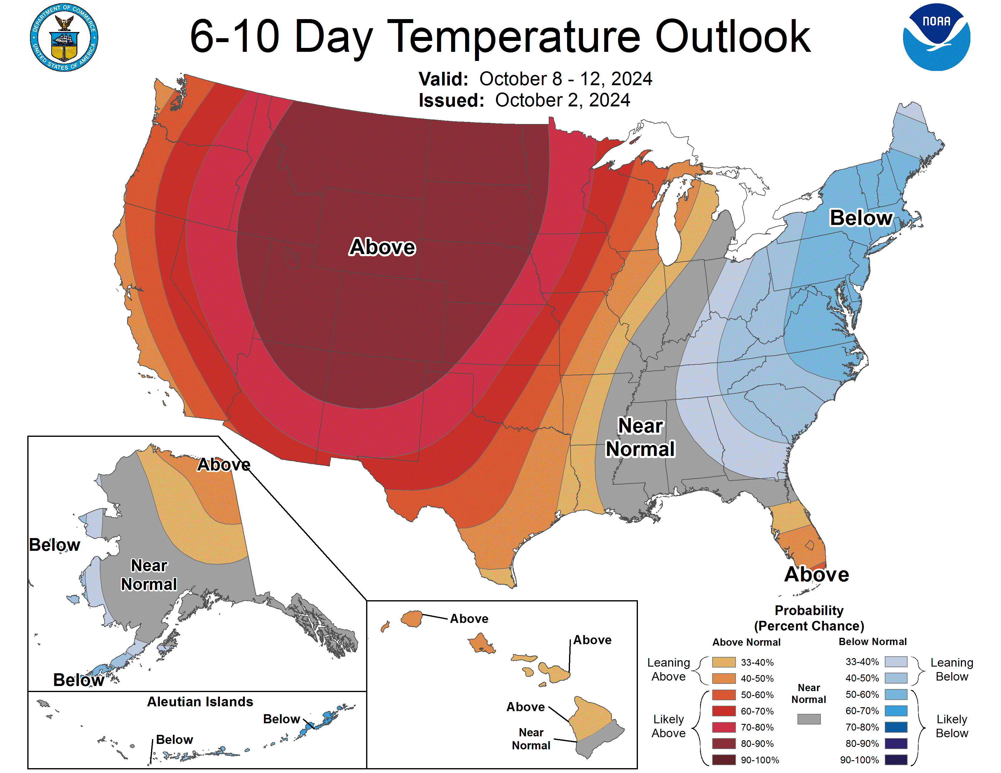
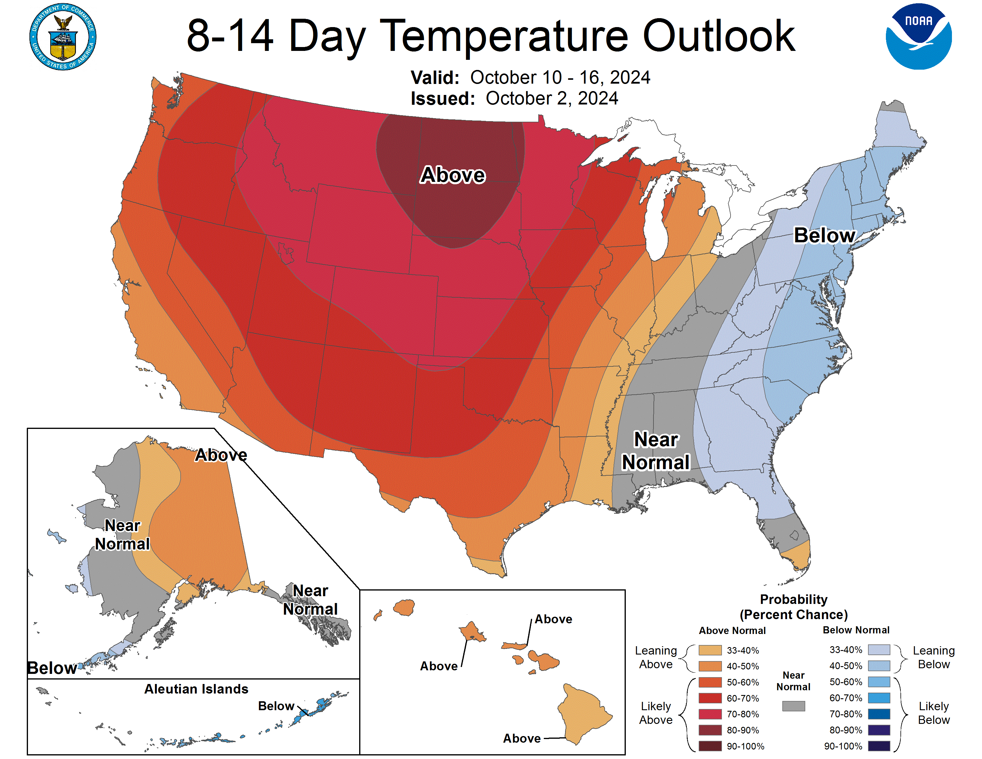
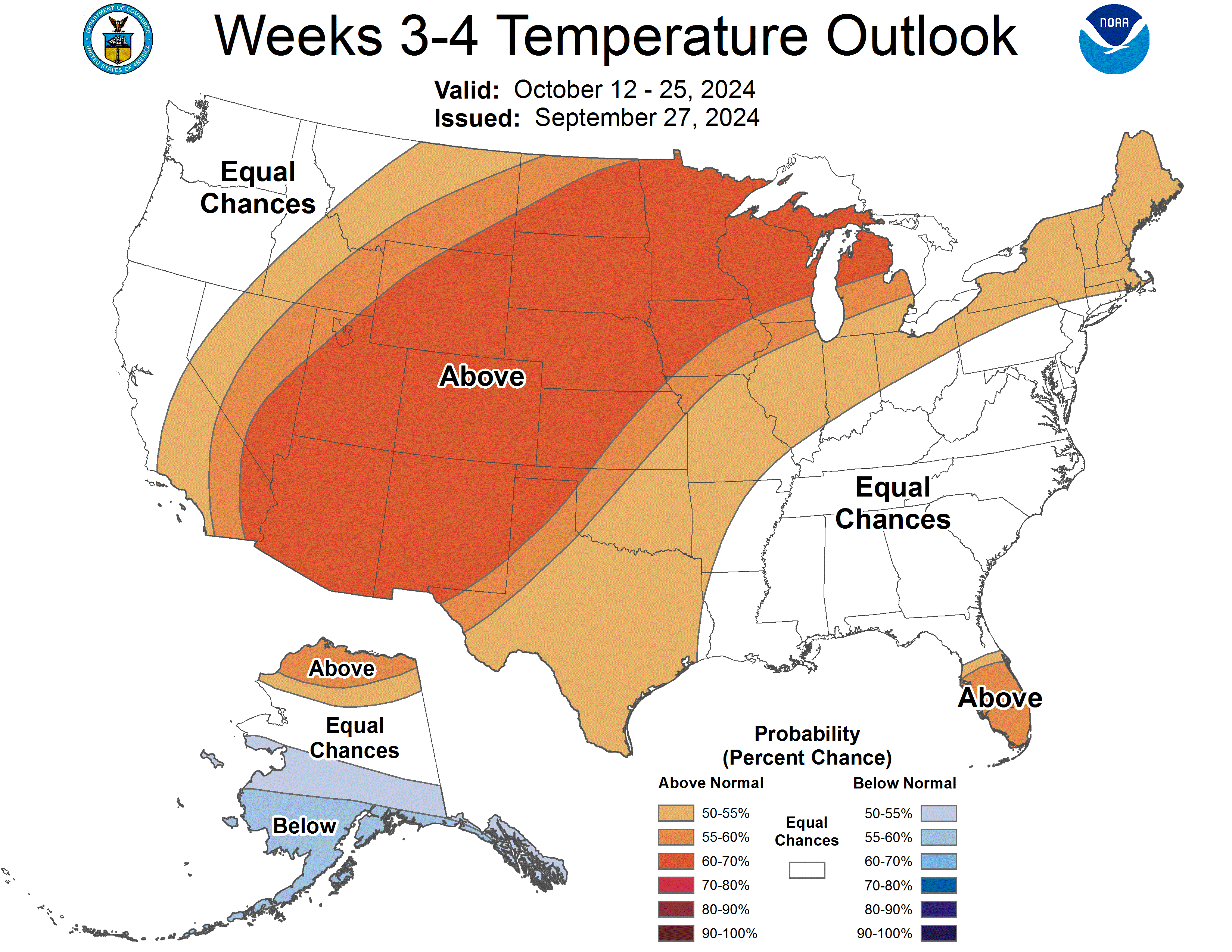
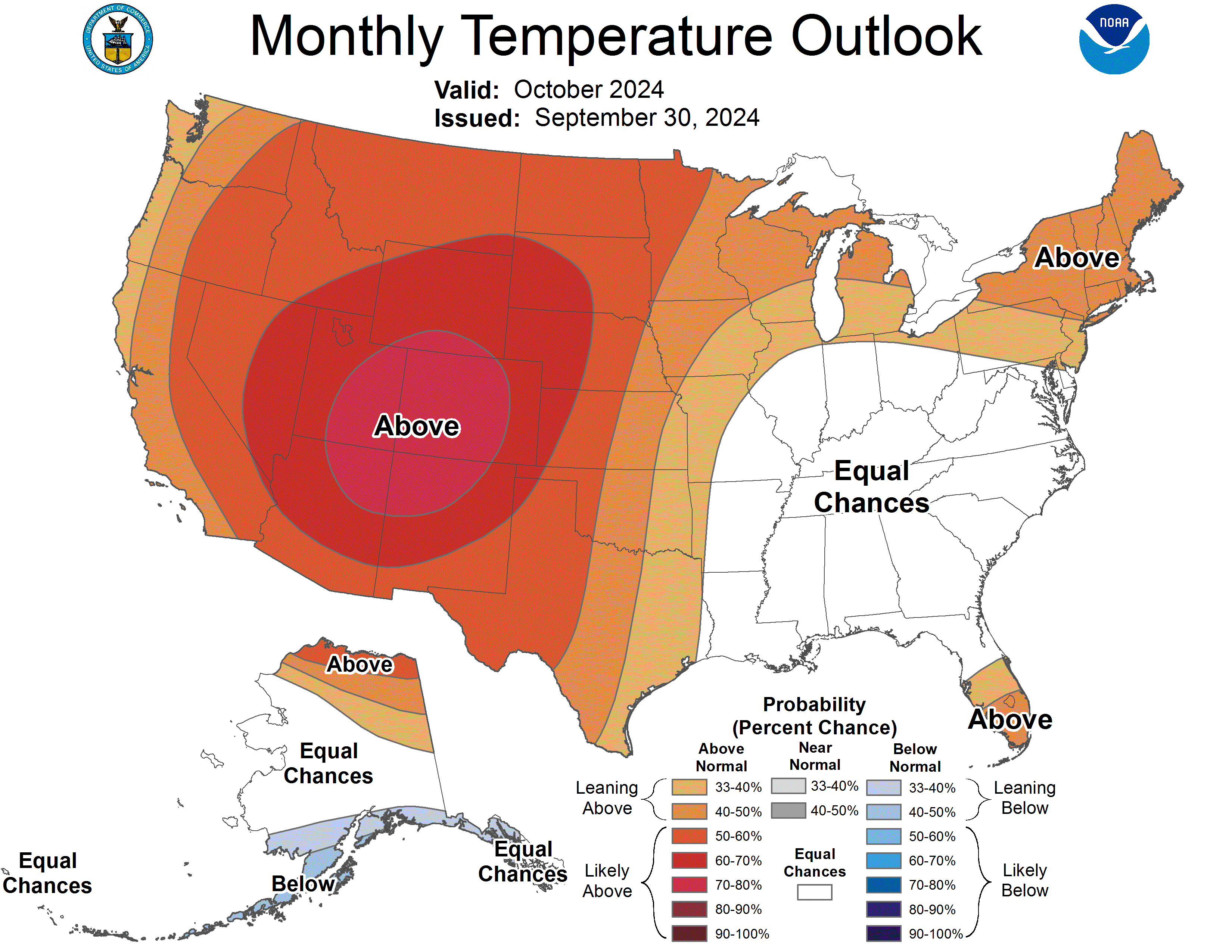
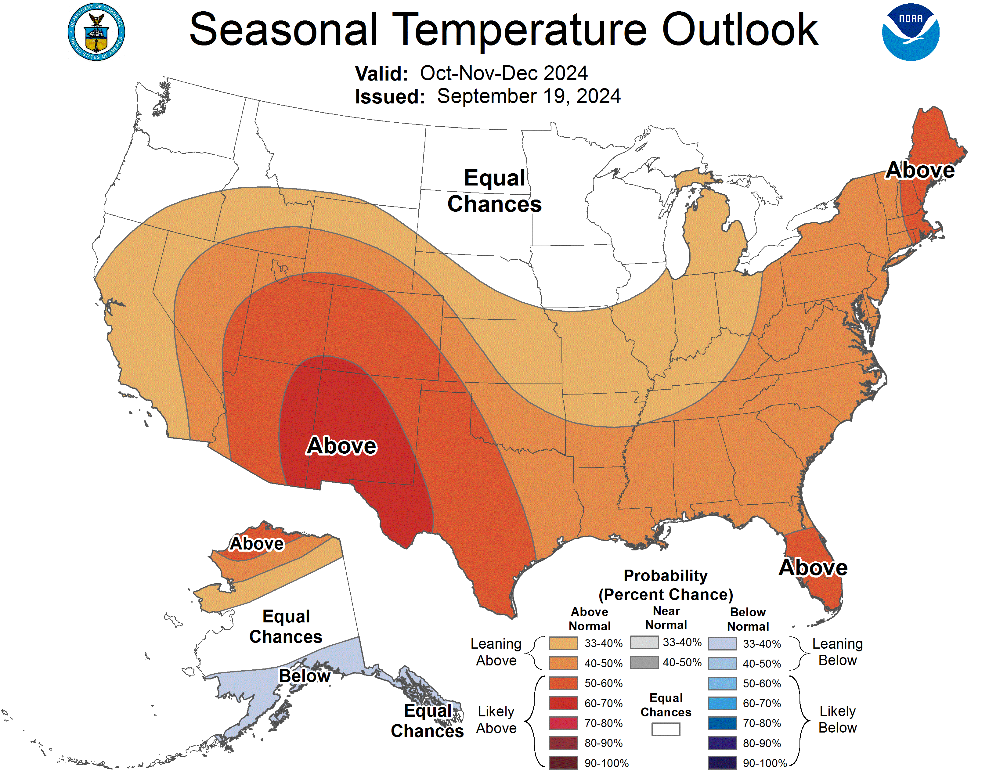
It’ll also continue to be very warm during this extended period of dryness as our vegetation continues to prime itself awaiting the next wildland fire ignition. There literally isn’t a map currently published by the CPC right now that doesn’t paint the Front Range in a reddish hue. This is not good at all, folks…
Get BoulderCAST updates delivered to your inbox:
Go Premium, get all the perks.
Daily Forecast Updates
Get our daily forecast discussion every morning delivered to your inbox.
All Our Model Data
Access to all our Colorado-centric high-resolution weather model graphics. Seriously — every one!
Ski & Hiking Forecasts
6-day forecasts for all the Colorado ski resorts, plus more than 120 hiking trails, including every 14er.
Smoke Forecasts
Wildfire smoke concentration predictions up to 72 hours into the future.
Exclusive Content
Weekend outlooks every Thursday, bonus storm updates, historical data and much more!
No Advertisements
Enjoy ad-free viewing on the entire site.
Enjoy our content? Help us out and give it a share:


You must be logged in to post a comment.