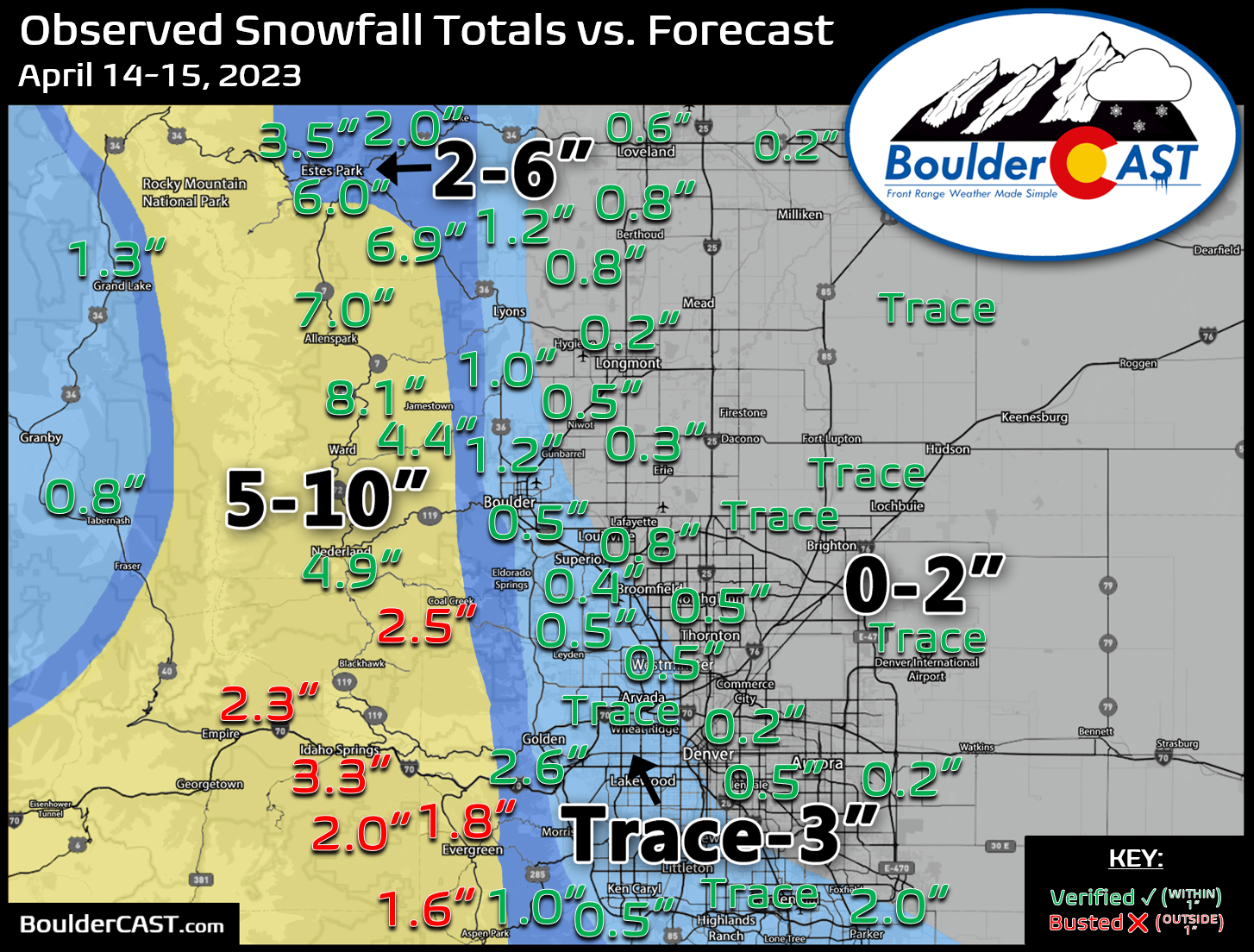
Shown below is our snowfall forecast map issued Thursday evening with actual storm totals overlaid. Green values indicate that our forecast verified to within one inch of the observed snowfall total. Red numbers did not. We had fairly good verification across most of the immediate Boulder-Denver area which received generally a trace to 2″ of wet snowfall despite above freezing temperatures throughout the event. Officially 0.5″ of snow fell in Boulder, but just a trace for Denver at DIA. The highest totals, as expected, were in the Foothills of Boulder and Larimer County which saw 5 to 8″.


You must be logged in to post a comment.