There was a lot of complaining this week about the poor snow forecast, but it actually turned out pretty okay — not amazing, but definitely okay. Let’s take a quick look at the totals from across the area for what was a rather impressive winter storm by January standards. We also peek ahead to the cold and snowy stretch of weather to come.
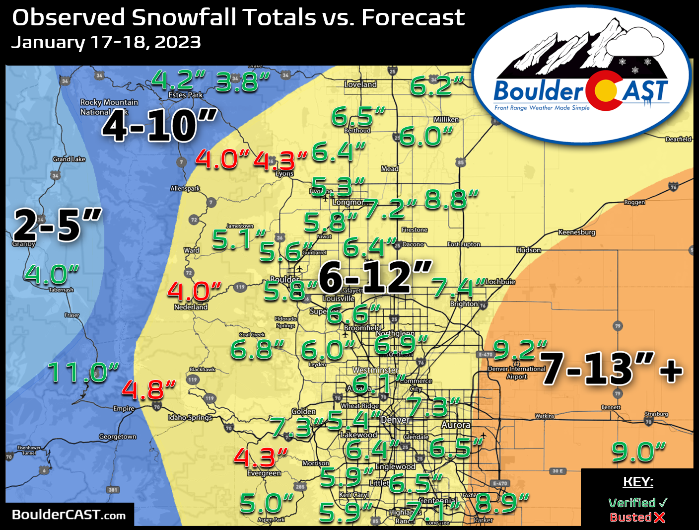
Shown below is our snowfall forecast map issued Tuesday morning with actual storm totals overlaid. Green values indicate that our forecast verified to within one inch of the observed snowfall total. Red numbers did not. Denver officially reported 9.2″ of snow at DIA, while Boulder recorded 5.8″. Most of us saw a broad brush of 5 and 9″ — definitely on the low end of expectations, but not a complete surprise. The only places that truly busted were the Foothills — an area we did caution would see the lowest totals and had the highest bust potential. The 5.8″ of snow that fell in Boulder was a new daily snowfall record for January 18th by the way. The old record was 4.2″ set in 1988.
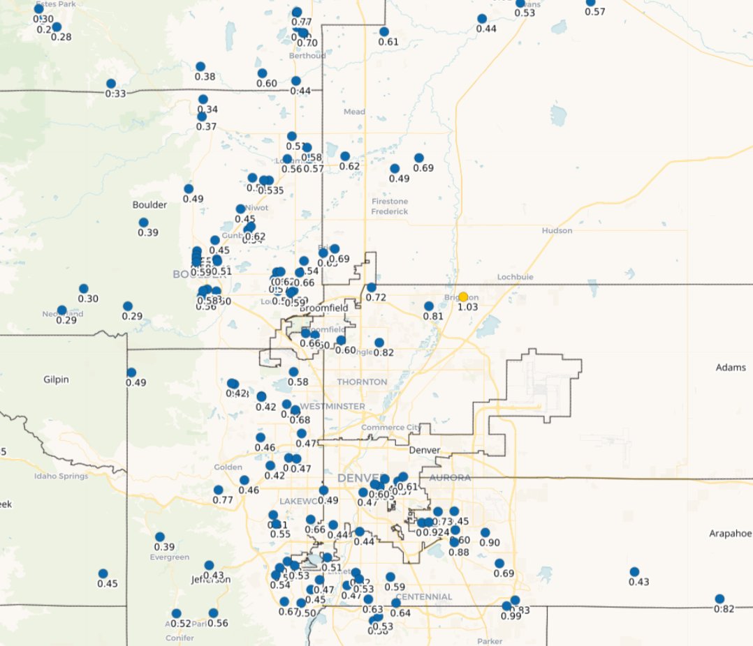
This storm delivered a hefty amount of moisture to the Front Range, with most areas seeing north of 0.5″ of liquid from all that snow. Some of the heaviest hit spots in eastern Denver received close to 1″!
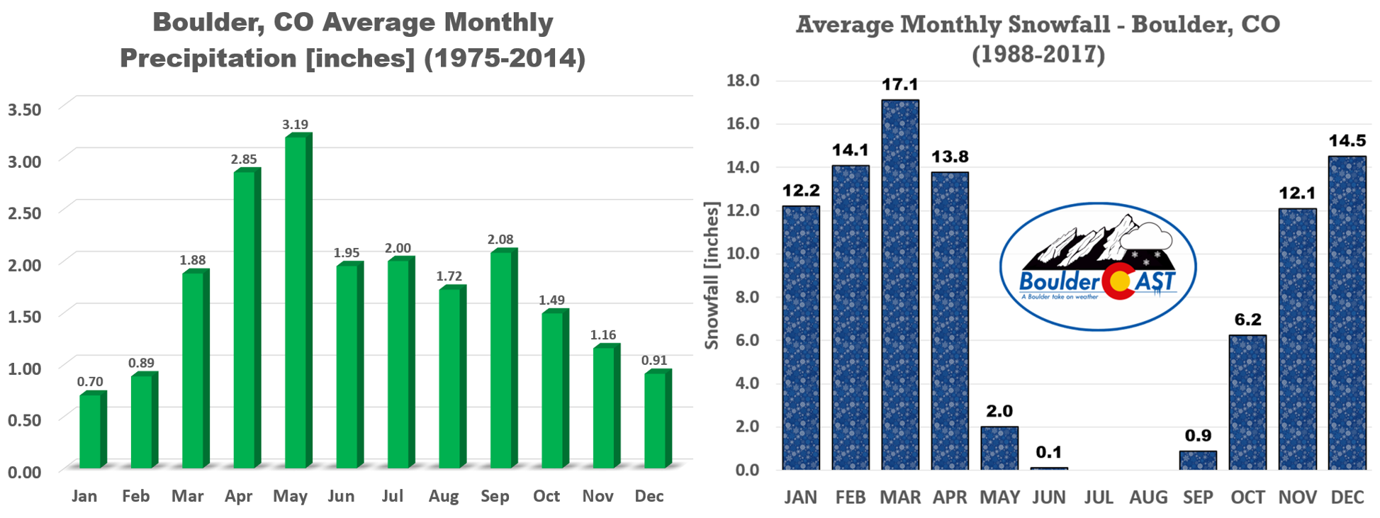
This storm actually put down anywhere from 100-200% of the average monthly allocation for January!
Admittedly the storm didn’t play out exactly as we had expected, but they often dont around these parts. Many times everyone gets their allocated snow just as forecast but do not realize things actually went down differently than us weather people were anticipating. This event was almost entirely devoid of heavy snowfall (1″+ per hour snowfall rates), something that seemed almost guaranteed based on everything we were seeing in the days leading up to the storm. Nonetheless, the 24 consecutive hours of light snow added up and got just about everyone into the lowest bounds of our forecast. The potential for heavy snow was definitely there — and that would have indeed been the boost needed to see the higher end totals. Unfortunately the storm was a bit over-hyped in public perception — with too many focusing on the highest snow potential and forgetting about the lower end of things. This left many angry and wondering why schools and businesses were unnecessarily closed for just 6″ of snow.
PS. You all weren’t exactly right either! 🙂
❄️SNOW POLL TIME! ☃️ As is tradition, how much snow do you think will Boulder receive from this winter storm? #COwx #Boulder #Colorado #COwx #COsnow #Denver
— BoulderCAST Weather (@BoulderCAST) January 17, 2023
In all seriousness though, things are looking up for most of the state right now. Drought has been eradicated from the Mountains and Denver Metro area alike.
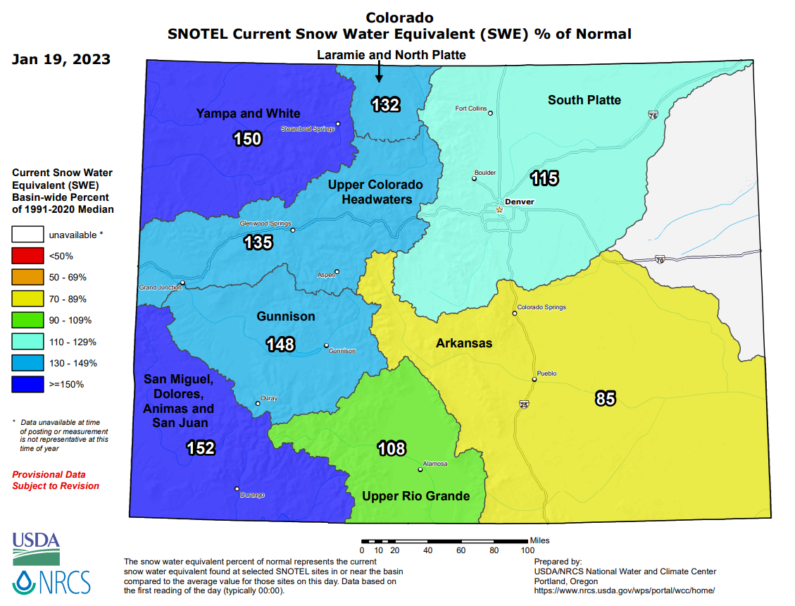
Statewide snowpack is in excellent shape, with the exception of the southeast part which is slightly below normal. That is more or less the snowpack map we would expect to see during what is now the third La Niña in a row. There’s been a lot of drought and fire concerns the last few years. Not to say those are completely quelled, but we are in a good place as we head into our wettest/snowiest months of the year!
Looking forward, the cold will stick around for at least the next week or more with highs staying below normal in the 20s and 30s — that new snow won’t be melting all that fast. There’s at least a few chances for more snow on the horizon as well— one late-day Friday (a dusting or less) and another late Sunday. into Monday (perhaps up to a few inches). Nothing looks all that impressive just yet, so stay tuned and enjoy the continued chill of winter..


You must be logged in to post a comment.