Two strong Pacific storm systems are moving ashore this week but unfortunately will pass mainly north of Colorado. This will result in continued warm conditions with little opportunity for rainfall or Mountain snow as we conclude the summer season.
DISCLAIMER: This weekly outlook forecast is created Monday morning and covers the entire upcoming week. Accuracy will decrease as the week progresses as this post is NOT updated. To receive daily updated forecasts from our team, subscribe to BoulderCAST Premium.
I
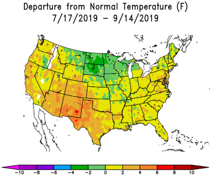
t has been a very toasty September thus far with Boulder’s average temperature sitting more than 5 degrees above normal. So far this month, there have been six 90+ degree days and who can forget the scorching 100-degree day. The recent warm pattern isn’t anything new; it can be traced back more than seven weeks ago to the tail-end of July when a ridge of high pressure developed and more-or-less persisted throughout the rest of the summer. At times, the high pressure to our south became double-lobed, which ultimately is what killed off the monsoon several weeks early and prevented even a single tropical system from making landfall in Baja California this year.
As a consequence, 47 of the last 53 days have been warmer than normal in Boulder. The Four Corners region and West Texas have been the most anomalously warm part of the country for the last several months.
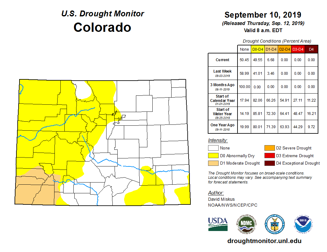
At the same time, rainfall has been hard to come by across the state, with drought unfortunately making a return. A wet late-winter and spring totally eradicated drought from the state for the first time in more than two years. Now, however, it’s back with “Moderate Drought” present in southwest Colorado, and “Abnormally Dry” conditions spreading through most of the Mountains, Boulder County and Denver.
The week ahead will unfortunately offer more of the same with generally warmer than normal conditions and only meager chances of rainfall for most.
Warmth continues…
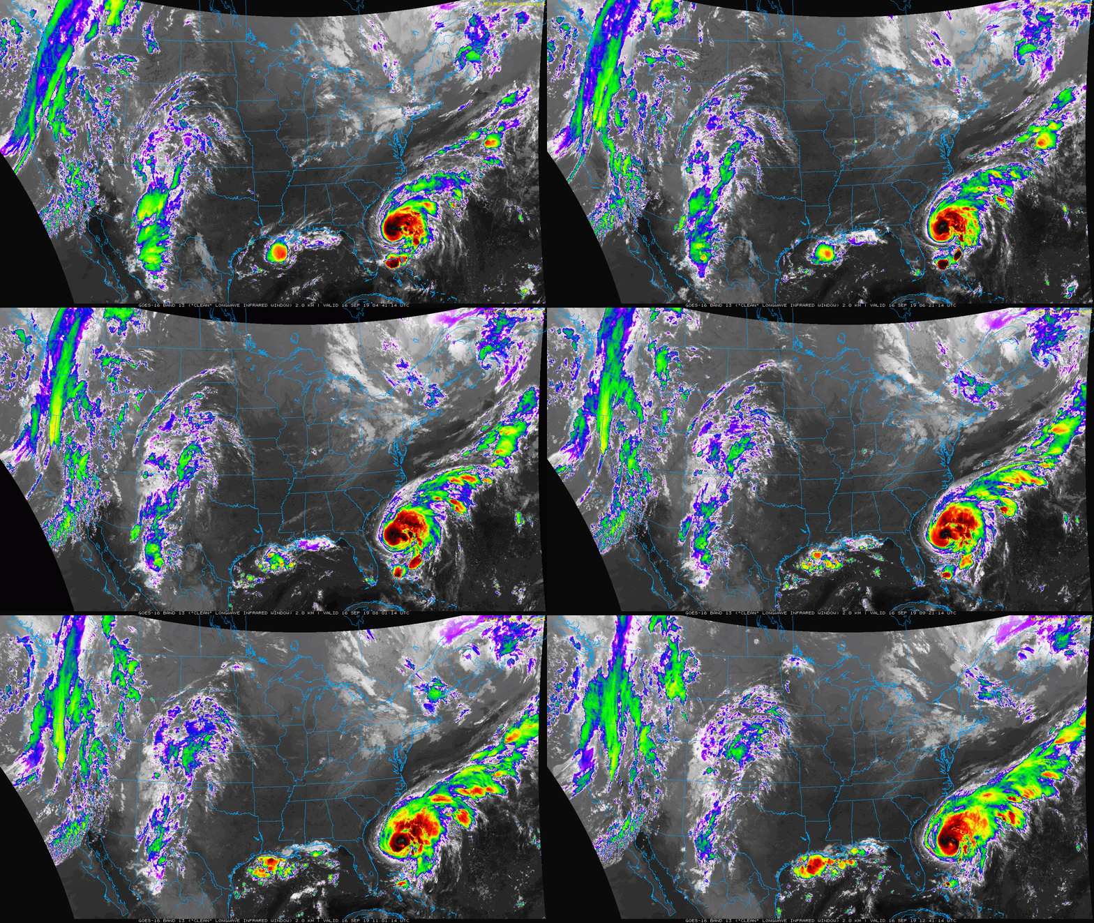
As of Monday morning, a weak disturbance with tropical origins is moving northward through the state of Colorado. This system is responsible for the thick high clouds across the Front Range this morning, but hasn’t been producing much rainfall outside of a few storms in far southwestern portions of the state. The high pressure that brought four straight days of complete sunshine to the area has now pushed eastward into the Midwest. Hurricane Humberto is churning off the coast of Florida and fortunately, unlike Category 5 Hurricane Dorian two weeks ago, Humberto will not be making a landfall in the United States.
All of the weather features mentioned can be seen in the infrared satellite animation below from GOES-East.
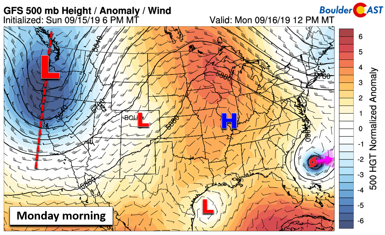
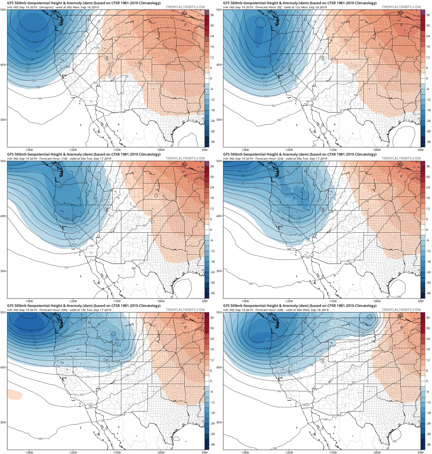
A key factor early on in this week’s forecast should have been the deep Pacific trough coming ashore into Washington and Oregon. While initially it looked like this trough would come in stronger and further south bringing wind, colder temperatures and Mountain snow to Colorado, this no longer is the case as the trough will rapidly weaken and make a hard northeast turn through Wyoming and Montana (see below). A second trough is waiting in the wings, though, likely to arrive sometime Friday.
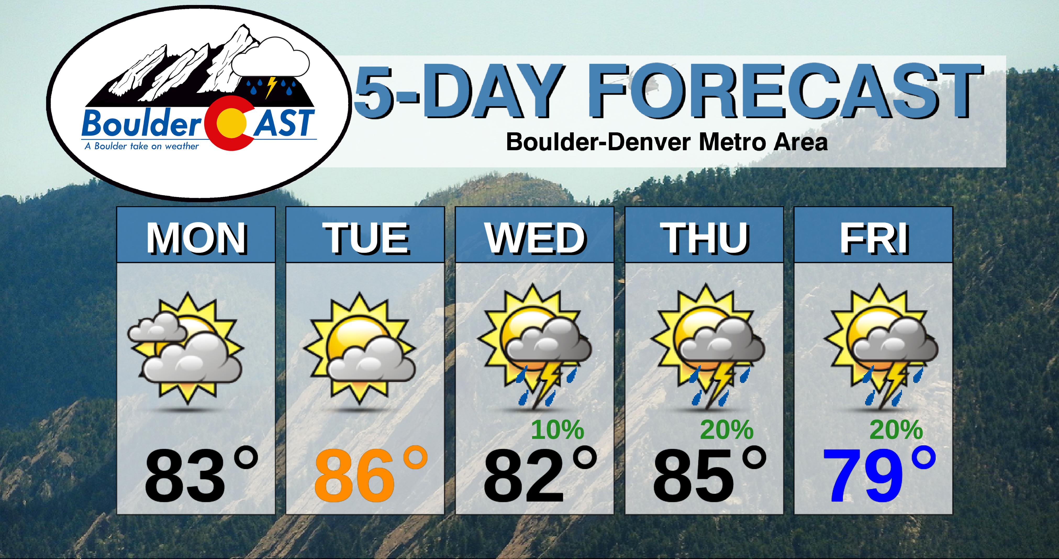
Very little energy will actually move across our area from the first trough. As a result, the Front Range will catch mainly dry and warm southwesterly flow as the system skirts to our north. Highs both Monday and Tuesday will be in the 80’s. The only impact from the passing trough, a minor one, will be a weak Pacific cold front scheduled to move into the Metro area Tuesday afternoon or evening from the northwest. This will force temperatures to drop slightly Tuesday afternoon and evening, and allow for breezy conditions.

GFS 800 mb temperature and wind forecast for Tuesday afternoon. A cold front will be moving through the Front Range. A second system and front is also visible further northwest.
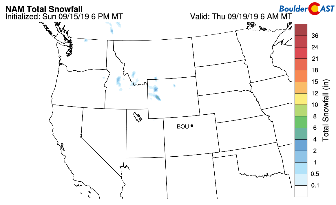
There could be a few isolated showers and storms over the northern Mountains and out across the northeast corner of the state on Tuesday, but most if not all of us will remain dry. The higher mountains of Wyoming, Idaho, and Montana could pick up a few inches of snow from the system. Any snow in Colorado’s High Country will be localized and light, only falling on the highest of peaks and within the stronger storms.
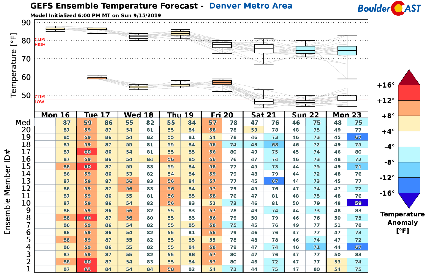
Following the cold front, highs on Wednesday will be slightly cooler in the lower 80’s, which still is above normal for this time of year. There may be just enough moisture for a few isolated late-day storms, but this appears very minimal as of now.
Late week trough misses north, too?
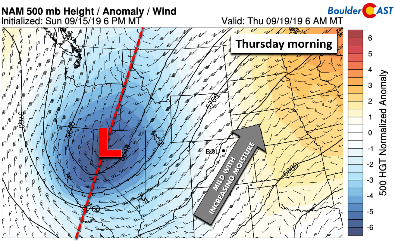
By Thursday, the second strong trough will be ashore and moving through the Great Basin. Ahead of it all, mild southwesterly flow will setup across Colorado facilitating a slight uptick in moisture for the region. This should breed a marginally better chance of storms, mainly across the higher elevations, though. A few storms may move across the Plains as well. Highs will warm slightly on Thursday into the middle 80’s.
Just like the early week trough, the late week one will skirt across northern Colorado. There is some model discrepancy in the timing, with the European model forecasting a later arrival (Friday night) than the GFS (Friday morning). Depending on when the trough axis and associated cold front move through, Friday could stay in the 80’s with a decent chance of rain, or be dry and much cooler with highs in the 70’s. We’ll go with a blended solution for now with a slight chance of storms and highs in the upper 70’s.
In the wake of the secondary trough, the weekend will sport seasonal temperatures (lows in the 40’s and highs in the 70’s) and mainly dry conditions. Not bad for the last weekend of summer!
Forecast Specifics:
Monday: Partly to mostly cloudy with isolated afternoon storms in the Foothills. The Metro area should stay dry. Highs in the lower to middle 80’s on the Plains and lower 70’s in the Foothills.
Tuesday: Partly cloudy skies and breezy with a slight chance of isolated weak storms, mainly north of Interstate 70. Highs in the middle 80’s for the Plains and lower 70’s in the Foothills. A cool front will advance through during the afternoon or early evening with temperatures falling slightly thereafter.
Wednesday: Increasing clouds with a slight chance of thunderstorms. Highs in the lower 80’s on the Plains and upper 60’s in the Foothills.
Thursday: Increasing clouds with scattered afternoon and evening thunderstorms lingering into the overnight hours. Highs in the middle 80’s on the Plains and upper 60’s in the Foothills.
Friday: A mix of clouds and sunshine with highs near 80 for the Plains and lower 70’s for the Foothills. Depending on the timing of a late-week storm system, a few isolated storms may be possible in the afternoon or evening.
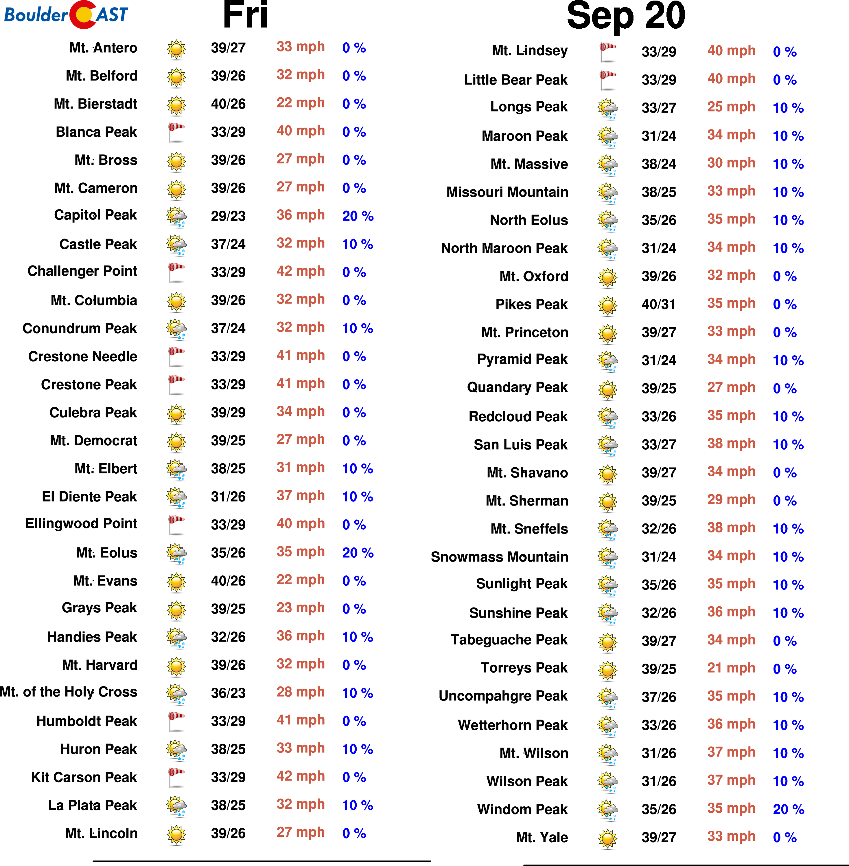
High Country: Isolated thunderstorms will be possible across the Mountains on Monday and Tuesday as the first trough moves through. A better chance of storms and perhaps a few snowflakes comes Thursday into Friday as the second trough passes. Winds will be blustery in the Mountains as well most of the week. Visit our SummitCAST page for updated forecasts for more than 120 Colorado mountain destinations, including all of our state’s majestic 14ers.
Spread the word, share our forecast!




You must be logged in to post a comment.