Damaging hail fell across northern portions of the Metro area Wednesday evening. The storm system responsible is already out the door, with a lengthy period of sunshine about to overtake our forecast.
Hail on Wednesday
In our weekly outlook on Monday, we let you know that a Pacific storm system would pass to our north Wednesday evening offering the best chance of thunderstorms across our region for the week. Yesterday, we fine-tuned that forecast for our Premium members, pin-pointing the region north of Interstate 70 as the most likely area to pick-up the much needed rainfall.
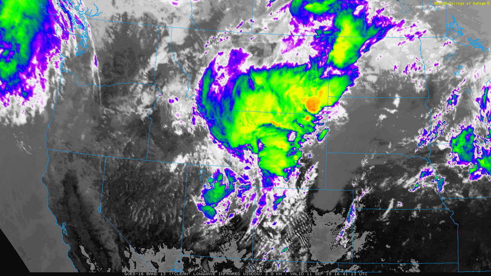
As the Pacific low pressure moved along the Wyoming/Montana border Wednesday evening, the atmosphere just destabilized enough from Boulder through Greeley to Sterling to facilitate rapid thunderstorm growth. The infrared satellite animation from GOES-East below shows the very tall and cold-topped storm clouds exploding over northern Colorado.
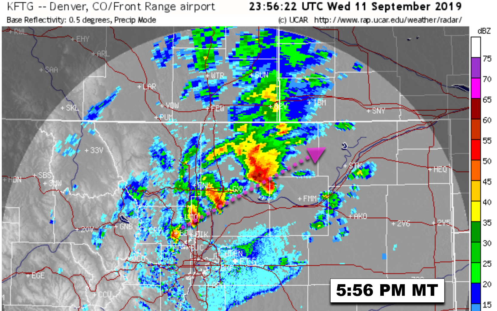
Dry air aloft and strong bulk shear made large hail the primary threat with these storms. The radar image below is from around 6:00 PM Wednesday evening. This isn’t a time-lapse image…there was actually a “train” of four strong to severe thunderstorms stretching from Boulder through Greeley at this time.
As each storm in the train moved northeast into more favorable conditions, they grew in intensity and so too did the diameter of the hail. Storm reports indicate quarter-sized hail near Lafayette, up to ping pong-sized hail in Longmont and Erie, and golf ball-sized hail in Greeley.
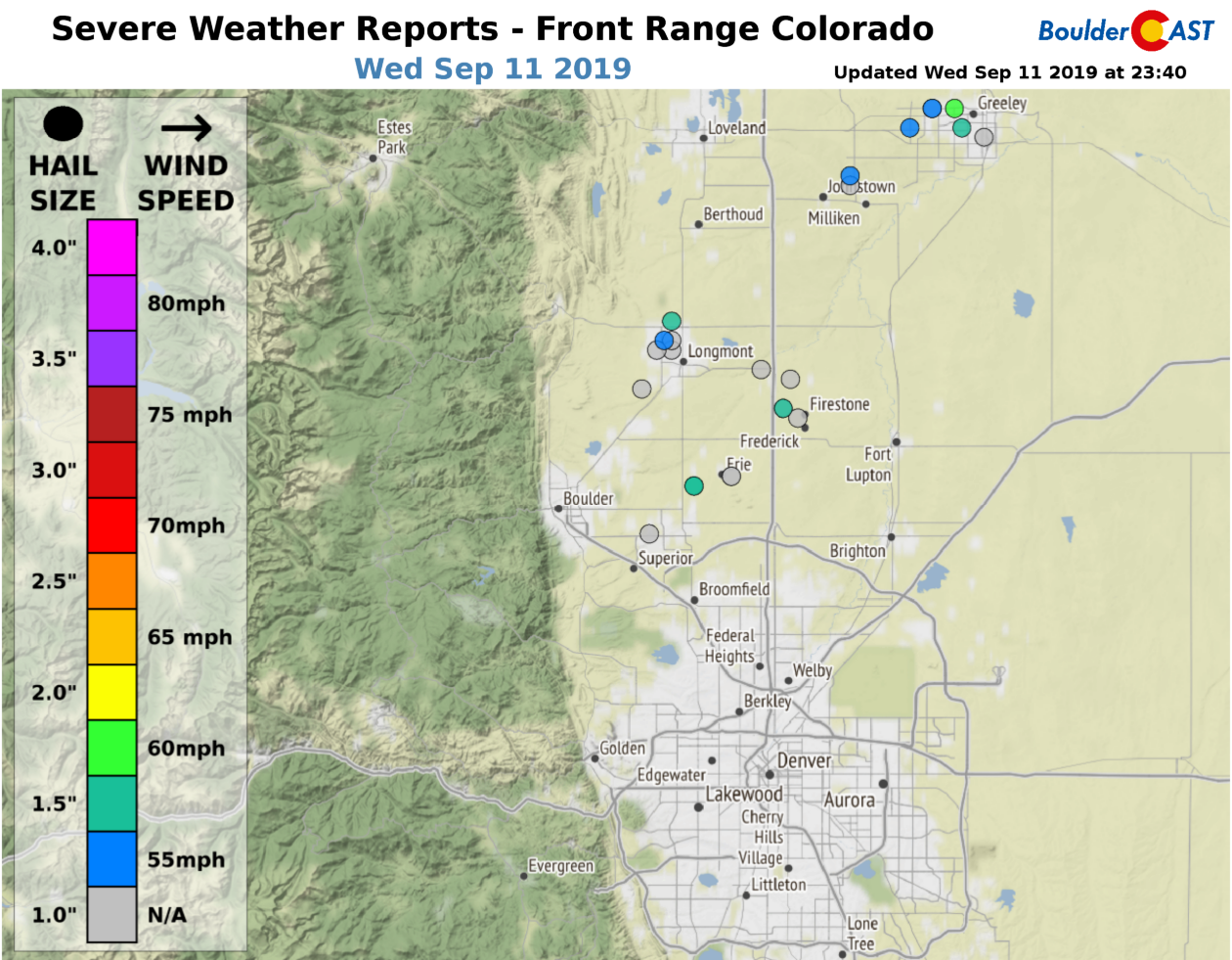
It’s off our storm report map, but these cells continued grow as the moved northeast, dropping nearly tennis ball-sized hail in Sterling.

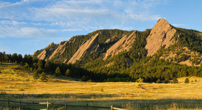
Photo by Esther Garza
Quiet times ahead
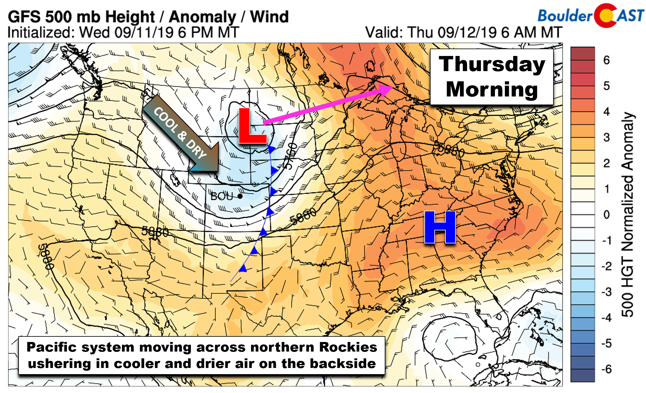
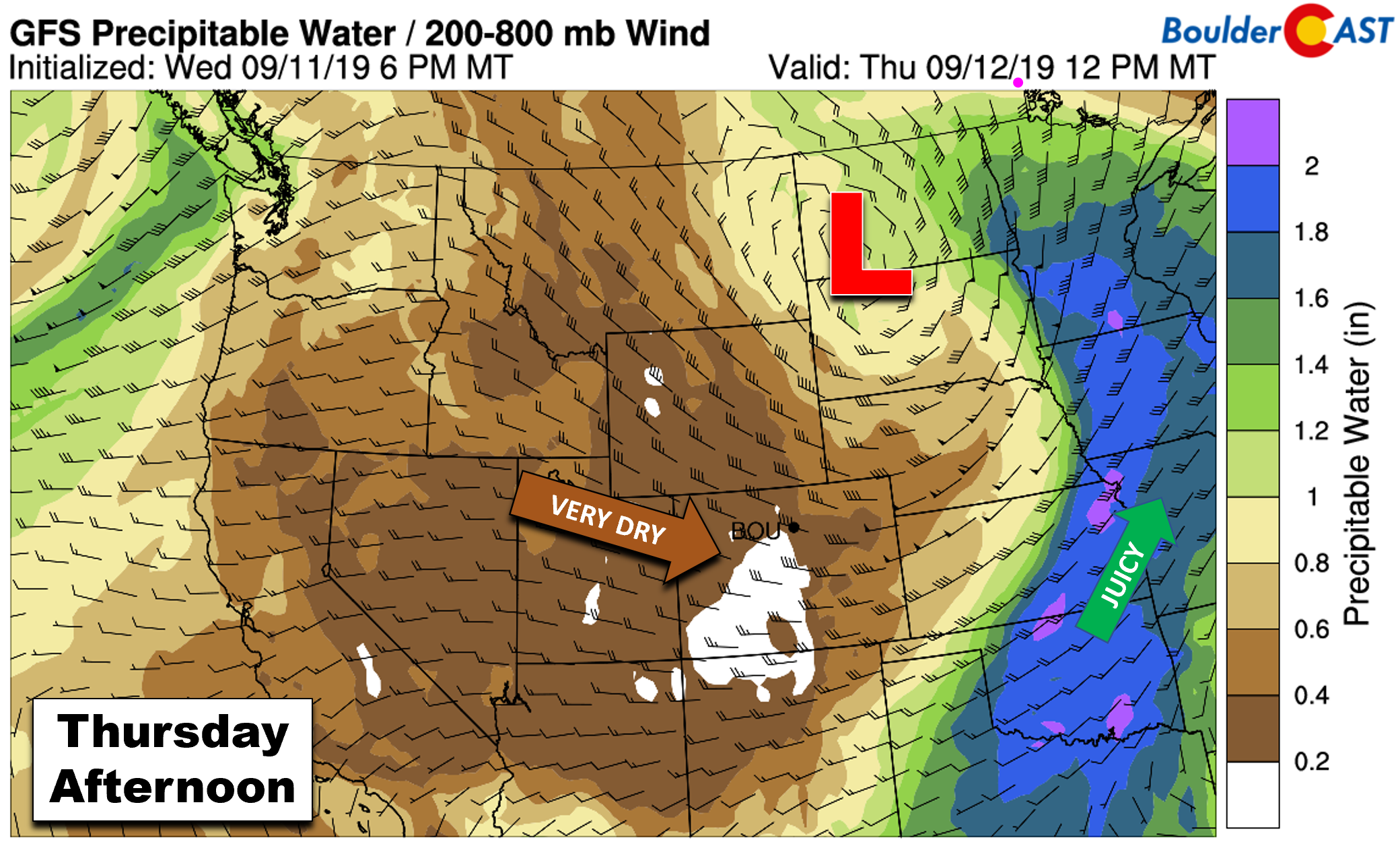
As active as it was on Wednesday, a figurative weather switch has been flipped. The rest of the week and weekend will shift remarkably tranquil. On the backside of the departing Pacific storm system, much drier and subsident air is moving into the state of Colorado.
Precipitable water has fallen to near 0.25″ in Boulder as of Thursday morning, barely enough to form any clouds, let alone storms.
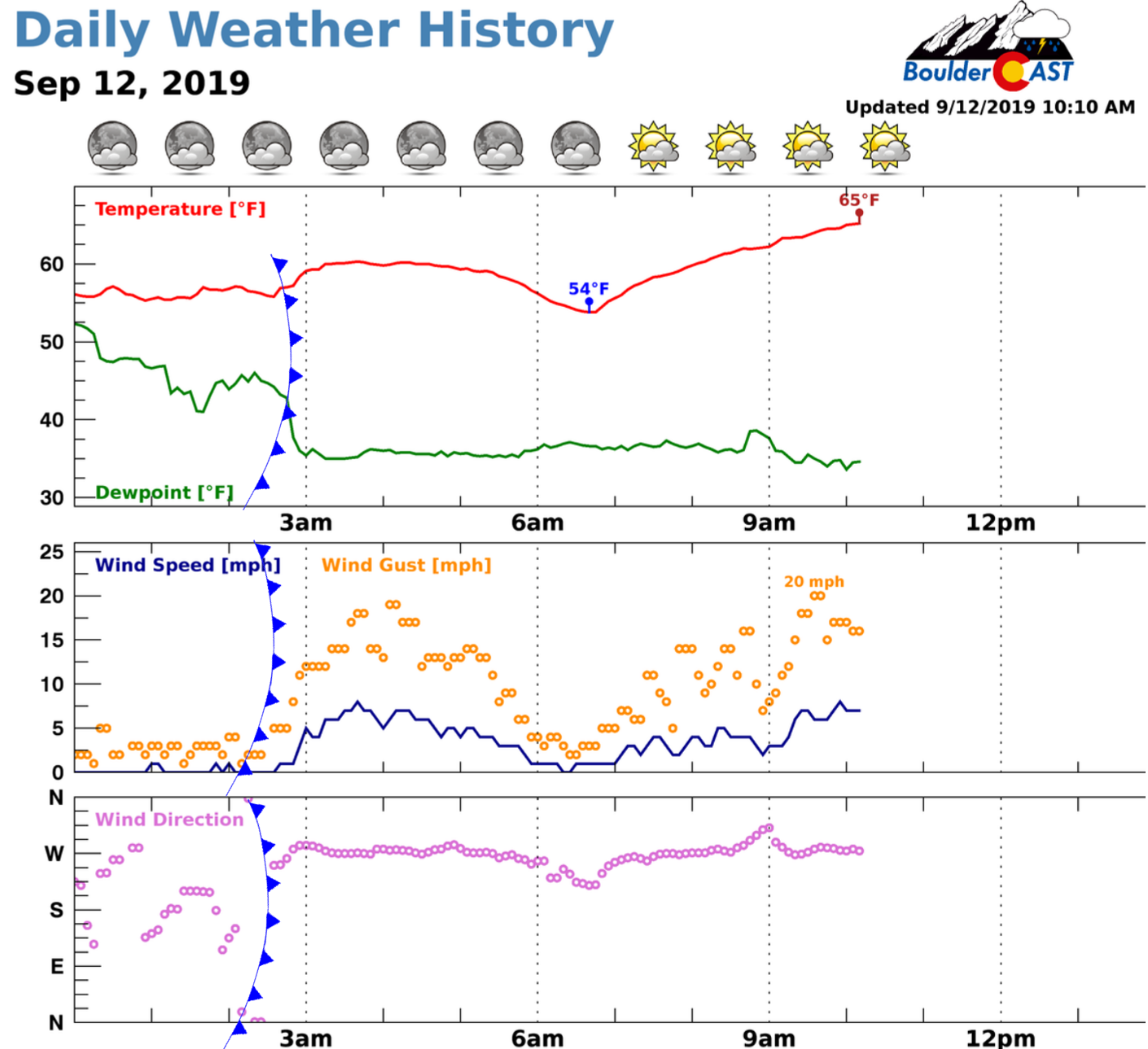
A cold front moved into Boulder around 2:30 AM last night with gusty winds and tumbling surface dew points (green line below). In this case, the air behind the front was actually slightly warmer than the soggy rain-cooled airmass that was sitting over the Denver Metro area following last night’s rainfall and severe weather.
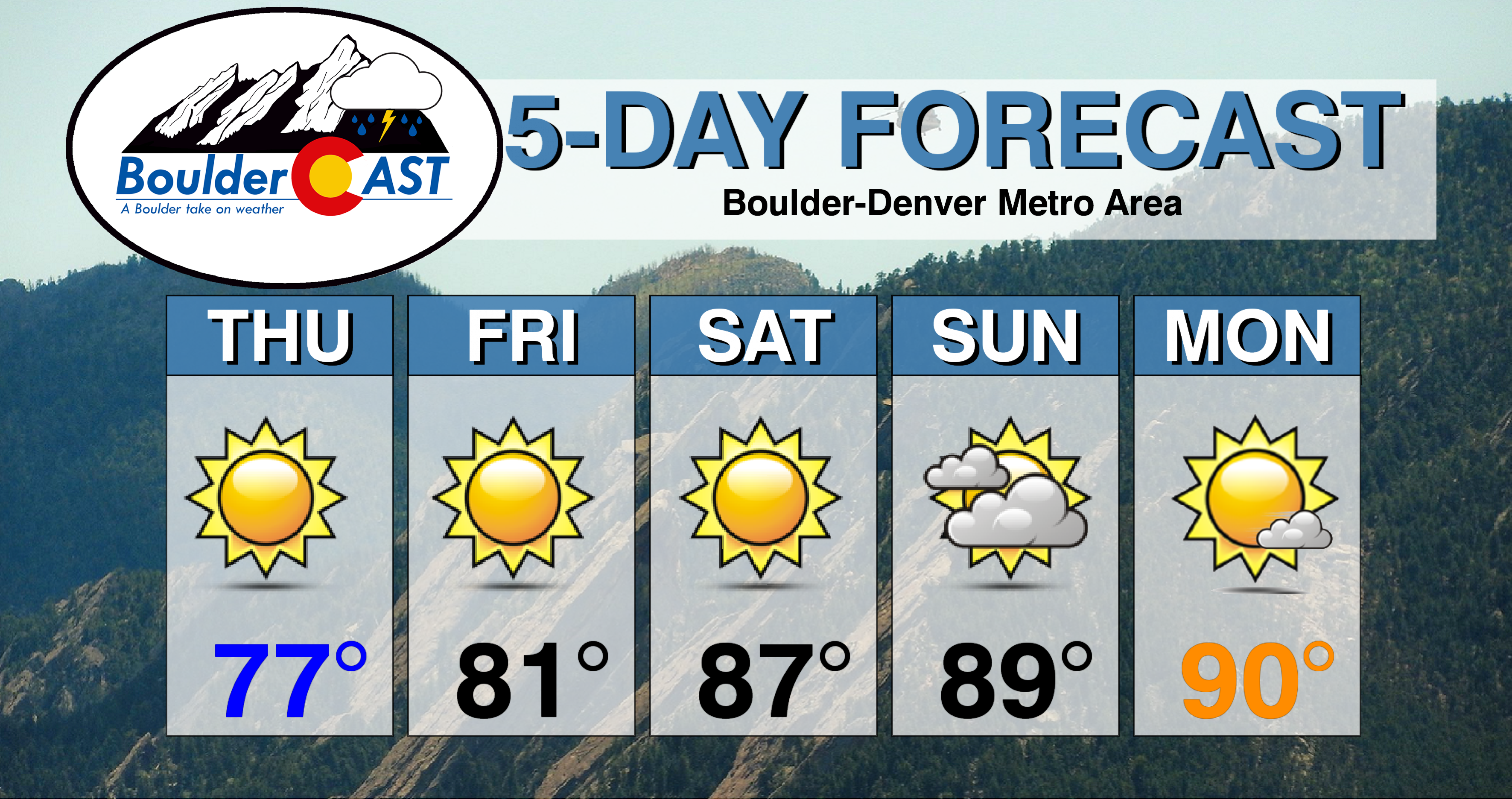
The aforementioned dry airmass will remain across Colorado through the upcoming weekend with no major weather players to mention. Lots of sunshine is expected over the next five days (save for clouds on Sunday). We’ll start with seasonal temperatures Thursday and Friday, but temperatures creep back towards 90 degrees in due time (which would be close to record values for mid-September).
The next, potentially stronger Pacific trough is currently slated to move ashore early next week, likely turning winds southerly across Colorado leading to increased moisture influx and a return of storm chances by Tuesday or Wednesday.
Here’s our forecast for the next five days. Enjoy!
DISCLAIMER: This extended forecast was created Thursday morning and covers the next five days. Accuracy will decrease as time progresses as this post is NOT updated. To receive daily updated forecasts from our team, subscribe to BoulderCAST Premium.

.
Share the BoulderCAST Forecast:
.


You must be logged in to post a comment.