After record-setting heat the last two days, the first wave of cooler air arrives early this afternoon. Then, an actual cold front is set to move in later tonight. Before that however, we’ll have to survive a few hail-producing severe storms this afternoon.
RECORD HEAT ABOUND
Temperatures Tuesday and Wednesday were in the mid to upper 90’s across the lower elevations. Boulder set a record Tuesday, reaching 97 degrees, and 98 on Wednesday (not a record). Denver International Airport hit 99 on Tuesday, a best as well. While we didn’t notice any Front Range locations hit the century mark, the usual spots in southeast Colorado did (Pueblo, Lamar, etc).
Of course, our “heat wave” was nothing compared to the real one that is ongoing across the Southwest. Many cities broke all-time record highs this week. Temperatures above 115 degrees were widespread. The warmest of them all, Death Valley, nearly hit 130 degrees!
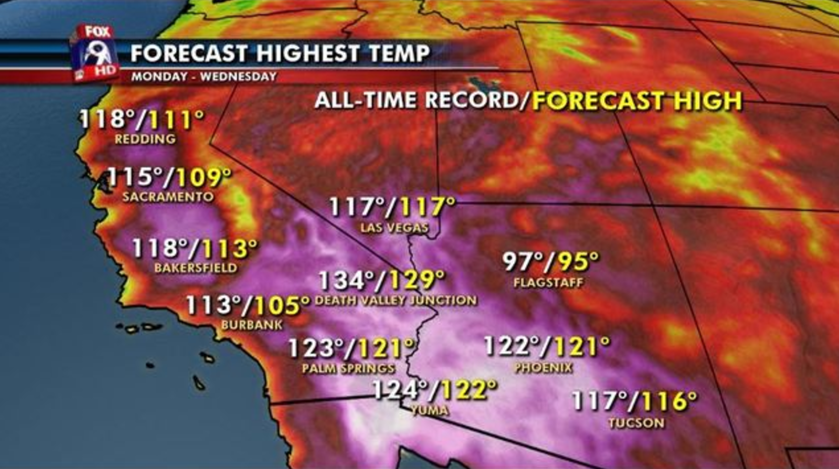
While our heatwave ends with the cold front passage tonight, it will hold strong in these desert locations. Excessive heat warnings are already posted for the maximum allowable length (five days out).
SEVERE WEATHER ON THURSDAY
A weak boundary is moving into northeast Colorado this morning from Wyoming (see below temperature map). It will reach Denver by lunchtime and will usher in slightly cooler air and gusty winds, but most importantly, provide low-level moisture and upslope to the region. Temperatures should briefly near 90 degrees this morning before the “cooler” air arrives.
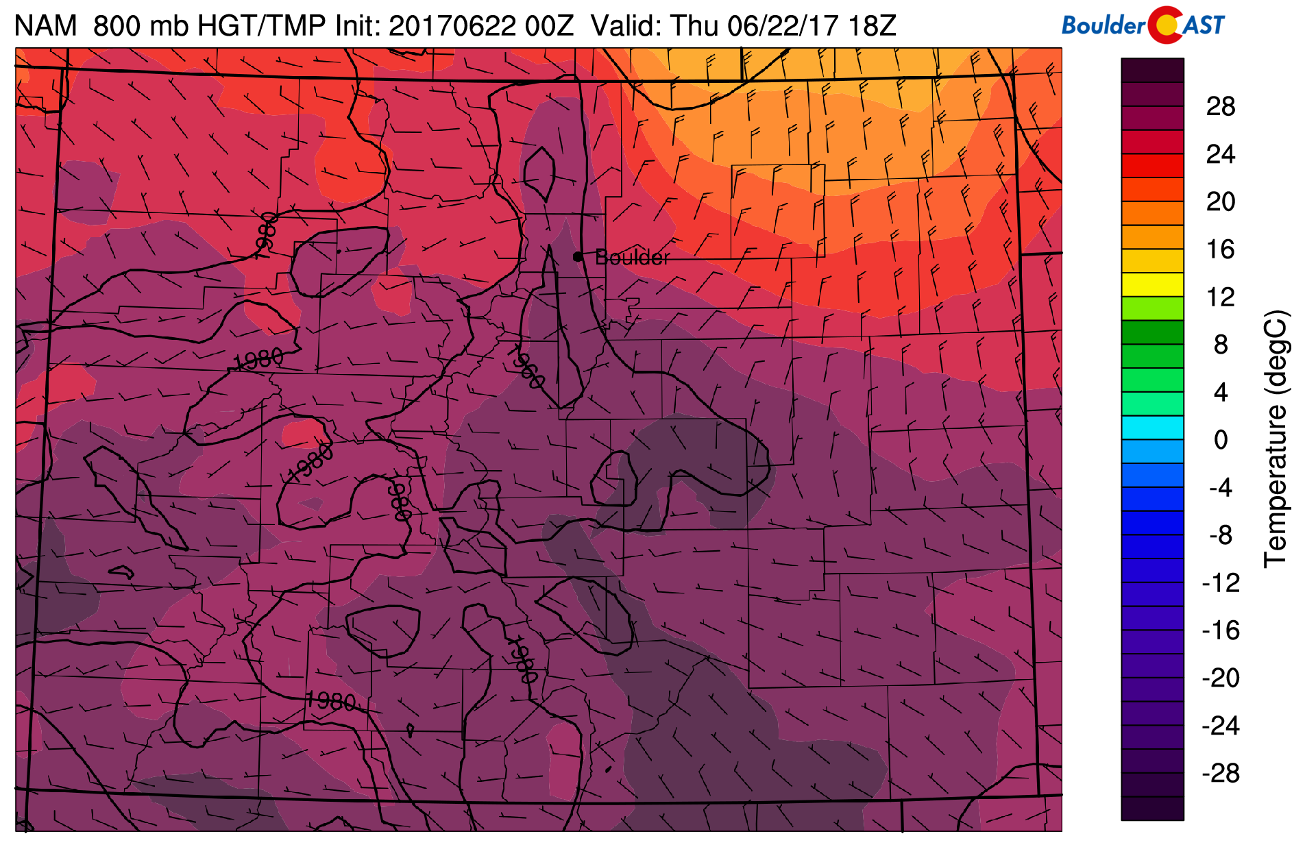
NAM 800mb temperature map for Thursday afternoon. The preliminary frontal boundary is clearly visible arriving in Denver
The added moisture will result in CAPE (convective available potential energy) values of 700-1400 J/kg across the Metro area…enough to support scattered thunderstorm development.
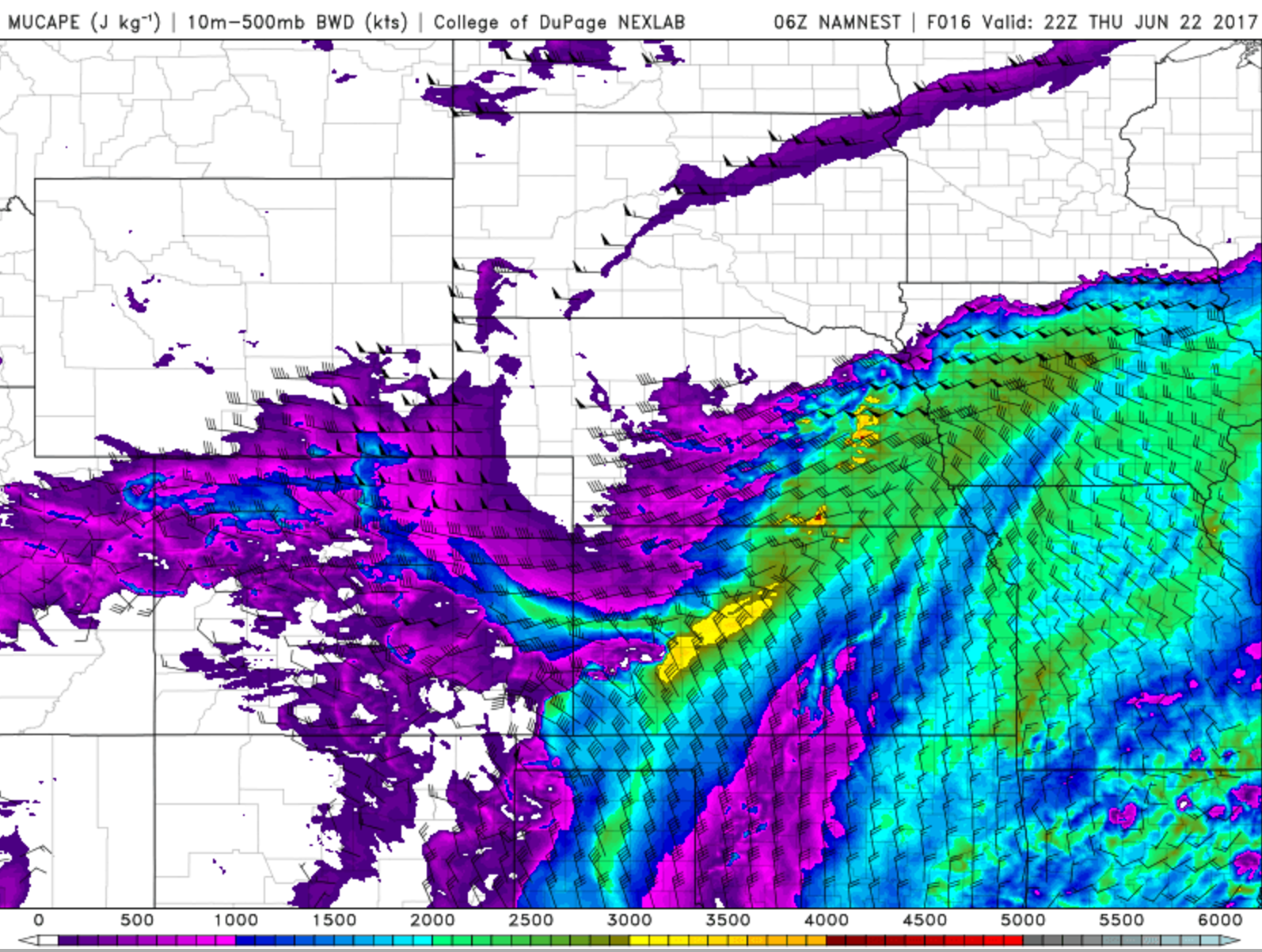
Forecast CAPE (colors) and bulk shear (wind barbs) for this afternoon from the 4KM NAM model
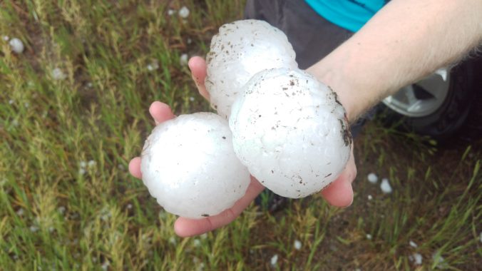
Easterly flow at the surface combined with northwesterly winds aloft will create a good directional shear environment this afternoon to turn those thunderstorms into isolated supercells in and around the Denver area. The main threat will be large hail…not quite as big as shown the header image above, but 1 to 2″ is definitely possible (golf ball sized). It’s not really a great day for tornadic activity…dewpoints are too low….so at least there’s that.
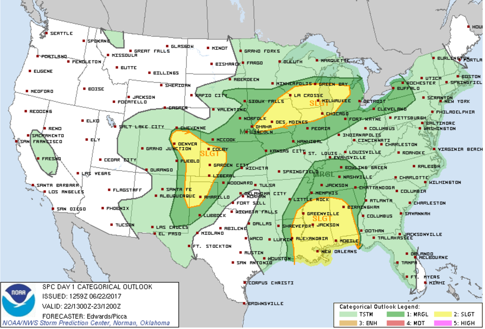
Convective storm outlook for today | Storm Prediction Center
Expect storms to begin to develop as the deeper moisture and upslope arrive around 1PM this afternoon. The best chance of large hail producing supercells will be early on, before storm initiation becomes outflow-dominated, mostly before 6PM. Keep in mind the storms will be widely scattered in nature. Of course not everyone will see hail, and many places will remain dry today. Storms should die down after midnight. It’s sure going to be another fun day across the Front Range!
UPSLOPE TONIGHT, COOLER FOR THE WEEKEND
Tonight’s main cold front will arrive after midnight and produce upslope-dominated precipitation for the region overnight and into Friday morning. While not impossible during the summer months, this only happens a few times each summer, so enjoy it!
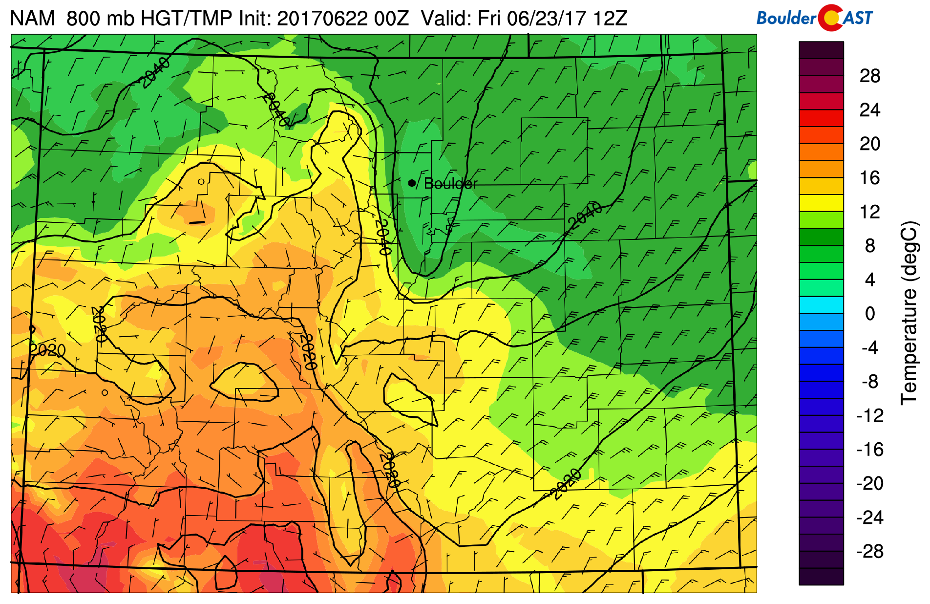
NAM forecast temperatures Friday morning showing cool air and upslope across the Front Range
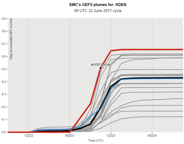
Expect dreary weather tonight and tomorrow morning, with cloud cover lingering into Friday afternoon. Latest ensemble plume guidance predicts 0.3 to 0.6″ of rain from the upslope portion of the storm alone. This seems reasonable considering the strength of the upslope and that precipitable water values will be nearing an inch tonight.
Temperatures on Friday will top out near 70 degrees. If clouds can persist through the day, we may very well remain in the 60’s…quite the change from the heat of late. The cool and moist airmass will linger through the upcoming weekend. Highs will be in the 70’s both Saturday and Sunday with isolated and scattered afternoon showers and storms.
The ridge will be rebuilding next week, bringing the 90’s back. We’re also on watch for the commencement of monsoon season. More on that in our weekly outlook on Monday.
Have a good weekend folks!
Spread the word about the hail…share our forecast with your friends!
.



You must be logged in to post a comment.