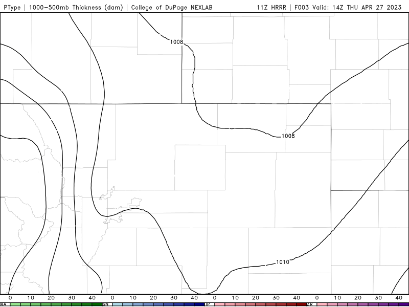
Another wave of precipitation will accompany a cold front racing into the Front Range from the north Thursday night with rain changing to snow across the Denver Metro area. This precipitation will be joined by strong dynamics and northerly flow, making for a gusty and unsettled evening ahead, with some grassy accumulations possible across the lower elevations as snow mixes in late for some. This storm will largely favor areas south of Interstate 70, with the northern Front Range including Boulder not expected to see much. Let’s take a look.
W
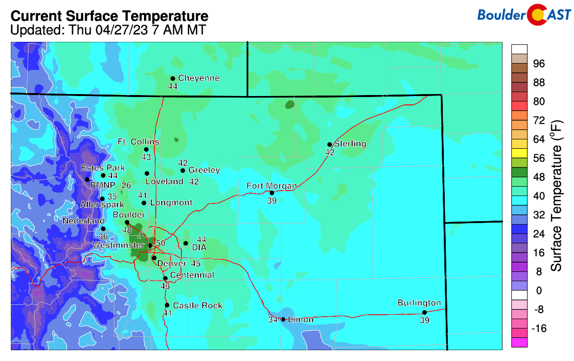
e’re starting our on the “mild side” this morning with temperatures already in the 50s at the base of the Foothills here in Boulder.
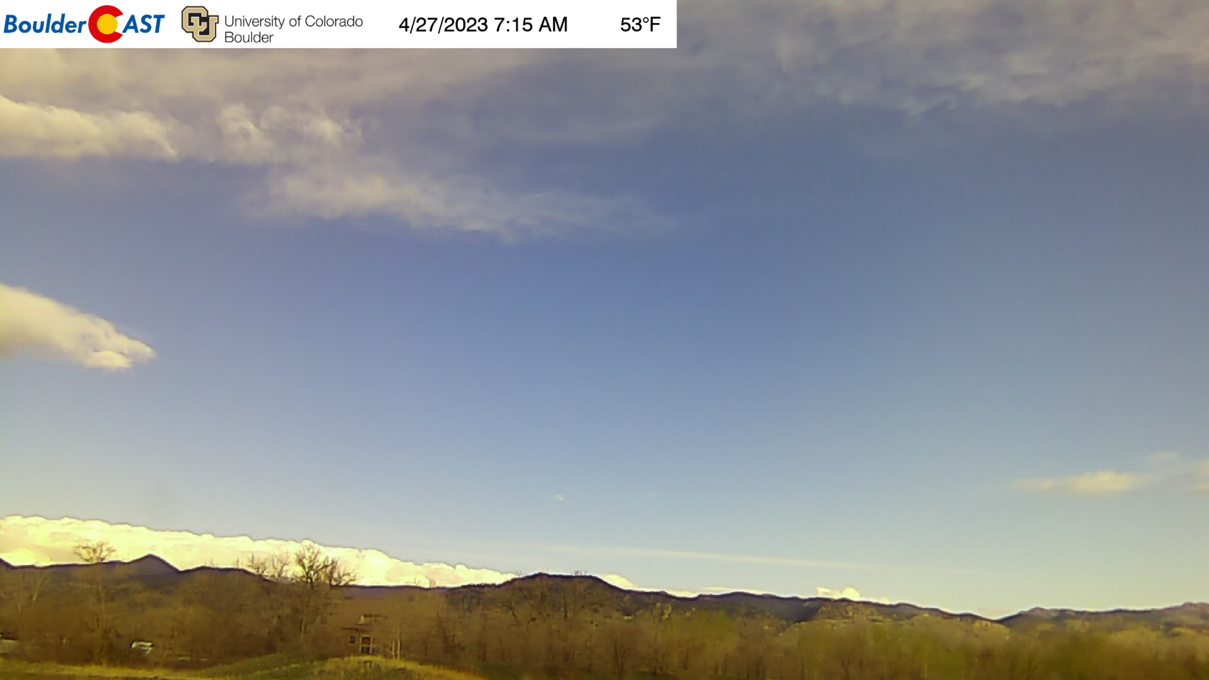
Some wave clouds are hanging around this morning as well indicating that downslope is lurking in the skies above!
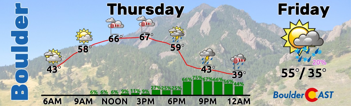
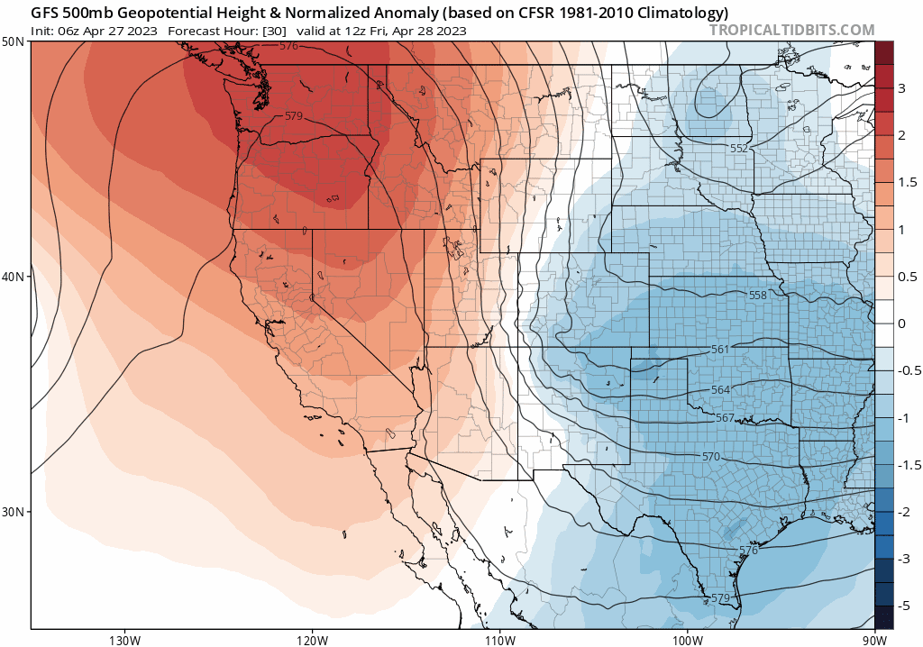
Today will be the warmest day of the work week, but alas, another fast-moving storm is knocking on the door and will arrive early this evening from almost due north out of Canada. The storm track right now is largely being controlled by the existence of an amplified high pressure center along the West Coast.
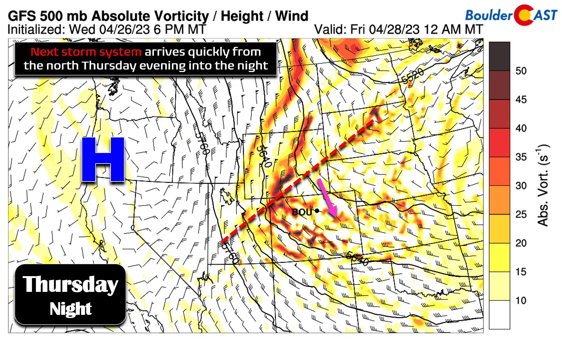
This approaching system will bring a quick shot of frontal forcing, upslope, and weak jet dynamics to the Front Range this evening and overnight allowing a burst of precipitation. The primary window for wet/snowy weather comes from 6PM to Midnight tonight with precipitation beginning to wrap-up from north to south after midnight into the early Friday morning.
Unlike our last storm which had nearly perfect upslope at times, this one will definitely not! Winds behind the cold front turn almost due northerly through the entire low atmosphere. The GFS forecast indicates 30-40 MPH north winds at midnight tonight at 10,000 feet elevation. Some of these stronger winds will also be present near ground-level during much of the evening and overnight for us. Expect a significant uptick in winds this afternoon (from the northwest before the front) and into the evening (from the north behind the front). Wind gusts of 20 to 40 MPH will be common during this time. Gusts up to 50 MPH will accompany the front itself, along with a brief cloud of dust. Current timing on the cold front is around 5 to 6PM Thursday evening.
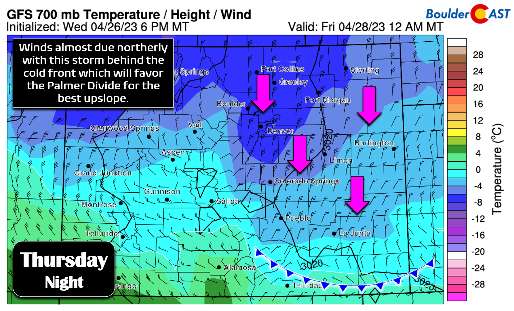
Though these northerly winds will help to pull in notably colder air, it won’t do much for precipitation in the Boulder area. Northerly flow will favor southern Denver, the Palmer Divide and parts of Jefferson County. These favored locales should end up with 0.25 to 0.5″ of moisture from this storm. Elsewhere, it will be 0.25″ or less — and realistically 0.1″ or less for the northern Metro area.
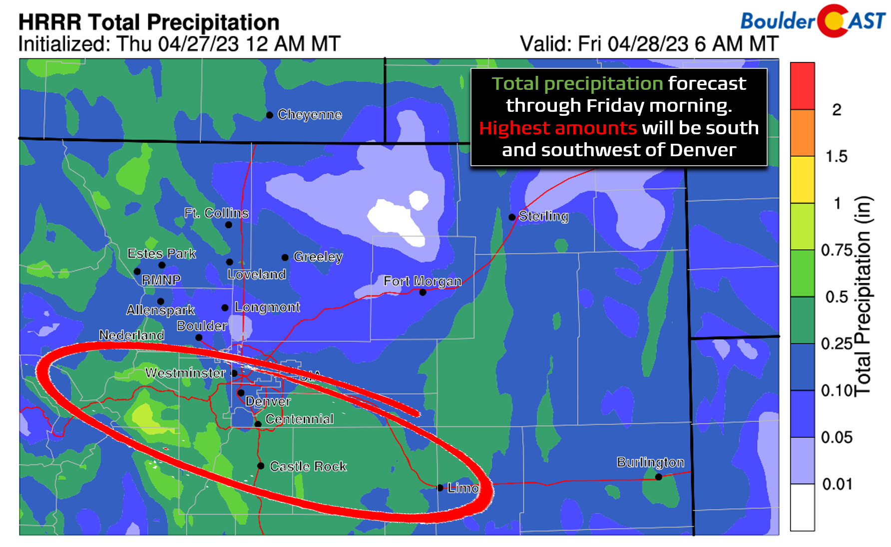
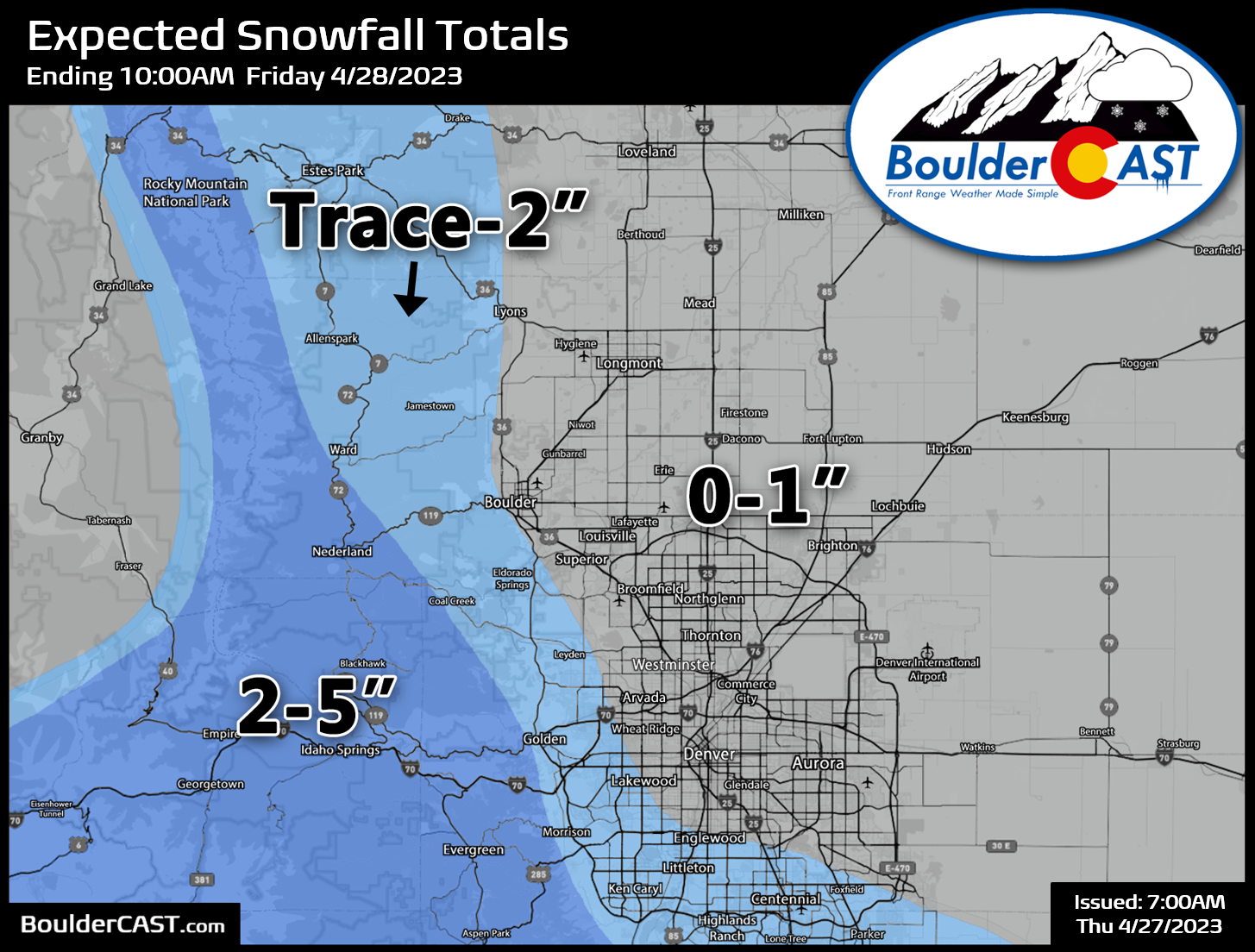
Earlier this week this shortwave looked to be accompanied by colder air with almost all snow in the cards. However, it has warmed up considerably and we are now expecting mostly rain across the lower elevations, but with snow levels bottoming out somewhere between 5000 and 5500 feet late Thursday night and into Friday morning. Thus, there could be some light slushy accumulations on the grassy surfaces for some of us, especially south and southwest of Denver tonight where up to 2″ could stick. Elsewhere, it will just be a cold rain with an outside chance of just 1″ or less of snow. The best forcings will largely be gone by the time the cold air arrives. Our snowfall forecast map for this event is below. Up to 5″ of snow could fall in the southern Foothills, Palmer Divide and I-70 Mountain Corridor.
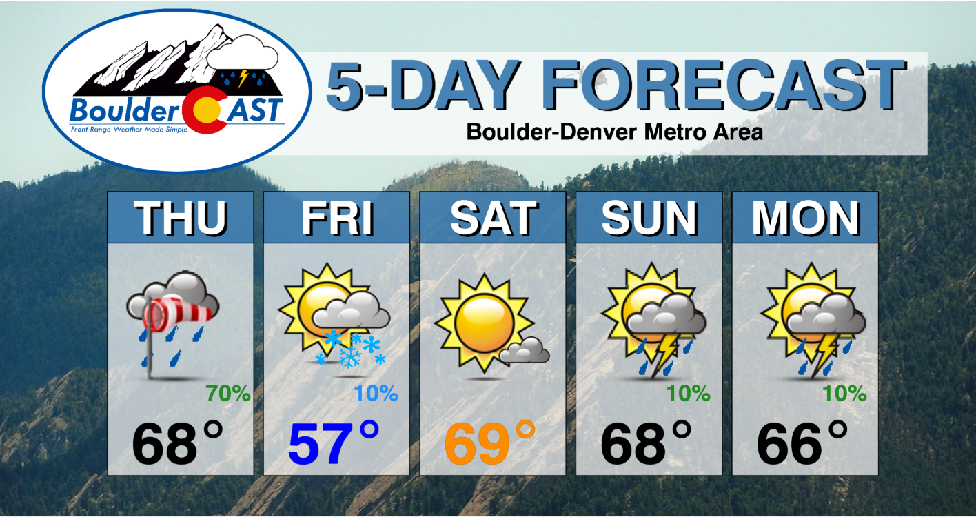
For Thursday, expect a mix of clouds and sun with increasing winds. As the front moves through this evening around 6PM, wind-blown rain will arrive from the north with snow developing in the higher elevations. Snowfall rates could exceed 1″ per hour in the heavy bands of snow. As temperatures cool overnight, rain may mix with some snow but only lead to minor grassy accumulations at best, mainly south and southwest of Denver in areas above 5500 feet.
After this system exits Friday morning, a peaceful period of weather will ensue across Colorado as that aforementioned high pressure center takes over the area. This ridge actually ends up getting pinched over Colorado, as two big cut-off lows on either side keep it from vacating. Models have come into pretty good agreement that this ridge will remain stuck here for an extended period leading to generally nice and fairly mild weather.
The weather this weekend will be pleasant and seasonal. Our next chance of precipitation won’t come until late Sunday or Monday in the form of isolated late-day thundershowers. Enjoy!
Get BoulderCAST updates delivered to your inbox:
Enjoy our content? Give it a share!
This content is for BoulderCAST Premium members only. Join Premium now to get access to our detailed forecast discussions for Boulder and Denver every single day, plus a bunch of other cool perks!

Go Premium, get all the perks.
Daily Forecast Updates
Get our daily forecast discussion every morning delivered to your inbox.
All Our Model Data
Access to all our Colorado-centric high-resolution weather model graphics. Seriously — every one!
Ski & Hiking Forecasts
6-day forecasts for all the Colorado ski resorts, plus more than 120 hiking trails, including every 14er.
Smoke Forecasts
Wildfire smoke concentration predictions up to 72 hours into the future.
Exclusive Content
Weekend outlooks every Thursday, bonus storm updates, historical data and much more!
No Advertisements
Enjoy ad-free viewing on the entire site.


You must be logged in to post a comment.