Following a rather benign stretch of weather this week so far, a strong storm system will bring winter weather back to the entire Front Range in the days ahead. After a warm day with fire danger on Thursday, a cold front will blow through in the early evening hours paving the way for a prolonged period of upslope-enhanced precipitation lasting into early Saturday. While the predominant precipitation type will indeed be snow with this storm, even across the lower elevations, there will be a lot of melting happening limiting the overall impacts and potential snow accumulation. We discuss the latest storm details, how much moisture will fall, and how much wet snow this will translate into for the area.
At a Glance
- Current Storm Status: A strong but slow-moving spring storm system will impact Colorado Thursday into the weekend ahead with widespread rain and snow for the entire area
- Fire Danger Thursday: Warm and dry southwest winds will bring fire risk to the area on Thursday, mainly south of Interstate 70. Enjoy this final warm day, but please no sparks or flames!
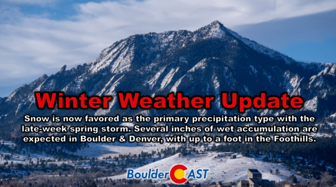
- Snow Wins Out, But It Will Melt: After a brief period of rain Thursday evening, we’ll change-over to snow Thursday night, staying all snow through the rest of the event into Saturday morning. However, there will be a lot of melting throughout this long-duration, low intensity event.
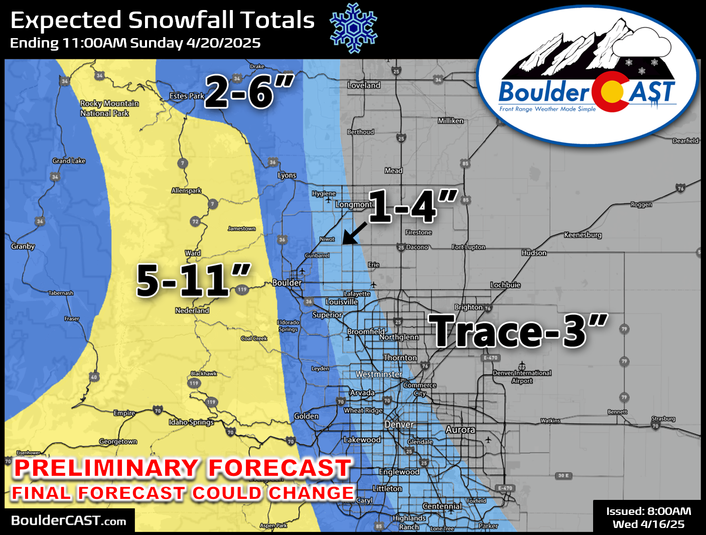
- Wet Snowfall Amounts: Our preliminary snowfall forecast calls for up to 6 inches of snow across the lower elevations (highest west, including Boulder), with most of that coming Friday evening and night when melting will be lessened. The Foothills could see up to a foot of snow.

Go Premium, get all the perks.
Daily Forecast Updates
Get our daily forecast discussion every morning delivered to your inbox.
All Our Model Data
Access to all our Colorado-centric high-resolution weather model graphics. Seriously — every one!
Ski & Hiking Forecasts
6-day forecasts for all the Colorado ski resorts, plus more than 120 hiking trails, including every 14er.
Smoke Forecasts
Wildfire smoke concentration predictions up to 72 hours into the future.
Exclusive Content
Weekend outlooks every Thursday, bonus storm updates, historical data and much more!
No Advertisements
Enjoy ad-free viewing on the entire site.
Late-season snow on the way!
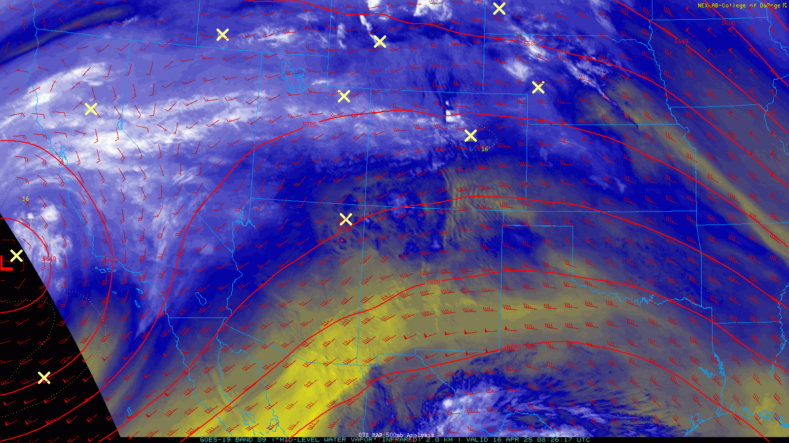
As of Thursday morning, water vapor imagery shows a notable trough to our west associated with a cut-off low offshore from California. Colorado resides downstream from this trough in a weak area of ridging under increasingly strong southwest flow. Some moisture embedded in this flow has kept clouds over the Front Range through the night with mild overnight temperatures (40s to lower 50s), but there will be some sunshine taking over early in our Wednesday at least.
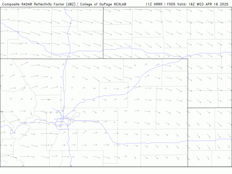
The influence of the sun is growing increasingly strong this time of year. Even in a neutral environment, the sun can kick off some convection with only minimal moisture availability. That will be the story Wednesday as isolated convective showers spawn late this afternoon into the evening, mainly after 3PM as indicated by the HRRR model:
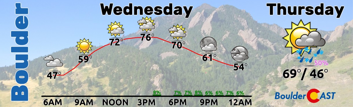
Morning sunshine will give way to increasing clouds through the afternoon as a few showers and isolated high-base thunderstorms try to develop. These will produce only light rain with brief gusty winds. Our forecast high temperature is 77°F, four degrees shy of the existing record high for the date and about 15 degrees above normal for mid April.
Tomorrow begins the stretch of messy weather for us as the well-advertised strong spring storm system takes shape across the Intermountain West. We’ll begin Thursday quite warm with another run towards 70 degrees in a dry southwest flow regime. This will bring fire concerns for the southern part of the Metro area where gusty winds and low humidity will overlap. Fire Weather Watches are posted for Thursday there but will definitely be upgraded to Red Flag Warnings in due time.
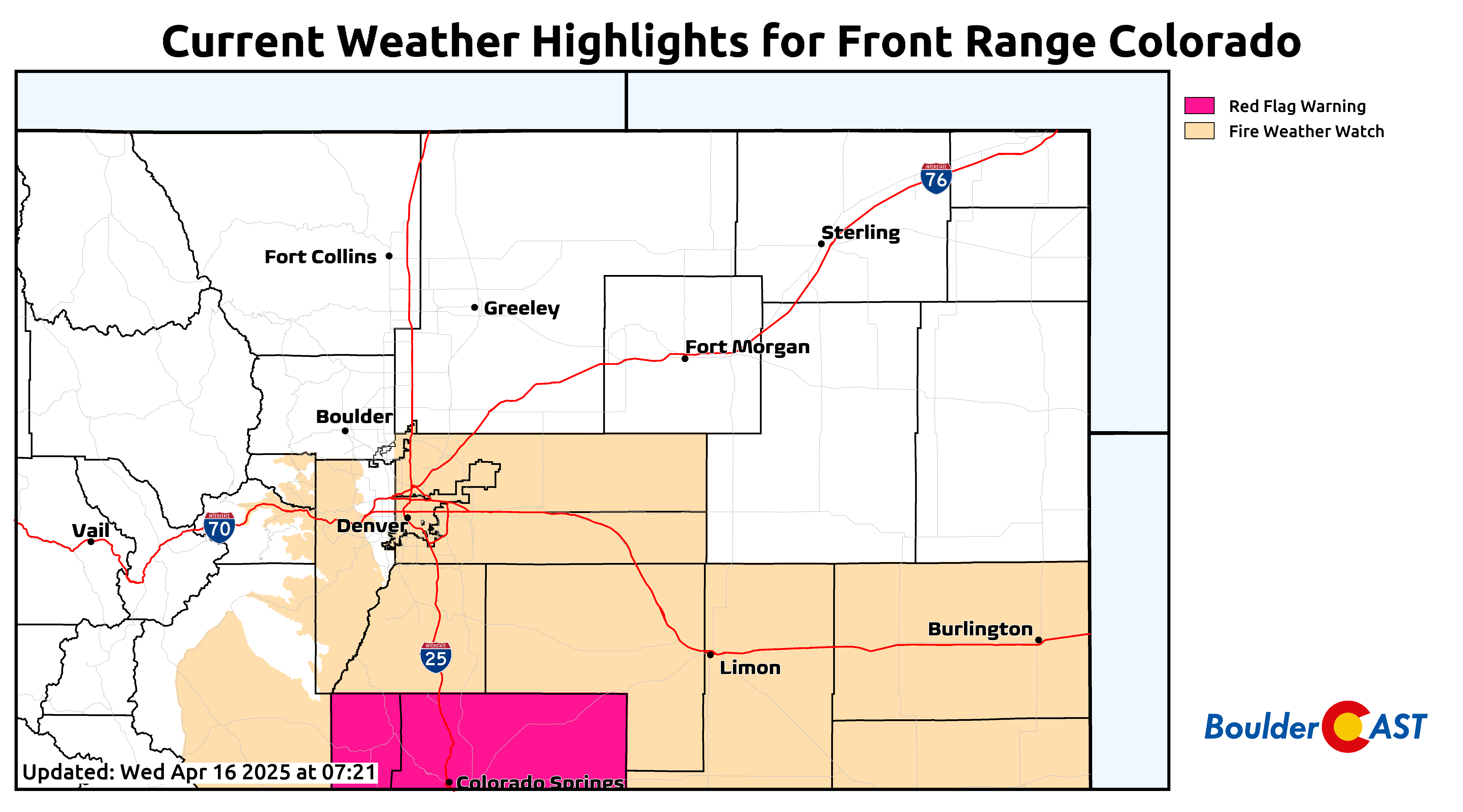
Areas north of Denver won’t be as primed for fires thanks to a cold front moving in during the afternoon hours. There still could be a period of increased fire danger around Boulder, but it may not be enough to trigger a Red Flag Warning. Latest guidance has been keeping the frontal timing around 6PM into the Denver area, though these things usually come earlier than expected. The sooner the front comes through the better as it will alleviate the fire risk.
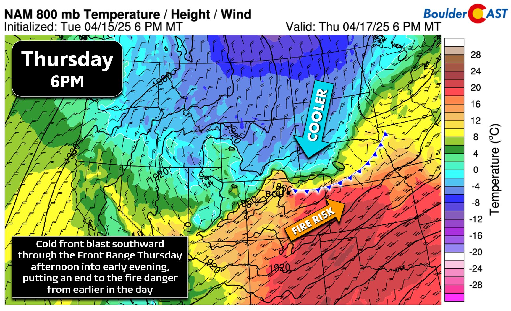
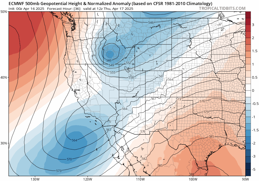
After the front blows through, upslope flow will ensue for us Thursday evening into early Saturday, about 36 hours or so. The track of the storm remains a concern. Models have moved the path closer to our area over the last couple days, but it’s still going to be pretty far away dropping south through Salt Lake City Thursday night into northern Arizona on Friday. This position will provide only light upslope and minor amounts of large-scale lift to our area leading to an extended period of mostly light precipitation. This light aspect is further reinforced by a lack of significant moisture wrapping into the area with this system.
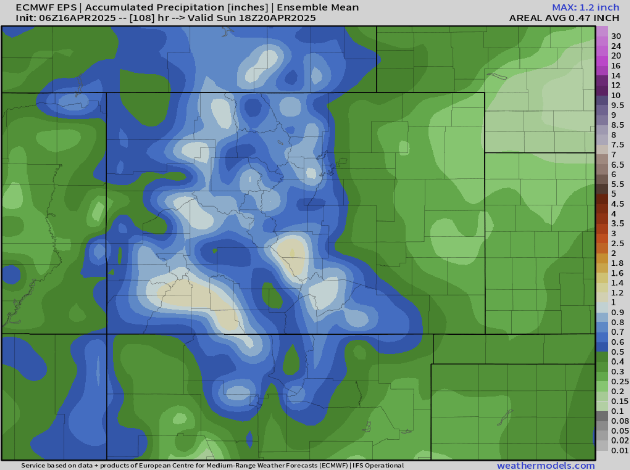
However, over time this light precipitation will add up to around 1″ of moisture in and near the Foothills from the storm, including in Boulder as shown below in our latest ensemble plume forecast below. The lack of intensity in the precipitation will limit how much snow accumulation we will see in this springtime affair. Yes, snow is favored to be the predominant precipitation type with this event. After a couple hours of rain near the onset Thursday evening, we’ll see a change-over to snow Thursday night and never look back. However, the lack of intense lift or upslope, combined with marginal temperatures and the mid-April sun angle, will mean a lot of the snow the falls will melt.
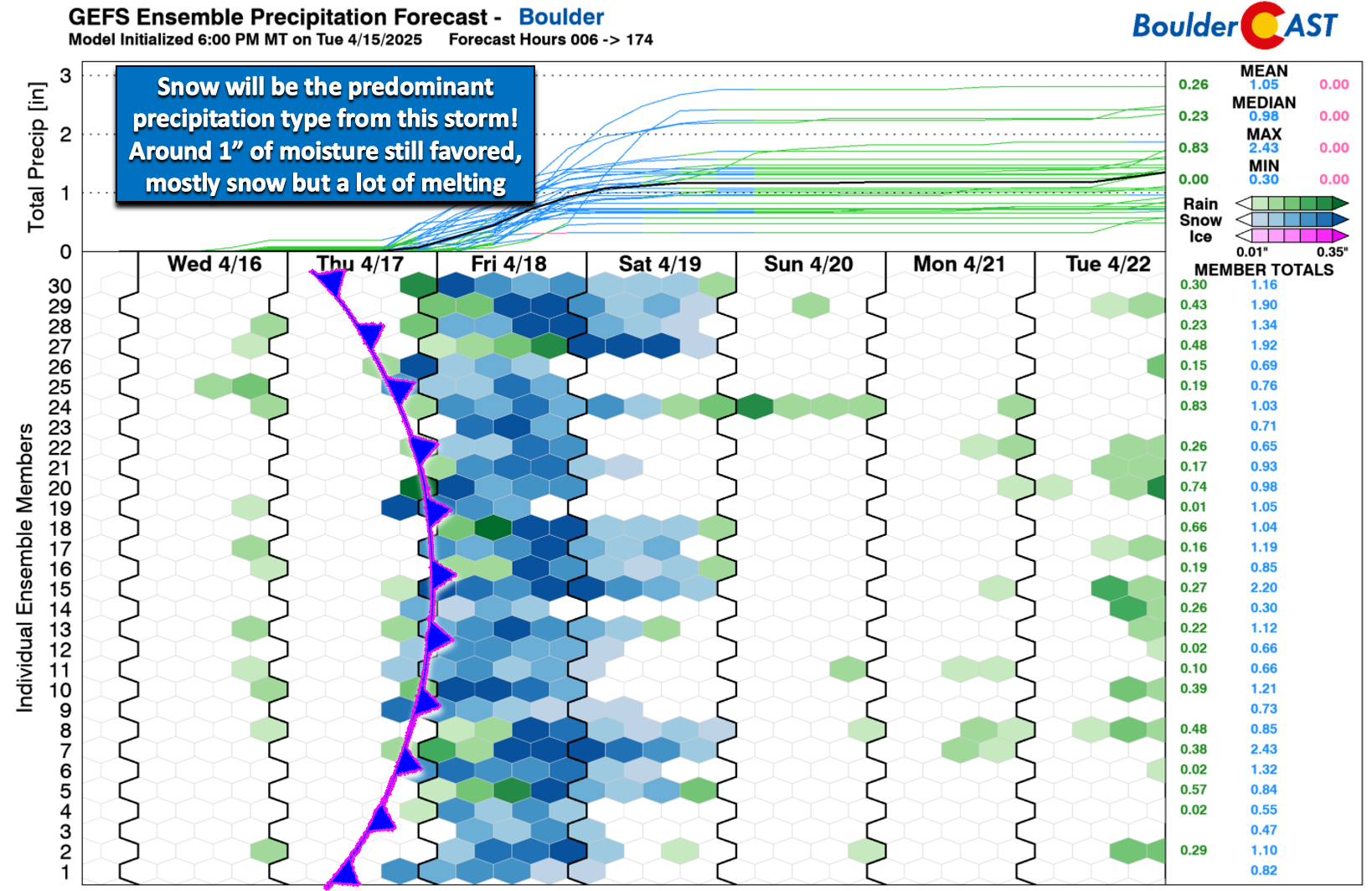
Precipitation amounts around 1″ are possible in/near the Foothills, with lower amounts heading eastward away from the terrain. This is shown in the European ensemble precipitation forecast graphic for Colorado below:
As it stands now, the overnight period and the lower-angle sun timeframes will be when we stand to see snow accumulate most. Our team thinks we could see a dusting to 2 inches of snow Thursday night into Friday morning across the lower elevations. Though it will continue to snow pretty much all day Friday, it won’t add much accumulation through the day across the lower elevations. As the sun lowers and sets Friday evening, accumulation should pick back up again, with another 1 to 5 inches of snow possible Friday night into Saturday morning. Our (very) preliminary snowfall forecast map is shown below covering all snow through Saturday night. The main risk for travel impacts will be across the Foothills and Mountains which could see upwards of a foot of spring snow from this storm. We still think daytime travel would be mostly fine up there as well given the April sun. Across the lower elevations, roadways are expected to remain wet throughout the event, though some slush may develop Friday night. A few inches of snow across the Metro area shouldn’t cause any major issues with power lines or leafed-out trees. However, once you start getting up around 6 inches, we may start to have problems. Totals of 6 inches are possible in Boulder and the western Metro area, so this bears watching as we get closer.
There is still a decent amount of uncertainty with this event given the expected light precipitation intensity, limited moisture, cold (but not super cold) temperatures, high April sun angle, and how these ingredients will all fit together in terms of timing. For now, just focus on the broader timeline and highlights of this strong spring storm:
- Thursday: Warm with elevated fire danger, mainly south of Interstate 70. Highs around 70 or so.
- Thursday night: Precipitation begins as rain and changes to snow overnight. Up to 2 inches of grassy accumulation by sunrise Friday on the lower elevations
- Friday: Light snow continues the entire day, but with limited accumulation due to melting. Roads remain just wet, even in the Foothills where it will be colder. Highs only in the middle 30s.
- Friday night: The period to watch for the most snow accumulation and the highest potential for impacts to powerlines and vegetation. 1 to 5 inches of snow accumulates overnight, possible with some slush developing in the neighborhoods above 5600 feet elevation.
- Saturday: Gloomy and cold with light snow lingering in and near the Foothills in the morning. Snow tapers off.
We’ll pass along another one of these larger winter storm updates Thursday morning with our final snowfall forecast map included. Come join us on Twitter, Bluesky, Facebook, and Threads for impromptu weather updates as this snowstorm unfolds, or subscribe to get notified of our long-form updates here. Think snow, or at least moisture — we need it!
Get BoulderCAST updates delivered to your inbox:
Go Premium, get all the perks.
Daily Forecast Updates
Get our daily forecast discussion every morning delivered to your inbox.
All Our Model Data
Access to all our Colorado-centric high-resolution weather model graphics. Seriously — every one!
Ski & Hiking Forecasts
6-day forecasts for all the Colorado ski resorts, plus more than 120 hiking trails, including every 14er.
Smoke Forecasts
Wildfire smoke concentration predictions up to 72 hours into the future.
Exclusive Content
Weekend outlooks every Thursday, bonus storm updates, historical data and much more!
No Advertisements
Enjoy ad-free viewing on the entire site.
Enjoy our content? Give it a share:


You must be logged in to post a comment.