We provide a quick update on the ongoing atmospheric river event which will pile up feet of snow in Colorado’s mountains by Christmas morning. With mild temperatures holding across the lower elevations and a few rare December raindrops falling from the sky, it looks like a white Christmas will elude us once again.
We discuss Boulder and Denver weather every single day on BoulderCAST Premium. Sign up today to get access to our daily forecast discussions every morning, complete six-day skiing and hiking forecasts powered by machine learning, access to all our Front Range specific weather models, additional storm updates and much more!

T
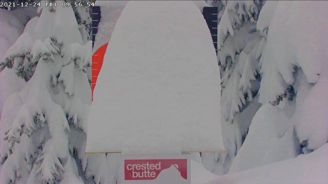
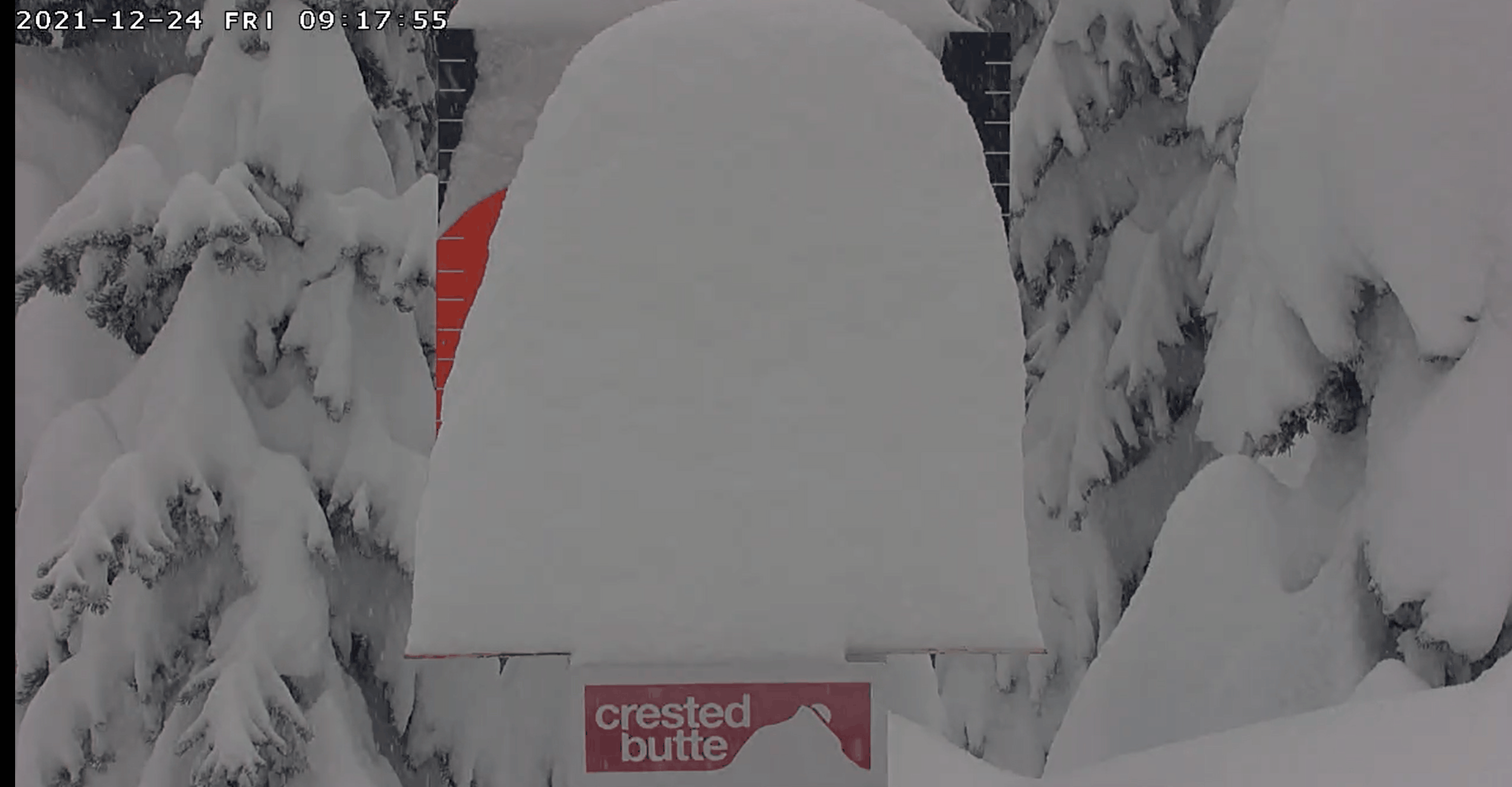
he well-advertised atmospheric river event has been pounding our Mountains with heavy snowfall since Thursday afternoon. Roadways have become very treacherous across much of the state as a result. As we expected, the San Juans have benefited most from this event so far. This is a live view from Crested Butte Ski Resort this morning as heavy snow continues to fall. They have already seen nearly two feet in the last 24 hours!
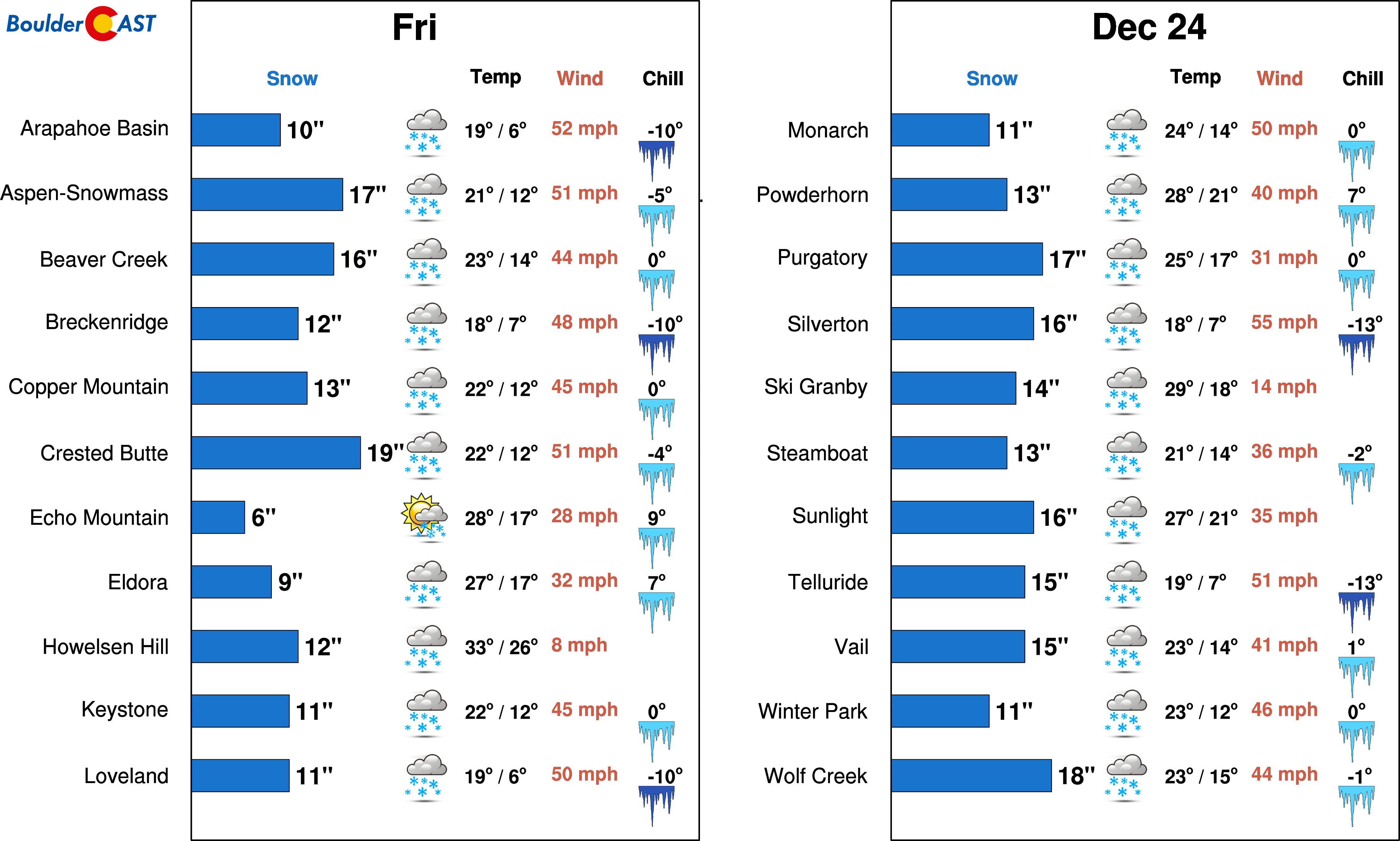
We’re expecting most ski resorts to see between 14 and 30″ of total snow by Christmas morning! Some lucky spots in the San Juans could actually pile up more than 3 feet! If you want extra deep powder this weekend, head to Crested Butte, Wolf Creek or Purgatory — good luck getting there at this point though!
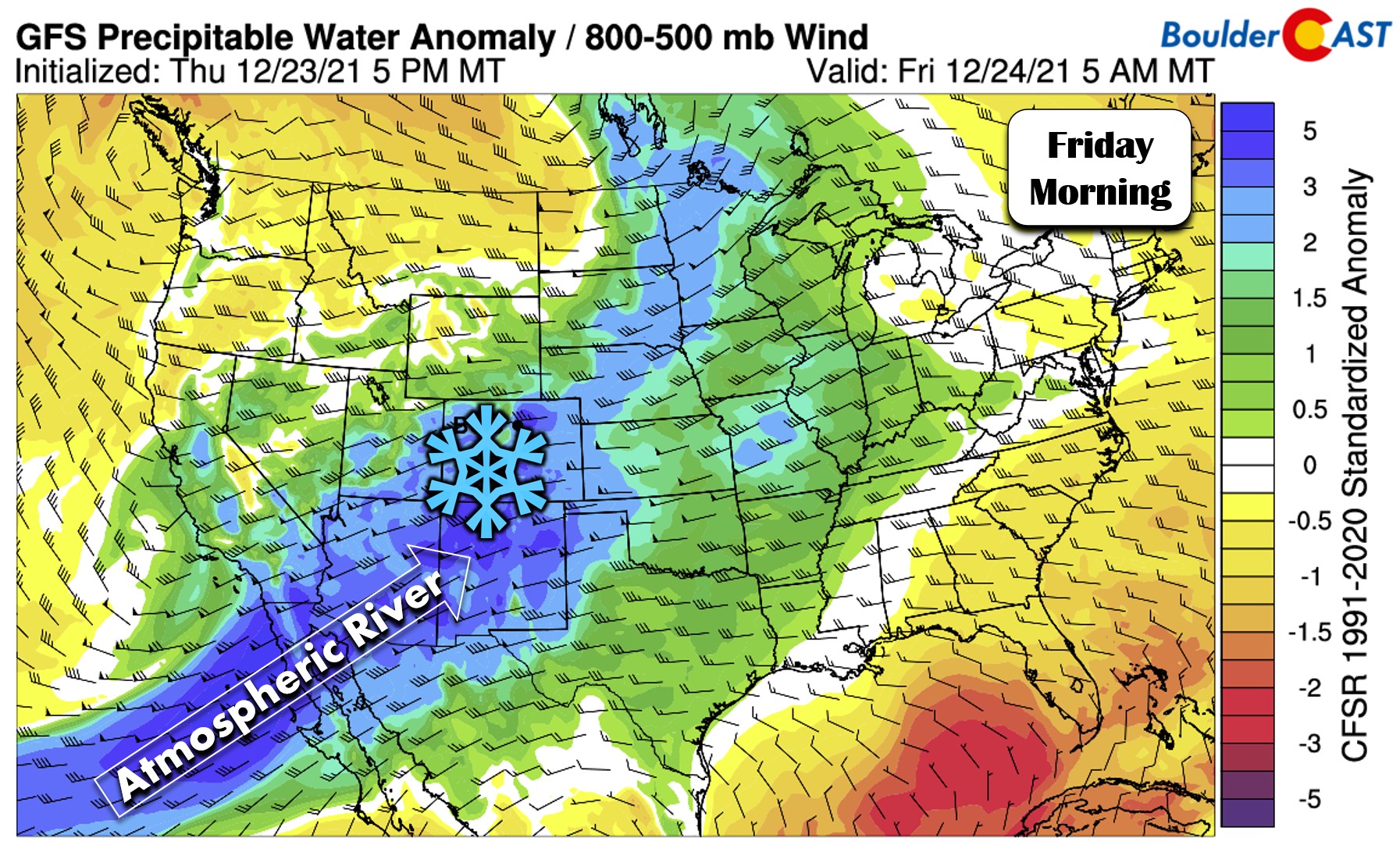
The GOES-East infrared satellite animation below shows the pipeline of moisture flowing into Colorado which indeed has subtropical ancestry. This is essentially an animation of cloud cover, but it’s clear as day that the Mountains are getting hammered with much-needed moisture and also that things are a lot less wintry east of the Continental Divide, unfortunately.
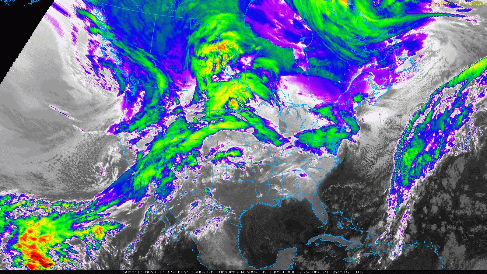
Ironically, the weather balloon launched in Denver earlier this morning measured a new Christmas Eve record for atmospheric integrated moisture content at 0.42″ (for the AM launch). This is a critical reminder that copious moisture doesn’t always equate to lots of precipitation, especially in the Front Range. Without any lift to wring out the moisture, it simply remains as water vapor in the air above with no beneficial impacts!
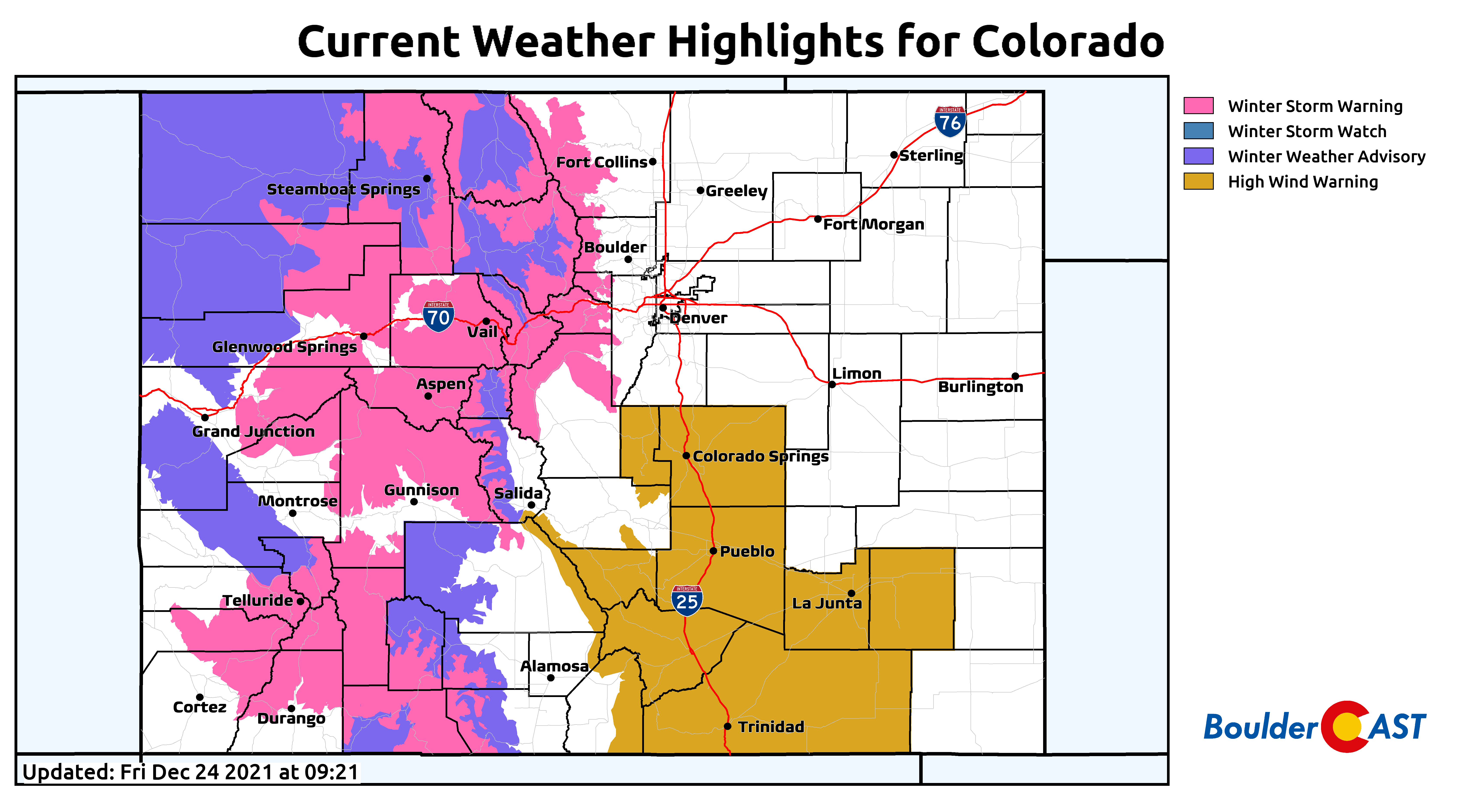
Heavy orographic snow will continue in the Mountains through most of the day Friday and will be enhanced by two jet-features overhead and a cold front sagging southward across the state. However, the snow should begin a drastic decline in intensity by early evening. Winter Storm Warnings and Weather Advisories remain in effect for much of the High Country through Christmas morning, so do use caution for any holiday travel today or tomorrow!
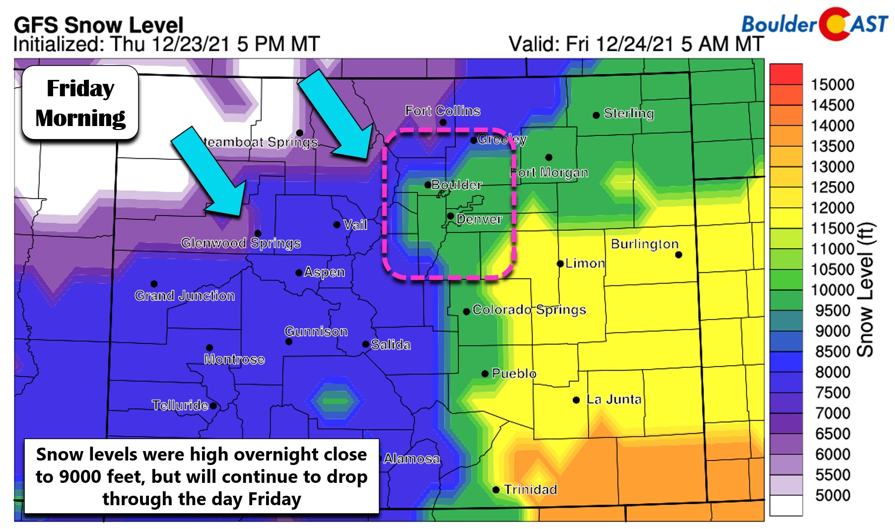
These atmospheric river events certainly pump in the moisture, but their very origin means they tend to be on the warmer side with snow levels remaining unseasonably high for this time of year. For example, despite some snowflakes overnight in the Nederland area at near 8500 feet elevation, little to no snow has stuck so far due to the above-freezing temperatures! Through the day Friday slightly colder air will be working in from the northwest as the core of the atmospheric river continues to sag southward — taking the best moisture with it as well. Snow levels will be dropping which should allow for better accumulation in the higher Foothills communities as we head into the afternoon and evening hours.
Across the lower elevations, it doesn’t appear that much if any snow will be possible today or tonight dashing the hopes of a white Christmas for most of us in the Denver Metro area. We’ve already seen a few spill-over raindrops in Boulder, Loveland and Fort Collins, but that’s been about it. Occasional rain showers will continue through the day Friday, possibly mixing with some snowflakes near and after sunset. Temperatures don’t really drop below freezing in Boulder or Denver though so the chance of accumulation is essentially nil.
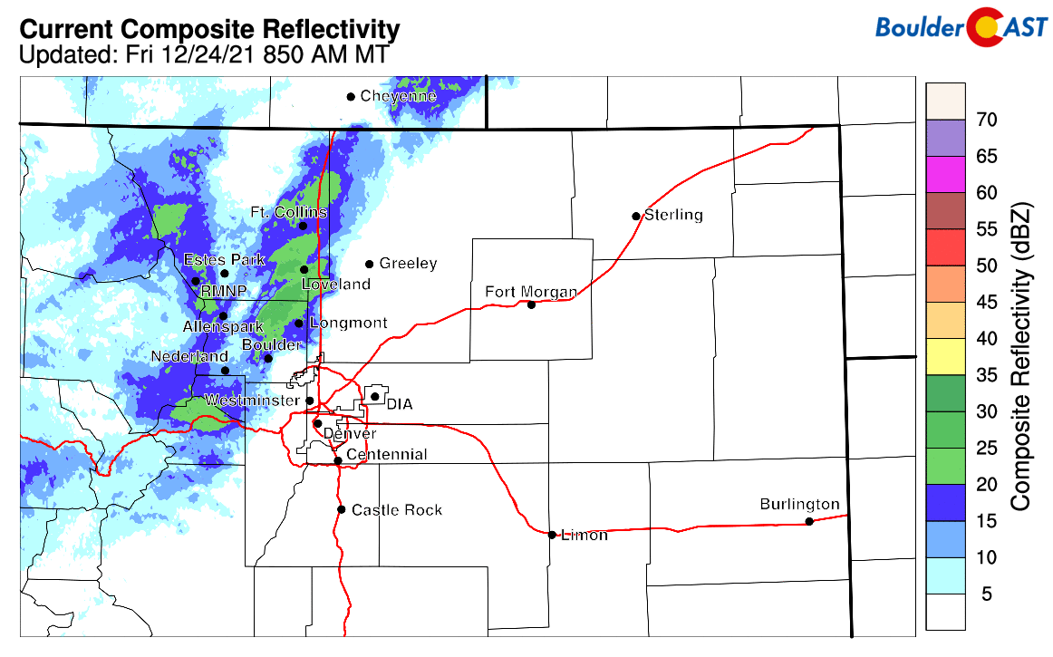
Radar animation from Friday morning showing spotty precipitation falling across the northern Front Range. Most of this is light rain on the Plains, with some snow in the higher elevations.
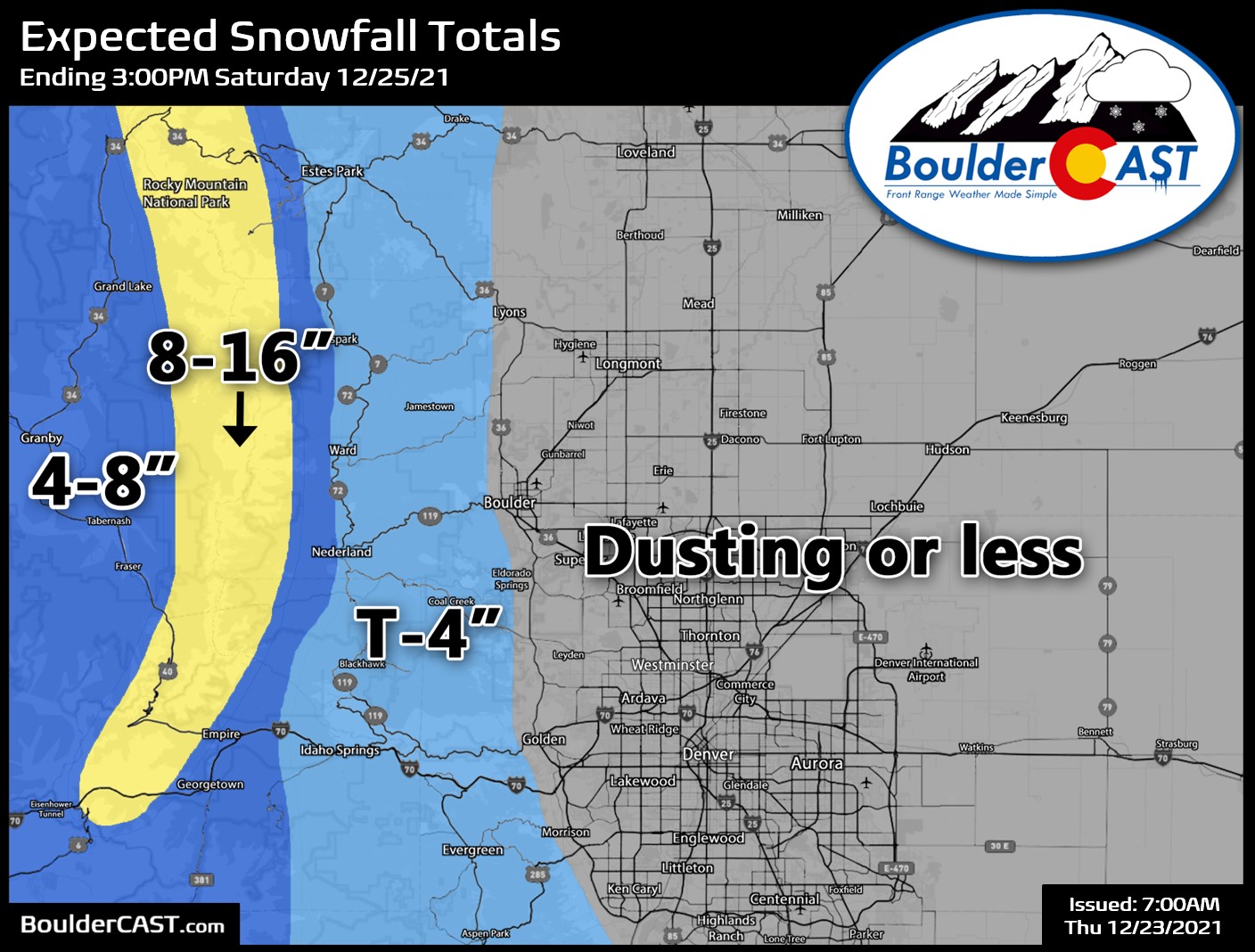
Our snowfall forecast map for storm totals heading into Christmas is shown below. Again, expect mainly rain showers below 7000 feet elevation, but a few flakes may mix in this evening in Boulder or Denver as temperatures drop and the front pushes through. This should mark the 7th year in a row with no Christmas snowflakes in Boulder, and the 4th year in a row with no snow even on the ground. Above 8500 feet, you’ve hit the lottery and are nearly guaranteed a white Christmas this year!
Christmas Day will be mundane for most of the area. There will be just a few lingering snow showers in the Mountains with only light accumulations. For Boulder and Denver, it will be sunny and gusty with highs in the 50’s. Looking further ahead, a round of light snow may materialize for us on Sunday. More on that later.
From all of the BoulderCAST Team,
we wish you Happy Holidays!
Subscribe to receive email notifications for BoulderCAST updates:
We respect your privacy. You can unsubscribe at any time.
Help support our team of Front Range weather bloggers by joining BoulderCAST Premium. We talk Boulder and Denver weather every single day. Sign up now to get access to our daily forecast discussions each morning, complete six-day skiing and hiking forecasts powered by machine learning, first-class access to all our Colorado-centric high-resolution weather graphics, bonus storm updates and much more! Or not, we just appreciate your readership!
Enjoy our content? Give it a share!


You must be logged in to post a comment.