The run of beautifully warm autumn days is about to end with our first major storm of the season heading towards Colorado! It will bring a slew of impactful weather Sunday into Monday, including heavy mountain snow, dangerous fire conditions, blowing dust, strong downslope winds, and a chance of the first snowflakes of the season in the Denver area. We discuss the latest on the incoming storm and who will see which flavors of crazy weather over the next 36 hours.
At a Glance:
- After a lengthy stretch of beautiful weather, BIG changes are coming Sunday as the first major storm of the season slams Colorado
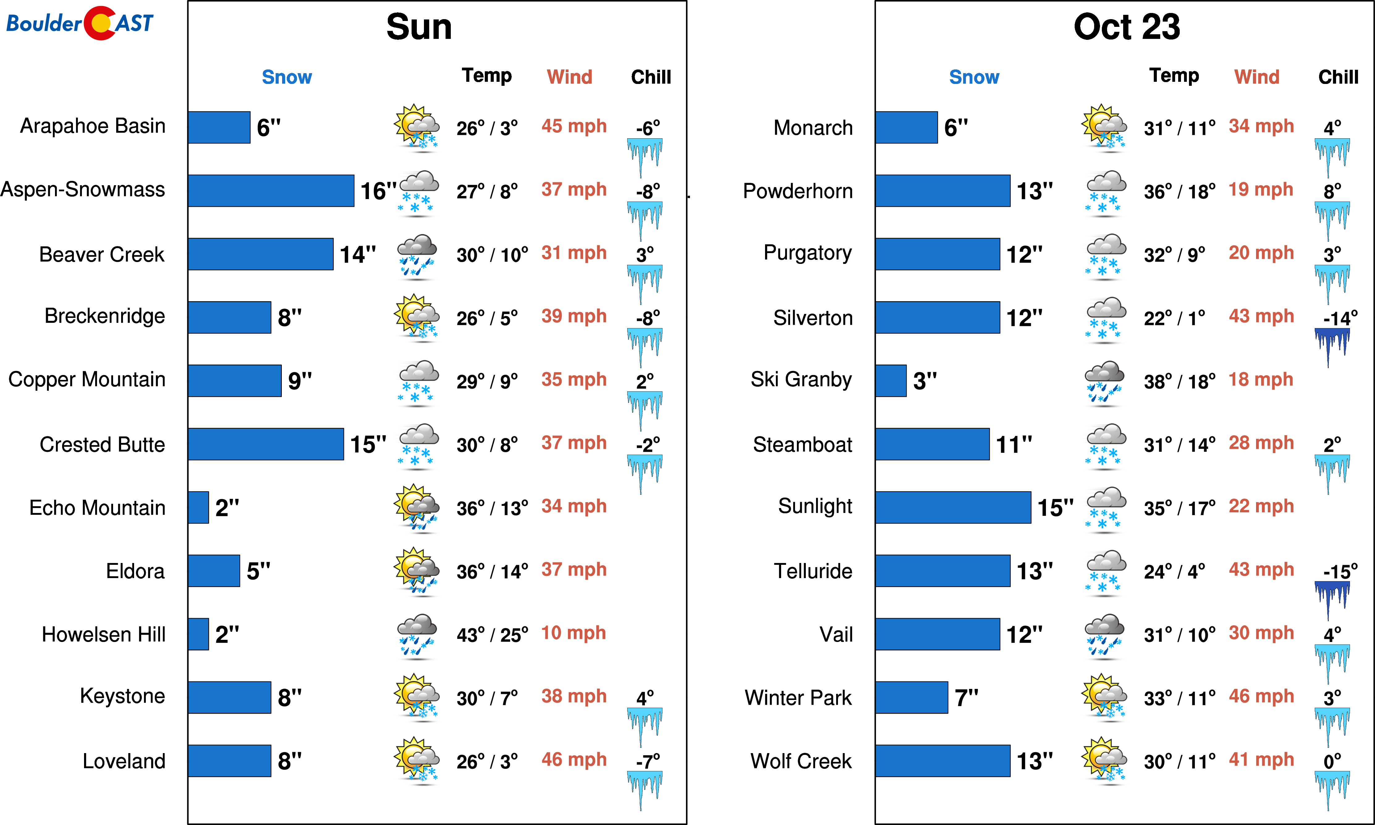
- Heavy mountain snow is for the state — up to 18 inches in central and western Colorado’s peaks
- This will be a mostly wind event for the Denver Metro area with gusts of 25 to 45 MPH on Sunday creating elevated fire concerns
- There is a slight chance of rain and snow showers late Sunday afternoon into Sunday evening for Boulder and Denver, but the elusive first accumulating snow of the season is not anticipated from this event
- As skies clear Sunday night, temperatures could drop slightly below freezing across the area — winterize your homes ASAP!
We discuss Boulder and Denver weather every single day on BoulderCAST Premium. Sign up today to get access to our daily forecast discussions every morning, complete six-day skiing and hiking forecasts powered by machine learning, access to all our Front Range specific weather models (including smoke forecasts), additional storm updates and much more!

Main stories: Mountain snow & high fire danger on the Plains
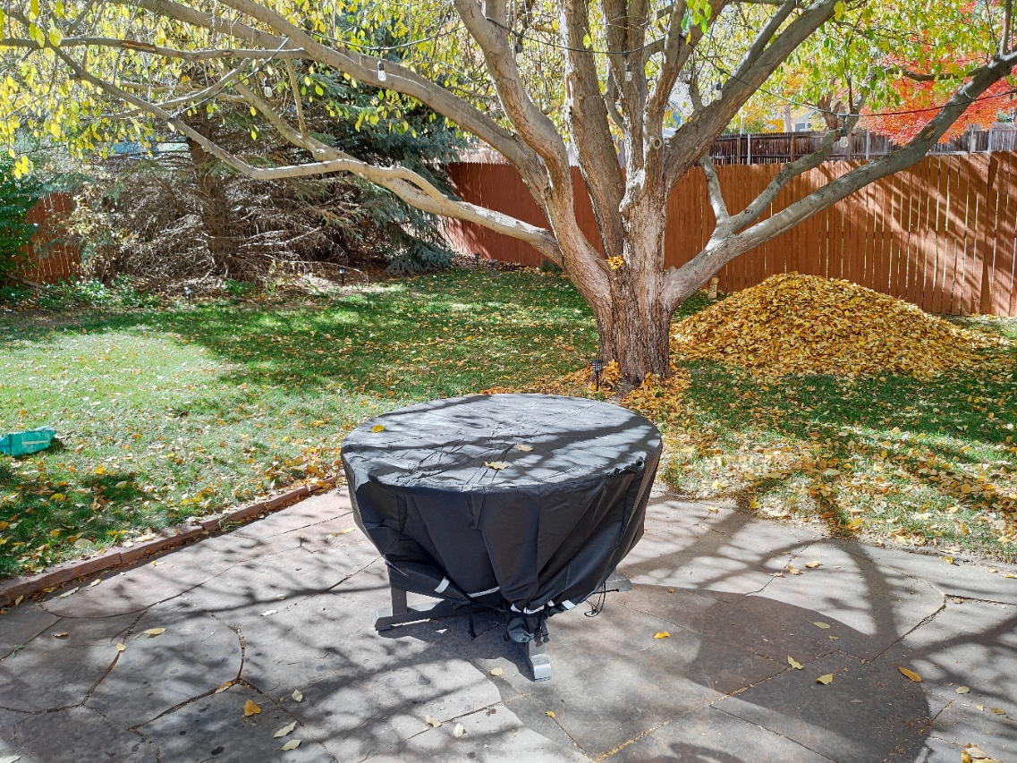
We hope you enjoyed this truly incredible Saturday in late October before the seasons finally attempt to change in the next 24 hours. Our family took advantage of the beautiful weather this afternoon to play some tennis and to put a dent in the leaves that have already fallen in our yard.
As always, when we provide a weather update to you, something is usually brewing upstream from Colorado and today is no exception! As of Saturday evening, the first major winter storm of the season is gaining its strength over the Great Basin in the form of a formidable trough. The first clouds and showers ahead of this trough are just now entering western Colorado.
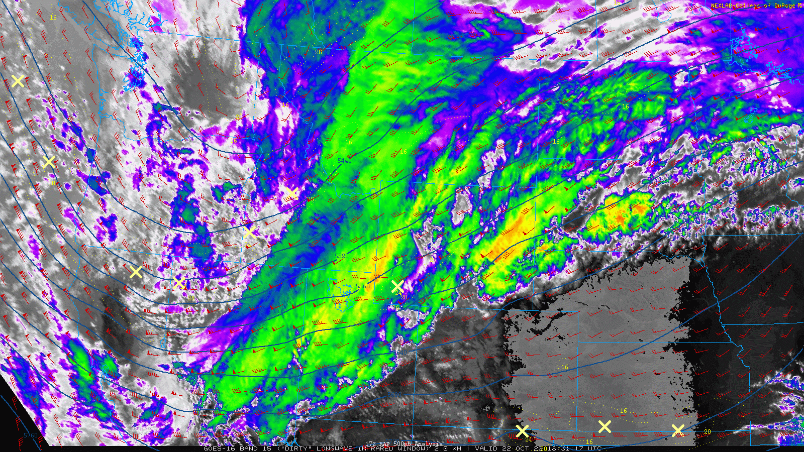
Over the next 24 to 36 hours, the state will be rocked by a profusion of weather — heavy mountain snow, strong winds, sub-freezing temperatures, blowing dust, high fire danger and potentially the first snowflakes of the season in Denver will ALL be on the table — though not necessarily in that order! The statewide map of current weather highlights looks like a long-lost Andy Warhol painting….
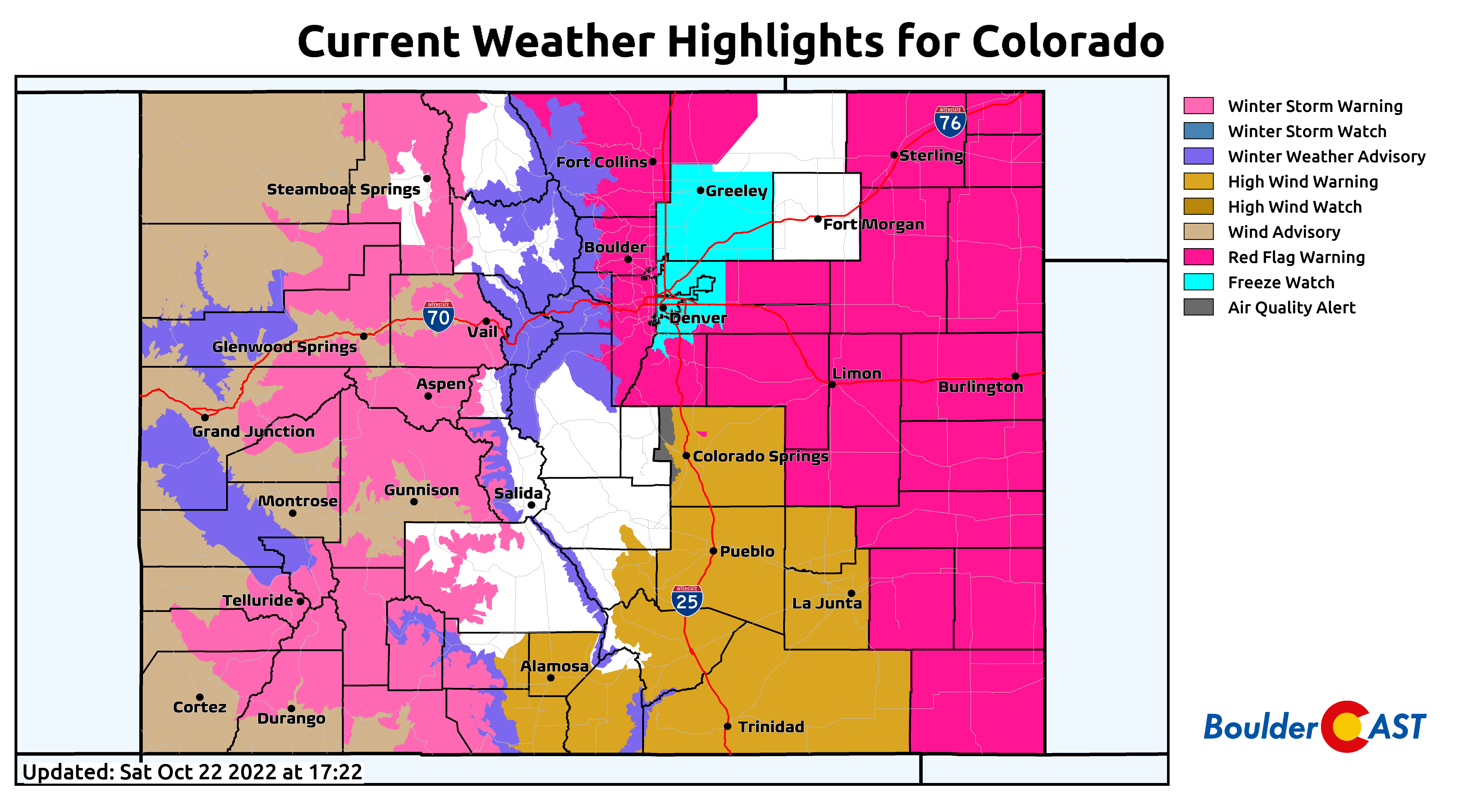
The Mountain snow begins quickly Saturday night, heavy at times, and will continue into Sunday night as Pacific moisture slams into the terrain. We don’t recommend travelling as more than a foot of snow will be possible, particularly in southwestern and central Colorado. Winter Storm Warnings are issued for those ranges. The Front Range Mountains will not do as well from this system but should still pick up a few inches — Winter Weather Advisories are posted just west of our area. The ski resorts should all do fairly well from this system — picking up anywhere from 6 to 16″. Opening day in many resorts may not be as far off as it once seemed…
For the lower elevations of the Denver Metro area, the focus from this system sadly won’t be heavy snow (though it certainly could be this time of year!). Instead we’re watching for strong winds and elevated fire danger on Sunday before transitioning to a chance of a few raindrops/snowflakes and sub-freezing temperatures Sunday evening and night. The cold front with this system will be a decent one. It will blow through in two waves actually — one Sunday morning and another Sunday evening — both accompanied by gusty winds. Most areas will likely get into the 60s ahead of the front but temperatures will quickly drop into the 50s by afternoon and 30s by evening. Peak wind gusts for the entire area will range from 30 to 50 MPH on Sunday, strongest in the Foothills and southeast of Denver. Areas east of the Palmer Divide will likely see pockets of blowing dust given just how dry it has been.
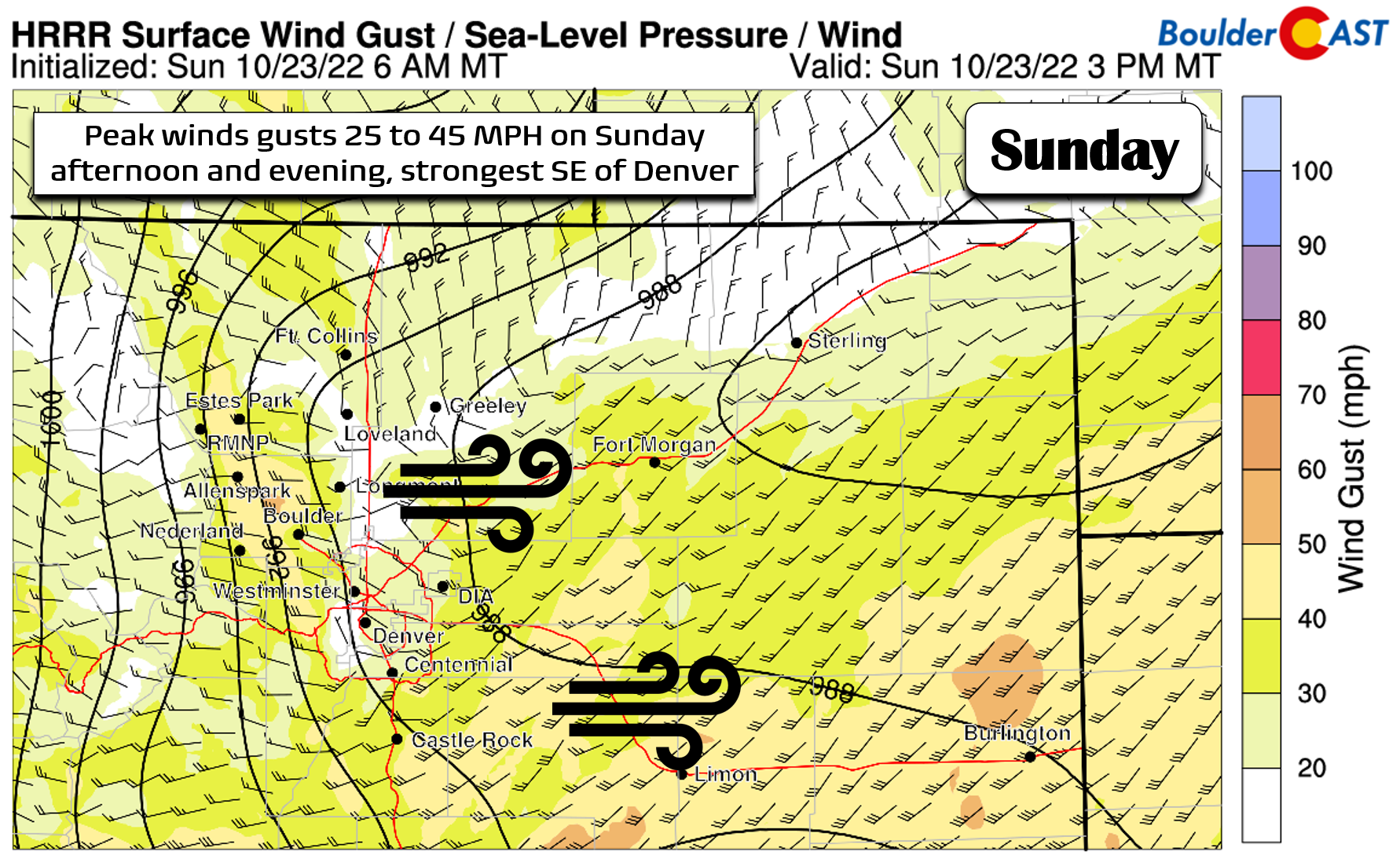
As we alluded to in our last forecast update for this system on Tuesday, this storm will pack more wind than anything for the Boulder-Denver area. However, as we all have learned over the last few years (e.g. Calwood & Marshall Fires), the pre-winter storm downslope winds CANNOT be overlooked as they can breed extreme wildland fire growth conditions.
Fortunately the fire danger on Sunday will be not be as extreme as it could be. The morning arrival of the first cold front will prevent temperatures from rising too much, thereby keeping relative humidities from plummeting into dangerous territory. If the front were to arrive later in the day, this may be a much different conversation…
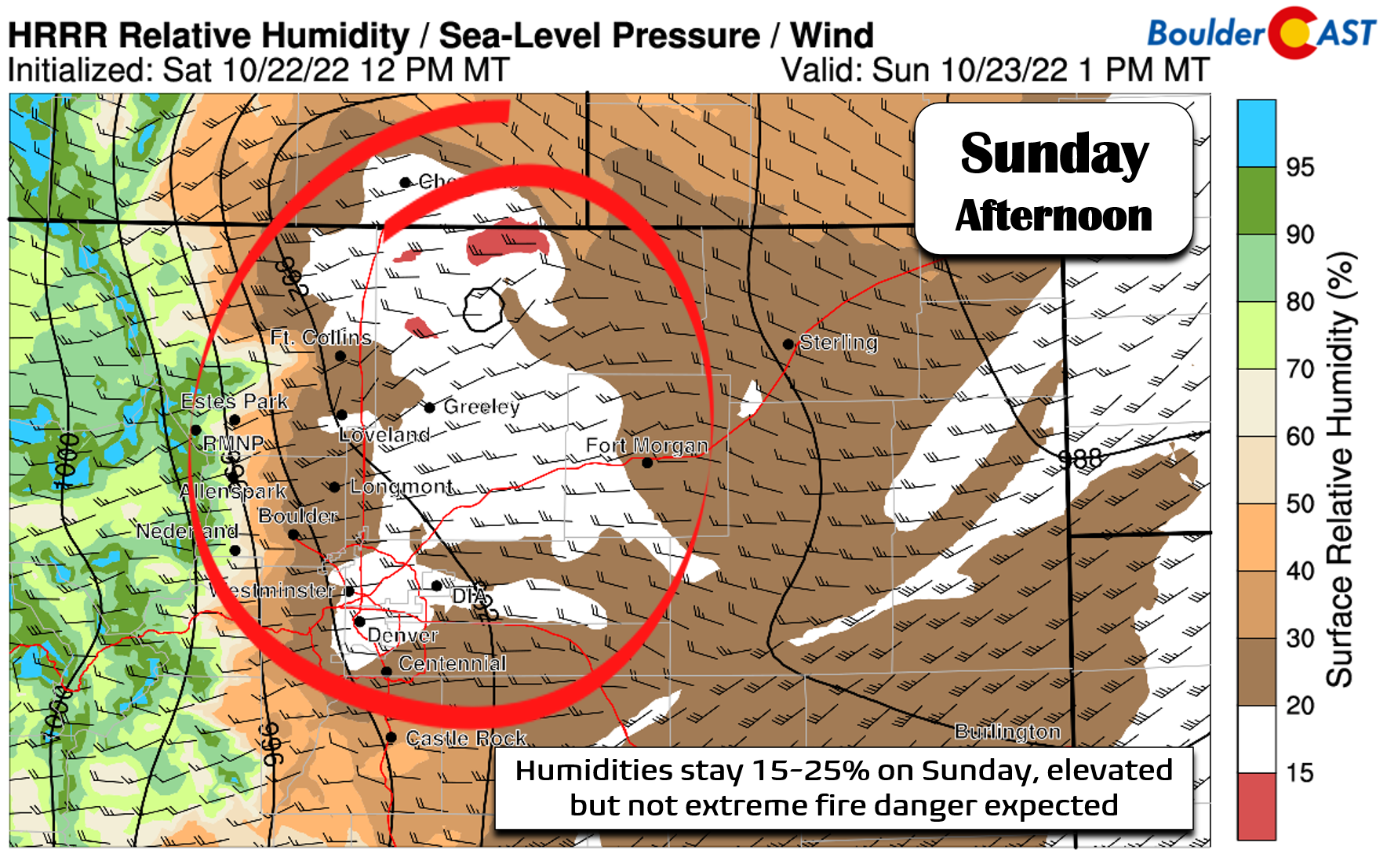
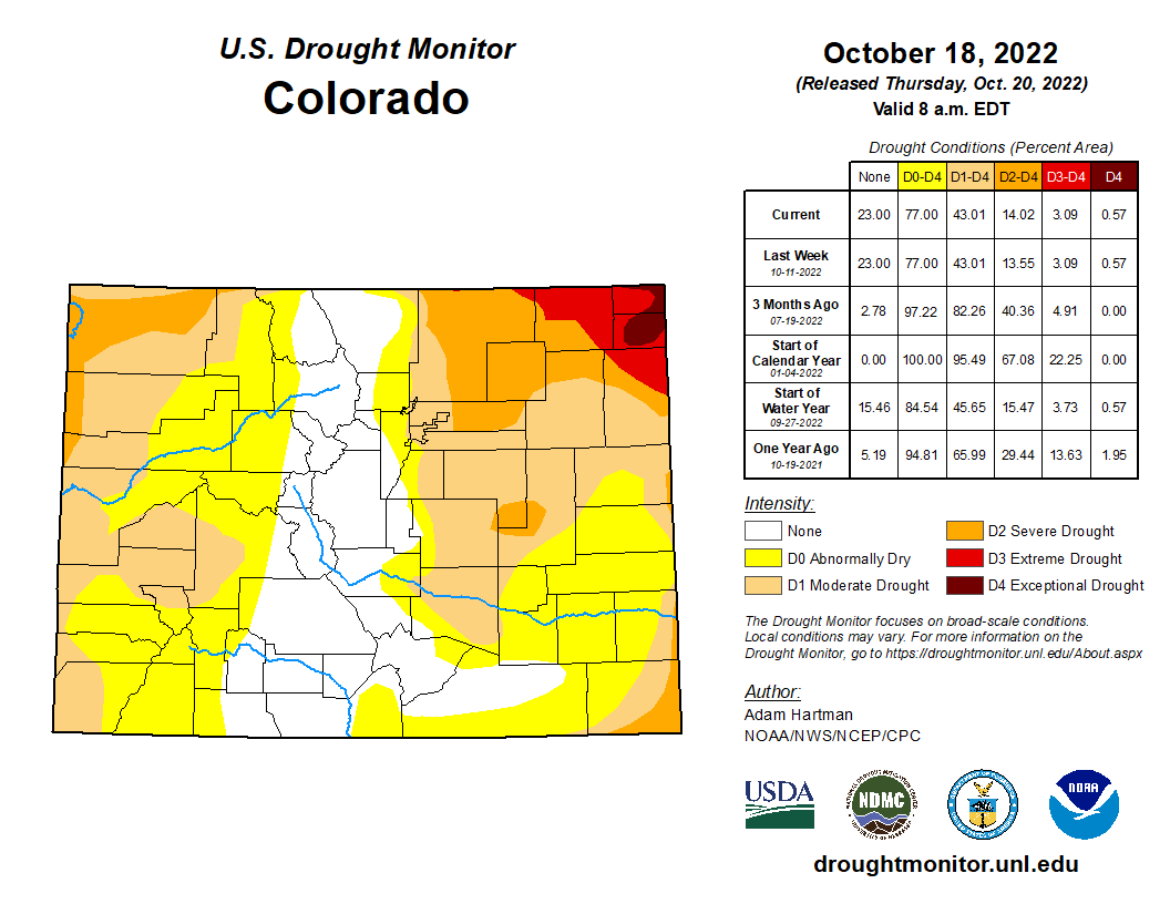
Nonetheless, the fuels around the area are bone dry as most of us have only received a half inch or less of rain in the last 30 days. That facet cannot be ignored given the strong winds inbound. Any spark could create a large blaze rather quickly so be extra careful on Sunday. Red Flag Warnings are posted southeast of the Denver Metro area where winds will be most intense!
Throughout the day Sunday it will be blustery in Boulder and Denver but overall largely dry east of the Continental Divide as downslope rules the roost. However, if you are heading up Interstate 70 or to Rocky Mountain National Park, plan for snow. With the left-exit region of the jet nearby and the strong cold fronts blasting through, snow squalls will be possible if not likely in the High Country Sunday morning and afternoon. These could create brief intense whiteout conditions making driving temporarily impossible and exceptionally dangerous. Again, travel is not recommended Sunday into Sunday night!
Sunday afternoon into the evening, watch for a few showers to spread out across the lower elevations. The best chance comes from roughly 4PM to 10PM Sunday evening with the secondary front — but still we’re thinking only widely scattered coverage (~30% chance). We were hopeful there would be a bigger push of upslope with this system, but that just isn’t the case anymore as models have trended drier and more “downslopey” overall. The GFS model (shown below) tries to turn low-level winds somewhat easterly Sunday evening, but it likely won’t be enough to support much if any precipitation.
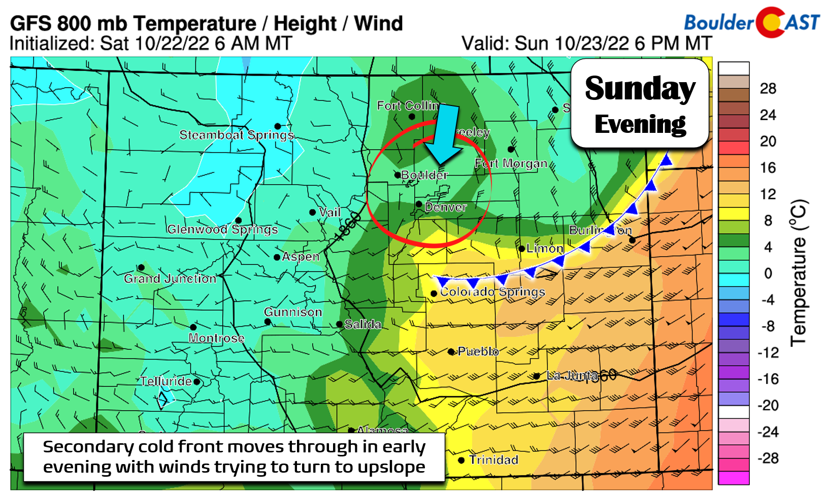
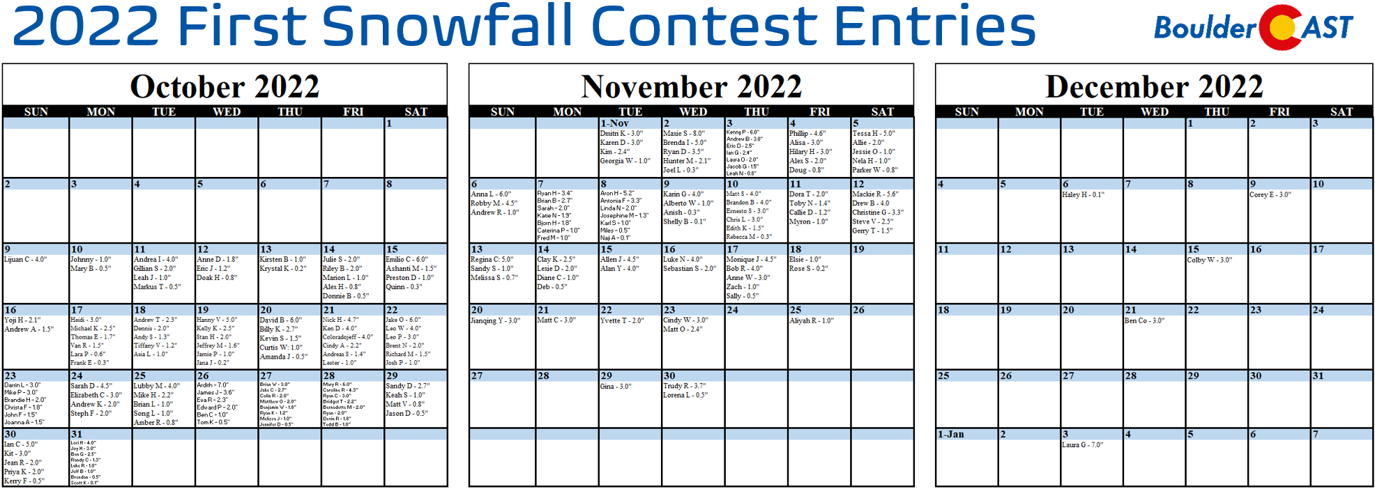
Initially temperatures will be in the 50s and 40s, but they will fall further in the evening into the 30s. Whatever brief precipitation that does materialize will begin as rain but a mix with snow is possible after sunset Sunday evening. Sadly, we’re not expecting any accumulation with this system in the Boulder or Denver area. Precipitation chances are too low, temperatures are too warm, and the upslope is too faint. This is probably good news because if Boulder did report its first snow Sunday night, our own meteorologist Andrew would have taken home the bacon in our 2022 First Snowfall Contest!
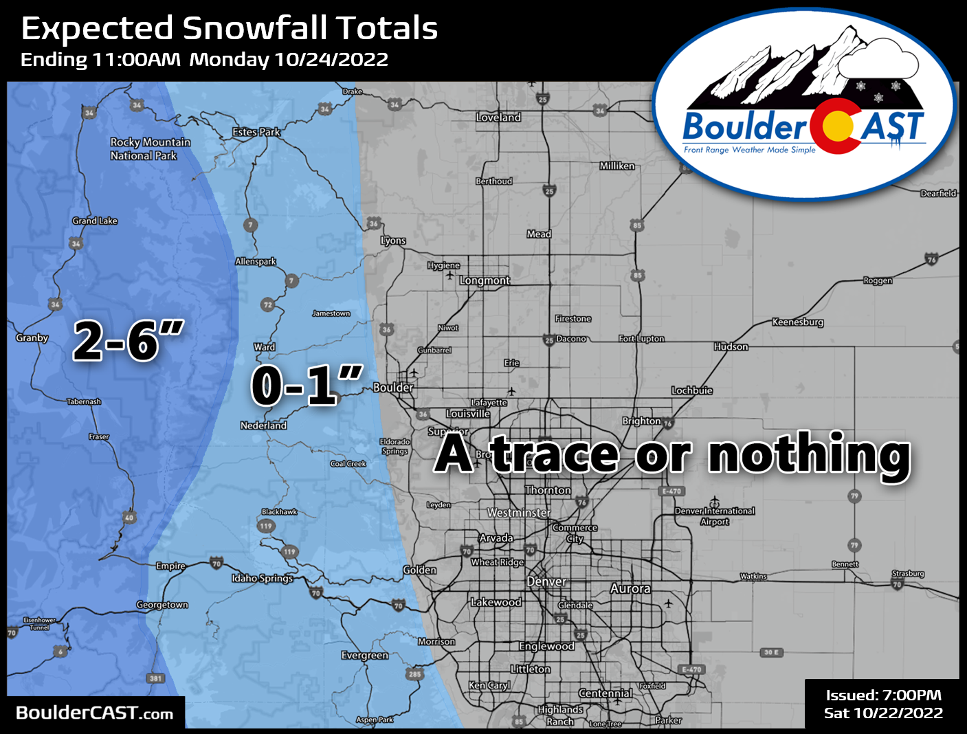
Our official snowfall forecast map, the first of the 2022-23 snow season, is shown below. This covers all snow falling through Monday morning. We’re going with a trace or less across the Plains for reasons mentioned prior, an inch or less in the Foothills, and 2-6″ in the Mountains and areas west.
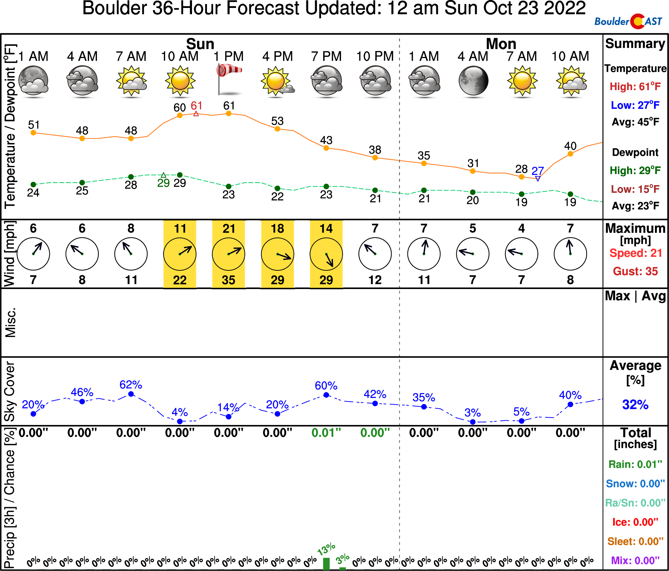
Here’s a look at the weather in Boulder over the next 36-hours — hold onto your hats Sunday!
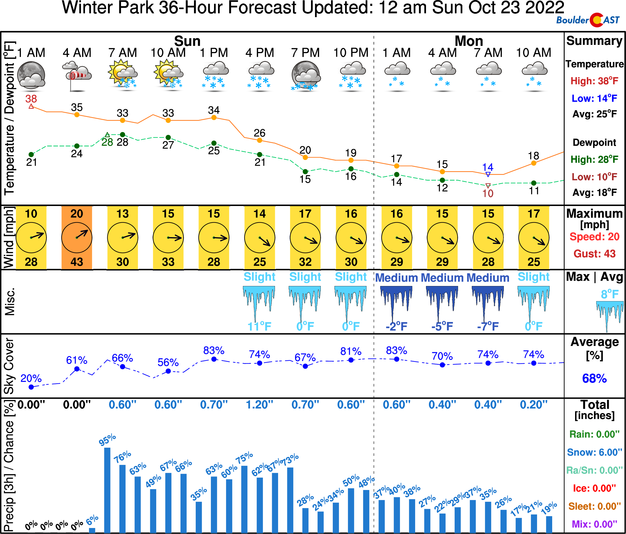
Things are definitely snowier on the other side of the Continental Divide. Here’s how they are looking for Winter Park:
Models continue to trend towards a rapid shift to downslope Sunday night with skies quickly clearing. It looks like just about everyone could drop a degree or two below freezing by sunrise Monday, if the winds can die down that is. Be sure to take appropriate winterization steps — disconnect your outdoor hoses and drain your backflows and swamp coolers. Pick those remaining fruits and veggies in the garden, etc.
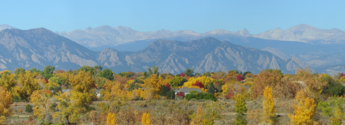
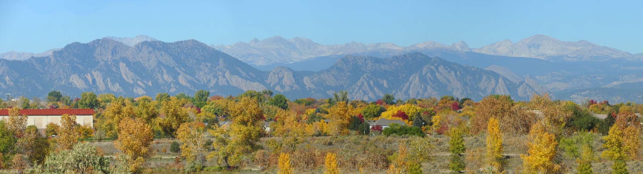
Given everything that is about to unleash across the Front Range and the state as a whole, the best fall colors are certainly now behind us. We hope you were able to get out and peep a few leaves this year before thing turn brown and bland for the next six months. We took this distant shot of the Flatirons this past Thursday when the colors were really popping!
That’s all for now. We’ll see you on the other side of our first true autumn storm of the season! Check back Monday for our regularly scheduled weekly outlook…

Get BoulderCAST updates delivered to your inbox:
Enjoy our content? Give it a share!


You must be logged in to post a comment.