Many western suburbs of Denver experienced their first snow of the season last night, with Boulder officially recording 0.2 inches. The colder, higher elevations to the west saw a more significant dump, up to 15 inches in some areas. We briefly recap the underwhelming first snow of the season and announce the winners of our 2024 First Snowfall Contest.
Storm Recap: First snow is in the books for some
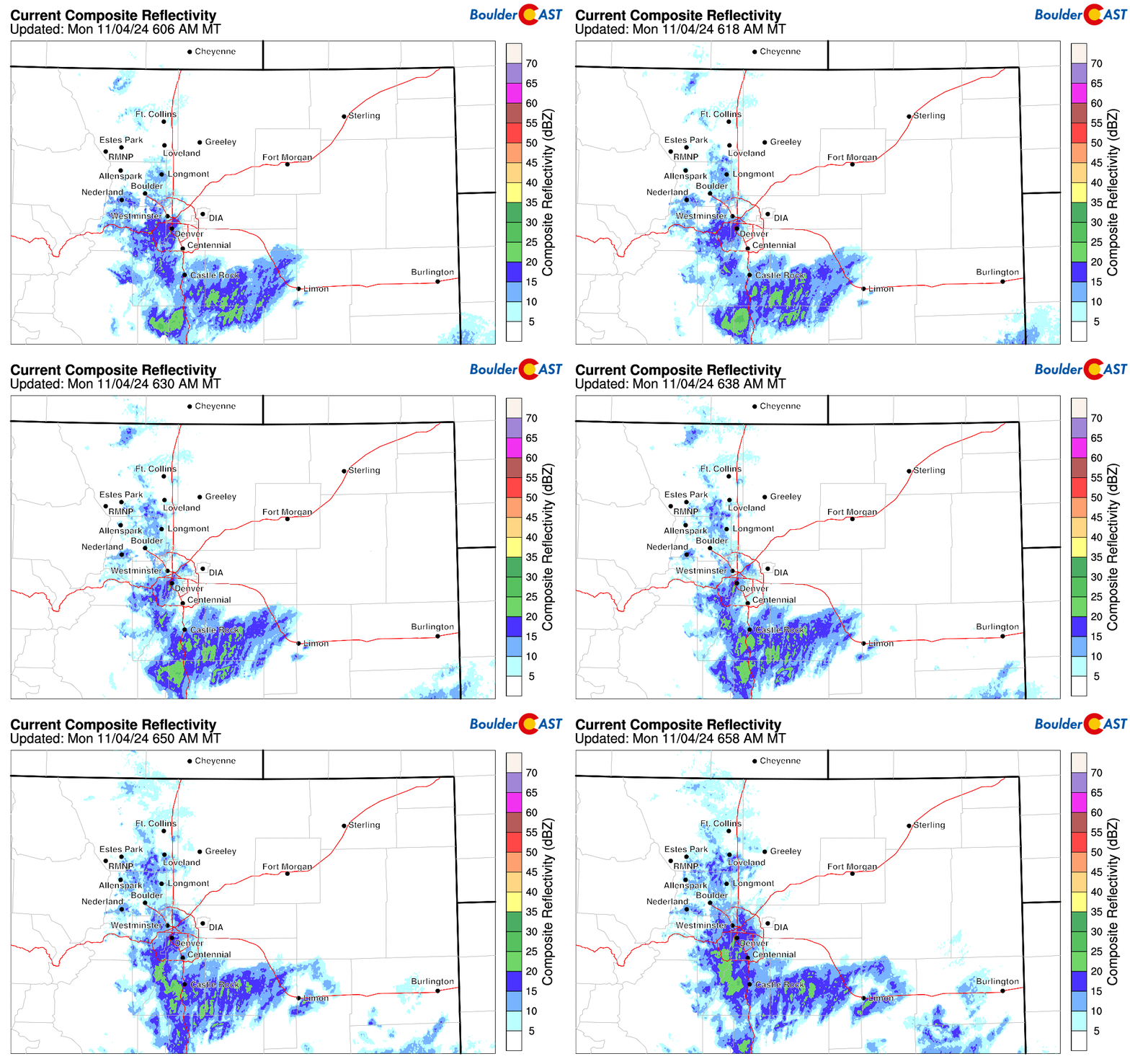
Light showers continue to linger across mainly the western and southern Denver Metro area this morning. This is shown on the radar animation below. The Monday morning commute likely went off without a hitch as any spots of slushy accumulation on the roadways have since melted off.
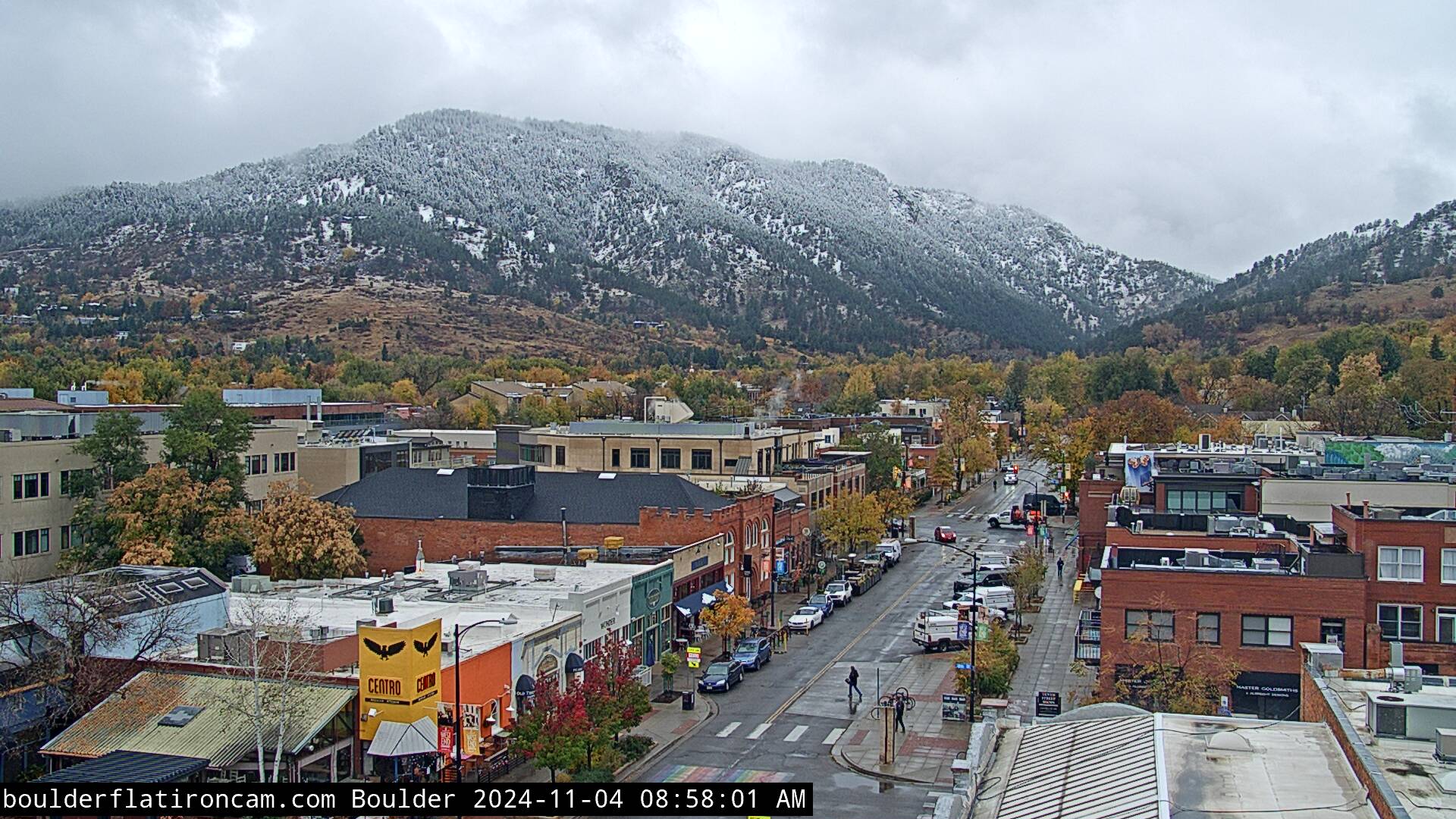
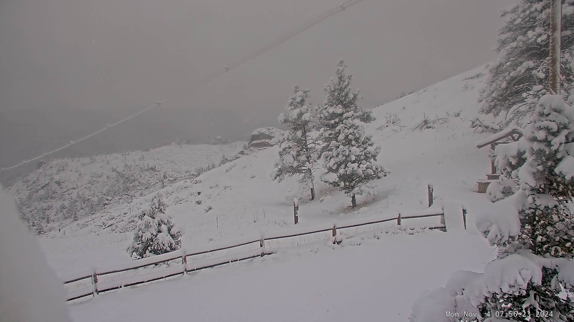
Here in Boulder, it’s currently still snowing lightly, occasionally mixing to drizzle. We had trouble keeping temperatures down overnight so the coating of snow that briefly accumulated on the grass last evening has since melted with temperatures in the middle 30s now. The view of Flagstaff Mountain from Boulder this morning is telling…
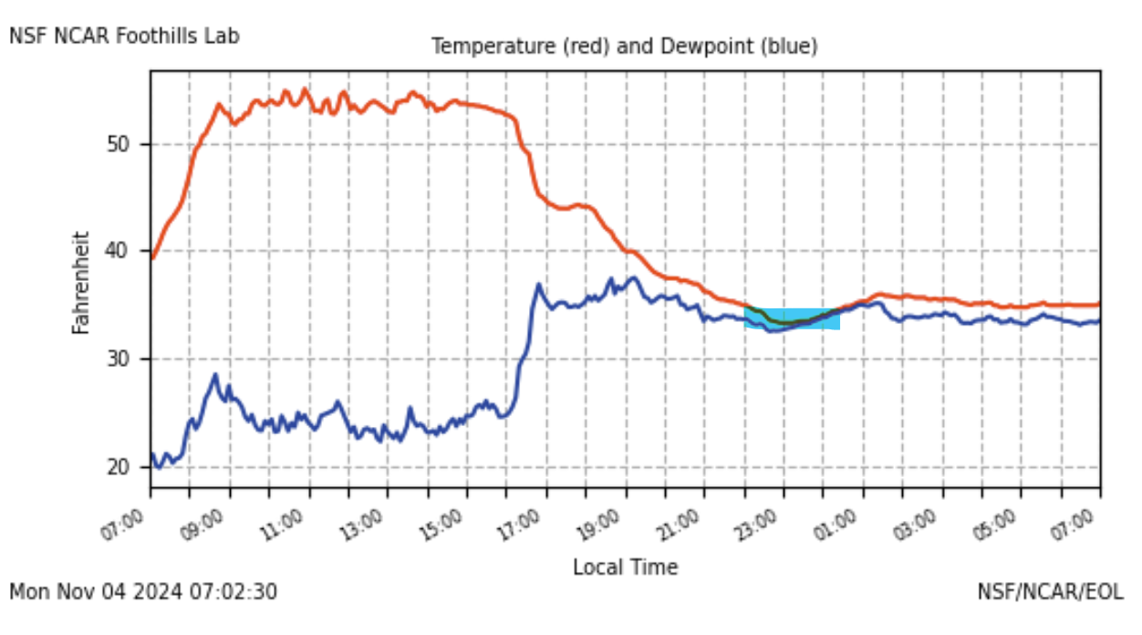
The temperature graph below (red line) shows that we cooled down to around 33°F in the hours leading up to midnight when precipitation rates were greatest. As intensity waned after midnight, we warmed back up to around 35°F, mixing snow back to rain and melting whatever accumulation we had.
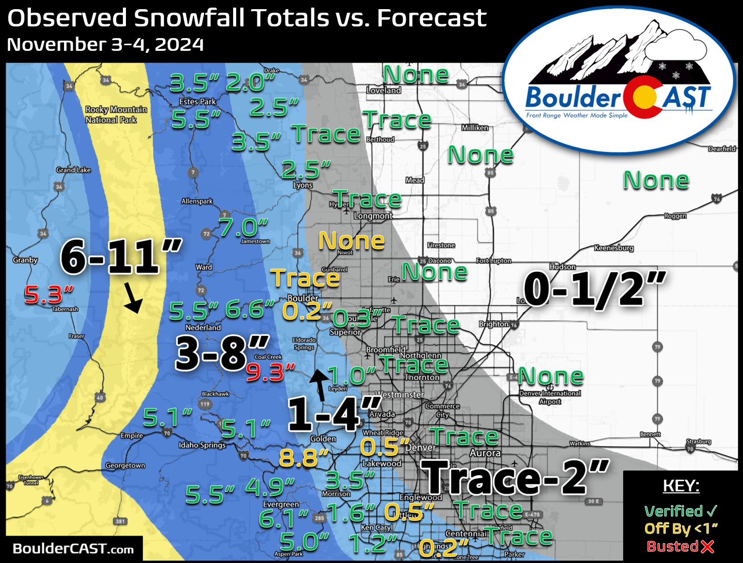
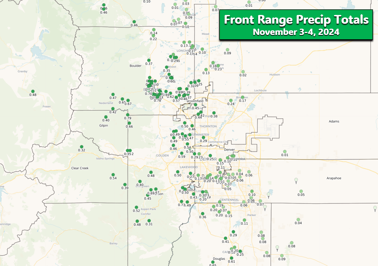
Still, there was some accumulation in the western suburbs of Denver, generally above 5500 feet elevation — the first snow of the season is out of the way for places like Boulder, west Arvada, Golden, Littleton and Roxborough. Our snowfall forecast map for the event is shown below with storm totals overlaid. Green values indicate our forecast verified, Yellow values mean the observed total was just outside our forecast, while Red was a busted forecast (more than 1″ off). The lower elevations were plagued by temperatures being a degree or two on the warmer side leading to generally 1″ or less of snow. Nowhere east of Interstate 25 saw more than a trace, including Denver International Airport which received exactly zero snow.
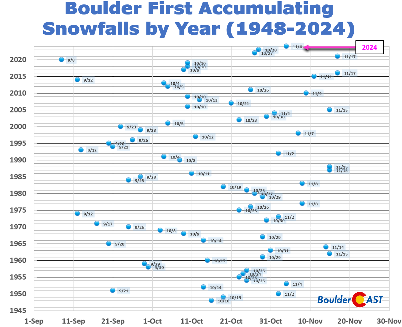
Boulder’s official snow total was 0.2″ which accumulated on the grass late Sunday evening — an underwhelming first snow of the season, but there you have it! This was tied for the 14th latest first snowfall since 1948 — definitely in the bottom quartile for lateness, but far from record-breaking.
The Foothills & Mountains verified quiet well, with anywhere from 2 to 10″ accumulating above 6000 feet elevation. The scene below is from just up hill above Boulder (7200 feet) — a true winter wonderland!
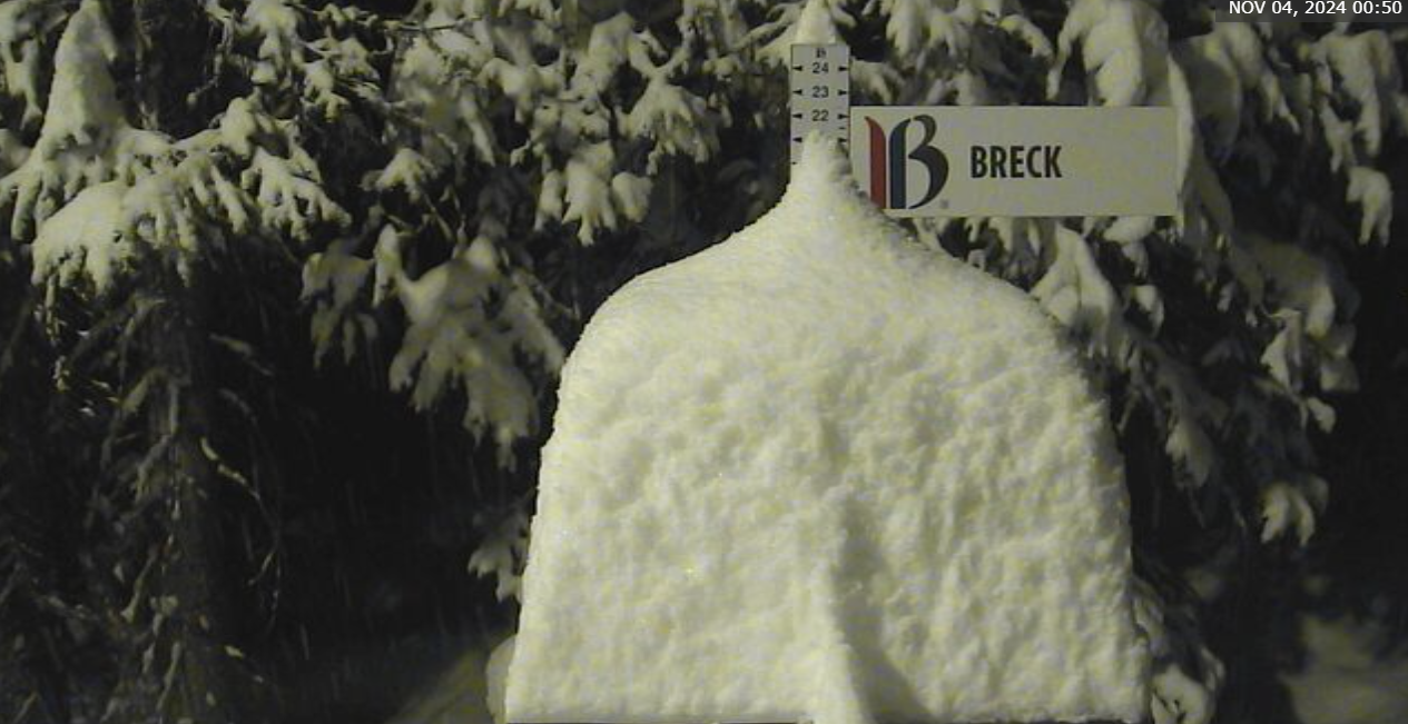
Though outside our forecast domain, Breckenridge ski resort had the highest snow total we’ve seen with ~15″ dumping overnight!
More importantly, that meager first snowfall was accompanied by a generous amount of moisture. Boulder was the bullseye, with ~0.7″ of moisture falling from the sky (rain and melted snow) — significantly higher than forecast. This will help somewhat with the ongoing Extreme Drought. Regionally, precipitation totals ranged from next to nothing out near DIA to over 0.5″ in the Foothills, a big win for our west-side readers!
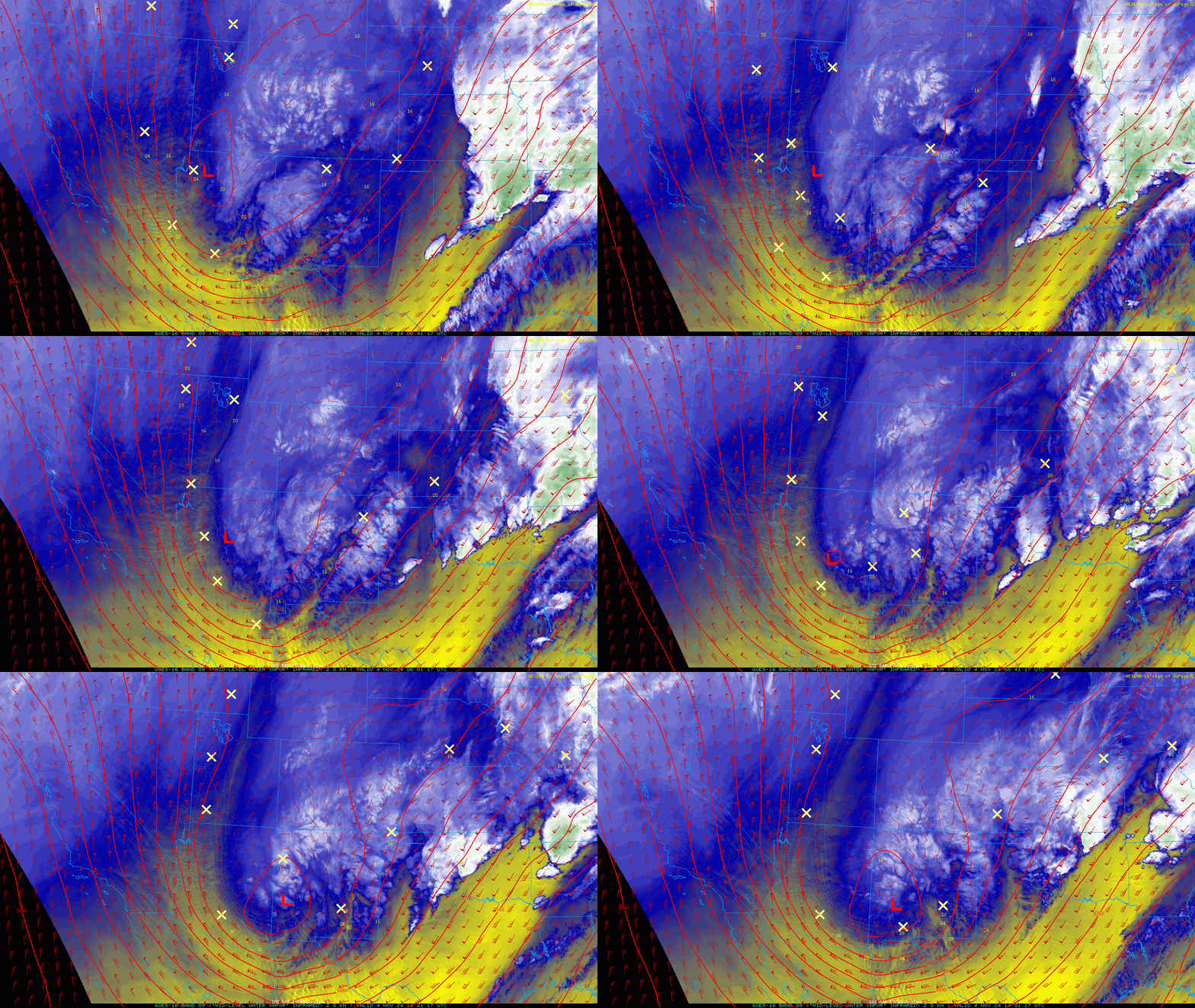
The big storm system responsible for the rain/snow continues to churn across New Mexico on Monday. Much of southeast Colorado is getting slammed with widespread rain and wet snow today. This is yet another example of a storm system tracking too far south. We’ve had several of these of late and missed out on a lot of moisture because of it in the Front Range.
Things will be quiet for the next 36 hours or so before another, colder storm system drops out of Canada and straight south across Utah Tuesday night. The last of the light rain/snow will dissipate Monday morning. Temperatures should climb into the 40s by afternoon with skies becoming partly cloudy.
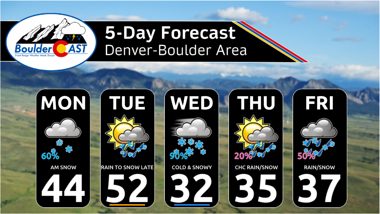
The incoming storm will linger across the Four Corners region for the rest of the week leading to multiple chances for snow in the Front Range and chilly temperatures. Next up — we should see a round of widespread accumulating snow Tuesday night through Wednesday with even colder temperatures moving in. Be sure to read our complete weekly outlook posted yesterday where we dive into the week’s details. Check back through the week for (one or two) winter storm updates and/or subscribe. Continue reading below for the announcement of the 2024 First Snowfall Contest winners.
Announcing the 2024 First Snowfall Contest Winners
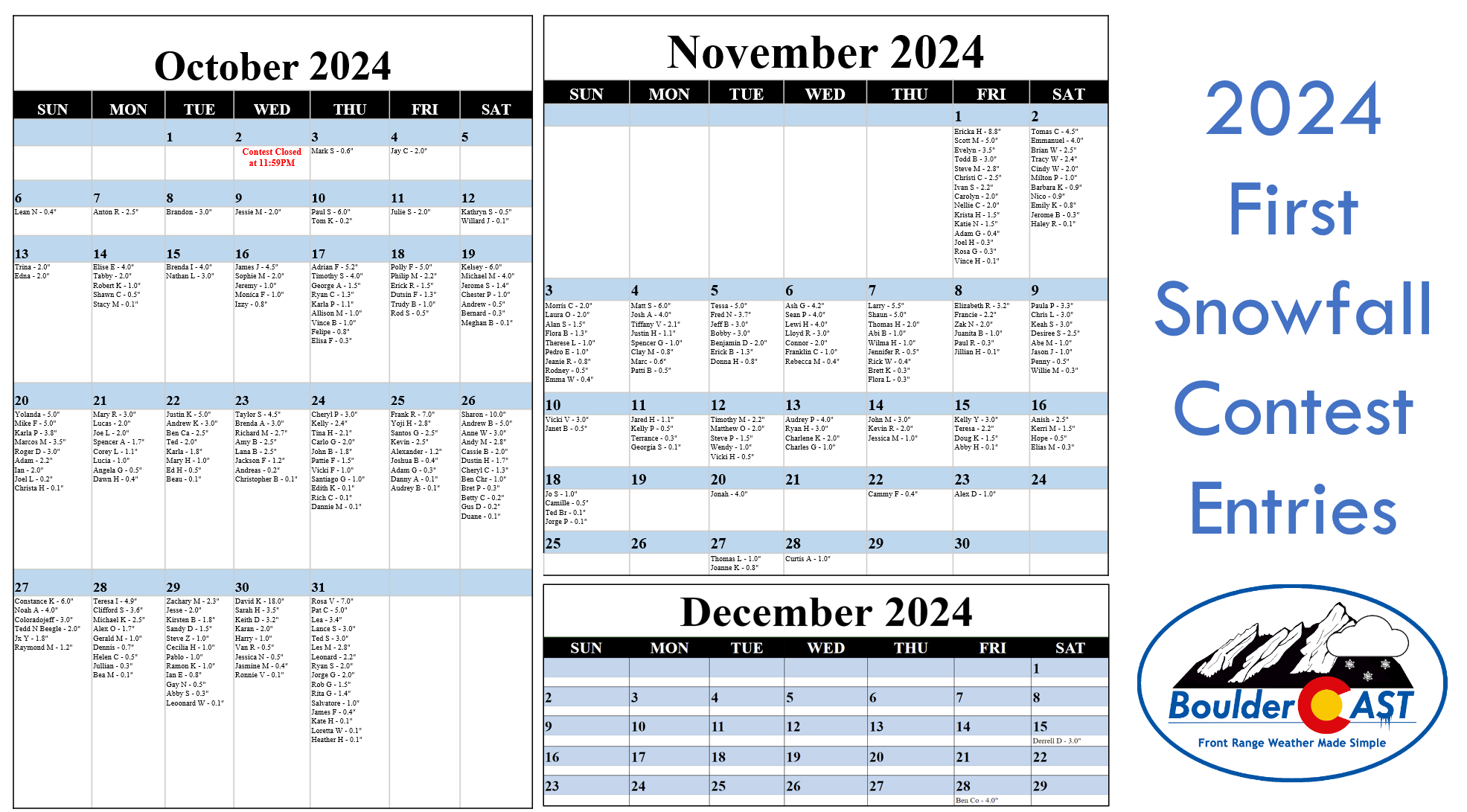
With Boulder’s first snow of the season officially in the bag, it’s time to announce the winners of our 10th Annual First Snowfall Contest. There were more than 270 entries this year which are summarized in the table below (click to enlarge).
A few notes about the predictions:
- Dates range from October 3rd to December 28th, the latter being nearly six weeks later than the existing latest first snow on record for Boulder! Our readers are really pessimistic aren’t they?
- Amounts range from 0.1 to 18.0 inches. Keep in mind there’s only been one first snow in the last 75 years that was greater than a foot!
- The median date of the guesses is October 29th. This is nine days later than climatology, perhaps a sign of public sentiment being marred by the recent prolonged warm pattern
- The most popular date chosen was October 31st with sixteen picks — no doubt influenced by the long-standing Denver area urban legend that our first snow is always on Halloween!
- 90% of entries predicted a first snow of 4.0 inches or less. Bravo, climatology strongly agrees with these folks!
The verification of Boulder’s first official snowfall was November 4th at an amount of 0.2″. Despite the actual accumulation occurring before midnight Sunday evening (November 3rd local time), it was after 5:00PM which is the cut-off for the climate station’s calendar day which is based on UTC time. We don’t like it either, but that’s just how Boulder’s official climate station operates. Don’t hate the player, hate the game!
Congratulations to the winners detailed below. Prizes will be sent out via email in the coming days so do keep an eye on your inbox!
- 1st place: 12-month Premium subscription + $35 Amazon Gift Card
- Patti B (Nov 4 0.5″)
- 2nd place: 6-month Premium subscription + $15 Amazon Gift Card
- Marc (Nov 4 0.6″)
- Anyone who guessed within 1 day OR 0.1″ correct: 2-month Premium subscription
- Clay M (Nov 4)
- Spencer G (Nov 4)
- Justin H (Nov 4)
- Tiffany V (Nov 4)
- Josh A (Nov 4)
- Matt S (Nov 4)
- Tom K (0.2″)
- Willard J (0.1″)
- Stacy M (0.1″)
- Elisa F (0.3″)
- Meghan B (0.1″)
- Bernard (0.3″)
- Christa H (0.1″)
- Beau (0.1″)
- Christopher B (0.1″)
- Andreas (0.2″)
- Dannie M (0.1″)
- Rich C (0.1″)
- Edith K (0.1″)
- Audrey B (0.1″)
- Danny A (0.1″)
- Adam G (0.3″)
- Duane (0.1″)
- Gus D (0.2″)
- Betty C (0.2″)
- Bret P (0.3″)
- Bea M (0.1″)
- Julian (0.3″)
- Leonard W (0.1″)
- Abby S (0.3″)
- Ronnie V (0.1″)
- Heather H (0.1″)
- Loretta W (0.1″)
- Kate H (0.1″)
- Vince H (0.1″)
- Rosa G (0.3″)
- Joel H (0.3″)
- Haley R (0.1″)
- Jerome B (0.3″)
- Flora L (0.3″)
- Brett K (0.3″)
- Jillian H (0.1″)
- Paul R (0.3″)
- Willie M (0.3″)
- Georgia S (0.1″)
- Terrance (0.3″)
- Abby H (0.1″)
- Elias M (0.3″)
- Jorge P (0.1″)
- Ted Br (0.1″)
- All other entries: Virtual “pat on the back”
- More than 250 others
If you didn’t win, don’t worry. We’ll definitely host more weather-related contests periodically throughout the year, so do check back or subscribe.
Get BoulderCAST updates delivered to your inbox:
Daily Forecast Updates
Get our daily forecast discussion every morning delivered to your inbox.
All Our Model Data
Access to all our Colorado-centric high-resolution weather model graphics. Seriously — every one!
Ski & Hiking Forecasts
6-day forecasts for all the Colorado ski resorts, plus more than 120 hiking trails, including every 14er.
Smoke Forecasts
Wildfire smoke concentration predictions up to 72 hours into the future.
Exclusive Content
Weekend outlooks every Thursday, bonus storm updates, historical data and much more!
No Advertisements
Enjoy ad-free viewing on the entire site.
Enjoy our content? Help us out and give it a share:




You must be logged in to post a comment.