The onset of snowfall Tuesday evening was earlier and heavier than expected leading to booming overnight snow totals which range from 1 to 10″ across the Front Range already. We’re still far from done with this storm and its associated challenging forecast, with additional light snow expected today and Thursday, followed by potentially heavier snow late on Friday as the main storm system passes directly across eastern Colorado. Read on for the latest developments on what should be a cold and snowy rest of the week!
Daily Forecast Updates
Get our daily forecast discussion every morning delivered to your inbox.
All Our Model Data
Access to all our Colorado-centric high-resolution weather model graphics. Seriously — every one!
Ski & Hiking Forecasts
6-day forecasts for all the Colorado ski resorts, plus more than 120 hiking trails, including every 14er.
Smoke Forecasts
Wildfire smoke concentration predictions up to 72 hours into the future.
Exclusive Content
Weekend outlooks every Thursday, bonus storm updates, historical data and much more!
No Advertisements
Enjoy ad-free viewing on the entire site.
T
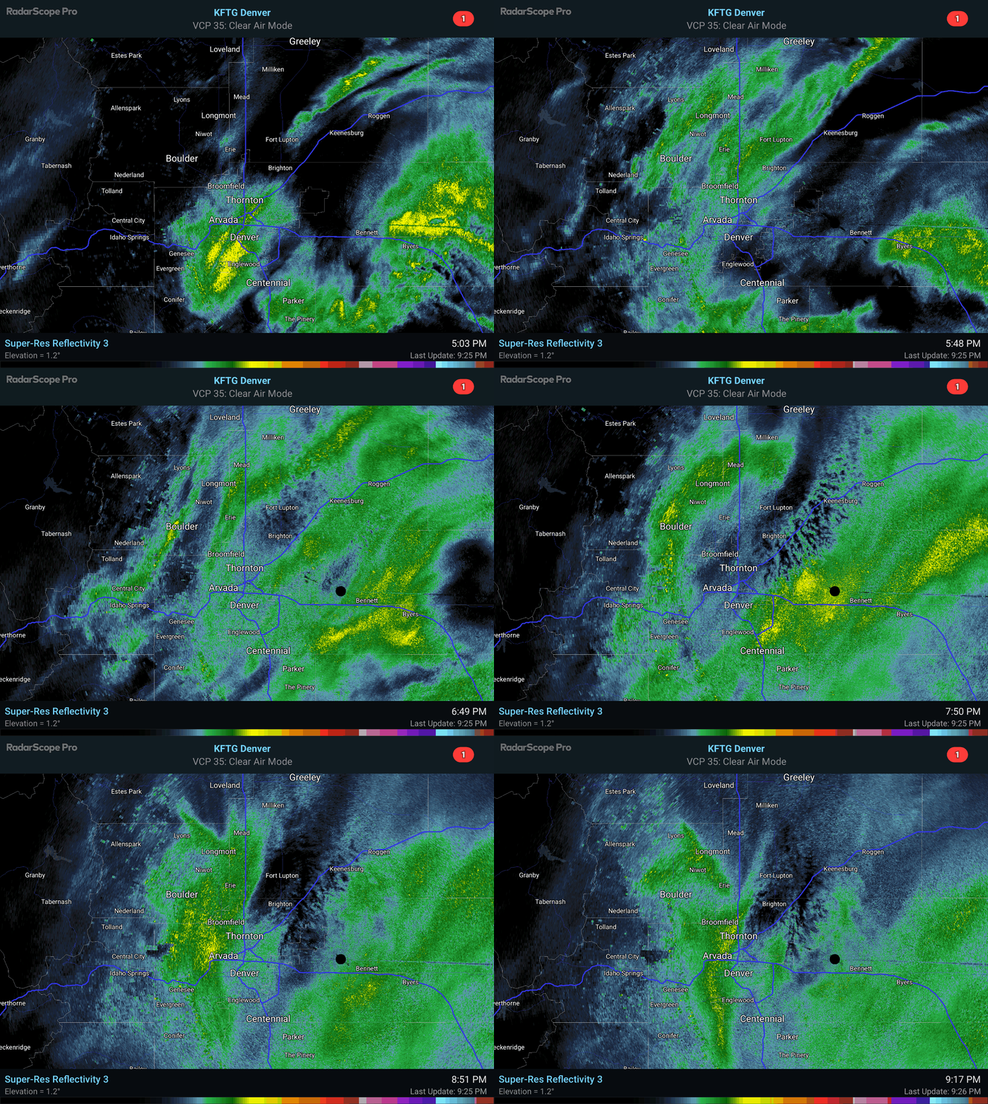
his forecast has been a bit of mess so far, with models sharply trending up in the final hours yesterday as the “feared” slower and more northern track took shape overnight. Bands of snowfall began earlier and harder than expected last evening, with many areas seeing 1-4″ of snow within just the first few hours of the event. For example, Boulder received close to 4″ of wet snow before midnight thanks to a heavier band that lingered over the city for a couple hours. The radar animation below shows the onset of the snow Tuesday evening.
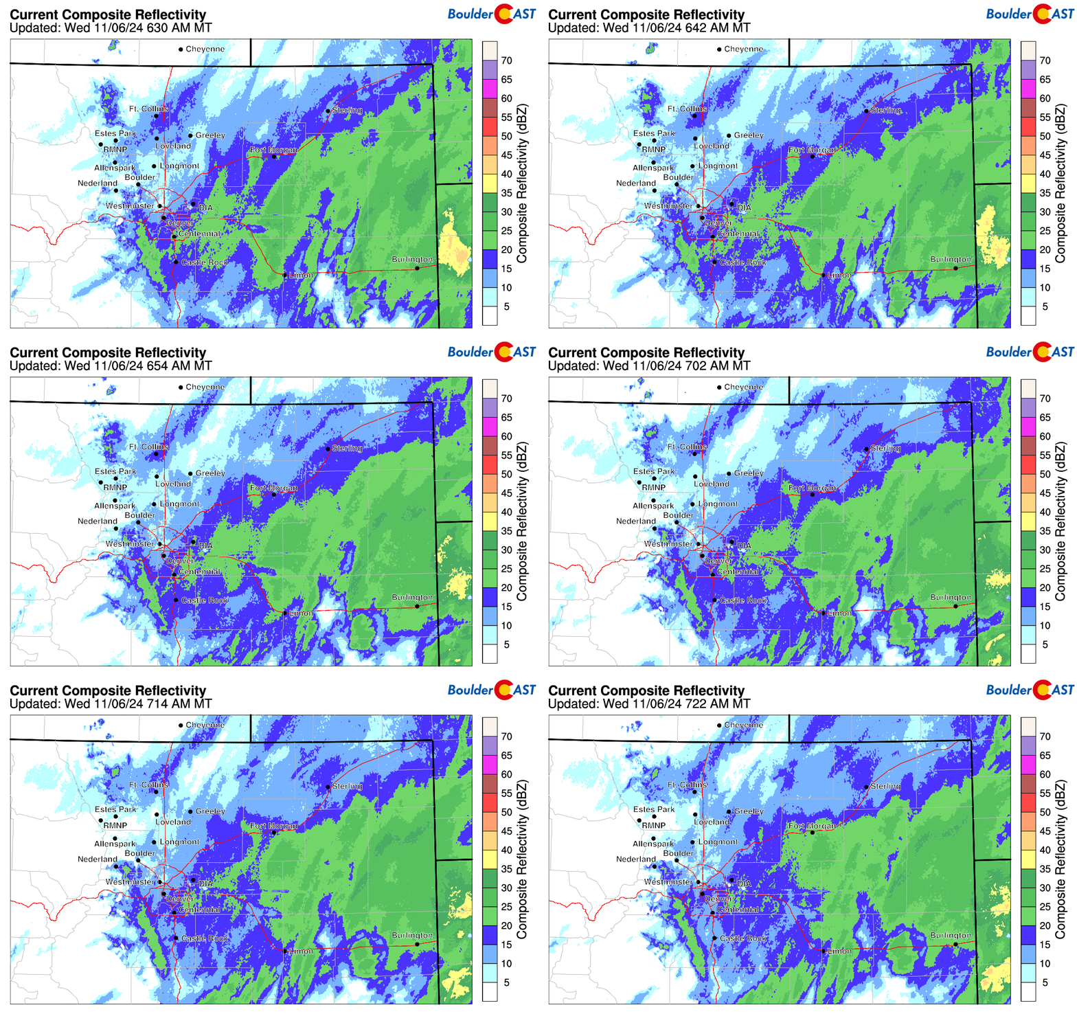
Overnight the snowfall rates have declined considerably. Now mainly just a very fine snow is falling across the Metro area, with slightly more intense snow on the fringes.
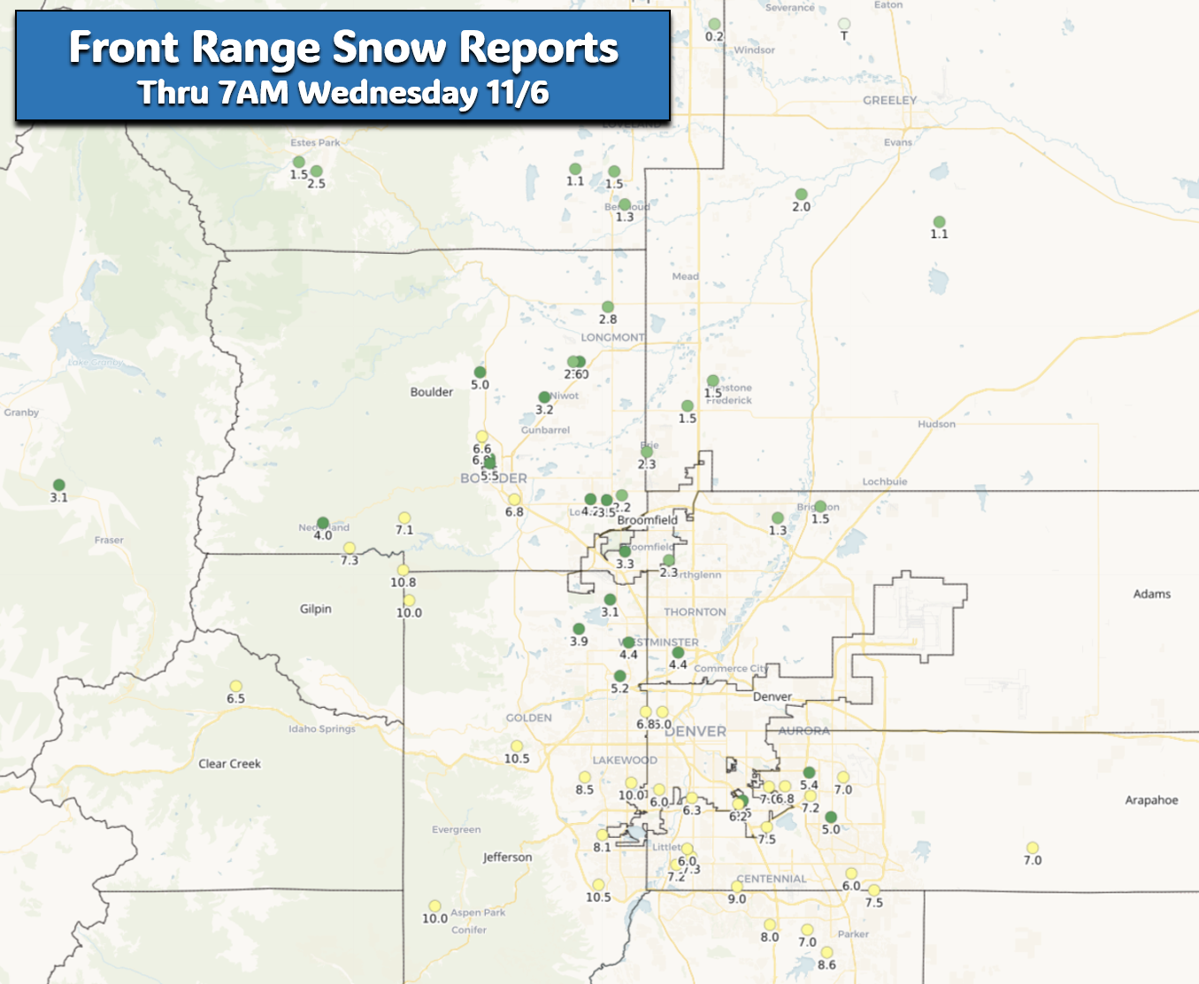
Snowfall totals are already impressive across the region, well beyond the scope of any official forecast that existed just 24 hours ago. Reports as of 7AM today are shown below. 5 to 9″ has already dumped south of Interstate 70. On the north side, snow totals generally range from 1 to 4″, with Boulder being the lone northern exception closer to 6″. Officially as of a few hours ago, Boulder has received 5.4″ and Denver (DIA) 4.0″. This is Denver’s first official snow of the season!
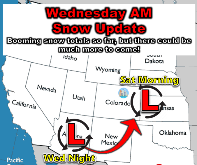
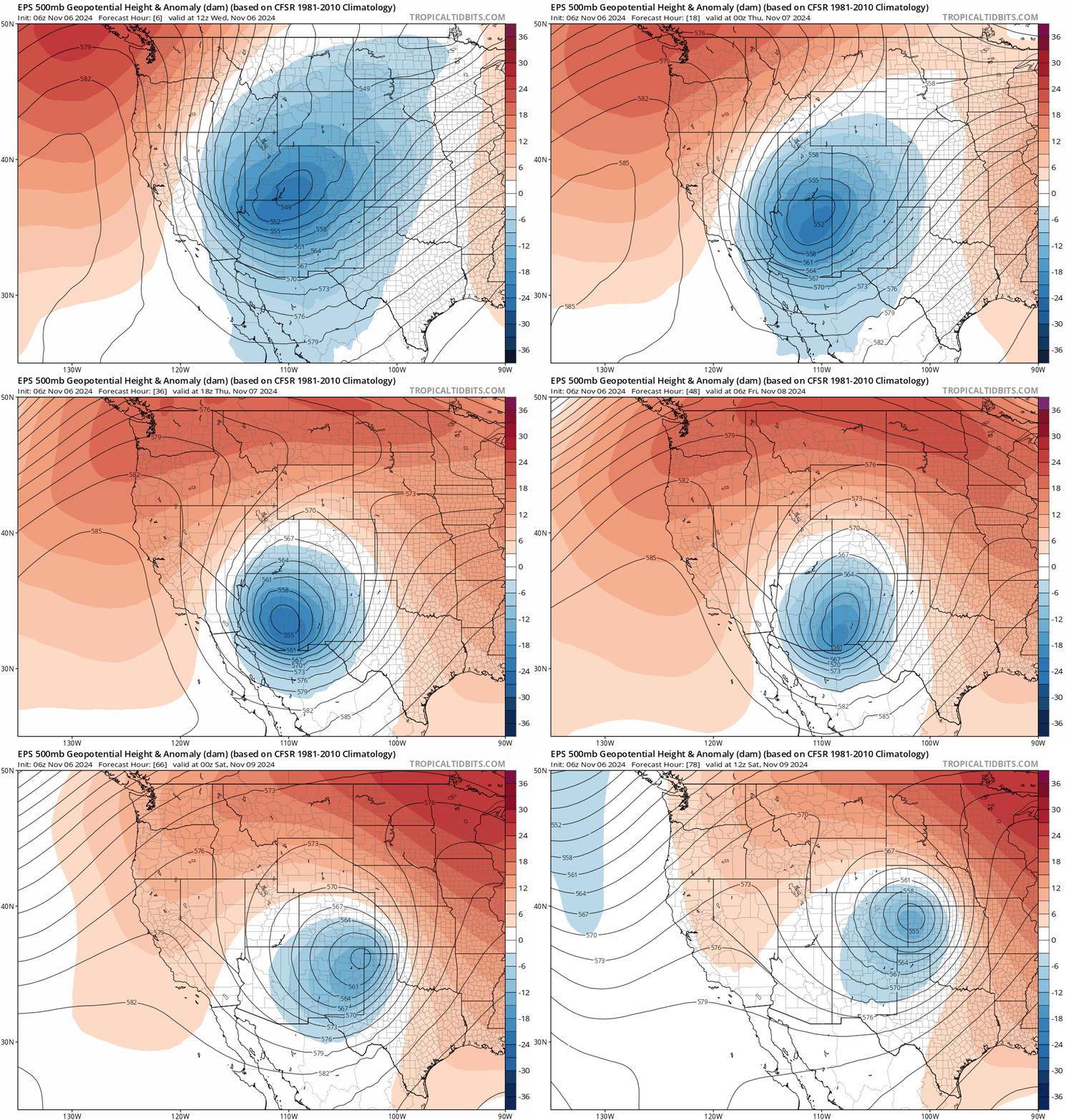
Our developing cut-off low pressure continues to make slow but steady progress southward through eastern Utah. The storm will continue south for another 300 miles today before stalling out, landing in southeast Arizona by this evening. As this happens, the large-scale lift provided by the low pressure will sag southward as well, taking the best snow with it into southeast Colorado through the day into tonight.
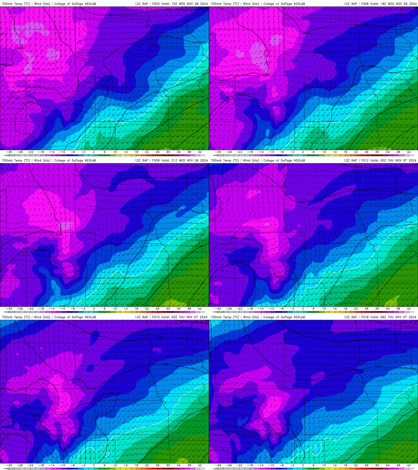
This remains a very tricky forecast moving forward, starting with challenges today determining if there will be any significant upticks in the snowfall, or if it will just continue to slowly wane through the day and sag south. We are losing large-scale lift as the low pressure moves further south into Arizona, but upslope directionality will stay at least marginally favorable for the next 12 hours from a NNE direction into the Denver area aloft. This should continue to keep snow going across the Metro area through the day, especially south of Interstate 70 and along the Foothills from Boulder southward. The animation below shows wind speeds and temperatures at ~10,000 feet elevation through 11PM tonight. Notice the very cold temperatures overhead (-15°C) and near constant NNE winds of 20-30 knots through the day. Winds start to weaken just at the tail-end of the animation which is when snow will most likely fully cease in our area.
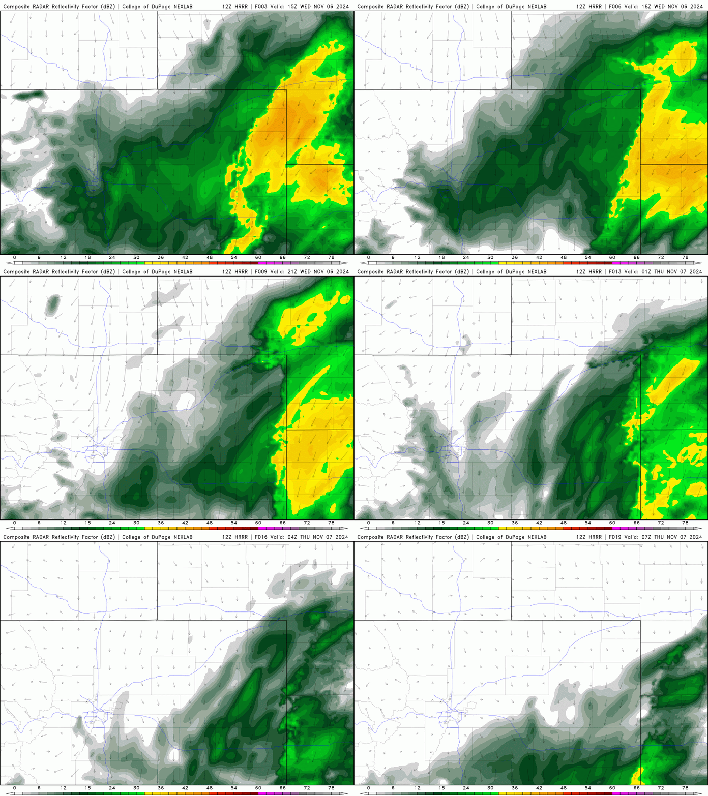
The latest HRRR simulated radar animation shows a few embedded areas of moderate snow possibly flaring up this morning, with snow waning in intensity through the afternoon and possibly coming to an end by late evening. Given this, most areas will see another 6-12 hours of light snow. This storm is far from over!
Current temperatures as of 8AM Wednesday are in the upper 20s across most of the lower elevations (we’re at 29° at our station). We won’t warm up too much today given the ongoing snow and thick clouds, but we should get near or slightly above freezing by afternoon, especially if the snow wanes faster than expected. Look for light snow, with occasional brief bursts of moderate snow, to continue through at least the afternoon hours, even well into the evening south and southeast of Denver.
ADDITIONAL accumulations through sunrise Thursday:
- North of I-70, including Boulder: Dusting to 3″
- South of I-70: 1-4″
- Foothills south of Nederland and Palmer Divide: 3-8″
- Foothills north of Nederland: Dusting to 3″
The rest of the week’s forecast is an absolute mess too as models (and forecasters alike!) struggle to pinpoint exactly how the Arizona low will eject eastward. Thursday should be quieter across our area, but there may be periods of light snow during the day. This is most likely to happen south of Denver, but it may reach into nearly the entire Metro area. This should translate into less than 1-2″ of snow at worst — most of us get 1″ or less.
Then the storm will swoop east across New Mexico and then north into far eastern Colorado by Saturday morning. Depending on exactly how this low tracks and holds together will determine whether we receive a final blow of heavy snow as it revs up and departs into the Great Plains. Snow lovers will be happy to know that the odds for additional snow Friday have increased in recent model runs, with most now showing at least a glancing blow for the Denver area Friday afternoon through Friday night. The storm will have moderated by then, so temperatures will be warmer and there may be some rain mixing in, and if not, at least more melting across the lower elevations. We don’t yet have a definitely forecast, but the odds of several additional inches of snow late Friday into early Saturday have increased, with an even bigger snowstorm not being ruled out.
Updated Storm Timeline:
- Wednesday: Intermittent light snow or flurries through the day with additional accumulations of 1-4″, highest south of Denver. Up to 8″ more snow may fall in/near the Foothills of Jefferson County and across the Palmer Divide. Highs only near the freezing mark. Travel should remain not too bad with roads generally wet or slightly slush in the Metro area.
- Wednesday night: Any lingering snow should taper off leaving behind cold temperatures in the 20s. If your area somehow hasn’t had a hard freeze yet, it will happen this night with temperatures falling into the lower 20s and even some teens!
- Thursday: Drier and a bit warmer, but there could be period of light snow, especially south/east of Denver. Additional accumulations of 1-2″ at worst. Highs stay in the 30s.
- Friday into Friday Night: The big low pressure will move up into eastern Colorado with areas of rain and heavy snow across the eastern half of the state. The Denver area is likely to see some rain/snow mix or heavy snow, but this is uncertain as of now. Watch this day’s forecast closely in the coming days!
That’s all we have for now! We’ll be back tomorrow with another long update regarding Mother Nature’s potentially snowy finale on Friday. Be sure to follow us on Twitter, Facebook, and Threads for impromptu weather updates in the coming days, or subscribe to get notified of our long-form updates like this one.
Get BoulderCAST updates delivered to your inbox:
Daily Forecast Updates
Get our daily forecast discussion every morning delivered to your inbox.
All Our Model Data
Access to all our Colorado-centric high-resolution weather model graphics. Seriously — every one!
Ski & Hiking Forecasts
6-day forecasts for all the Colorado ski resorts, plus more than 120 hiking trails, including every 14er.
Smoke Forecasts
Wildfire smoke concentration predictions up to 72 hours into the future.
Exclusive Content
Weekend outlooks every Thursday, bonus storm updates, historical data and much more!
No Advertisements
Enjoy ad-free viewing on the entire site.
Enjoy our content? Help us out and give it a share:





You must be logged in to post a comment.