We hope you had a safe and fun holiday weekend. With most of the BoulderCAST team either out of town visiting family or off somewhere exploring the wilderness, we ask that you please excuse the brevity and delay of this week’s forecast. Read on for our short and sweet outlook for the upcoming week.
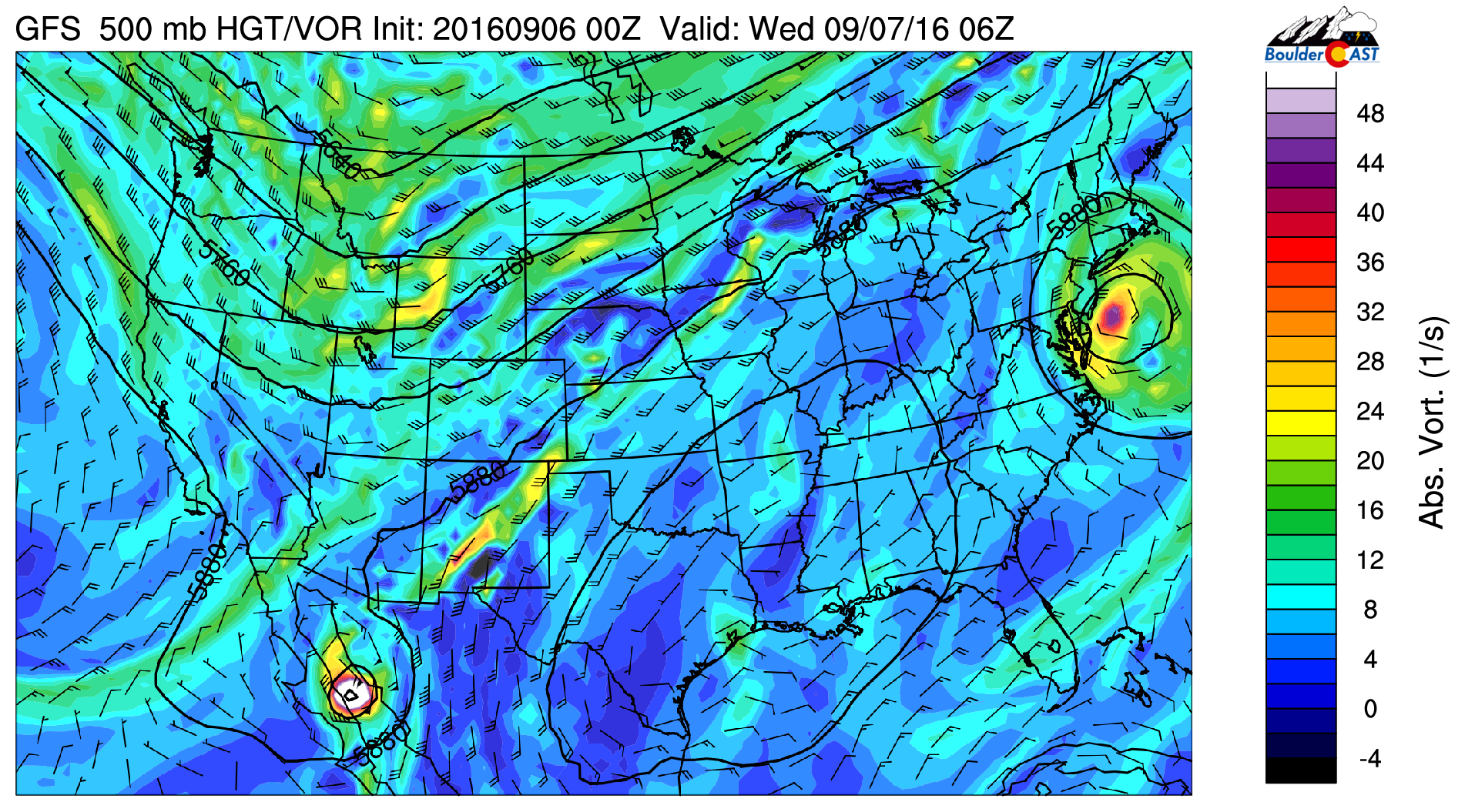
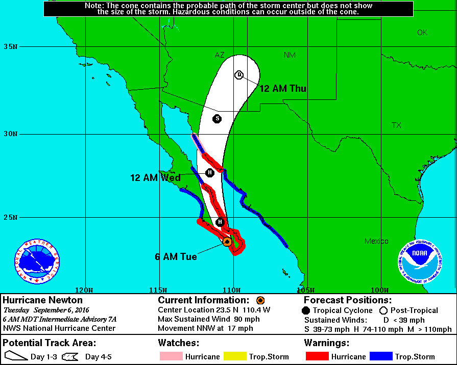
Overall, we’re not expecting much in the way of interesting or impactful weather this week. The main features of concern in the atmosphere through Friday are a large trough across the northern Rockies and Hurricane Newton whose remnants will be making a bee-line towards Colorado in the coming days.
The trough will keep southwesterly flow across Colorado Tuesday and Wednesday, and then westerly downslope flow Thursday and Friday. Outside of a sprinkle of moisture today, very dry air will be in place with precipitable water values below 0.4″ through the week and upcoming weekend. With little in the way of forcing, this foretells mostly sunny and dry conditions for the Front Range for the foreseeable future. As mentioned, there will be just enough moisture to spawn a few storms on Tuesday during the late afternoon and evening, particularly east of Interstate 25. This will basically be our only chance of rain for the week, and it’s minimal at best for the Boulder area.
As for Hurricane Newton, it is currently making landfall in Mexico and will most likely track into northern New Mexico and southern Colorado by late day Thursday or early Friday. The trough mentioned earlier looks to keep Newton too far south to impact the Front Range, outside of maybe a few high clouds.
With that said, we’re tracking a cold front for Friday as well which will cool us off into the 70’s. It doesn’t look to bring much in the way of rain, however. The weekend will likely remain dry everywhere, with our next major storm system arriving early next week.
Forecast Specifics:
Tuesday: Overcast in the morning, followed by mostly sunny skies in the afternoon. Expect a few isolated storms in the late afternoon and evening, primarily east of Interstate 25. High temperatures near 80 for the Plains with upper 60’s in the Foothills.
Wednesday: Some clouds / light fog early on, then mostly sunny, dry and seasonal. Highs in the low 80’s on the Plains and near 70 in the Foothills.
Thursday: Mostly sunny with extremely isolated storms south and east of Denver associated with the remnants of Hurricane Newton. Dry elsewhere. Temperatures in the mid 80’s for the Plains and mid 70’s in the Foothills.
BRONCOS GAME (6:30 PM-10:00 PM): Mostly sunny/clear with temperatures falling from the upper 70’s into the mid 60’s throughout the game. No precipitation. #LifeAfterPeyton
Friday: Expecting a cold front to arrive during the afternoon hours to bring cooler weather to the region. Increasing clouds with a very slight chance of isolated showers in and near the Foothills behind the front in the evening. High temperatures in the mid 70’s for the Plains with low to mid 60’s in the Foothills.
High Country: Expect a rather nice week in the Mountains. After isolated storm chances on Tuesday, Wednesday through Friday should see mostly sunny conditions with no chance of rain. Winds will also be relatively calm and westerly.
Extended: The upcoming weekend looks to be beautiful in all of Colorado. Conditions will be dry everywhere, with rain holding off in most locations until Monday. However, several models bring forth a potent storm system around the Tuesday time-frame, with a big cool down and increased rain (and mountain snow) chances.
Tue
Wed
Thu
Fri


Temperature
80
82
85
76


Precip Chc (Plains)
20%
0%
0%
10%


You must be logged in to post a comment.