Following yesterday’s dumping of snow, especially in Boulder and the Foothills, a large ridge of high pressure takes over for the upcoming week, with temperatures gradually warming back up. We’re watching a weak cold front later in the week, but overall the week remains dry with near to slightly above average temperatures to end the week.
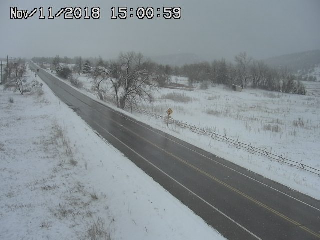
Thawing out from the snow storm on Veterans Day
Yesterday’s snow storm produced a little more than expected in some areas, especially in Boulder area. Some locations saw over 10″ of snowfall. We’ll have a complete recap of the event in a separate post, so be sure to check it out.
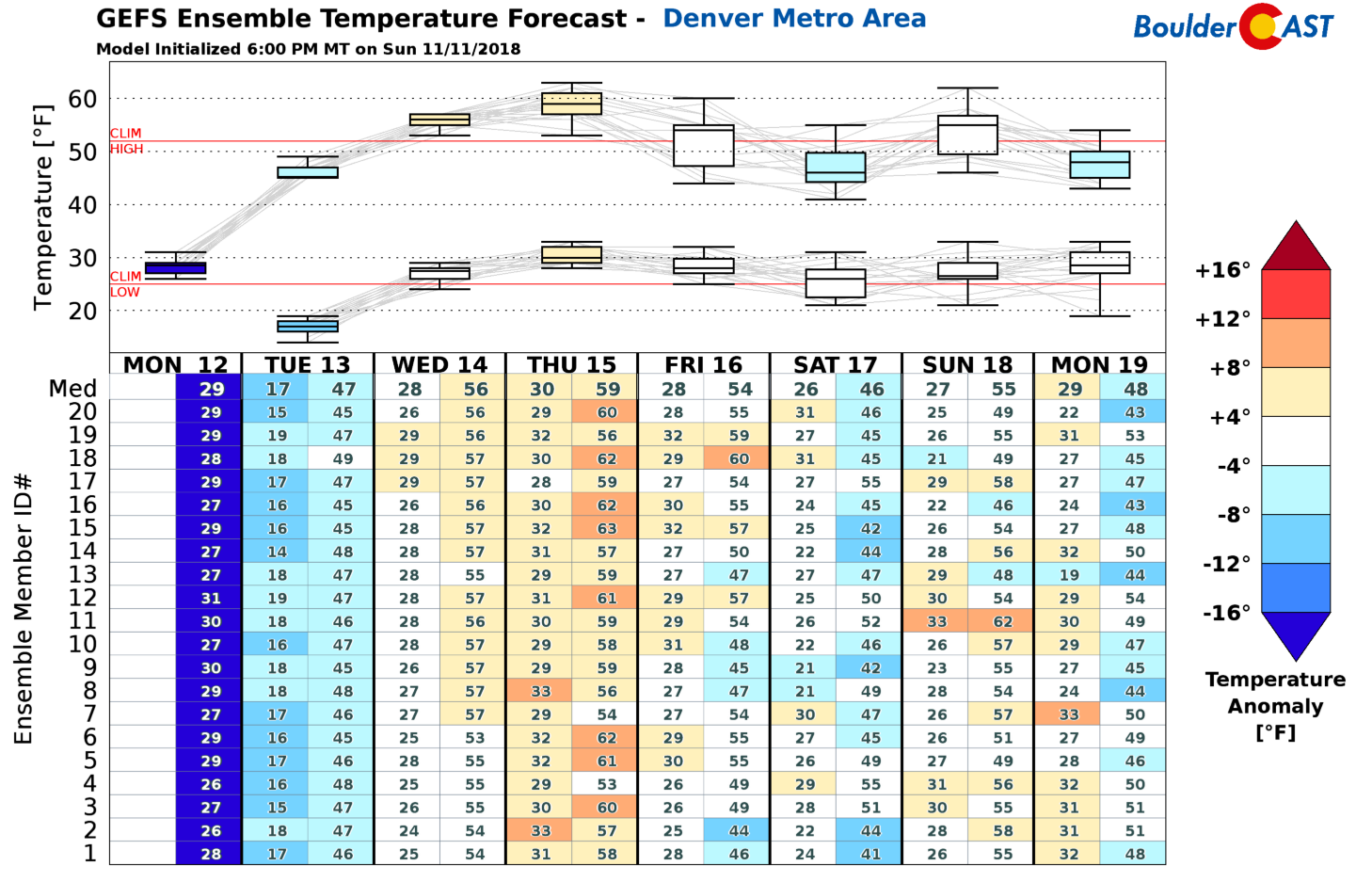
We will be thawing out this week. There are several inches of snow that need to melt and a cold airmass that needs to move out. After today, we’ll see a quick warming trend tomorrow through Friday (see below). A weak front on Thursday/Friday may shave off a few degrees of our highs, but won’t keep us from remaining near or slightly above average. The GEFS ensemble shows highs rebounding back into the 50’s for Wednesday and Thursday.
Today’s system exits, high pressure builds
Below shows the GFS 500 mb mid-level pattern and vorticity this morning. The winter storm is currently located in northeast New Mexico. The system will continue to trek east-southeast today, tonight, and tomorrow, moving into the Midwest bringing rain and snow to these areas as well. High pressure currently is centered off the coast of California. As the winter storm moves east, high pressure will slowly take over in its place tomorrow and much of the week ahead.
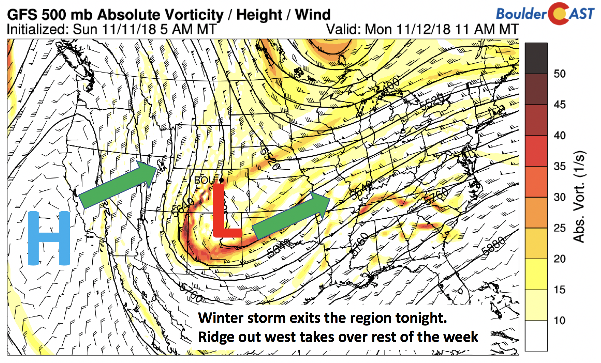
GFS 500 mb absolute vorticity this morning
High’s Monday afternoon with hover in the mid to upper 20’s. Snow on the ground and persistent cloud cover, as well as the cold airmass in place, will keep us on the cold side. Sunshine may peek through the clouds later this afternoon, clearing out fully tonight with lows dipping into the teens.
Ridge is our story tomorrow and Wednesday
As we mentioned above, the ridge will be taking over this week. The GEFS ensemble of 500 mb heights is shown below for Tuesday. The ridge will be centered over California, extending into western Canada, with the coldest air now over the Great Lakes. This pattern is very consistent in all of the ensemble members.
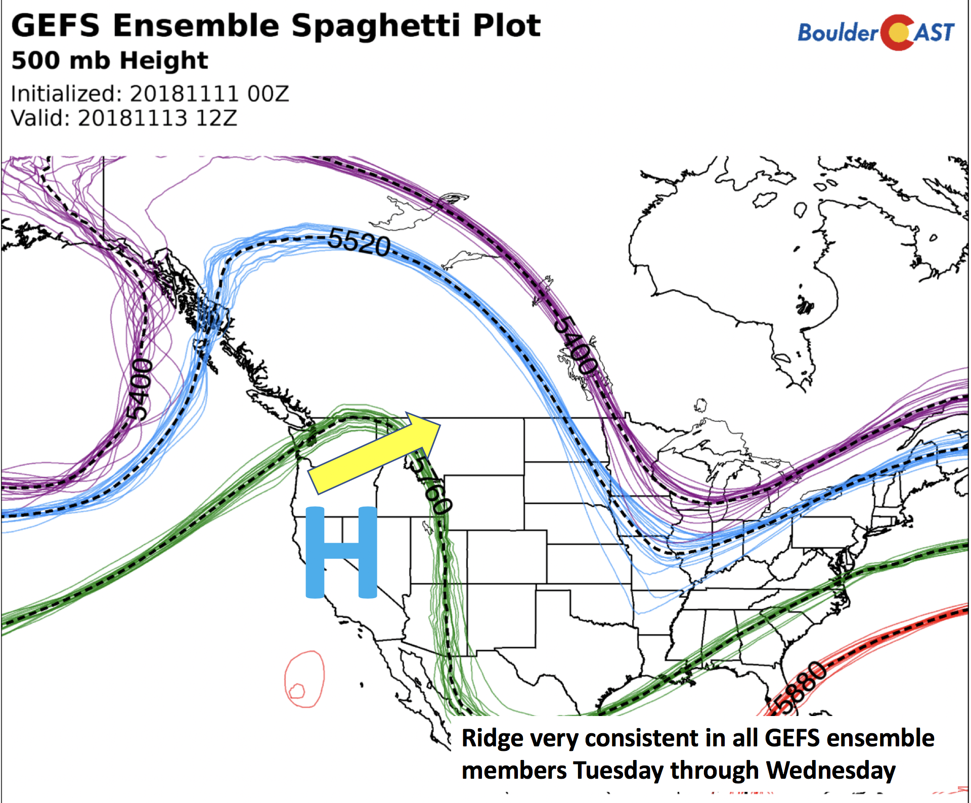
GEFS ensemble members forecast of the 500 mb height pattern Tuesday
Thanks to this and lots of sunshine, along with slight downslope flow, highs rise into the middle 40’s Tuesday and 50’s on Wednesday. The warming trend is shown below for the next two days. Notice how the cold air is almost non-existent over the West by Wednesday.
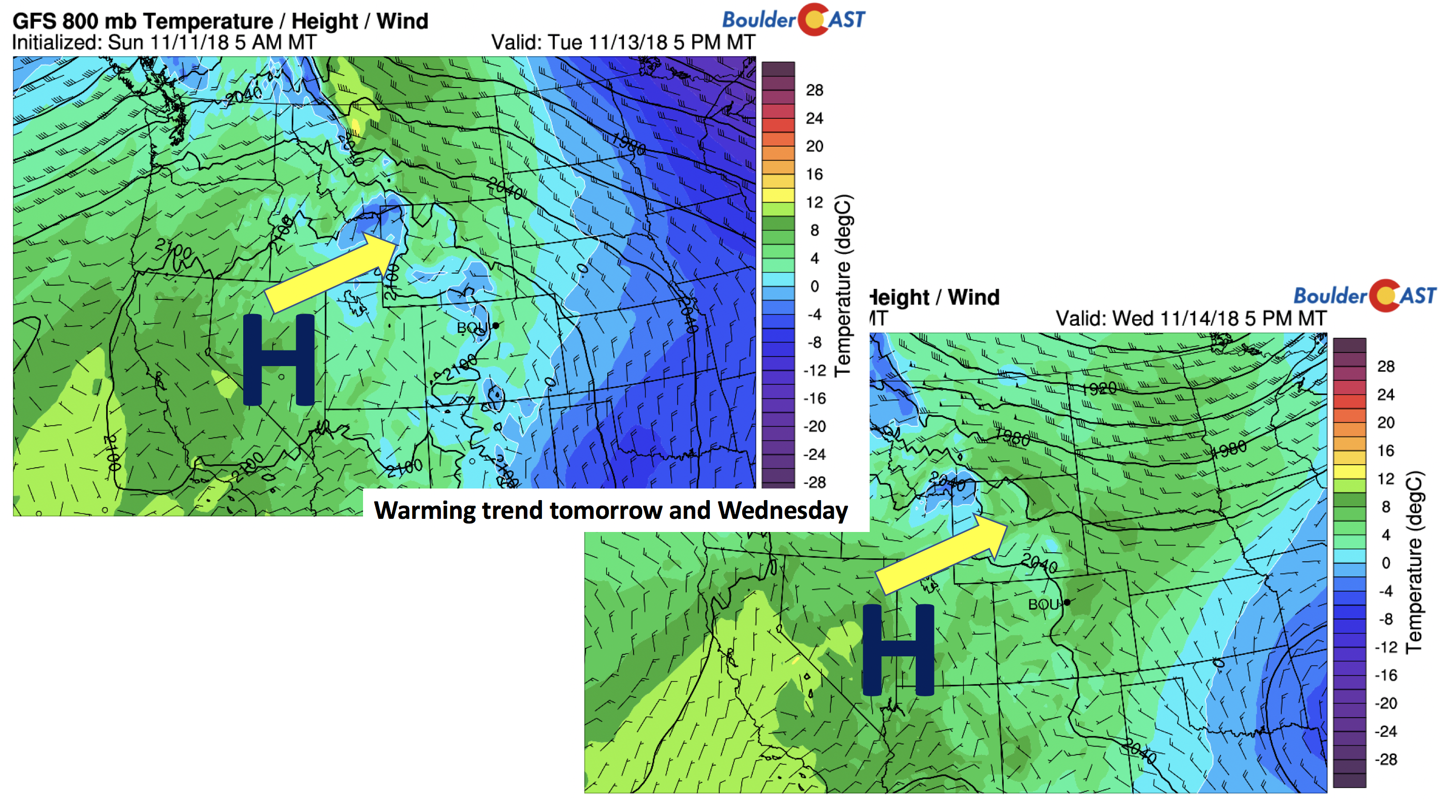
GFS 800 mb temperature Tuesday (left) and Wednesday (right)
Weak cold front Thursday/Friday?
On Thursday and Friday, the jet stream slides down once again (below), but its position will be just to our east and northeast over Nebraska and Wyoming. We’ll be on the western fringe of the jet streak as a result. But nevertheless, the models are hinting at a weak cold front sliding down sometime Thursday evening or Friday morning with the ridge weakening slightly.
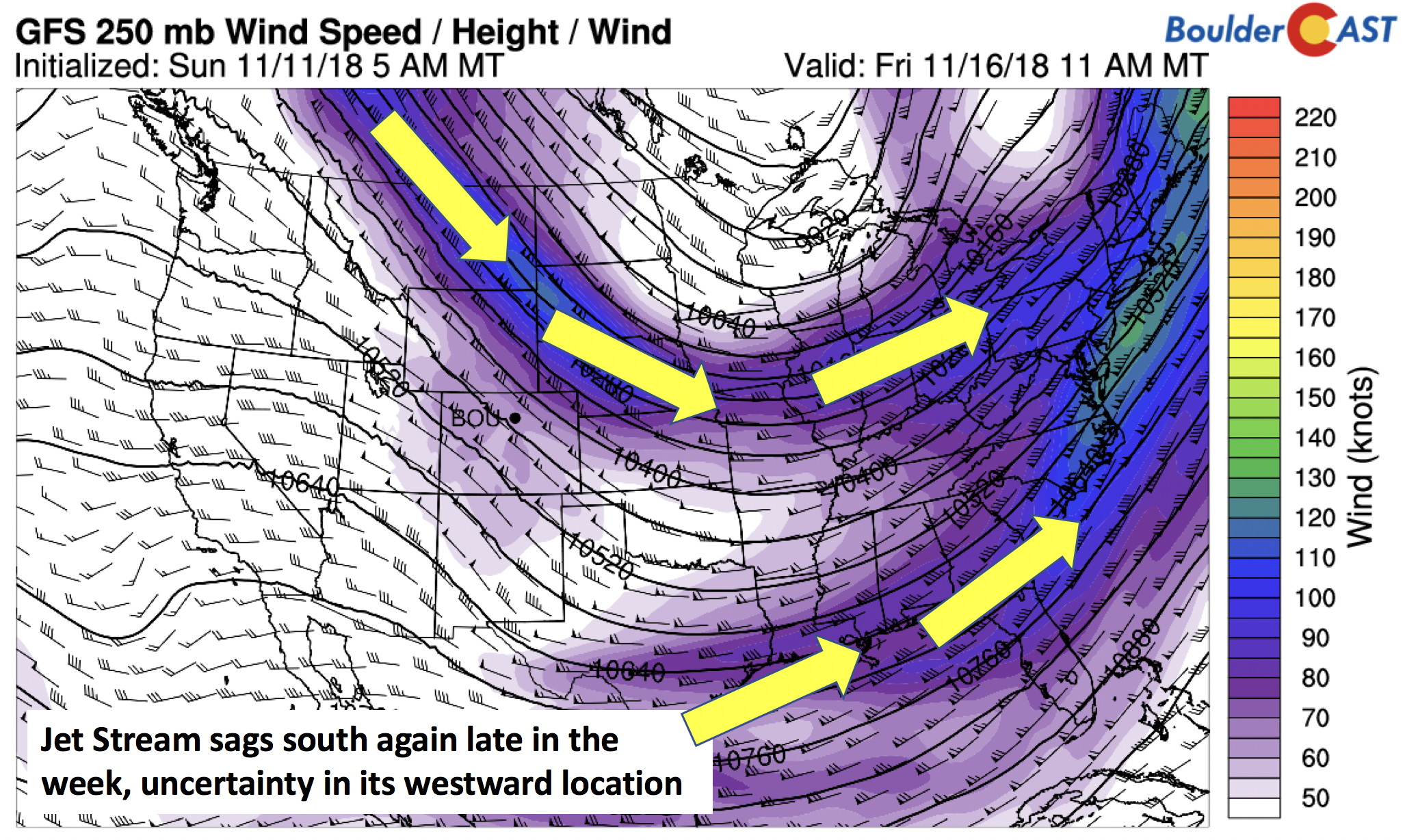
GFS 250 mb jet stream on Thursday
The models, however, are not consistent on how much cold air will move into northeast Colorado Friday. The GEFS ensemble (below) clearly indicates the uncertainty, with the position of the ridge anywhere from Washington state to California, with the trough in Canada extending anywhere from the Dakotas to possibly northeast Colorado. Nevertheless, with the uncertainty, we don’t expect temperatures to be more than a few degrees cooler on Friday compared to Thursday – probably lower 50’s.
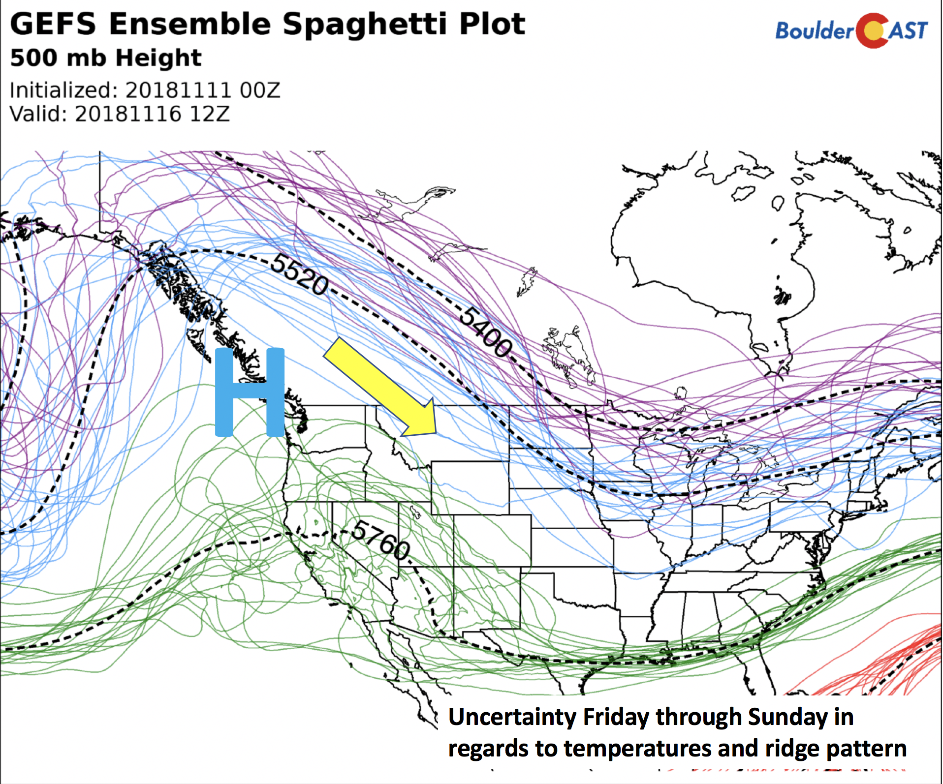
GEFS ensemble member forecast on Friday
An example of the uncertainty is shown below from the Canadian model for Saturday. The GEM model is certainly more westward with the trough late in the week. It shows enough upslope to produce another chance of snowfall in the state. This is not seen in the GFS and ECMWF though, so our confidence in this is quite low at the moment.
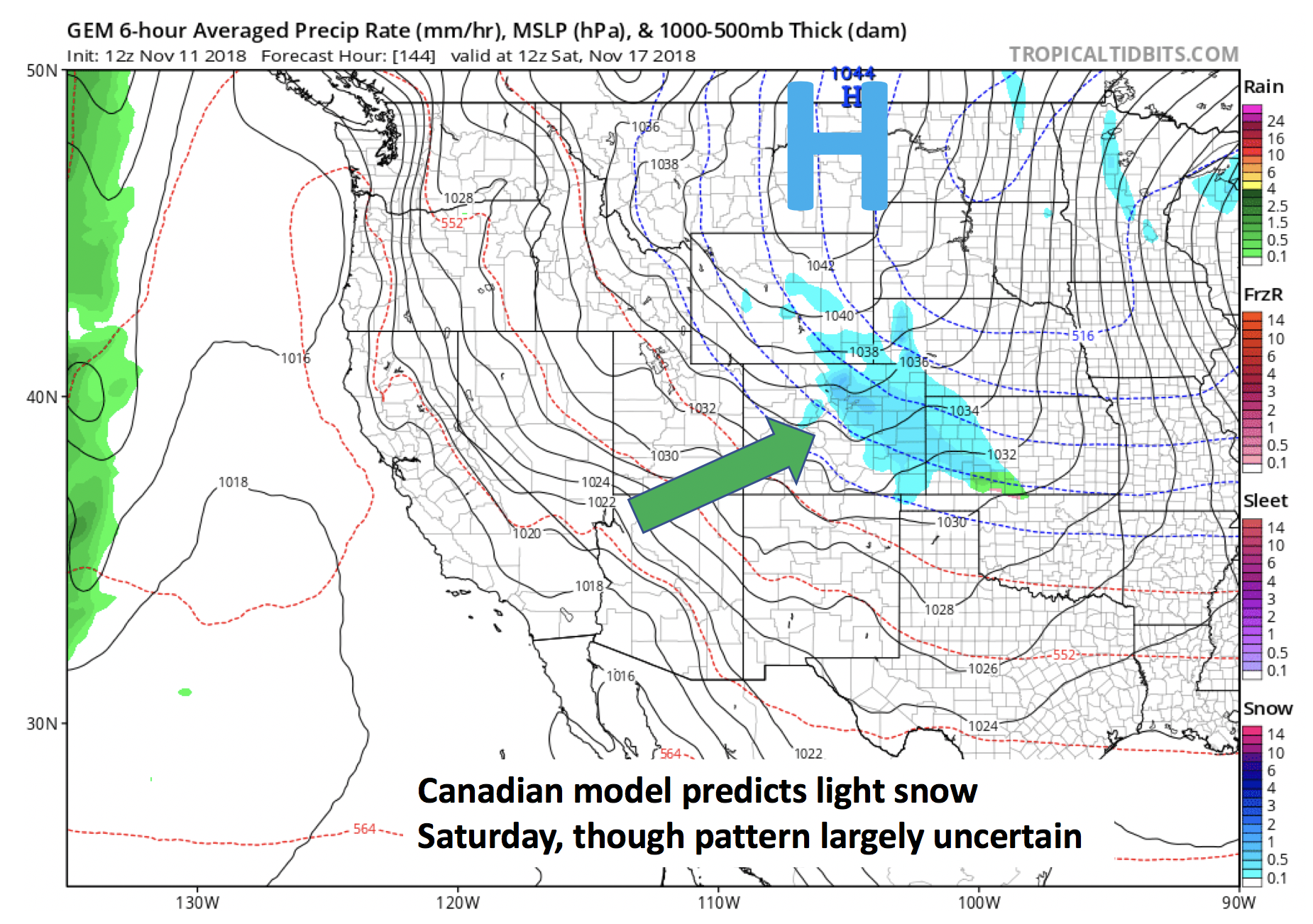
Canadian model snow forecast Saturday
Overall, a calmer week should be welcomed given the recent dabble of winter.
Forecast Specifics:
Monday: Light snow showers in the morning, then mostly cloudy skies gradually becoming partly sunny in the afternoon. Highs in the mid to upper 20’s on the Plains and upper teens in the Foothills. Clearing skies tonight with lows in the teens for the Plains.
Tuesday: Sunny skies and warmer. Highs in the middle 40’s on the Plains and in the lower 30’s in the Foothills.
Wednesday: Sunny and warm with highs in the middle 50’s on the Plains and lower 40’s in the Foothills.
Thursday: Mostly sunny and mild with high temperatures in the mid to upper 50’s on the Plains and middle 40’s in the Foothills.
Friday: A mix of clouds and sunshine with highs near the lower 50’s for the Plains and lower 40’s in the Foothills.
High Country: Mostly sunny skies will prevail much of the week over the mountains…great weather for skiing under fresh snow cover, especially in Eldora which reported 8″ this weekend! Outside of some mid and high clouds streaming in from west to east, dry weather will persist the entire week.
DISCLAIMER: This weekly outlook forecast was created Monday morning and covers the entire upcoming week. Accuracy will decrease as the week progresses as this post is NOT updated. To receive daily updated forecasts, subscribe to BoulderCAST Premium.

.
Share our forecast!


You must be logged in to post a comment.