
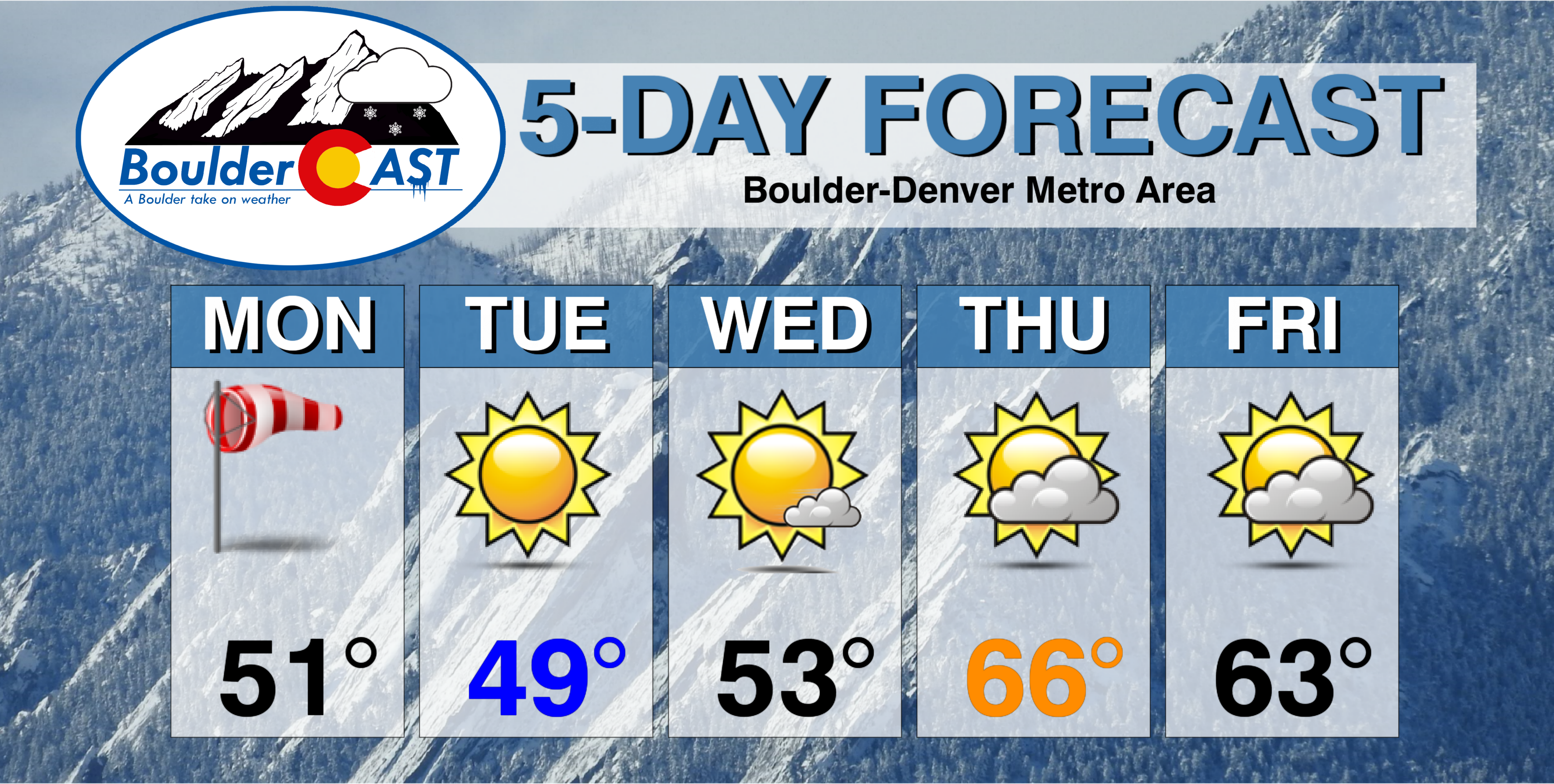
We begin the week with windy conditions, followed by a gradual warming trend into the 60’s to end the week. There may be a chance of snow by Saturday, but current model indications look meager at best.
A windy Monday!
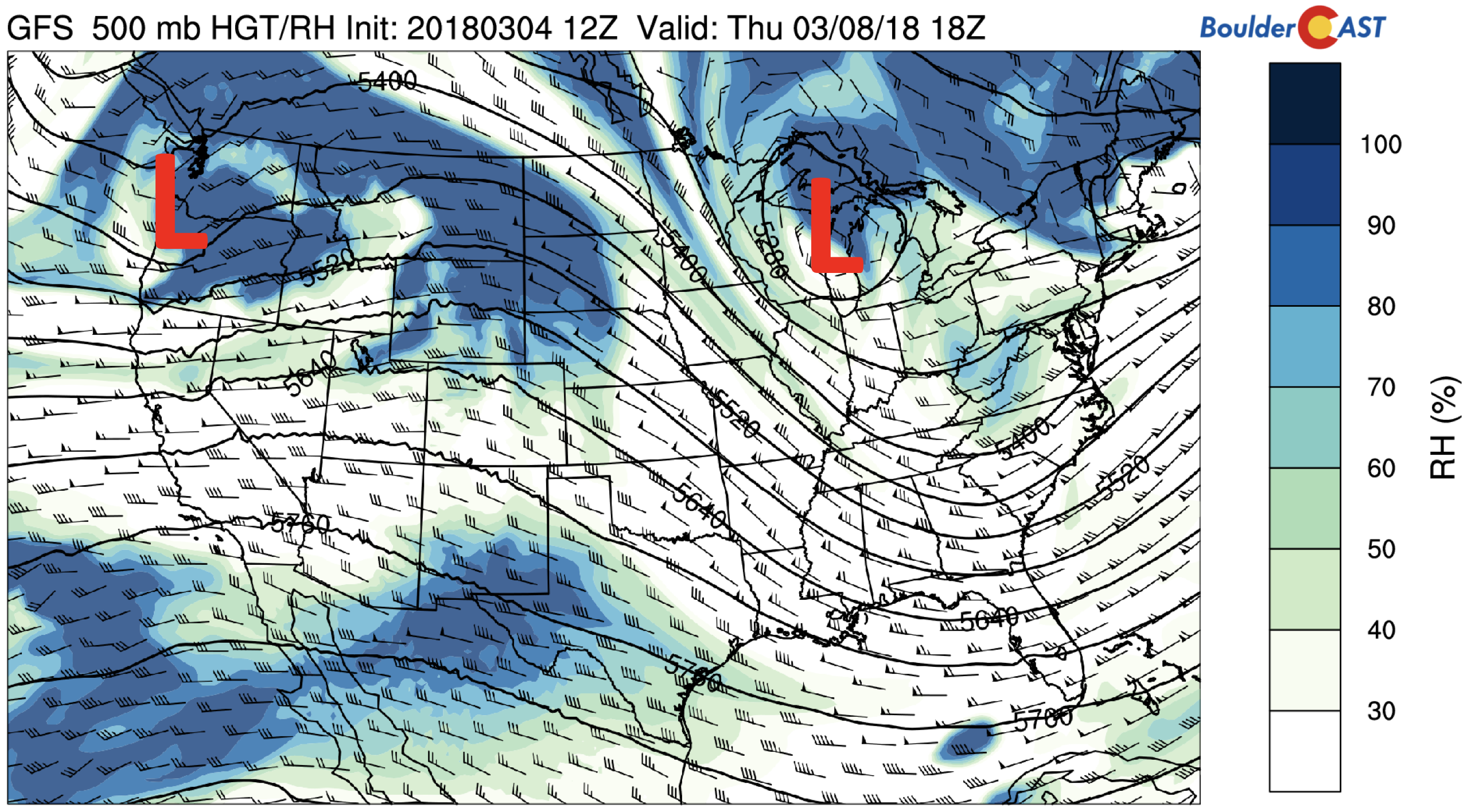
You may be thinking to yourself…. “What is with all this wind?”. An overhead jet streak of 100+ mph oriented west to east across the state today is the main culprit, as well as the below trough of low pressure over Nebraska and South Dakota. This same system was over us yesterday, with gusty winds at times up reaching 40 mph across the Metro area. The image below shows a tight height gradient in the mid-level flow over Colorado. This will once again produce a strong downslope flow for the morning and afternoon hours on Monday. Highs will be cooler in the upper 40’s to low 50’s under sunny skies. Heightened fire danger exists once again due to the low humidity and high winds, at times exceeding 50 mph on the Plains. Red Flag Warnings are in effect for the Plains today.
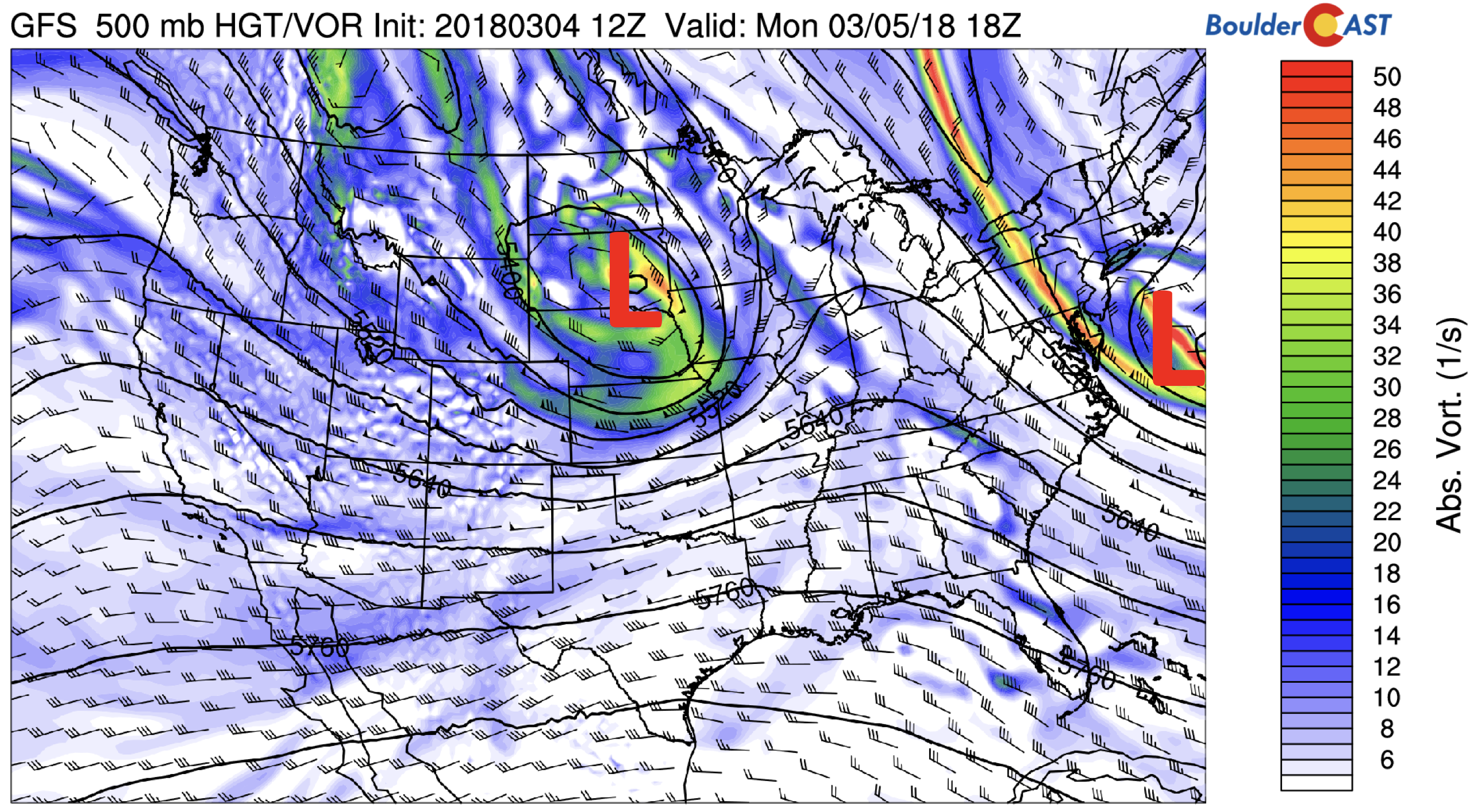
GFS 500 mb absolute vorticity today
A more zoomed-in image over the state shows a tight height gradient in the low-levels across the Foothills, with northwest winds of 30+ mph over the Plains. We can expect sustained winds of 20+ mph much of the day.
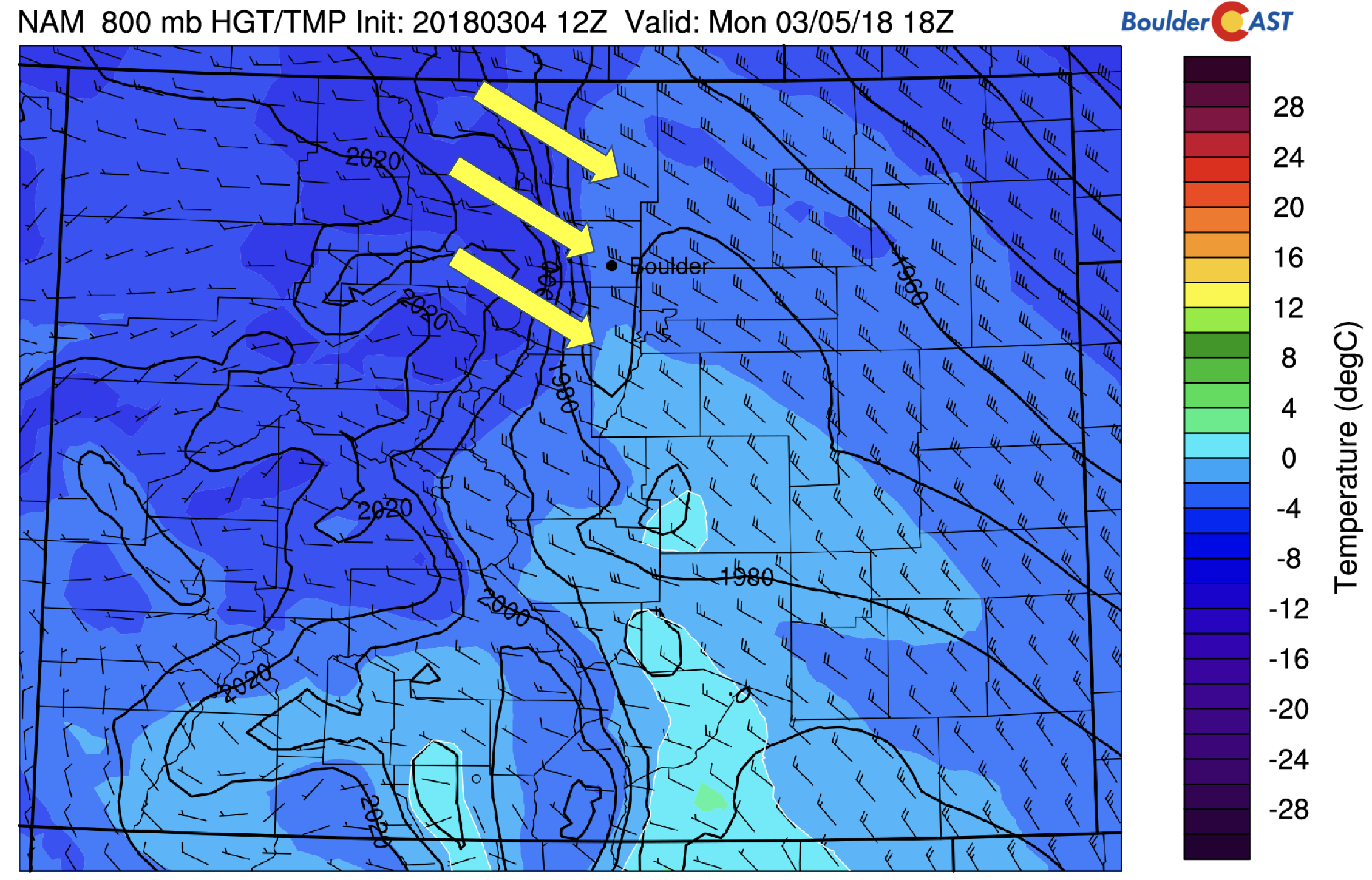
NAM 800 mb near-surface height, wind, and temperature this afternoon
Our NowCAST forecast indicates gusty winds of up to 50 mph for the afternoon with temperatures hovering near 50 degrees. It’s going to be windy out there!
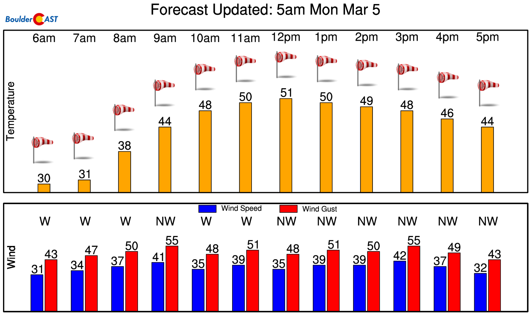
NowCAST forecast for Monday.
For the High Country, another 1-3″ will likely fall over the Divide and northwestern favored ski areas due to the upslope flow over Western Colorado – this is on top of the 2-6″ that fell on Sunday.
Quiet overall Tuesday through Thursday
After Monday, the pattern turns tranquil for Colorado, at least through Thursday. On Tuesday, the system pulls out to our east, allowing weak surface high pressure to take over. Low moisture in the atmosphere will lead to lots of sunshine with temperatures near 50 degrees on Tuesday. On Wednesday, the ridge will slowly move further east from Utah (see below). This should help relax the height gradient and allow temperatures to moderate further. The airmass continues to remain dry so expect another sunny day, although the passing wave cloud is certainly possible.
GFS 500 mb relative humidity on Tuesday
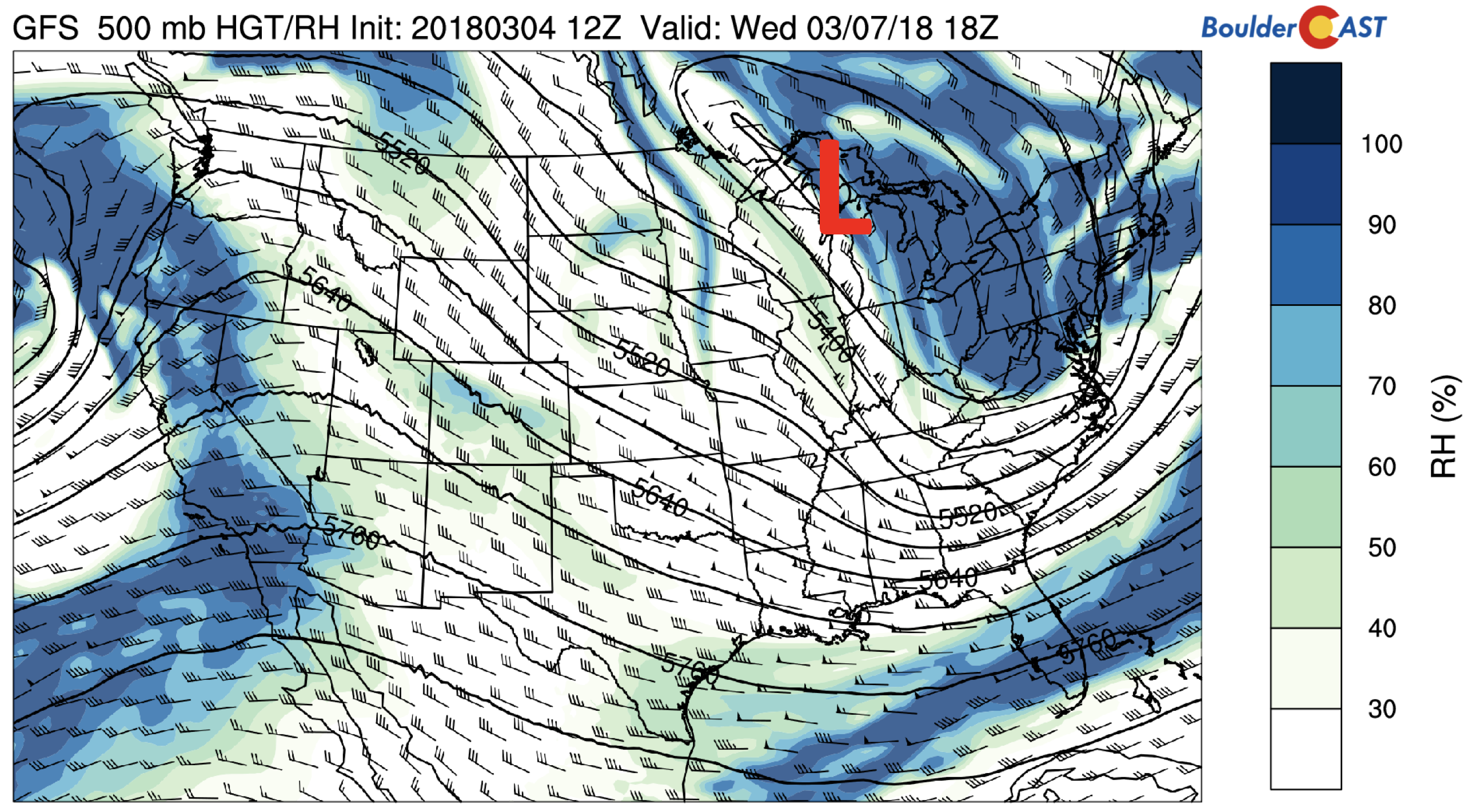
Here is what the pattern looks like Thursday in terms of the mid-level relative humidity and heights. Not much has changed over Colorado. Weak area of low pressure exists over the Great Lakes, and a secondary system approaches the Pacific Northwest. This second system will advect in moisture to the north of us in Wyoming and Montana. Some of this moisture may affect Colorado – in terms of some high cloudiness. But with westerly flow remaining, temperatures will continue to warm, reaching the 60’s.
GFS 500 mb relative humidity on Thursday
Potential system Friday
On Friday, the aforementioned system is projected to dive southeast into Idaho and Wyoming, with energy out ahead of the storm over Colorado Friday night and Saturday. The exact track of the storm is uncertain at this point. There has been numerous occasions this winter where the GFS model’s prediction of northern-tier systems five days out shifts quite a bit. Nevertheless, it will be something to watch, both for the Mountains and Plains. Currently, it mostly looks like a mountain snow producer (light amounts so far), though a more southern movement could bring upslope conditions to the Plains to produce light snow as well. We will update you through the week if things change. But in general, we can expect increasing clouds with mild temperatures, with a trend into more seasonal weather for the weekend.
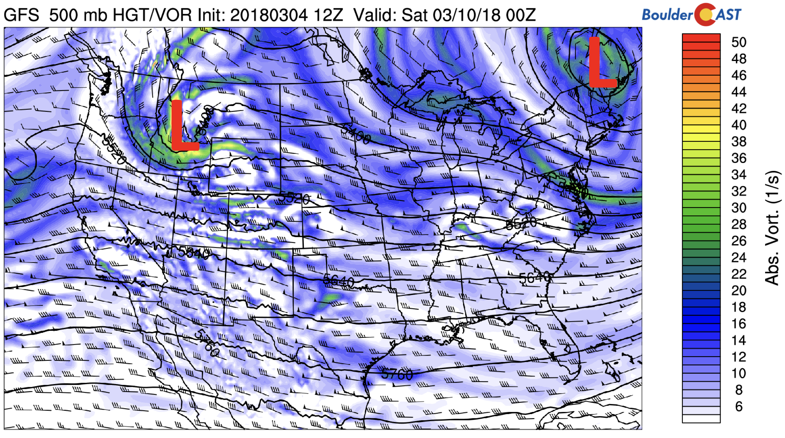
GFS 500 mb absolute vorticity on Friday
Forecast Specifics:
Monday: Sunny and windy with highs in the upper 40’s to lower 50’s across the Plains and in the mid 30’s in the Foothills. Winds may gust at times over 45 mph. Winds should relax after midnight.
Tuesday: Sunny skies with temperatures near 50 degrees for the Plains with upper 30’s in the Foothills.
Wednesday: Mostly sunny with highs in the middle 50’s across the Plains, and middle 40’s in the Foothills.
Thursday: Partly cloudy and dry with temperatures rebounding back into the mid 60’s for the Plains and into the 50’s in the Foothills.
Friday: A mix of clouds and sun. Temperatures in the low 60’s across the Plains. Expect highs near 50 degrees in the Foothills. A slight chance of snow exists Friday night into Saturday with slightly cooler air filtering in.
High Country: Outside of today’s 1-3″ over the resorts, it will not be a great week for powder…The only chance of snow for the Mountains is today and Friday. High pressure will remain in place Tuesday through Thursday. The forecast looks slightly better on Friday and Saturday, but the overall pattern does not favor significant snowfall until at least next week. A slight change in the storm on Friday could be more promising for powder on Saturday, so stay tuned. Find the latest forecast for all your favorite Colorado ski resorts on our PowderCAST page.
DISCLAIMER: This weekly outlook forecast was created Monday morning and covers the entire upcoming week. Accuracy will decrease as the week progresses as this post is NOT updated. To receive daily updated forecasts, subscribe to BoulderCAST Premium.

.
Share!


You must be logged in to post a comment.